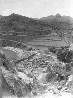
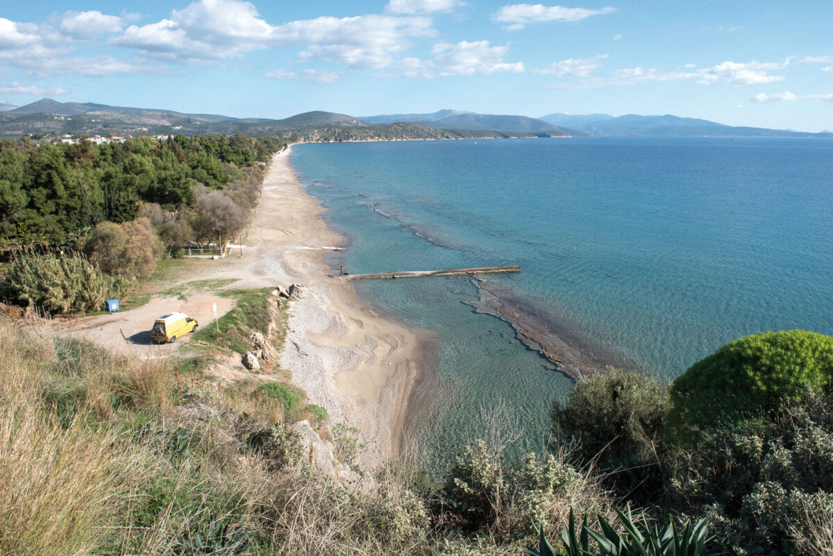
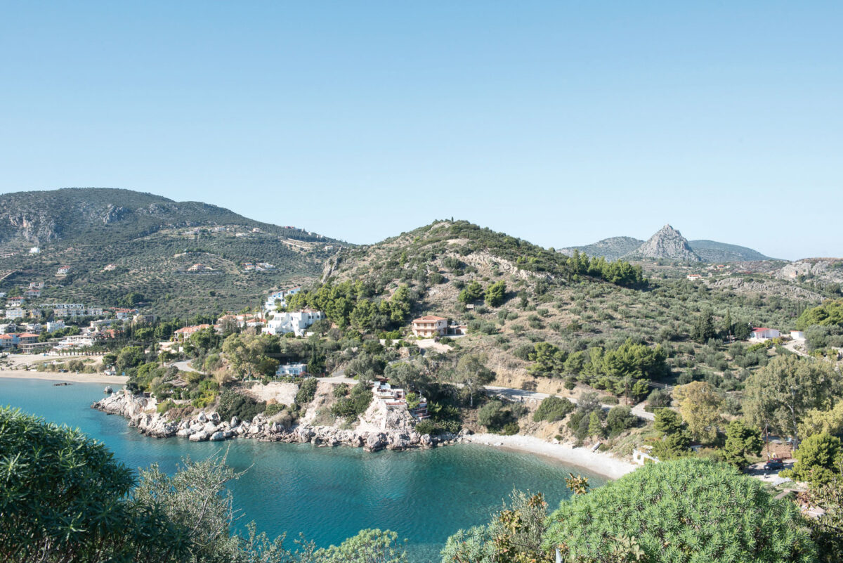
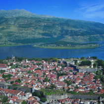
The impressive natural landscape of the Kastraki Peninsula, the allure of the name Asine, due in no small part to the poem by the Greek poet and Nobel laureate Georgios Seferis, and the results of the archaeological investigations attract visitors in droves to the hill which is identified as the heart of ancient Asine. Decisive too is the site’s proximity to popular tourist resorts of the Argolid, as ancient Asine is located barely one kilometre east of the holiday town of Tolo, between two popular beaches on the Argolic Gulf, Psili Ammos at Tolo and Plaka at Drepano.
Until a few years ago, due to the destruction of a large part of the antiquities during the Second World War, visiting the hill was mainly a pleasurable experience for nature-lovers, indeed rather an adventure, considering the precipitous points of the rocky terrain and the wild vegetation covering pathways, military earthworks and the scant ancient remains. Works carried out in recent years by the Ephorate of Antiquities of Argolida, in the framework of the project ‘Asine-Acropolis of Ancient Asine. Presentation of the Archaeological Site at Kastraki’, with funding from the National Strategic Reference Framework, an archaeological site has been laid out, where the now faint traces of man’s long presence in the area have been reconstituted by conventional and modern means. Conscious choice of the project was the equal presentation of the recent history of the archaeological site, with nodal points the Swedish excavations of the 1920s and the capture of the hill by Italian Occupation troops during the Second World War. Concurrently, the overall planning of the interventions included the incorporation of the necessary installations for the operation and safety of an archaeological site into already existing constructions, so as to avoid marring the natural landscape.
This guide endeavours to bring to life the history of the place over time, with epicentre the recently presented archaeological site of Ancient Asine, offering today’s visitors a useful aid to its understanding. Human presence in the region, spanning millennia but imprinted haphazardly in the space, will be revealed in the course of wandering overvthe Kastraki headland.
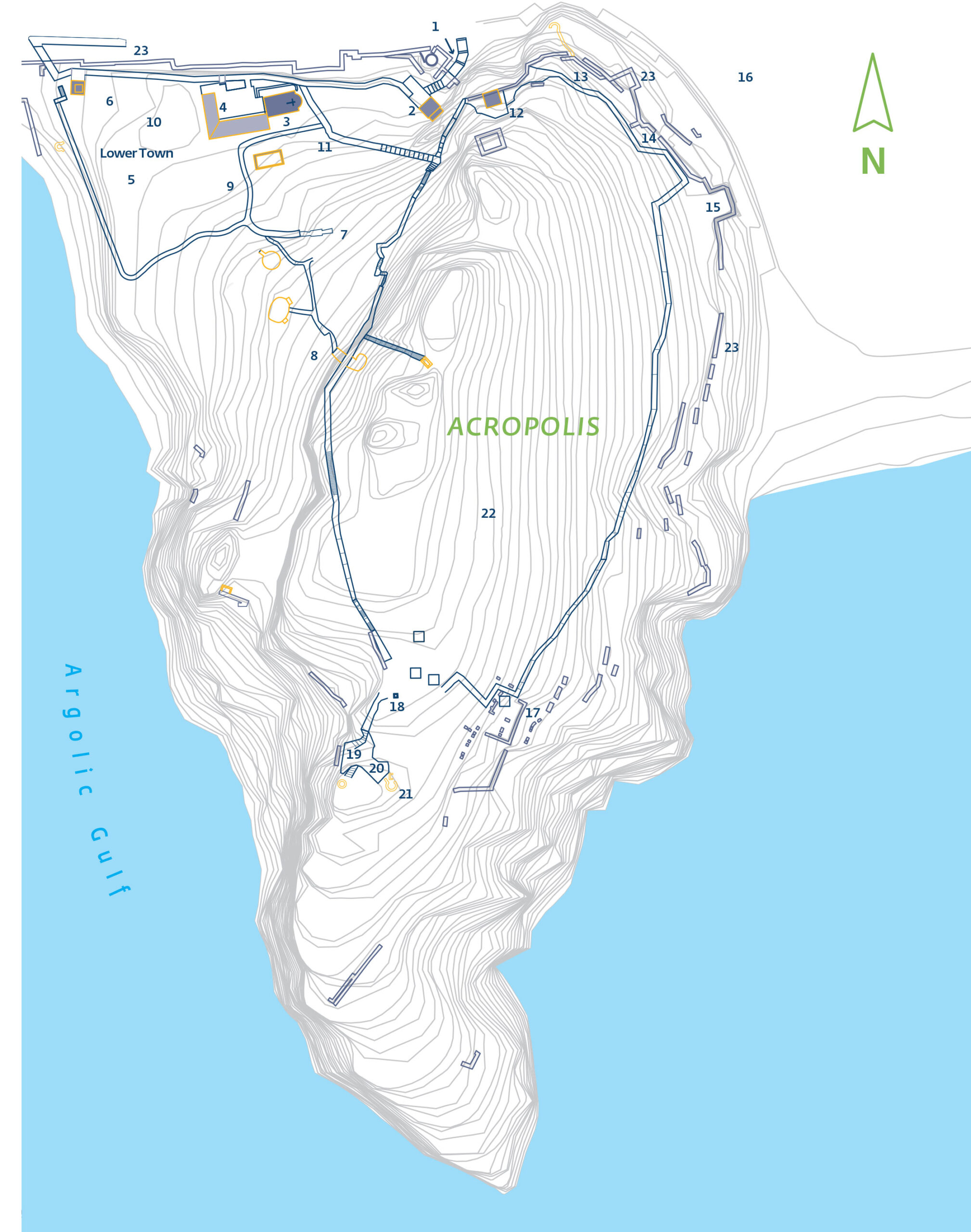
Name – Identification of the site
The hill named Kastraki or Paliokastro had been identified already in the mid-nineteenth century as the site of Homeric Asine. Ernst Curtius, in 1852, in his book Peloponnesos: eine historisch-geographische Beschreibung der Halbinsel, was the first to argue that the steep hill projecting from the sea, between the small villages of Tolo and Drepano, was the Asine ’that enfold[s] the deep gulf’, of the Iliad (II.561). This is also the sole reference to Asine in Homer, in the Catalogue of Ships, as one of the cities of the Argolid which participated with ships in the campaign against Troy, under the command of the king of Argos Diomedes. The identification of the site as ancient Asine was accepted and disseminated by Heinrich Schliemann. Today, Asine is the name of the village on the route from Nafplion to Kastraki, about one and a half kilometres north of the hill. During the Ottoman period the village was known as Tzaferaga.
Features of the location
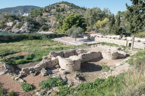
The Kastraki promontory is connected to the mainland by a spit about 100 m. wide. According to E. Zangger, the present form of the hill is the outcome of intense geological instability, which affected the coast of the Argolic Gulf until the end of the third millennium BC.
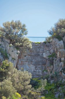
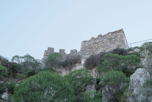
Today, almost half ofKastraki, 350 m long (N-S) and 140 m wide, is surrounded by sea. On the seaward side, to the south, the hill is virtually unscalable, with sheer cliffs up to 52 m. high. To the northwest, the rock is joined to the land by a smooth slope. This slope was named the ‘Lower City’ by the Swedish excavators, in contradistinction to the rocky summit of the hill, which was characterized as the ‘acropolis’. These conventional names have been established in the international bibliography.
To the northwest stands BarbounaHill, 92 m. high, which protects Kastraki from the blustery north winds. Natural protection from the winds blowing from the west is provided by the islet of Romvi opposite Tolo, so creating a safe haven in the small bay formed to the west of Kastraki. The doubly privileged site, naturally fortified and sheltered from the winds, seems to have played a decisive role in the choice of the area for settlement from as early as the third millennium BC, and determined its development in the ensuing centuries.
Excavations
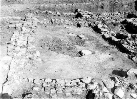
In the 1920s, Swedish archaeologists, in the course of an ambitious excavation programme, brought to light a complicated mosaic of multiple phases of habitation, a palimpsest of the history of the area for over three thousand years. Evidence relating to the daily life of the inhabitants of Asine continues to be revealed to this day, as result of the excavations but also of the study of the old and the new finds. Between 1970 and 1990, the Swedish Institute at Athens conducted excavations at selected points, while sporadic investigations were carried out also by the Ephorate of Antiquities of the Argolid. Last, the recent project for the presentation of the archaeological site was an opportunity for ‘locating anew’ and re-examining ancient remains that had been forgotten over the years, and in parallel to enhance monuments of the more recent history of the place.
The reason for the Swedes’ involvement with Asine was a journey made by the then Crown Prince and later King of Sweden Gustaf VI Adolf, in the autumn of 1920. On this visit, the prince was accompanied by the Greek numismatist Ioannis Svoronos. A few months earlier, Svoronos had brought Asine to the attention of archaeologists of the French School at Athens, and they had proceeded to a preliminary recording and mapping of the site. After Prince Gustaf expressed interest in undertaking the excavation, the French withdrew. There is reference to an excavation of vague extent on the northeast side of the hill, in the late nineteenth or the early twentieth century, by the schoolmaster Ioannis Kophiniotis, but with no further written information.
Almost two years after the prince’s visit, in spring 1922 the excavation began. Preparations for it included among other things the necessary correspondence between the Swedish and the Greek authorities, the securing of funding, manning the scientific team, gathering together and transporting the equipment by the means of the time. The preliminary study of the site was entrusted to Axel Persson, a Classical archaeologist at the University of Lund, who was subsequently appointed co-director of the excavation, together with Otto Frödin, an archaeologist with significant excavation experience. Prince Gustaf became president of the Asine Committee in Sweden, took part in the excavation in the autumn of 1922 and made a decisive contribution to publishing the results in 1938, eight years after investigations were completed.
Brief archaeological review
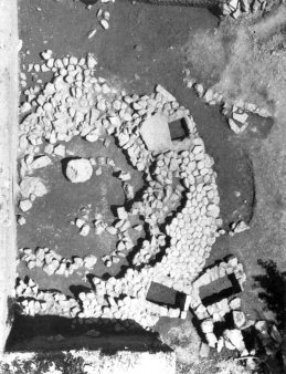
The arrival of the first inhabitants in this area is dated to the sixth millennium BC, as deduced from Neolithic potsherds found in the deepest levels of the excavations at the foot of Barbouna Hill. During the third millennium BC (Early Helladic period) the settlement seems to have developed in the area of the Lower City and on terraces of the acropolis, while in the first half of the second millennium BC (Middle Helladic period) the settlement of the Lower City expanded, gradually occupying part of the south slope of Barbouna. East of Kastraki, where there is a campsite today, part of a Middle Helladic cemetery was excavated, in which the burials were organized in and around a circular stone-built tumulus.
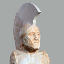
The finds from the cemetery and the settlement of Mycenaean times are befitting to the brief but telling reference by Homer to Asine, as a city linked directly to the sea. The growth of mercantile activity during the Mycenaean period and the existence of the great palaces of Mycenae, Tiryns and Midea in the Argolid, apparently gave the inhabitants of coastal Asine the opportunity to play an active role in transit trade between the Argolic palaces and the Mediterranean centres. A small part of a cemetery of chamber tombs of these years was investigated on the east side of Barbouna Hill, yielding rich grave goods, often of exotic provenance. In contrast to the finds from the chamber tombs, the settlement contemporary with them is not particularly impressive. It developed mainly in the area of the Lower City, while remains of houses have been uncovered both on the south slope of Barbouna and in the flat area east of Kastraki.
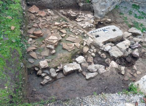
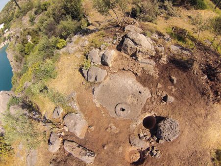
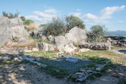
Life at Asine continued after the demise of the Mycenaean world, without any disaster, abandonment or other kind of interruption in habitation evident in the archaeological record. In Submycenaean times and throughout the Geometric period, activity on and around Kastraki never ceased. During these years the economy of the settlement was based mainly on the fruits of labours on land and at sea. A small temple-like edifice excavated on the summit of Barbouna was in use from the late eighth to the early fifth century BC. Researchers have identified the sanctuary as that of Apollo Pythaios, mentioned a few centuries later by Pausanias. Today, the hilltop is occupied by the concrete base of an anti-aircraft machine-gun and fortification works of the Second World War.
At the end of the Geometric period, c. 700 BC, the site was abandoned by its inhabitants, after a siege laid by the Argives. According to Pausanias, the beleaguered residents were forced to leave their land when they were attacked by Argos as a reprisal for assisting the Lacedaemonians in a campaign in Argive territory. So, the people of Asine embarked on ships and, tradition has it, resettled in the area of what is now Koroni in the Messenian Gulf, where they founded a new city of the same name. Modern research has shown that ancient Asine was not totally deserted for the next four hundred years, as the first excavators had believed. Small cultic assemblages from the acropolis, burials of the early fifth century BC and fragmentary traces of settlement in Classical times, to the east of the hill, confirm the existence of a small population here during the centuries following its recorded ‘abandonment’.
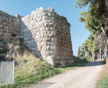
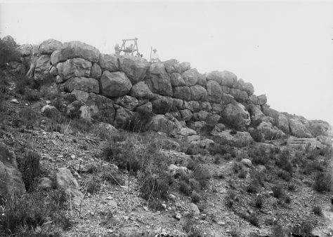
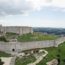
Around 300 BC, Kastraki was once again the epicentre arount which life at Asine evolved. It was then that the fortification walls, which gird the hill to this day,
were built. Houses, workshop installations, cultic assemblages and graves are dated to this period too.
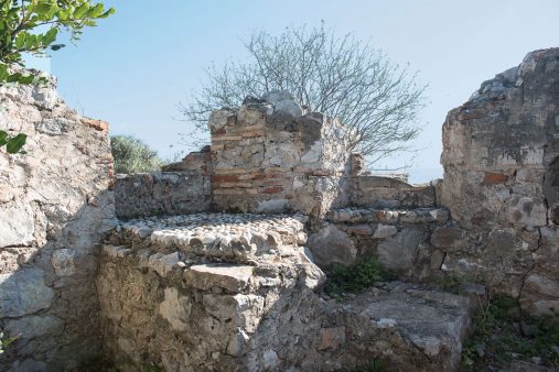
When Strabo visited Asine in the early first century AD, he beheld a small village, while one hundred years later, in the mid-second century AD, Pausanias saw only ruins on the site of the ancient city. In the fourth and the early fifth century AD, the Lower City was inhabited once again. New houses were built on top of the Hellenistic residential complexes, some of which utilized parts of the earlier buildings. Dated to this period are two small bathhouses: the first, now destroyed, stood extra muros to the east, and the second, still preserved, is in the east part of the Lower City.
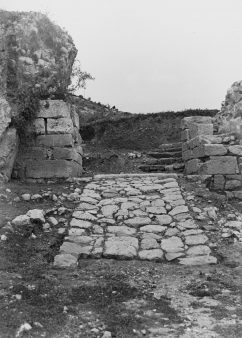
Henceforth and until the recorded presence of the Venetians in the area of Tolo, during the Second Period of Venetian rule (1686-1715), the information we have on Asine is scant, making every attempt to trace its existence in Byzantine times difficult. The paved access to the central gate of the Hellenistic and Roman city should perhaps be dated to the Early Byzantine period, while small-scale repairs and alterations to part of the walls, mainly the northwest branch, could have been made in the Byzantine Age.
During the German-Italian Occupation, Asine was captured by the 433th Motorized Regiment of the Piemonte Infantry Division. Its strategic position and the fear of a possible landing of Allied Forces on the neighbouring beaches of Tolo and Plakaat Drepano led to the hill being turned into a modern fort, with pillboxes, arsenals, shelters, bunkers and ancillary buildings. Their construction destroyed to a large degree the ancient remains, which were moreover a ready source of building material. After the end of the war, the extent of the destruction became obvious, which in the words of the Ministry of Ecclesiastical and Public Education, was ‘total, radical and absolute’.
In the ensuing decades, the in any case few surviving remains suffered even further from erosion, riotous vegetation, exposure to the elements and the lack of any measures of protection and conservation.These circumstances made it difficult for modern visitors to find their way around the ancient settlement. The tour suggested in this guide follows the paths laid out in the framework of the NSRF project for the presentation of the archaeological site, with halting points the extant ancient remains and the recent interventions. It offers visitors the possibility of understanding the specific characteristics and the long history of the place, from the remote past to the present.
Access to ancient Asine
Ancient Asine is about 15 minutes by car from the town of Nafplion. From Nafplion we travel along Asklepiou Avenue and veer east as far as the Agia Eleousa intersection. This same intersection is reached by visitors coming from Athens, avoiding entering Nafplion, or from Epidauros. At Agia Eleousa we take the exit towards Tolo/Drepano. We pass by the village of Lefkakia on our left and continue straight ahead in the direction of Tolo. After passing through the village of modern Asine, at the next roundabout we take the road to Kastraki/Archaia Asine, 1,300 m. along which, to our left, is the archaeological site.
BARBOUNA HILL
On our right, just before we reach the organized archaeological site, looms Barbouna Hill. At the top and on its south and east slopes, settlement, cultic and mortuary remains have been identified, dating from the sixth millennium BC into Roman times.Of these remains, today’s visitors can see only part of the Mycenaean cemetery on the east slope, as the antiquities uncovered have either been destroyed in the past or are not accessible.
ΜYCENAEAN CEMETERY
To the right of the road to Kastraki, about 650 m. beyond the roundabout at the exit from the village of Asine, a short cement-surfaced road leads to the area of the excavated chamber tombs in the Mycenaean cemetery at Barbouna. Just before the end of this side road, about 60 m. from the main road, a narrow dirt path leads off to the left. Some 180 m. along this path is a field under an expropriation order, in which the Swedish excavation of the chamber tombs was conducted. While touring the site, visitors must be particularly careful because of the steeply sloping ground and the wild vegetation.
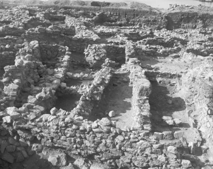
The accounts of the first excavators speak about 50 identified chamber tombs on the east and north sides of the hill. Of these, only about a dozen have been excavated to date. The cemetery was in use from the LH IIB until the late LH IIIC period.
Of the tombs cut in the soft bedrock, particularly interesting is tomb 1. In its chamber and its lateral conches, at least six or seven dead had been buried, accompanied by an abundance of grave goods. Two sloping dromoi, which were cut in different phases of use of the tomb, led to the chamber. The north dromos seems to have been abandoned, perhaps because it was unsafe, and the south dromos then opened in its stead. In this phase, the central chamber was expanded towards the side where the new dromos ended. The central chamber, of irregular circular plan, was supplement by two lateral conches.
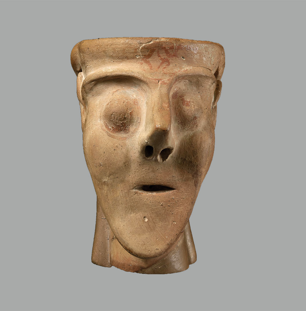
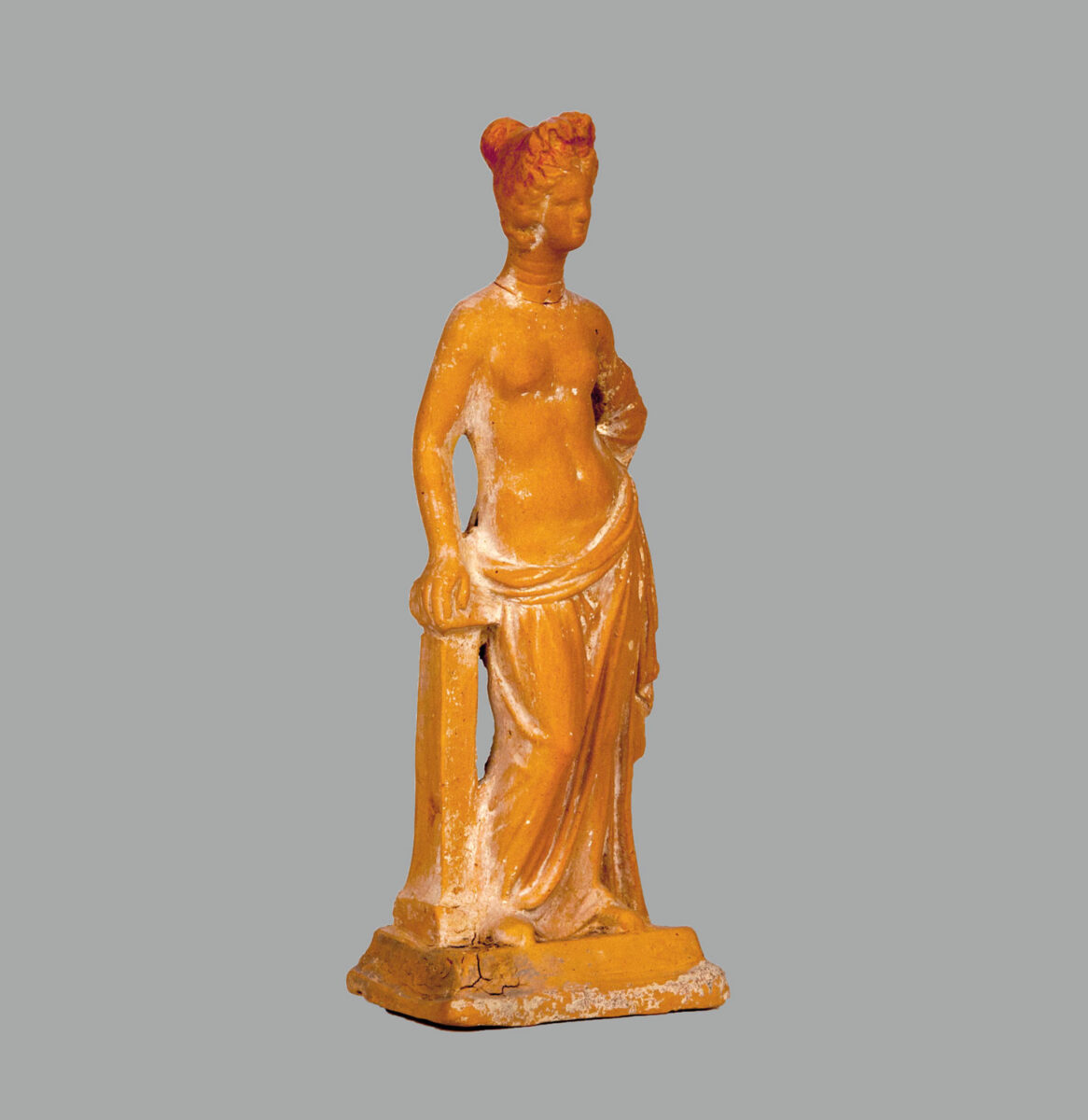
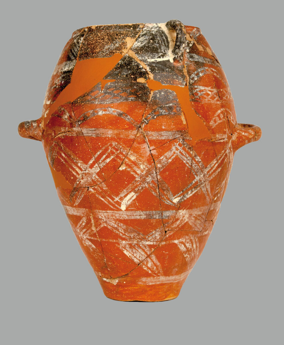
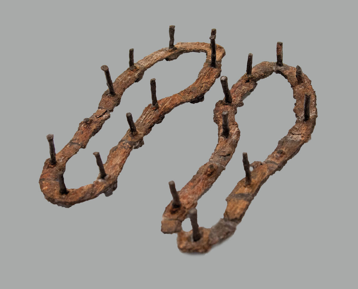
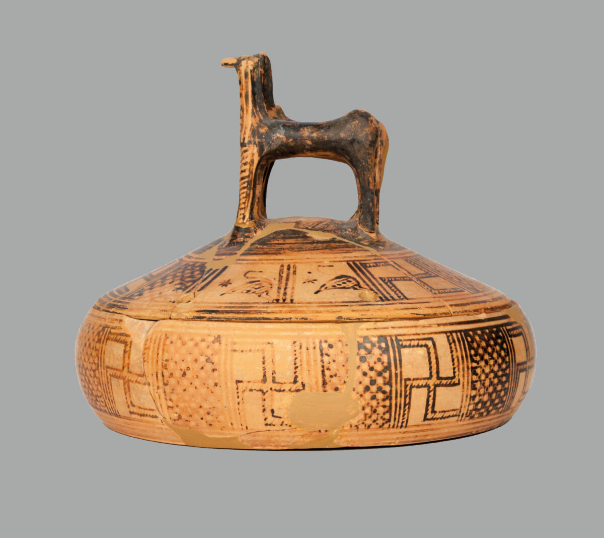
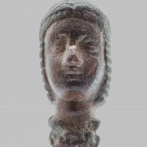
This tomb yielded 80 vases, 41 of them decorated, seal-stones and beads made of raw materials from India, Egypt, Lebanon, the Black Sea, gold and bronze finger-rings, and other minor objects of glass, faience, bone and ivory. It was in use over a long period, spanning the duration of operation of the cemetery. A small sample of the rich grave goods recovered from the chamber tombs is exhibited in the first storey of the Nafplion Archaeological Museum.