Archaeological sites

Onithé, Goulediana

Crete

Kyriakos Psaroudakis (Dr Archaeologist)

1
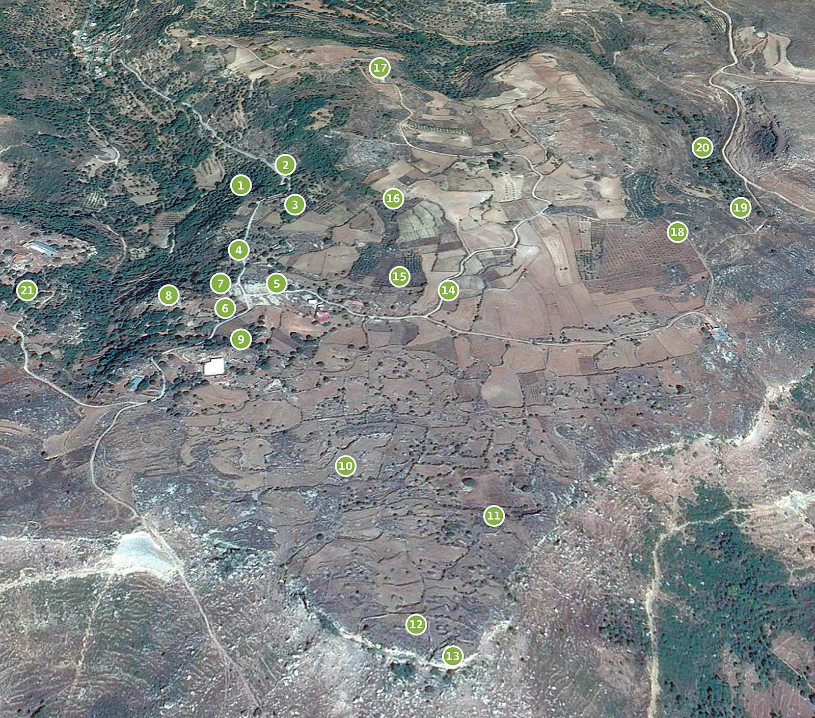
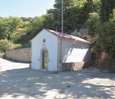
St Elessa (Eleousa)

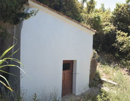
The first building visitors come across on the road from the village of Goulediana to Onithé is the chapel of the Virgin Eleousa (the Merciful). It stands on the west side of the road, on the ridge of the plateau, sanctifying and demarcating with its presence the territory of Onithé. The downward slope that follows and covers the rocky scarp of its plateau is densely-wooded and virtually impenetrable.

The church is small, single-aisle and vaulted, with pitched roof and a spacious courtyard that fills with people on 15 August, when the feast of the Dormition of the Virgin is celebrated.

The entrance to the church is on the west side and has a semicircular lintel decorated with ribs and two incised bands. Above the lintel is a fanlight. In the interior of the church are two strainer arches with plain braces at their base, while on the long sides of the wall runs a horizontal decorative cornice which emphasizes the point of transition to the vaulted ceiling. The sanctuary conch is cut in the bedrock. The founding of the church has been dated to as early as the fifteenth century.

2
The small fountain

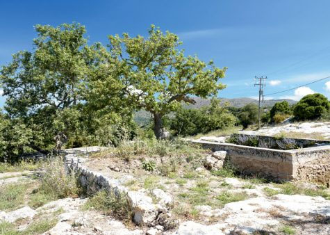
Exactly opposite the church, on the east side of the road, is a built fountain. The date incised on its front records that it was constructed in 1945. It is a simple square building of dressed-stone blocks, literally nestled in the rocky embrace of the slope. Inside the fountain house is a water-abstraction tank and at the foot of the front is a stone water-collecting basin. Exactly above the fountain-house passes a cobbled street, today ruined, which led to the adjacent settlement.

3
The abandoned settlement (metochi)

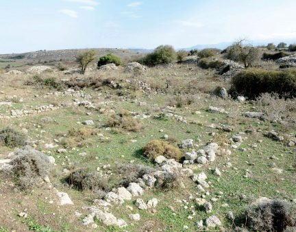
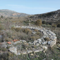
After walking up a few metres on the verge of the plateau, visitors encounter the first houses of the most recent settlement of Onithé. The hamlet (metochi) comprises scattered stone-built houses in the northwest part of the plateau, which were used seasonally until the mid-twentieth century. Today, the buildings are badly dilapidated or in ruins, although some have been repaired and serve as storehouses.

The stone-built houses are examples of vernacular architecture, with distinctive architectural elements of the Venetian and Ottoman periods. Most have outbuildings and threshing floors cut in the bedrock.

It is difficult to date the hamlet, in the absence of chronologically reliable evidence and given the conservativism in the development of buildings, without essential changes in the long term. Nevertheless, it is speculated that it was established in the Late Middle Ages (16th-17th c.), when there was settlement development in the wider area.

Curious, of course, is the lack of reference to the settlement in registers and lists from the sixteenth and seventeenth centuries. However, some researchers have proposed that it should be identified with the toponym Christochori, mentioned by Barozzi and recorded in notarial documents of the mid-seventeenth century (such as those of the notary Marinos Arkoleos).

4
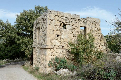
The country house

Shortly before reaching the locality ‘Plakes’ and the spring of that name, just above the main street, visitors see a rectangular building with entrance in the first storey and relatively luxurious building features. In its upper storey is a rectangular doorway which led onto a balcony. Preserved inside it are stone brackets. In all probability this is a country house (‘villa rustica’) of Venetian times, which continued in use during the period of Ottoman rule.

5
‘Plakes’

‘Plakes’ is one of the most typical points on the Onithé Plateau. It is a spacious rocky terrace with an unimpeded view and a gushing water source, a cool place to halt and rest. Situated at the entrance to the plateau, ‘Plakes’ could be described as the ‘reception hall’ of Onithé, since it not only welcomes visitors but also prepares them before they penetrate further inside.
6
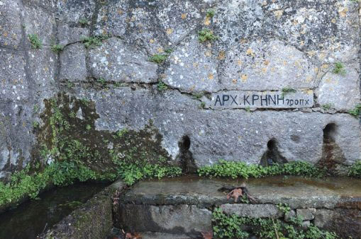
The fountain (locality ‘Plakes’)

A copse of plane trees and a ruined Late Ottoman house form the west border of the rocky terrace and flank a fountain that is still in use. In 1954, Professor N. Platon excavated here and the modern interventions were completed.

Today the fountain is in the form of a rectangular basin, open on the north side and without shelter. The east face of the trench is cut in the bedrock, while the other two sides are built. On the south face, a conduit cut in the bedrock channels water to a small cistern.

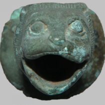
The ancient fountain is on the west side of the trench, on the rock-cut face of which there are three small mouths. According to Platon, metal lion-head water spouts were affixed to these. In other words, this was a kallirrhoe (fair-flowing) fountain from which issued the chalkopylon hydor (water from bronze gates). The surmised sculptural decoration of the spouts with lion-heads is not unusual, as from the sixth century BC onwards the lion as krenophylax (guardian of the fountain) was selected almost exclusively to decorate the waterspouts of fountain houses. Today, water no longer flows through the spouts of the ancient fountain because the spring now supplies the later spout on the modern front of the south side.

The façade of the ancient fountain may well have been completed with basins for collecting water (that is, as it was laid out in the modernist version along its south front) and possibly had some kind of shelter, like those depicted in a host of ancient vase-paintings.

The ancient fountain at Onithé is considered rare – indeed unique for the Archaic period – as such buildings were not popular in ancient Cretan cities. We do not know of such buildings in Minoan times, while in historical times they are few and far between.

Recent rescue interventions by the Ephorate of Antiquities of Rethymnon, on the outside of the south front of the fountain, brought to light rock-cut conduits and walls of basins, likewise rock-cut. The cuttings seem to have been made in various periods (Antiquity, Byzantium, Venetian rule), bearing witness to the diachronic use of the fountain.

7
The fountain sanctuary

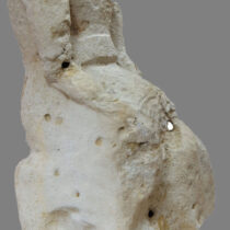
The fountain acquired its present aspect in 1938, with the formation on the south side of a built front with spout and water troughs. In the same year, in the angle formed between the ancient fountain and its westernmost terrace, a poros statue of a seated female figure was revealed. The fact that the sculpture, obviously of a goddess, was found turned towards the fountain reinforces the hypothesis that a sanctuary existed on this spot.

In antiquity, the belief that divine forces were ubiquitous and could appear through springs or trees was widespread. For this reason, it was common practice to found sanctuaries near water sources, which were frequently considered numinous, particularly in areas susceptible to drought. The fountain sanctuary at Onithé, which was possibly in the form of an open-air sacred precinct (temenos), may have been dedicated to Hera or Artemis (as Britomartis – frequent epithet of the goddess in Crete), or some local Nymphs.

8
Chapel of St Antony (locality ‘Skouro’)

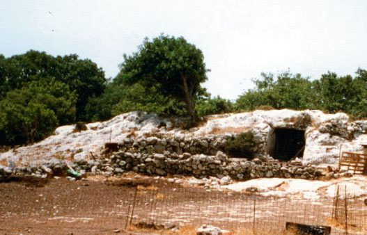
From ‘Plakes’ visitors take the modern pathway leading westwards, 200 m along which is the chapel of St Antony. It projects from within a cavernous hollow in the east bank of the long and narrow gorge that begins at this point and ends to the north in the village of Goulediana.

The church is partially cut in the rock, at the foot of which was trickling water (hagiasma). It is not known whether this space was a locus of pagan cult, prior to the advent of Christianity. However, worship in caves and rock shelters in antiquity was not unknown, and, by the same token, the founding of churches in ancient sacred places.

The church is difficult to date exactly. From analogous cave chapels, an early dating in late Medieval times is possible, but a much later date, in the nineteenth century, cannot be ruled out.

9
Τhe ‘gymnasium’

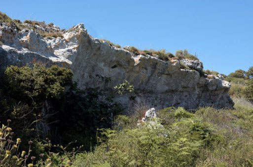
South of the ancient fountain, a short distance from and in visual contact with ‘Plakes’, is a rock face, cut vertically to great depth and over a wide extent. The configuration of the rock, in combination with remnants of masonry on one side of it suggest the presence of a building. Bearing in mind the robust construction and privileged position of the building, between important houses and the fountain, it must have served a special function, such as a temple or a public edifice. The modern name of the space, ‘gymnasium’, is conventional and does not imply the identification in the architectural remains of a use corresponding to ancient gymnasium complexes. Obviously it is due to the strong impression the monument creates even today.

The vertical cutting encountered here, as well as the horizontal cutting and quarrying found all over Onithé confirm the rule applicable not only to Crete but also to Greece as a whole in areas with rocky terrain: the bedding surface is cut horizontally to ensure the stability of the foundations and the stone quarried in the process is used as construction material.

10
House Α: Residence or Andreion?

‘House A’, measuring 21 x 36 m and 400 sq. m. in area, comprises eight rooms. Its façade faces east, while its back is founded in the bedrock. A cross-wall that divides the complex into two parts, the south and the north, may well define two residential units. Inside the rooms were several stone bases of wooden columns and pillars (now perished), which upheld the ceiling.

The building complex is entered from the east, through a small trapezoidal porch (Θ). This leads into a spacious precinct (Ζ), just before the long corridor (Ε), to which there are three entrances. On the west side of the corridor are three new entrances, leading respectively to three contiguous parallelogram rooms (Η, Α, Β).

In the north part of the house, the successive arrangement of rooms is repeated, with front and entrance on the east side. The southernmost room (Γ) is smaller and rectangular. Its arrangement is interesting because with the four columns in its interior and the existence of an antechamber (Δ), it brings to mind the type of the Mycenaean megaron. The middle room (Ι) is the largest in the north part, while the room even further north (Κ) is oblong with a triangular extension in the northwest corner.

All the rooms, including the corridor (Ε), contained vases of various sizes, as well as storage jars (pithoi). The vases were placed carefully along the length of the walls and were set upon stone slabs or blocks. The greatest concentration of vases and pithoi was observed in Room B, which yielded also two fragments of bronze vases (spout and handle). Some pithoi had outstanding decoration. From Room A, correspondingly, an impressive marble basin with lion-head waterspout was brought to light.

Both the large size of the building complex and its content are unusual for a conventional house-residence. The quantity of vases and storage jars exceeds the needs of a household, while the construction emanates a sense of prosperity which is at variance with the dismal economic circumstances believed to have been prevailing in sixth-century BC Crete. Unusually luxurious for an ordinary house are the fragments of bronze vases found, as well as the marble basin (vessels that could have had also a ritual use). Interesting too is the lack of objects for everyday use.

When all this evidence is taken into account, it seems more likely that House A was a public building, even though its architectural layout does not conform to any of the known types of public buildings, such as the andreia or the prytaneia (‘council chambers’).

The truth is that although buildings such as the andreia are documented philologically, they are extremely difficult to identify archaeologically. The fourth-century BC Cretan poet Dosias gives the most informative description of them, as complexes which included halls for meals and quarters in which guests were accommodated. House A at Onithé could be identified as a building of this kind, such as those dispersed throughout Crete.

The dating of House A in the Archaic period (late 7th-early 6th c. BC) was based mainly on the dating of the pithoi found inside it. However, such storage jars remained in use for a long time after their production. The pottery that could be considered a more reliable chronological pointer has not been studied systematically. Moreover, there are persuasive indications that the building continued in use in Classical times. This is advocated by the dating of objects, such as the bronze handle, which is placed in the fifth century BC, of some architectural elements, such as the large number of wedge-shaped stones found in one room, which refer to later times, as well as by the architecturally advanced conception of the building.

11
‘Tou Vasili o spilios’ (the cave of Vasilis)

In the southernmost part of a wide terrace, just a few hundred metres southeast of Houses A and B at ‘Tsigouna’, the remains of a building have come to light. The building, at a higher level, covered a cavernous hollow in the rock (‘tou Vasili o spilios’). On the flanks of the rock-shelter are holes or sockets for inserting beams, at different levels. At the lowest point of the rocky flank is an outcrop in the form of an acute-angled triangle. Immediately south of the building, above the rock-shelter, another complex of buildings existed, the spaces of the lower part of which are rock-cut.

The complex of buildings, which stands out by virtue of its extent and sturdy construction, must have served a public function, with cultic use equally possible, particularly of the cave.

12
The fortified enceinte (locality ‘Pyrgos’)

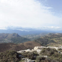
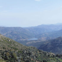
Just below the foot of the east slopes of Onithé spreads the fertile vale of Geni. At the far end of the panoramic horizon stands Mount Kedros, to the northeast the fortified height of Veni and even further north the manmade lake of Potamoi.

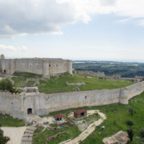
A winding and largely untrodden path on the edge of the precipitous slopes of the Onithé Plateau brings visitors to the fortification of the ancient city. A stone ‘arm’ cuts off the highest part of the slope with the triangular finial. Its function as an enceinte is obvious, while its fortified character emerges from the form, the extent and the robustness of the construction, as well as its complementary role in relation to the other fortress features of the location.

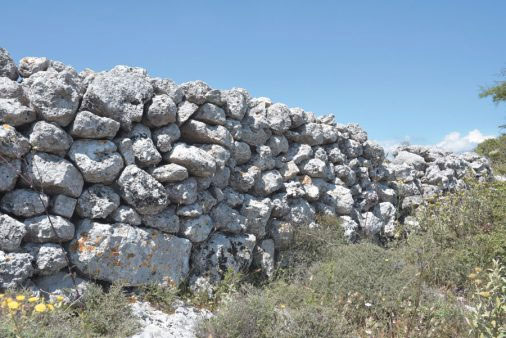
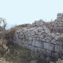
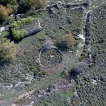
The enceinte is almost triangular in plan, with its sides ending at the precipitous and unscalable scarps of the plateau. It is built of rubble masonry with fieldstones, very few of which have traces of working or of the use of mortar. Τhe thickness of the enceinte ranges from 1.10 to 1.30 m, and the average height is 1.30 m. The uppermost courses of stones have been filled in in recent times. The space enclosed by the enceinte is arranged on two slightly-sloping levels. The marked concentration of stones inside it indicates the existence of buildings, probably of administrative function.

The way in which the enceinte is built refers to early constructions, the beginning of which can be dated to the Post-Palatial period (c. 1400 BC). Given the presence of Early Minoan and Late Minoan pottery in the wider area of ‘Pyrgos’, the existence of a prehistoric settlement cannot be ruled out. In the years following the collapse of the Minoan palaces, a host of external threats, in combination with internecine conflicts, pushed the population into the mountains. During this period of instability, sites such as Onithé, with natural fortification and other advantages, such as potable water, proved to be attractive destinations.

13
The acropolis (‘Pyrgos’)

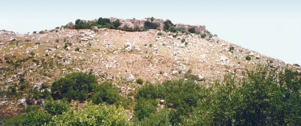
The acropolis, which evidently was constructed in various phases, occupies the summit of the triangular slope (638 m. asl). Its present aspect is probably due to a reconstruction in Hellenistic times, a period when many Cretan cities completed or rebuilt their fortifications.

The acropolis is delimited to the south by the sheer scarp, which is why there are no fortifications on this side. On its other two other sides is a fortification wall of pseudo-isodomic masonry, 12 m. long in each case, which form a right angle.

On the west side there was a gate, which was protected by a tower – now difficult to discern. Further west, the rock has been cut to form a long channel with split-level floor and a rock-cut parapet towards the precipice. Its function was related to the defensive needs, perhaps a lookout post for the guard.

The high altitude and the naturally fortified position of the acropolis ensured its unimpeded surveillance of both the road axis to and from Agios Vasileios, which links the south to the north area of the Prefecture of Rethymnon, and of the valley linking the district of Agios Vasileios with the district of Amari.

Due to its strategic and nodal location, ‘Pyrgos’ must often have been a theatre of war and battles. Onithé played an important role in the Cretan uprisings of recent times (1821, 1878 and 1897), which fact is recorded in folk poetry. Its blood tribute in the struggle for freedom is referred to by an anonymous bard:

Ah wretched Onithé, which has devoured strapping lads and produces nothing but broadbeans and fish.

Even your stones are soaked in blood and no man can say how many have been killed…

The modern toponym ‘Dabia’, given to the area around the acropolis, also echoes its fortress role, as it derives from the Turkish word dabya, which means bastion.

14
Parts of a column

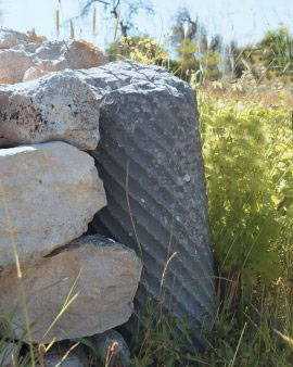
We walk up the dirt road in this direction and come across two fragments (possibly belonging together) from the shaft of a ‘twisted’ column, built into a modern dry-stone wall between the south kerb of the road and a vineyard.

The presence of the column, and indeed close to gigantic heaps of stones which in folklore tradition were said to conceal a golden loom, could point to the existence of an important building hereabouts, dating from Early Christian times. However, it is more likely that these spolia had been brought from the Early Christian basilica, the columns of which had been plundered.

15
Vineyards (locality ‘Pezoulos’)

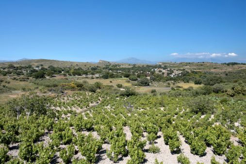
The gentle slope in the north part of the plateau, is known as ‘Pezoulos’, thus named after the stepped terraces. These terraces are planted with some of the oldest vines in the area.

The choice of this place for viticulture is not fortuitous. The slope is protected from the blustery winds and the limestone subsoil is favourable to the planting of vines. Furthermore, the area fulfils another essential precondition for vine-tending: good exposure to the sun and good ventilation.

16
Ancient cemetery (locality ‘Pezoulos’)

‘Pezoulos’, and specifically the rocky verge of its slope, must have been the site of one of the cemeteries of the settlement. Scant remains of rock-cut tombs have been identified here. A short distance southwards of this point other graves have been located, although it is not clear whether they date from the same period.

The development of the cemetery on a hillside and outside the boundaries of the settlement (extramural) is a quite common phenomenon in antiquity, not only for sanitary reasons but also to secure a symbolic distance between the living and the dead.

17
Grape-pressing installation (lenos) (locality ‘Leivadia’)

The rural road continues northwards, leading to the locality ‘Leivadia’, which lies outside the bounds of the ancient city and is now covered by cultivated fields. About 1,000 m. from the modern settlement, a grape-pressing installation (lenos) of rectangular plan has been found. It is dated to Venetian times or to the early Ottoman period.

We return along the dirt road to the point where it forks and this time take the main branch to the east. The route crosses the small Onithé plain, the depressions of which, together with the terraced fields of ‘Tsigounas’ and ‘Pyrgos’ were the area’s main source of income.

18
The Early Christian basilica (locality ‘Kera’)

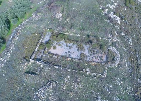
Just before we reach the end of the dirt road, to the east, we deviate from the main route and walk about 50 m. in order to reach the Early Christian basilica, which was brought to light by N. Platon. Its discovery has contributed to the better understanding of the Early Byzantine period in Crete.

Built at the foot of a hillside, the basilica is three-aisled and measures approximately 36 x 17 m. It is entered through a small porch  on the south side of the naos. From there three steps lead into the narthex. West of the narthex there was probably the atrium, into which the doorway at its south end led.

From the narthex we enter the three-aisled naos. The aisles are developed at three different levels, following the slope of the ground. The central aisle is the widest, while the north aisle is slightly narrower than the south one. The three aisles will have been separated from each other by stylobates, on which the columns stood.

In a later period and after the basilica had fallen into disuse, a small chapel destroyed part of the sanctuary and the apse. At its entrance a hole 34 x 45 cm. deep was revealed, which contained a few potsherds and a small bowl. This may have been the enkainion or foundation deposit of the basilica, a phenomenon that has been observed elsewhere.

To the east the basilica ends in a semicircular apse which is provided with a three-stepped synthronon or sedile, where the bishops sat behind the altar table when attending the Liturgy.

Interesting is the arrangement of the spaces on either side of the holy bema. It has been suggested that these were pastophoria, the north one functioning as the prothesis, the space were the Sacraments were placed before the celebration of the Divine Eucharist, and the south as the diakonikon, where the vestments and church plate were kept. The pastophoria communicate with the sanctuary proper through two small double doors and with the lateral aisles through large openings.

In the northern extension of the narthex there are also apartments of indeterminate use. The large room communicated with the narthex through a doorway and was perhaps the baptistery. The last room to the east is a narrow corridor giving access to the north aisle.

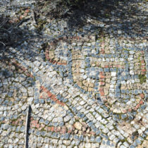
The floors of the basilica in the sanctuary, the north pastophorium, the central aisle and the narthex were covered with mosaics. In contrast, the floors of the side aisles were of bricks and flagstones.

The basilica is now bereft of its main architectural members and columns, as well as its sculptural decoration. Only some parts of the poros openwork closure panels, of provincial workmanship, have survived. The rest of the finds included very little pottery and fragments of glass hanging lamps. The basilica is dated to the end of the fifth and the beginning of the sixth century.

19
The han (locality ‘Kera’)

As we continue our way along the dirt road, about 200 m. east of the basilica we come to an interesting but puzzling – in terms of use – building complex.

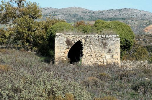
This is a stone-built vaulted building with flat roof, constructed of material taken from the adjacent basilica. Its entrance is on the wide east front, with a second entrance immediately next to it, perhaps opened when the first entrance was blocked up. The interior of the building is a single hall with plastered walls. On the tympanum of the north narrow side is a window opening. Around both the north narrow side and the long west one runs a low bench.

The date of the building is far from clear. Vaulted spaces in Crete are known already from Late Byzantine times, are characteristic of the years of Venetian rule and continue in use into the Early Ottoman period. The edifice appears as if it could have been built in the sixteenth or seventeenth century.

Enigmatic too is its use. Although it could have been the country house or farmstead of a local landowner, it seems more likely that it was a hostelry or han. Its nodal position on the pass leading northwards towards the provincial road axis, through the ‘Skourochlada’ ravine, its proximity to an abundant water source, from which the adjacent fields were irrigated until recently, the existence of a cistern in its north part and the presence of a series of rock-cut basins at a level below this reinforce the above proposal.

In recent times the building, also known as ‘metochi’, was lived in during the summer months, which use has left many traces. West of the building and close to it is a threshing floor.

20
Venetian church of the Life-giving Source (locality ‘Kera’)

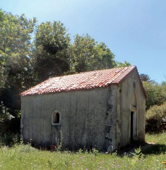
Just below the han, a stream marks the eastern limit of the area of Onithé. Within the deeply-shadowed ravine through which it flows, 200 m. northeast of the han, is the church of the Life-giving Source (Zoodochos Pege). This is a small single-aisle vaulted church with pitched tiled roof. Its entrance has a rectangular frame and an archivolt in the shape of a pointed arch. Above this is a cruciform fanlight. There are fanlights of semicircular shape also on the long sides, while in the sanctuary conch there is a fenestella.

In the interior of the church are two strainer arches with plain braces at their springing, while a cornice runs around the sanctuary at the point where the curvature of its conch begins.

The church has been dated to the late fourteenth or the early fifteenth century and is still used for worship.

21
Burial chambers (locality ‘Sykidi’)

We come back to the road towards ‘Plakes’ and follow the dirt road westwards, which brings us to the diametrically opposite edge of the plateau, the area of ‘Sykidi’. In this locality, clearly outside the speculated limits of the ancient city, two burial chambers have been found inside a modern sheepfold. The first chamber is cut in the limestone bedrock and is almost square in shape. Its entrance is a square doorway on the east side. Inside the chamber on the three sides are blind arcades in the form of arcosolia, that is, arched apses starting from the ground (arcus = arch and sol = earth), inside which the coffin of the dead (solium) was placed. Carved in the tympanum of each arch is a small niche, perhaps for placing offerings.

The tomb must have been created in Early Christian times, if not in the Late Roman period, as the last resting place of a distinguished person, perhaps a local dignitary or official, and possibly members of his family.

In a later period the tomb may have been converted into a Christian chapel. Oral tradition has it that the chamber was used as a secret school in Ottoman times, but this does not seem to be verified by historical sources and conceptions.

A short distance from the burial chamber is a second similar rock-cut tomb, but in a poor state of preservation.

The publication of the Archaeological-Travel Guidebook to ‘Onithé, Goulediana’ is tantamount to presenting the biography of the area. Though brief in its narration and paying due attention to the ancient monuments, this biography attempts to move away from the traditional confines of the archaeological site and to encompass the cultural landscape overall.

What is particularly striking at Onithé is that traces of human presence span a period of over 6,000 years, with the earliest evidence dating back to the Neolithic Age, to the fourth millennium BC. The material remains of human activity, which bear witness to this long course through time, form today’s palimpsest of monuments.

Of seminal importance in the historical narrative is the natural landscape, in which the monuments are incorporated and with which they converse. In essence, natural landscape, ancient monuments and modern constructions participate in a culture which links the past and the present in a single orbit. The peaks of Mount Vrysinas, the range of the White Mountains and the massif of Psiloreitis, to west and east respectively, constitute the physical setting and play a role in the cultural narrative of the place.

Men too helped to shape the social and the monumental landscape, through their action within the archaeological site and on its margins. Their narrative on the cultural landscape does not necessarily coincide with the official, the scientific one. Nonetheless, this narrative condenses the oral tradition, thus enlivening and complementing the silent material remains.

Primary aim of this Guidebook is to be a useful aid for those wishing to visit the site and to experience it uniqueness with the mind and the senses. Its narrative does not follow the chronological sequence of the monuments but the sequence in which visitors to the site encounter them. This is not a diversion from the conventional course of the historical sequence, as the mixing of periods, through the coexistence of their representative monuments in present time, is one of the distinctive features of Onithé.

The place name

The place name ‘Onithé’ sounds enigmatic in meaning. Not long ago, this conceptual vagueness almost led to the disappearance of the toponym, when a Civil Service bureau asked the then Community of Goulediana to delete it as a foreign word!

However, it is considered possible that the name is actually of prehellenic origin (like Kissamos, Silamos, Nimbros, etc.). Its etymology could derive from the ancient Greek noun ónthos (όνθος), meaning animal droppings. Odd as it may seem, this particular meaning is not without precedent in Cretan toponyms (cf. Koprana near Chania), while it befits a city with an economy apparently based on stock-raising. Moreover, the rendering and transfer of a word from ancient Greek into Modern Greek is frequently characterized by voids, since the spectrum of its notional nuances and its multiple semasiological levels over the centuries eludes us.

The possibility that the place name Onithé is a corrupted form of some other word is slight, even though the first references, such as by the British archaeologist John Pendlebury, refer to it as Ornithe. There is no testimony of an ancient city named Ornithe (ornis,-thos?) or of a later toponym in either literary sources or local lore, and the transmission of the name as such is probably due to erroneous copying.

Travellers – the first investigations

There is no special reference to the area of Onithé by the travellers who visited and described the island of Crete, from Renaissance times (such as Buondelmonte) to the Modern Age.

The first ‘eponymous’ visit to the area was made in 1936 by John Pendlebury, a legendary figure in Cretan Archaeology, dubbed ‘Lawrence of Crete’ because of his formidable activity in the island’s resistance movement during the Second World War.

Pendlebury walked over Crete from end to end, following routes and paths that were considered ancient, in order to include his impressions and his research in his unsurpassed work The Archaeology of Crete (London 1939).

In the course of his peregrinations, he reached Onithé, taking the main route from South to North and after having passed via the Preveli monastery, Gerakari, Patsos and Veni.

A few years later, in 1942, Onithé was visited by Εrnst Kirsten, one of the archaeologists who had remained at the German Archaeological Institute in Athens during the German Occupation. He describes his ascent to Onithé, along cart tracks and paths, and his impressions of the ancient city in an article included in F. Matz’s publication Forschungen auf Kreta (Berlin 1951, esp. p. 134).

The first investigations at Onithé were carried out by Nikolaos Platon, General Ephor of Antiquities of Crete and one of the most distinguished scholars in Cretan Archaeology. His researches were occasioned by the handing in to the Ephorate of sherds from relief pithoi with splendid decoration. So, in September 1954 a team of local workmen and specialist technicians of the Ephorate of Antiquities, under Platon’s guidance, explored various points in the area. The short excavation, which lasted three summer seasons, was funded by the Archaeological Society at Athens.

However, the aura surrounding the discoveries made in these early excavations put Onithé on the map. Its name was given to a street in Herakleion, the Archaeological Museum of which still houses a small part of the finds from these first excavations.

From the ancient polis to the modern hamlet (metochi)

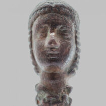
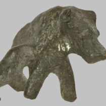
It is not known when exactly the yarn of Onithé’s history began to be woven, since no systematic survey of the site has been carried out. Nevertheless, the earliest indications of human presence (a stone axe and a grindstone) are dated to the Neolithic Age (4th millennium BC). Surface finds from the locality of ‘Pyrgos’ (= Tower), such as Early Minoan (EM I) and Late Minoan (LM I) pottery, a bronze zoomorphic figurine and a stone vase of the same period, denote that the site was inhabited also during the Minoan Age (3rd-1st millennium BC). Indirect evidence suggests an analogous situation for the transitional period from the demise of the Minoan palaces to the rise of the first poleis (12th-8th c. BC).

The early historical settlement at Onithé began to acquire the features of a polis or city (in the settlement and sociological sense of the term) from the end of the eighth century BC onwards. This city seems to have enjoyed its heyday in Archaic times (7th-6th c. BC), becoming one of the most powerful urban centres in the area, as is borne out by the large and ‘affluent’ residences which have been uncovered, the fortifications, as well as the few but choice artefacts in metalworking and sculpture, which have come to light. All these sketch the picture of a robust and well-organized city, with thriving outward-looking workshops, receptive to external influences. Furthermore, the monuments and moveable finds, which are dated to the sixth century BC, are considered particularly illuminating for our understanding of a period regarded as obscure – a ‘dark age’ – in Cretan research.

Life in the city continued during Classical (5th-4th c. BC) and Hellenistic times (3rd-2nd c. BC). Due to the piecemeal nature of research, testimonies on these periods are limited, without this reflecting the true picture of the city. The renowned ‘House A’ seems to have continued in use during the Classical period, as did other earlier constructions. Moreover, the (re)construction of the acropolis in the Hellenistic period reinforced the military might of the city and established its presence in the civil strife rife in these times.

The city, albeit weakened, endured in the Roman period too (1st c. BC-4th c. AD), which is known mainly from coins and surface pottery. During the final years of Roman rule and the Early Byzantine period (5th-6th c. AD) the monuments become more ‘expressive’. The existence of a large basilica with superb mosaic floors, although it cannot be considered indicative of population size, attests a relatively flourishing city. This picture is filled in by the evidence of the funerary monuments dated to the same period. The building of a small Medieval chapel upon the basilica confirms that habitation continued into the eighth century. Henceforth, next to nothing is known about the city, which seems to have been abandoned or to have degenerated into an insignificant village.

The area was inhabited once again in the period of Venetian rule, as attested by settlement remains, as well as by various small churches built in those years. The settlement was rather small and does not seem to have been permanent. In all probability it was linked with the cultivation of the fertile fields of Onithé by individual landowners. On the other hand, the small churches of provincial construction stand on the margins of the Onithé Plateau, essentially forming a sacral zone, with diverse ramifications beyond the symbolic-metaphysical. Characteristic is the proximity of these chapels to water sources, which hints at the existence of a land-management network.

Onithé continued to be inhabited in Ottoman times, during which the initial settlement was expanded and its productive space was highly developed. Quite the opposite of this is the present picture of the plateau, in which desertion and abandonment reign.

The name of the ancient city

The identification of the ancient city is particularly difficult, as all tangible testimonies are absent: no ancient inscriptions have been found, while the coin finds (collected from the surface) date from Roman times onwards and therefore are not inscribed with the name of the ancient city. Thus, efforts to elicit the name rely on information gleaned from literary and epigraphic sources, which in fact are not directly linked with Onithé itself.

Outcome of one such attempt was the identification of the city at Onithé as ancient Osmida, which is known from only one ancient source, the Periplous. This identification was supported initially by Pendlebury and later by Paul Faure. However, more recent research does not bear out a secure identification of Osmida with the site of Onithé. Some scholars seek ancient Osmida elsewhere, such as in the area of Potamoi and of Stavromenos. Others doubt the existence of an ancient city named Osmida and maintain that the hapax mention of it is due to a linguistic corruption.

The second ancient city with which the ruins at Onithé have been correlated – both by Kirsten and Platon – is Phalanna. Phalanna is attested in both literary and epigraphic sources, while it seems to have issued its own coinage. The literary reference to the city is made by Stephanos of Byzantion, while epigraphically it is mentioned in the famous ‘list of thearodokoi’, that is, of the cities which were visited by the official emissaries of the Delphic sanctuary (thearoi or theoroi), announcing the imminent festival and the games there (SEG 26, 624). In the list that the thearoi compiled of the cities they visited, Phalannai is mentioned after Rithymna and before Sybritos.

However, this entry does not prove the identification of Onithé as Phalanna, since there were also other cities between Rithymna and Sybritos, such as the ancient city at Veni. Moreover, the possibility that the thearoi had not visited the ancient city at Onithé, as it may not have appointed thearodokoi, cannot be ruled out. In this case, there will have been no need to include the city at Onithé in the said list.

Since it is not possible to identify the present ruins at Onithé with a city attested in the literary and epigraphical sources, we turn our interest to other sources, such as the geomorphological characteristics of the area.

On the basis of these, it is ascertained that the area of Onithé constitutes the southeast semi-mountainous part of the territory (chora) of the ancient city of Rithymna, the political geographical boundaries of which coincided with the natural ones (even today the site falls within the ambit of the Municipality of Rethymnon). Given that ancient Rithymna was established on the site of today’s Rethymnon only in Hellenistic times, it is quite possible that the city at Onithé had been its early urban centre.

A settlement model of this kind is not unknown, as other ancient cities had their strong settlement nucleus at high-altitude locations (Eleutherna, Lappa, etc.) and a secondary centre in a lowland or a coastal location, around a harbour. At the end of the Minoan Age, when the previous peace was succeeded by times of turbulence and insecurity, populations turned to more isolated and mountainous sites, where they established the so-called ‘defensive settlements’.

Regardless of the name that the city at Onithé had in early historical times, there is no doubt that it was the most powerful centre in the territory. From its vantage point, the ancient city controlled the vital passes, which coincided with the plateau’s natural boundaries to south and east, while at the same time it was protected against threats from the sea. The relatively restricted productive space did not prevent it becoming strong, by exploiting its crucial location and possibly its early (in Minoan times) habitation.

The Onithé Plateau

The Onithé Plateau, cradle of life and creation for several millennia, is a discrete territorial unit. A spur of the southern foothills of Mount Vrysinas, at an elevation of over 600 m asl, it is roughly triangular in shape, with the apex to the south, where the walled acropolis stands. This extensive terrace, with upward-sloping terrain, ends in sheer scarps to the south, east and west, forming a naturally fortified position. This nodal point secured control of the valley linking the area of Potamoi with the wider region south of Vrysinas, and of the main route of communication between the north and south parts of the Prefecture of Rethymnon.

The site of Onithé is accessible only from the north, where the gradients of the ground permit. North of it is the village of Goulediana, to the district of which it is subject. Goulediana is a settlement in the Municipality of Rethymnon, some 17 km. from the city of Rethymnon, capital of the Municipality and the Prefecture. The route from Rethymnon to Goulediana is short (30’) and smooth, along the provincial road network (see map, p. 110). From Goulediana, a rural road one kilometre long (with concrete surface for most of its length) runs upwards in a south-southeast direction to the Onithé Plateau.