In 1645, the landing of Turkish forces in the region of the Gonia Monastery, in the west part of Crete, marked the beginning of the island’s gradual occupation, completed in September 1669, after the fall of Candia, capital of the Kingdom of Crete. During the first two centuries of Turkish rule on the island, very few fortification works were constructed, most of which were erected during the Cretan war. The reason for a lack of new, large fortification works by the Turks, at least during the 17th and 18th centuries, was that the Venetians had already established an extensive fortification network in the big cities, as well as in other strategically important locations on the island. The new masters, therefore, preserved the most important forts in this network, after making necessary repairs on account of damages sustained by the war. It was only in the 19th century, during the great Cretan revolution of 1866, that the Turks undertook the construction of a new large fortification network in rural areas, aiming to suppress the revolt and control the island.
New forts in the 17th and 18th centuries
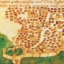
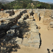
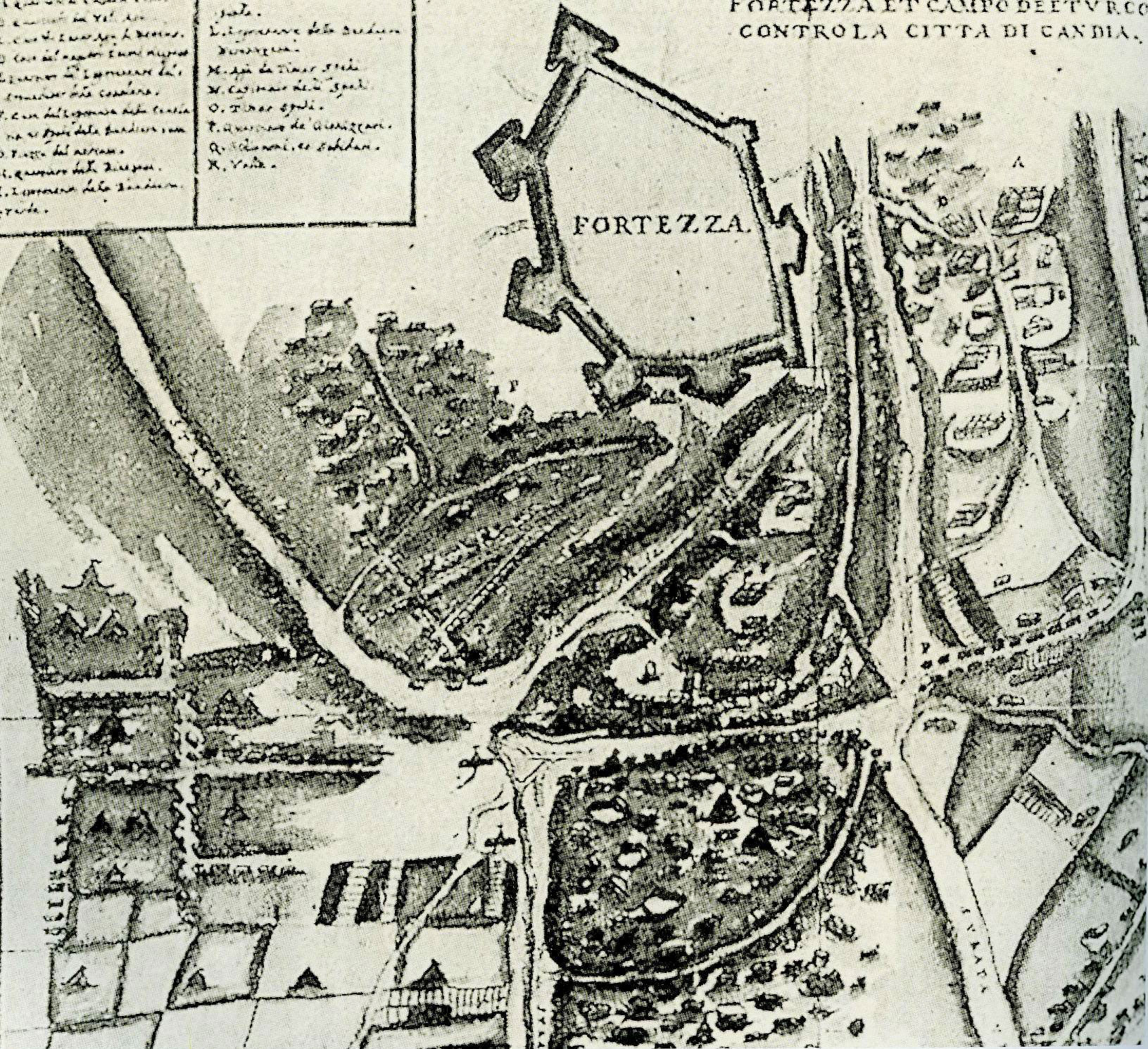
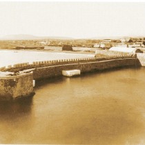
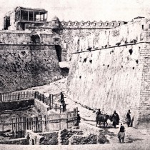
After their first failed attempts to take Candia, the Turks decided to construct fortresses around the city, as bases for the army. By command (firman) of the Sultan, in February 1649, the construction is ordered of three forts round the walls of Candia: one on the east coast opposite the Lazaretto, the second in the south of the city and the third to the west of the river Giofyros. The latter fort, in fact, is depicted in plans of the period as having been starshaped with four bastions. There is no trace of any of these forts today and their exact location is unknown. One more fort was constructed 5 klms south of the city, on the Ambrussa heights, on the site of today’s suburb of Fortezza (fig. 1). The fort, named Inadiye or Kale-I Cedit (New Fort), was erected by Gazi Hussein Pasha between 1648 and 1650 and was the army’s headquarters for administration and financial services. Sources mention that this fort with its six bastions was not well constructed since, while being erected, some of its sections collapsed due to heavy rainfall. Its rough construction, as well as the Fortezza settlement developing inside its walls after the 18th century, led to its almost total catastrophe. On the hill’s edges, small sections of the west and east sides of the enclosure survive today, clad on the outside with rectangular stones. In 1669, shortly after the taking of Candia, so as to reinforce the harbour’s defense, the Turks constructed a second fort on the east breakwater, opposite the Venetian Rocca al Mare fort (today’s Kule). It was called Kucuk Su Kalesinte (the Small Kule) (fig. 2). This fort, known to us through early 20th century photographs, was pulled down in June 1936, by order of the Port Commission of that time.
Realizing the great importance of the port of Souda, the Turks also constructed four small forts in the Chania region, during the Cretan war. These forts, considered necessary for the port’s more effective protection, were erected in places already selected by the Venetians for the construction of forts which, however, had never materialized. A small fort was built on the north coast, on cape Kalogeros, just before the entrance to the port. At the same time, another three were built on the south coast; that of Aghia Paraskevi, on the Venetian site of Koulata on the west part of the south coast, another one on the hill known as The Old Woman’s Jump (Pidos tis Grias) and a third on the Podomouri hill , opposite the islet of Souda. In the latter location, fort Kalami was erected, to be rebuilt, after 1866, as the pentagonal Itzedin fortress.
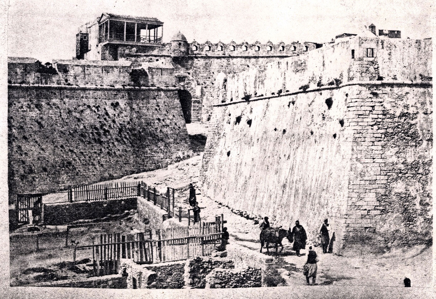
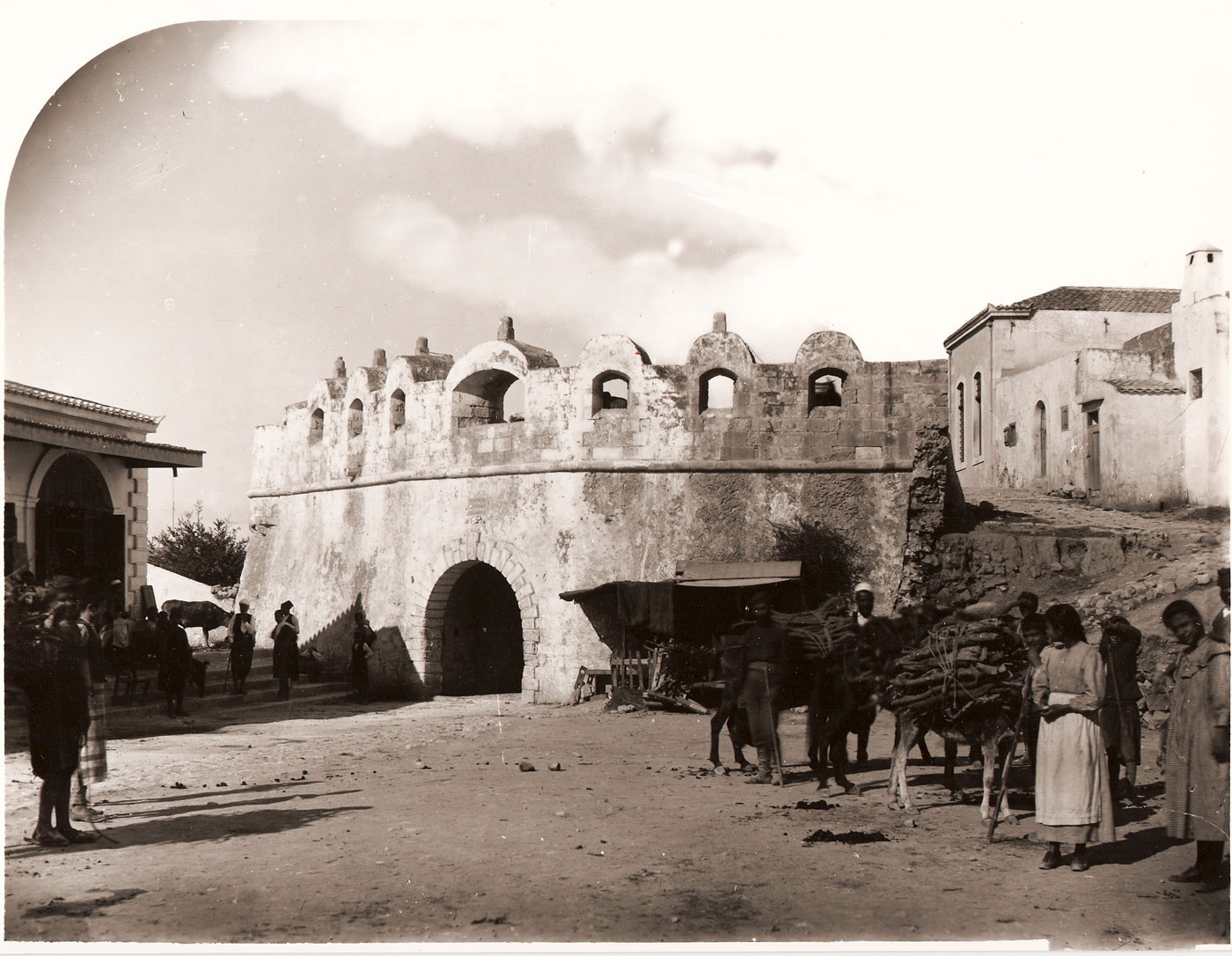
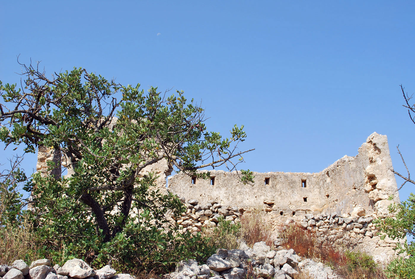
In the late 17th and early 18th century, shortly after the end of the Cretan war, three new forts were constructed in the city of Rethymnon. A fort measuring 46.50×30.50m that today houses the city’s Archaeological Museum, was constructed in front of the main east entrance of the Fortezza (fig. 3). A second, now destroyed, was constructed on the north side of the Venetian port and a third at the city’s east end, near the so called Ammos gate, also destroyed. The first reference to the surviving pentagonal fort, east of the Fortezza, specifically as a new fort, goes back to 1715. This fort, as has been noted, is a classic example of the way to secure the gate of a fort and can be described as a ravelin. Its structure is identical to that of corresponding fortifications from the period of Venetian rule which must not come as a surprise, since for centuries there were types of fortifications with bastions, regardless of who constructed them. The fort’s enclosure wall slanted as far up as the cordone (a string course), that corresponded to the level within, on which he soldiers moved around. The upper wall, like the fort’s corresponding section, was flat and formed by embrasures for cannons, now walled up. In its NE corner, as high as the cordone, the base remains from a circular watchtower, similar to those of the fort. Its appearance has been spoilt by its continual use over the centuries and mainly by its conversion into a prison, operating up to 1960. The other two forts seemed to have had a similar appearance, as deduced from early 20th century photographs.
There is still unconfirmed information by the Turkish traveller Evliya Celebi about coastal forts having been constructed by Gazi Hussein Pasha in the harbours of Fodele and Aghia Pelagia in Heraklion, during the first years of Turkish occupation. Celebi gives quite a lot of information, particularly about the castle of Fodele’s construction and equipment, while mentioning that it was repaired in 1666 by fleet admiral Fazil Ahmet Pasha.
Inland, during the early Ottoman period, no new fort seems to have been constructed.
Watch towers
It is worth mentioning the extensive network of watch towers operated by the Turks to tackle the scourge of pirate raids. This network, already in use since 1689, covered both the coasts and inland of Crete in its entirety. The towers had visual contact between them and in case of danger they alerted each other with a red flag by day and fires by night. The few sources on the subject give no facts about their being erected, even though it is possible that the existing Venetian network of coastal forts was used, being also spread across the island. A watch tower of this type survives on the hill of Aghia Paraskevi, NE of the Skepasti settlement and is already referred to in the report of Nicola Gualdo in 1633. This network operated at least till the 18th century, since the Frenchmen P. Bonneval and M. Dumas use them as landmarks in their reports on Cretan fortifications. They specifically mention that the towers in eastern Crete were manned and in good condition, while iron doors had been placed on some.
Interventions on existing Venetian forts
Immediately after the occupation of Crete in 1669, the Turks began repairing the most important existing Venetian fortifications on the island. In the early 18th century however, work on their restoration had not been completed, as two imperial decrees (firman) were issued in 1715, requiring the speeding up of repair work on the forts of Candia, Chania, Rethymnon, Gramvousa, Ierapetra and Kisamo. The cost of these works would be partly covered by the sultan’s funds and the rest by the annual contribution to the treasury of Crete. The specific forts appear to have suffered most damages during the long war in Crete and at the same time they were the most important on the island.
In the City of Chania, the bastion of Aghios Demetrios or Lando was initially repaired, as was the area of the Sabbionara gate on the east side of the fortification enclosure, both of which had sustained most damage during the city’s two month siege. Moreover, in a late 17th century Venetian plan of the city of Chania, various fortifications are depicted, built between 1645 and 1688, none of which survive today. Among them is a small fortress /stronghold west of the Rettimiota gate and another in the middle of the east curtain wall of the Venetian fortifications. There is evidence throughout Turkish rule of the city fortifications being repaired, while in some periods, such as after the Daskalogiannis revolution, it appears that work on them intensified, since there is mention of 1.500 Greeks working on the walls in 1776. All the same, it seems that the works done must have been very basic, because in the second half of the 19th century, the walls looked completely abandoned.
In the region of Chania, the forts also used were those of the Gramvousa and Souda islets, the Castel Chissamo as well as the Castel Franco. Repairs on these as well are testified in written sources, almost throughout the entire period of Turkish rule. Nevertheless, the 1783 report of Bonneval and Dumas mentions that the Castel Franco was already abandoned, which is confirmed by early 9th century sources. It is mentioned that the rest were operating, with garrison and cannons, despite being poorly maintained. The Souda fort is referred to as a typical example, with part of the ramparts and the cladding of the fortification enclosure having collapsed, while inside the fort, in a garrison made up of 700 village men, only 50 of them were paid wages and functioned as a proper garrison.
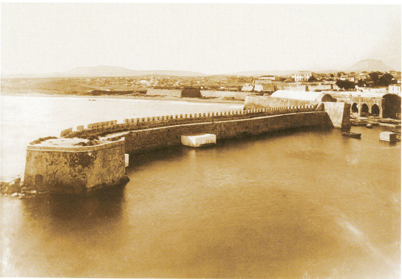
In the city of Rethymnon, no drastic changes were carried out in the area of fortification. Basic fortification works were restricted to the land walls of the city –mainly the Fortezza– that were periodically repaired, as made evident by relevant documents of the period, as well as the actual interventions on its walls and buildings. The walls on the east side above the gate were modified by the Turks with low arched openings, while similar openings were also placed on the section of the city’s fortification enclosure, above the walls’ central Guora gate (fig. 4). A densely built settlement was established at the start of the 18th century inside the fort where the city garrison lived, mainly in its southern and eastern part, with a population of 500 Ottomans in the 19th century. The big Venetian buildings, such as that of the Artillery, the rampart of Aghios Loukas, the so called Rector’s prison, the Councilors’ residence, are all repaired and acquire other uses or completely change their appearance. The siege of Candia, lasting almost a quarter of a century, had created many significant damages to its fortifications and for this reason the Turks immediately began repairs. It seems that much of the necessary stabilizing and reconstructing took place during the 17th century, continuing at a fast pace, however, in the first half of the 18th century when the major works were completed on the fortifications’ perimeter. First the southern part of the fortification enclosure was repaired and cladding was completed of the straight sections and bastions that had collapsed. The bastion of Aghios Andreas, that had been almost totally destroyed, was reconstructed as heart shaped, while to its southeast, a bastion was also added. Repairs were also carried out in the Kules Fort, mainly on its south side and ramparts on which built embrasures for cannons were added.
The fortification network of Kule during the 19th century
In the 19th century, during the great Cretan revolution of 1866-1869, the Turkish administration decided to construct a series of fortifications in key points of the island. In documents of the time, these forts are called towers or blockhouses, whereas today they are called kale after the Turkish word kale (= tower). The purpose of these forts was to cut off any communication between the rebels of different provinces, to severe their access to supplies from small harbours and for Turkish forces to be constantly present throughout the island. The kule usually had direct visual contact, for the garrisons to communicate with each other by using either sounds or fire as their signals. Over one year, 320 towers were built with summary procedures all across Crete. Many of these were abandoned, as in 1872 when there was a decrease in the numbers of soldiers manning them, while in 1874, 80 of them were pulled down, once again for military reasons.
This grandiose project was launched in July 1867 by Omer Pasha, commander in chief of the Ottoman forces. Their construction began in the region of Chania, specifically from Sfakia and as mentioned by documents “Considering the west part of the island as the most rebellious, he gathered there, over many months the majority of his forces, constructed a great number of towers, opened roads”. By the end of 1867, only three towers had been built in the Sfakia region, whereas the work gathered momentum with the arrival of Hussein Avni Pasha, Governor in chief of Crete and Commander in chief of the troops. On September 9th, 1868, 70 Kule had already been built; 48 of them in the Chania district (20 in Apokoronas, 22 in Cydonia, 3 in Selino, 1 in Kisamo, 2 in Sfakia, 3 in Rethymnon, 1 in Tymbani, 5 in Malevyzi, 5 in Ierapetra).
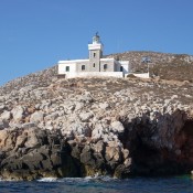
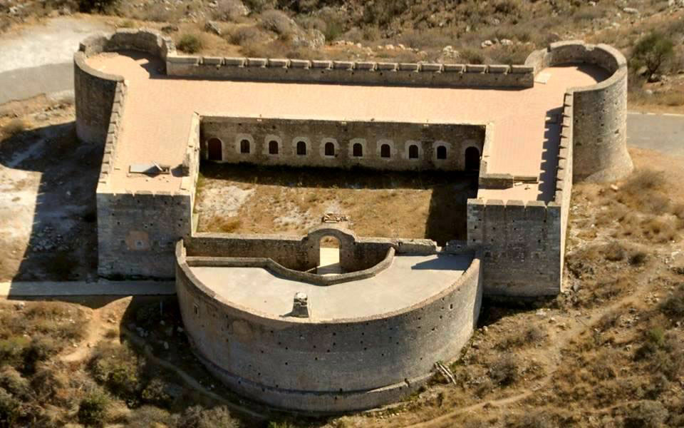
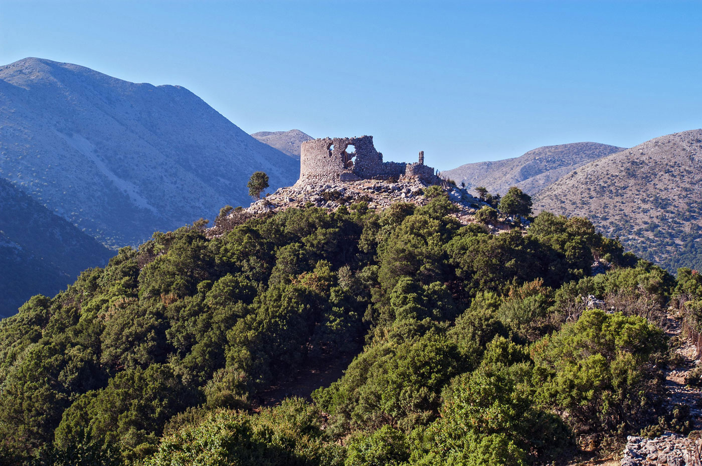
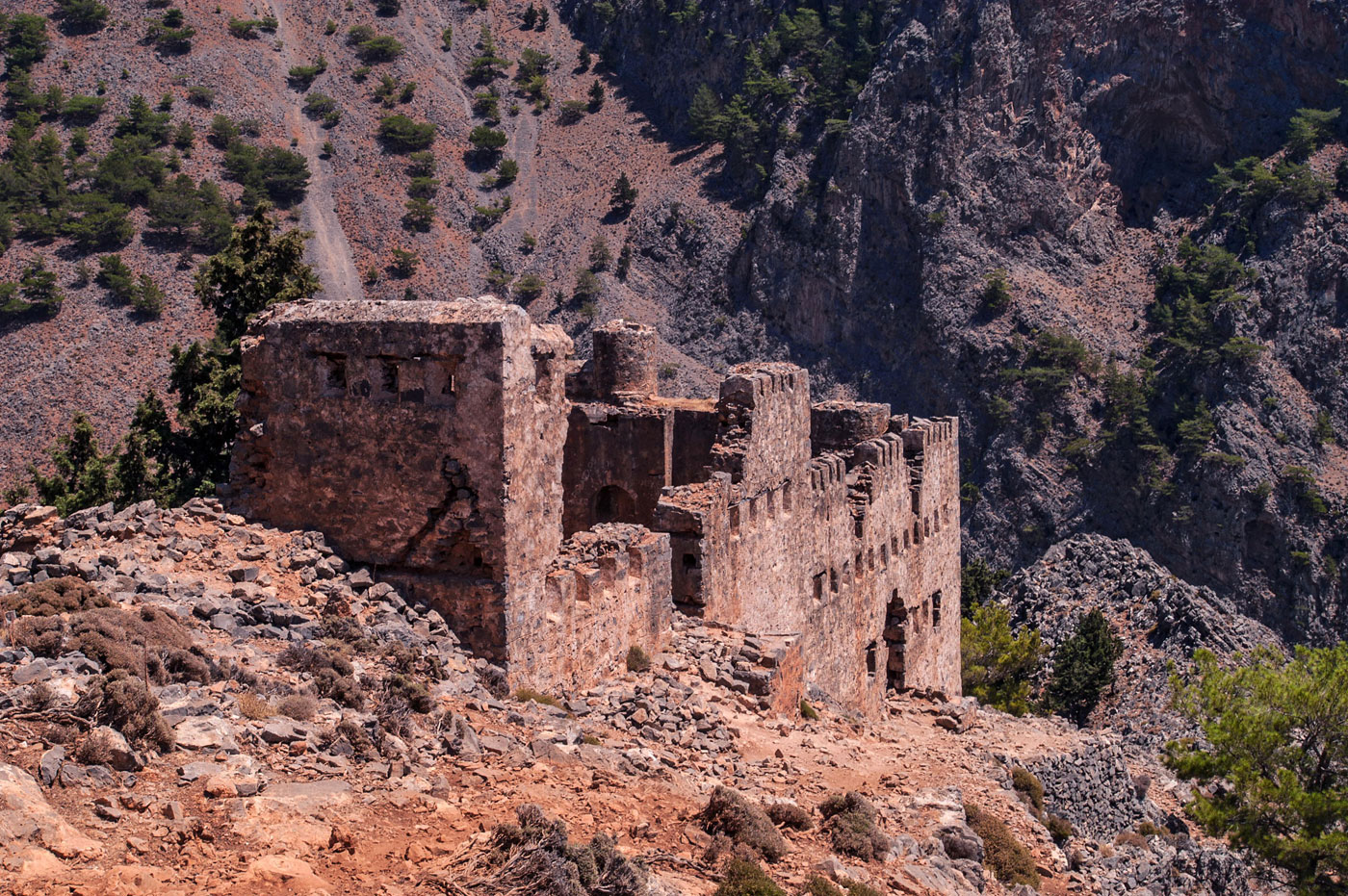
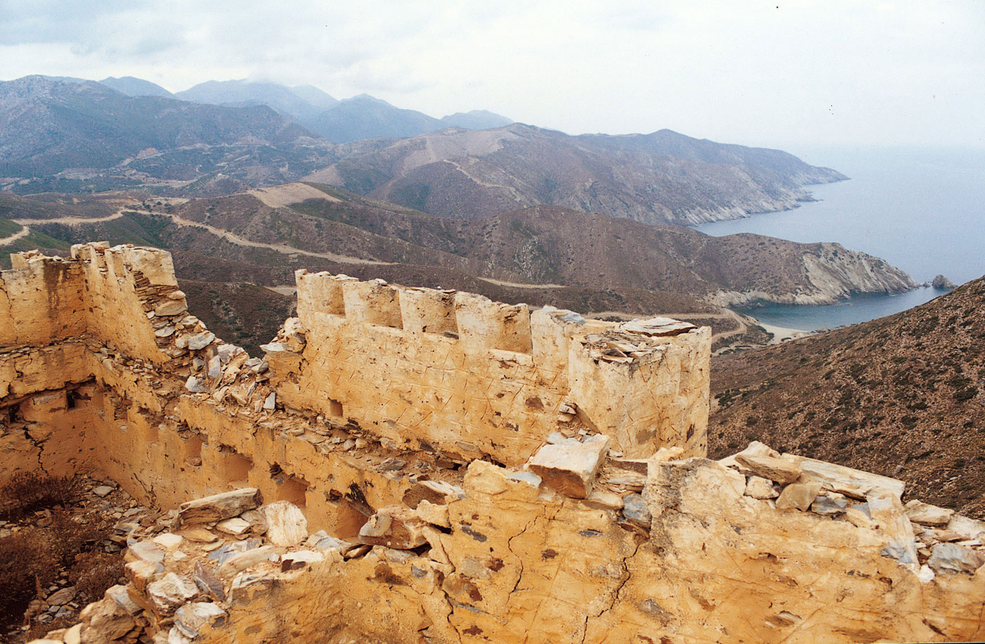
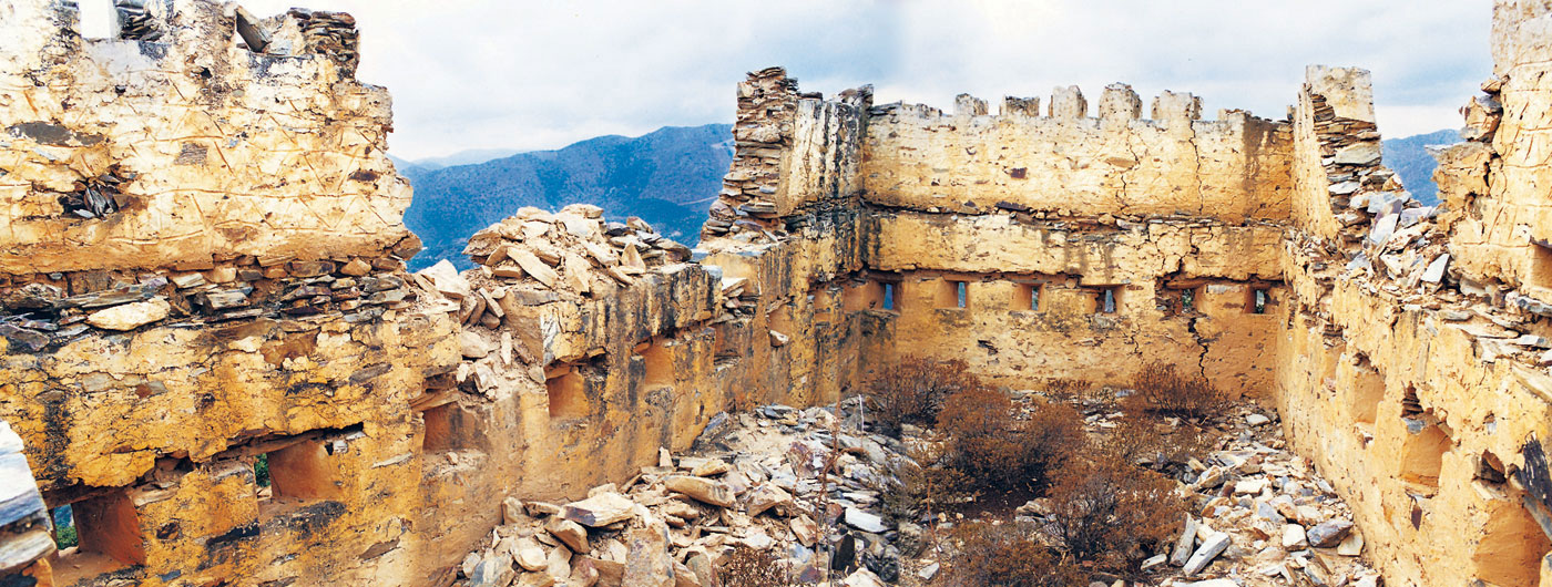
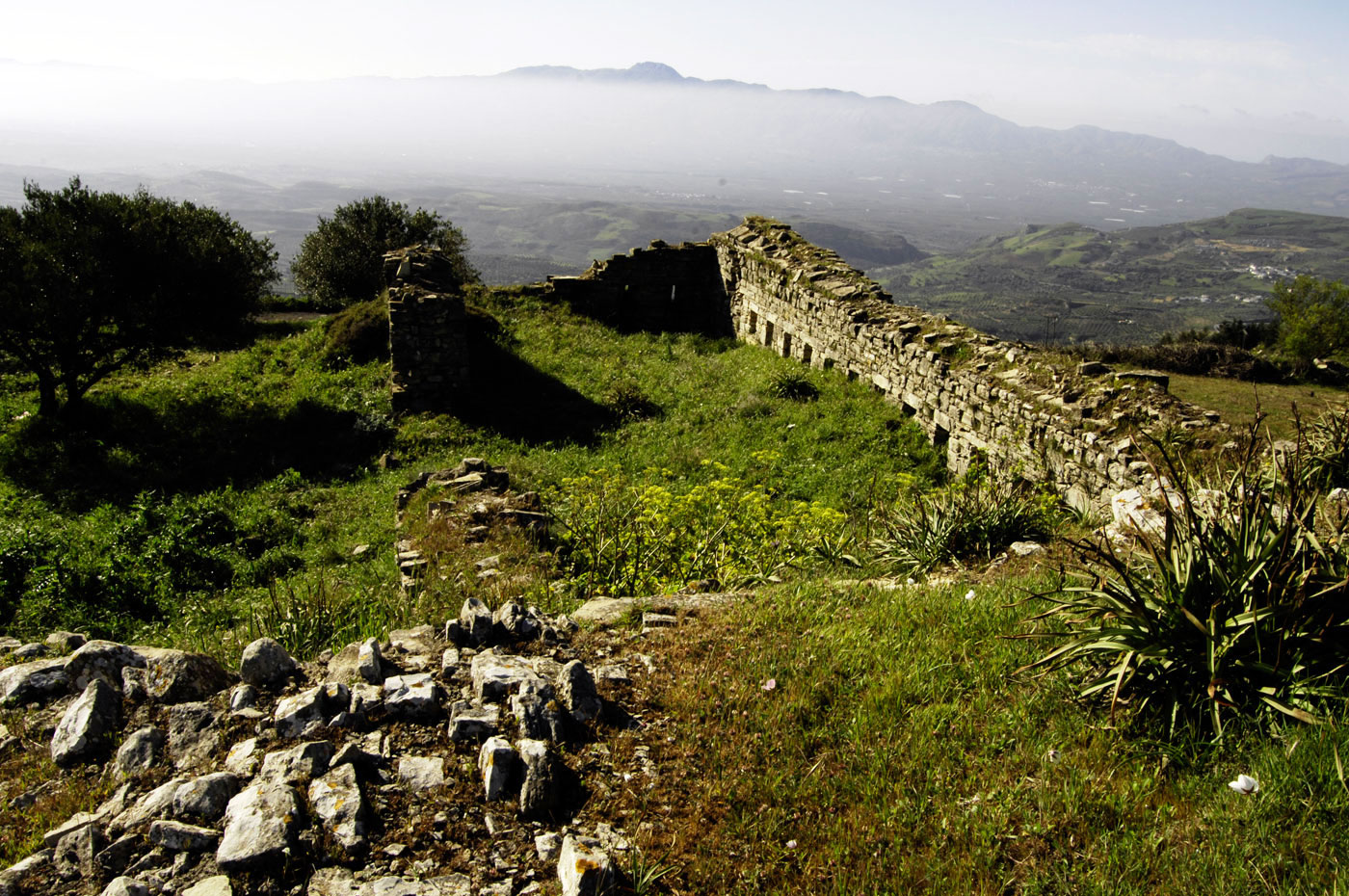
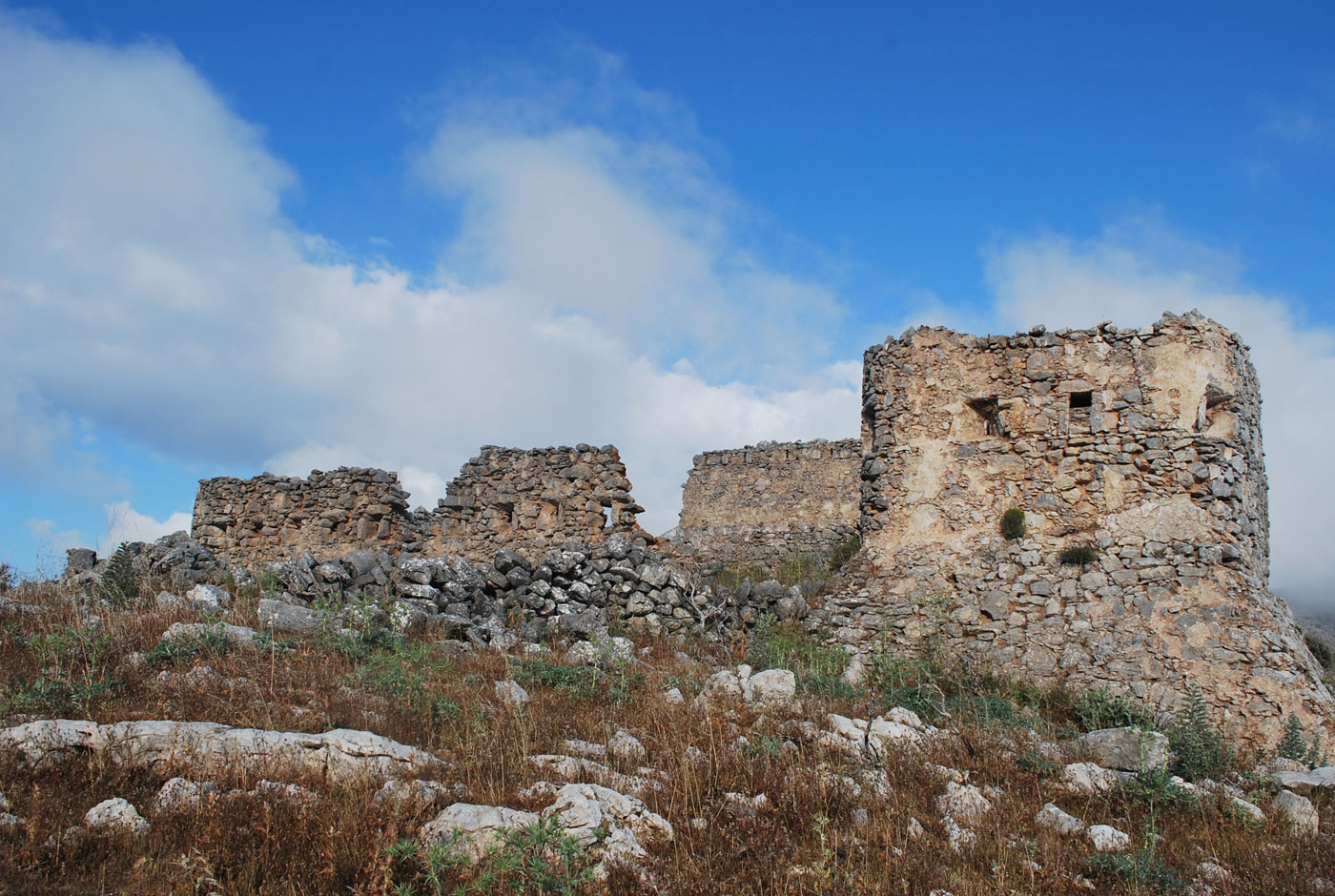
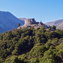
The fortification network of the geographical department of Chania was the island’s most dense and extensive. On the south side of the port of Souda, the pentagonal Itzedin fort was erected on the coast, in the place of the old Kalami fort. Higher up, at the foot of the Palaiokastro hill, on the site of the ancient city of Aptera, the big Soumbasi kule was built (fig. 5). Further south, two Kule were constructed in Nio Chorio, two in Kaina, one in Vamo, three in Ramnounta and one in Kares, Melidoni, Vafe, Embrosnero and Alikambo. These communicated with the kule on theKrapi plateau that had visual contact with the two kule on the Askyfos plateau (fig. 6) which in turn linked the Apokoronas forts with those of the Sfakia region. A similar network was also constructed on the south coasts. To the east was the active Venetian Castel Franco, followed by the kule of Sfakia and Loutro (fig. 7, 8), Aghia Roumeli (fig. 9), the kule of the Samaria Gorge and one on the steep hill of the Prophet Elias.
A large number of kule were also constructed in the prefecture of Rethymnon. On the road leading from Rethymnon via the valley of the Potamoi towards Amari, the Turks created a very important network of kule that included the following: the kule NW of Prassoi near the location of Aghios Cyrillos, the kule of the Potamoi, that of Patsou, one at the entrance of the Amari valley, between Apostoloi and Meronas and last, the kule at Neus Amari, the only one in the group that is completely destroyed. At the east end of the Amari valley, the Turks constructed the two kule of Apodoulos and Vatheiakos on the hill south of the settlement and the kule of Lochria east of the settlement. In this way they completely controlled the passage leading towards Messara. Another group, from which three kule have been located, is to be found on the road that led to Aghiovasileiotika. The first that was called Haroup Kule or Kalosynas is situated on the hill to the north of Armenoi, the second on the eastern heights of Armenokambos and the third above the Foteinou settlement. Today of course, several more survive that, despite seeming isolated, would have belonged to some network, like the one at the “Water of the Stone” (“Nero tis Petras”) location, on the road leading from Arkadi towards Throno (on the old highway from Rethymnon to Chania), near the village of Kalonyktis and elsewhere.
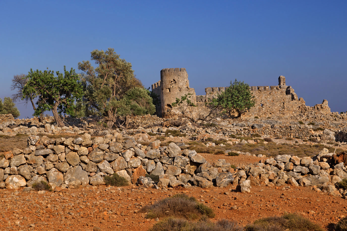
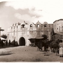
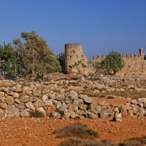
In the prefecture of Heraklion, it seems that the network of kule was not as extensive as in the previous two, since fewer are mentioned in the sources and today only a handful survive. At the west end of the north coast, in the Fodele district (fig. 10, 11), three kule were constructed at a stone’s throw from each other. In this way they not only controlled the pass leading from Heraklion to Rethymnon, but also the natural harbour created here. Another group was erected in the south part of the prefecture so as to control the passes leading to the plain of Messara. Three were built to the west, in the valley of the settlements of Kamares – Grammeni and Gregoria, out of which the one between Gregoria and Magarikari is quite well preserved. These kule were a continuation of the Rethymnon network and they had visual contact with that of Lochria which was the one situated more to the east. To the north, on the pass leading from Heraklion to the plain, is where the kule at Ano Moulia was built and it survives to the east of the settlement (fig. 12). There is evidence of one more in the plain, north of Moires. In the north part of the prefecture there is mention of a kule at Aghios Myronas and at Tylisos, that was however destroyed by the Greeks during the revolution.
In the Lasithi prefecture, not a great number of kule seem to have been erected. In the Ierapetra region, sources mention at least five kule. Three of these, surviving till today, are situated on the narrow pass of the Ierapetra isthmus that connects the western provinces of Lasithi with the Ierapetra region. They are the kule of Vasiliki, that of Episkopi which was the largest and the kule at Kendri. No kule seems to have been constructed in the province of Siteia, since there is no reference to that either in any source or contemporary bibliography.
The construction of kule often took place in the middle of fierce conflict between Turks and Greeks so, naturally, work on them progressed without much care, often leading to their collapse. Some of them were built by a large number of workmen in 8 to 10 days. One typical example are the kule in the area of the settlements of Aghia Pelagia, Fodele and Bali on the island’s north coast, constructed between the 7th and 27th of September, employing over a thousand workers. The builders were Armenians who had come from Constantinople or Cretans working either for pay or by force. They were usually locals from the greater area in which the towers were being erected, but sometimes they were brought from other districts, as in the case of the Sfakia forts where builders were sent from the city and outskirts of Candia. Building materials were obtained in the area, while Thessaloniki supplied the timber. A written source mentions that some churches in Prases and the nearby Chromonasteri settlement were demolished so as to construct the two towers of Prases in Rethymnon. Their size and appearance were according to the importance of the location they were overseeing. They were made of rubble and then plastered, while only their openings were of chiselled masonry. Overall they were covered by a flat roof surrounded by a high parapet. Whatever their size, they usually had two rows of embrasures for firearms, one at a man’s height and the other on the parapet surrounding the flat roof. The top part of these apertures was open, forming ramparts.
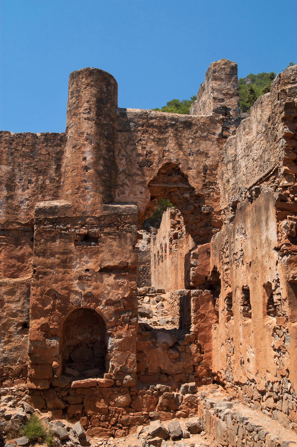
Generally, however, there were two types of kule; the small ones that were manned by just about 10 men and the big ones where a garrison could include as many as 100 individuals. Belonging to the category of small kule is the one in the Kalonykti settlement, situated on a hill, on the old highway between Rethymnon and Chania, near the settlement (fig. 13). It is a small, one storey, rectangular fort of 40 sq. metres, its only feature being the embrasures for firearms on its perimeter walls. Belonging to the category of large kule is the one of Prases that measures 400 sq. metres and those of Meronas in Rethymnon and of Aptera in Chania both measuring 40x47m. The latter two, like those of Loutra in Chania and of Episkopi in Ierapetra belong to the type with high, circular towers (one in those of Meronas (fig. 14) and Loutros, two corner ones in the Aptera kule and four corner ones in that of Episkopi), whose lower section slopes steeply. The bigger ones usually had barracks on their inside, while many had a fire place. Their water supply came from reservoirs collecting rain, since the majority had been built on hill tops that had no springs of water. In at least one case, that of the Itzedin Kule, an important water network had been constructed, ending as a fountain outside the fort’s main entrance. Sometimes there were auxiliary buildings near the kule. The one in the Meronas kule is characteristic, being a miniature of the big tower, since, even though small, on its one side it ends in a circular tower with embrasure for firearms.
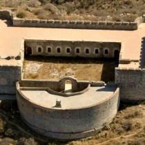
Today, most of this fortification network has been totally abandoned with the kule in ruins or else completely destroyed, while, in most cases, access to them is very difficult as they are on hilltops with vegetation running wild. The great kule of Soumbasi in Aptera is an exception, having been restored by the Archaeological Service in the year 2000.
Kostas Giapitsoglou
Archaeologist