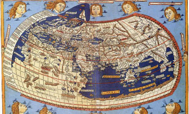
The Pelagios project, which has previously been focused on connecting online resources that refer to the ancient Greco-Roman World, is significantly expanding its scope. With new funding from the Andrew W. Mellon Foundation, Pelagios 3 aims to annotate, index and link place references in digitized Early Geospatial Documents that use written or visual representation to describe geographic space prior to 1492. As a result, the project will not be only dealing with texts and maps from the ancient Greco-Roman world, but also from the early Byzantine, Christian, Maritime, Islamic and Chinese traditions. Such records are visual or written descriptions of the world, or of part of it (originally) in Latin up to 1492, as well as translations of such documents into other languages (ancient or modern).
” We are going to need a great deal of help from the expert communities for each subject area!”, reports the research team, consisting of Drs Elton Barker, Leif Isaksen, Pau de Soto Cañamares and Reiner Simon. The first of these is the area of Early Latin Geospatial Documents. The team is currently compiling a list of suitable candidates for annotation, and they approach the scientific community for comments, as well as any additional digital content or translations related to them.