The Byzantine presence in Crete is divided into the 1st and 2nd Byzantine period, with an intermittent break due to Arabic rule on the island. The 1st Byzantine period dates from the 5th century BC to the conquest by the Arabs (824/6). The 2nd Byzantine period can be placed between 961 (the year Crete was reclaimed by byzantine troops) and 1206, when the island comes under Venetian rule.
The years of Byzantine presence on Crete are strongly marked by the Arabic Byzantine conflict, culminating in the founding of a peculiar Arabic emirate for over 138 years (824/6-961). Strategies, as determined by geography, both throughout the Mediterranean and in its eastern part, are shaped by new facts resulting from a series of attacks and conquests by the Arabs. Already by the end of the 6th century, Byzantium’s borders are under great pressure, as are its regions in Syria, Mesopotamia, southern Asia Minor and its territories in North Africa. Attacks by the Arabs threaten the island coasts, as in the case of Crete. Some such attacks and landings on the south coast of Crete and the Castle of Heraklion come in the wake of the earlier ones, as witnessed by archaeology. Both contemporary archaeological research and historiography agree on the gradual abandonment of the coastal towns, the shrinking of existing urban centres and the decline of any economic and cultural activity in Crete during the 7th century. Information about fortifications on the island of Crete, during the two Byzantine periods, should be seen in this light.
1st Byzantine period
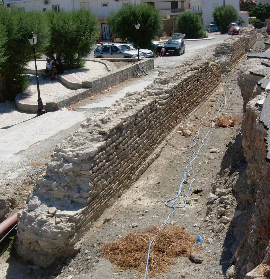
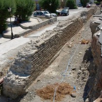
On the west boundaries of today’s Ierapetra (ancient Ierapytna), we encounter an early fortification work, namely a fortification enclosure that, as suggested by the construction’s particular morphology, protected the sea front of the Proto-Byzantine city since the 6th century. Quite a large section of a strong wall survives, parallel to the coastline (fig. 1), built with a generous amount of bricks. The technique used in the masonry resembles the one found in Proto-Byzantine fortifications, both in the empire’s capital city of Constantinople and important cities in Greece such as Thessaloniki and Nikopolis. A relatively recent survey of this structure (2006-2008) offers valuable information on the art of fortification in Crete, since, till now, we were not aware of such early Byzantine fortifications on the island. Most probably, it is the only fortification work of the Justinian period known to us.
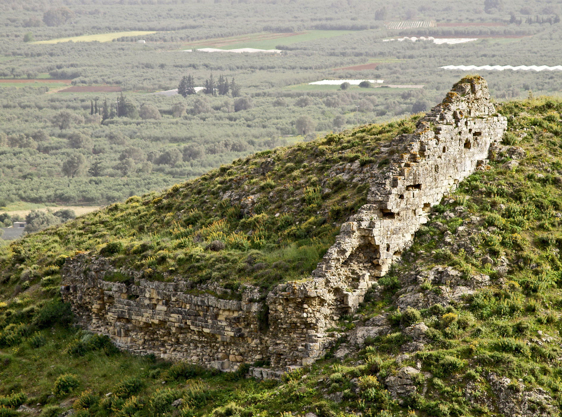
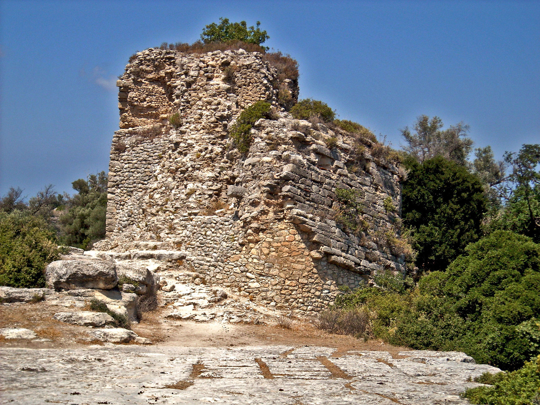
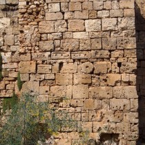
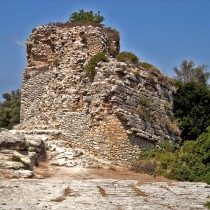
The citadel of Gortyna was an important fortification construction from the 1st Byzantine period. Gortyna in Messara, which is approximately in the centre of Crete, with access to harbours on the south coast, was already the island’s capital since roman times. The hill’s fortification to the east and north of the extensive city (different from the Hellenistic citadel on the Prophet Elias hill to the west), consists of a monumental fortification enclosure that crowns the hill, protecting a spacious flat expanse. There was already a large earlier building (known today as the Castle) inside the citadel. The wall has a strong polygonal tower on its accessible west side and three other square towers (two of them covering the NW and SW corners respectively).The masonry reveals that building blocks were used from the plentiful amount left from the once thriving city of Gortyna which, during the 7th century, had turned into a “shadow” of its former self. The outer side of the wall is carefully built of rectangular, well hewn blocks (fig. 2), it is founded on a rock and its form is reminiscent of the large fortification works of Ankara, Nikaia, Korykos, Macedonia and Cydonia, as well as many other places where important fortification works were built throughout the empire, during the 6th to 7th centuries, under threat of attacks by the Arabs. The citadel of Gortyna appears to have been reused following Arab rule, as proved by an extension to the east of the fortifications, which has the characteristic masonry of fortifications from the 2nd Byzantine period.
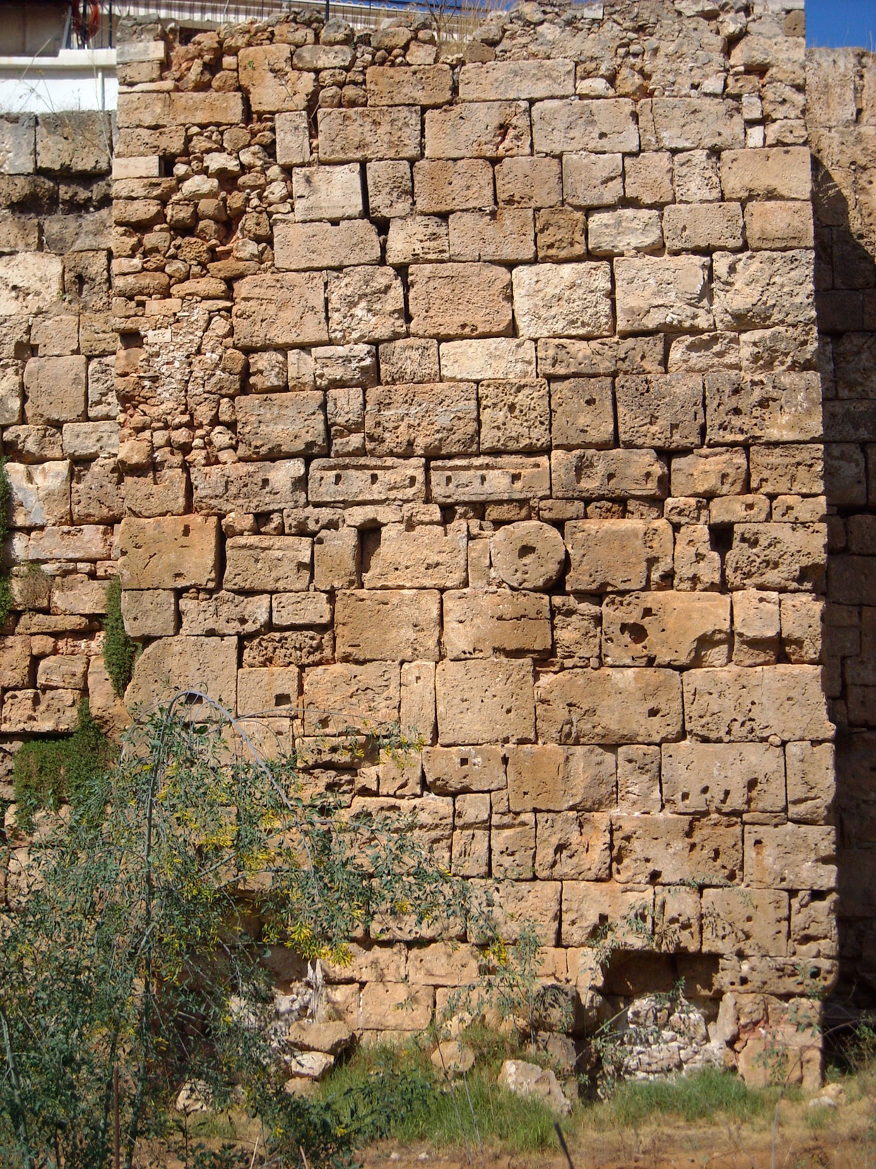
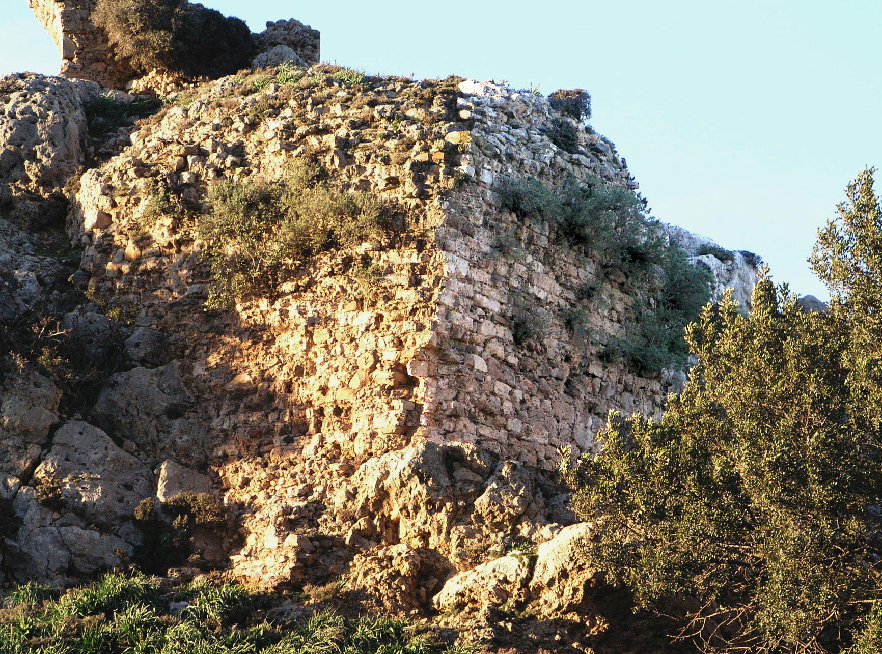
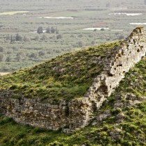
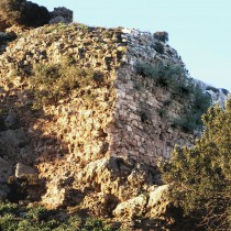
Perhaps the most impressive fortification work of the proto-byzantine period is that on the hill known today as Kasteli in Chania,on the siteof ancient and early Christian Cydonia. A monumental fortification enclosure is built on top of the walls of Cydonia’s earlier Hellenistic citadel and uses plenty of its building material a second time round (fig. 3.). This is a feature, in morphological terms, that points to large fortress constructions of the 7th century, all over the byzantine East. Very high towers, both square and rectangular, project from the outer side of the walls, all along the enclosure (fig. 4), with a monumental square tower standing out on the west side, towards the harbour. The city of Cydonia was abandoned during Arab rule and was re inhabited upon the arrival of the Venetians. Over the last few years, with archaeologist Michael Andrianakis as its head, the Scientific Committee for the Enhancement of the Byzantine and Venetian Fortification Enclosure of Chania has recorded, excavated and drawn attention to the Byzantine fortifications of Cydonia.
The fortress citadel of Lyktos in the Pediada region, inland from Heraklion, resembles those of Gortyna and Cydonia. Here, the Roman city is confined to a strong citadel with a fortification enclosure that surrounds the hill’s upper end. The masonry points to Proto-Byzantine fortification constructions, by incorporating rectangular blocks in successive rows and using strong mortar. Facing south, we encounter a powerful, semicircular tower with a clear defence orientation, since Lyktos was situated on the road artery connecting the south coast of Heraklion with the shores to the north.
In the Eleutherna citadel, the narrow rocky isthmus had a large fortification enclosure that protected the only entrance gate to the Early Christian city. Today, a small section survives of the monumental construction (fig. 5) and we can see how it relates to corresponding fortification structures in Crete of this period.
In the Kastelo in Varipetro (a big castle of the 2nd Byzantine period, near today’s Chania), a section of the southern fortification enclosure (fig. 6) reveals an early building phase that can be placed in the 7th century, just like the bulwark on the north side that differs morphologically from the main fortification enclosure. These sections in the castle of Varipetro are morphologically related to the fortifications of Eleutherna and Lyktos.
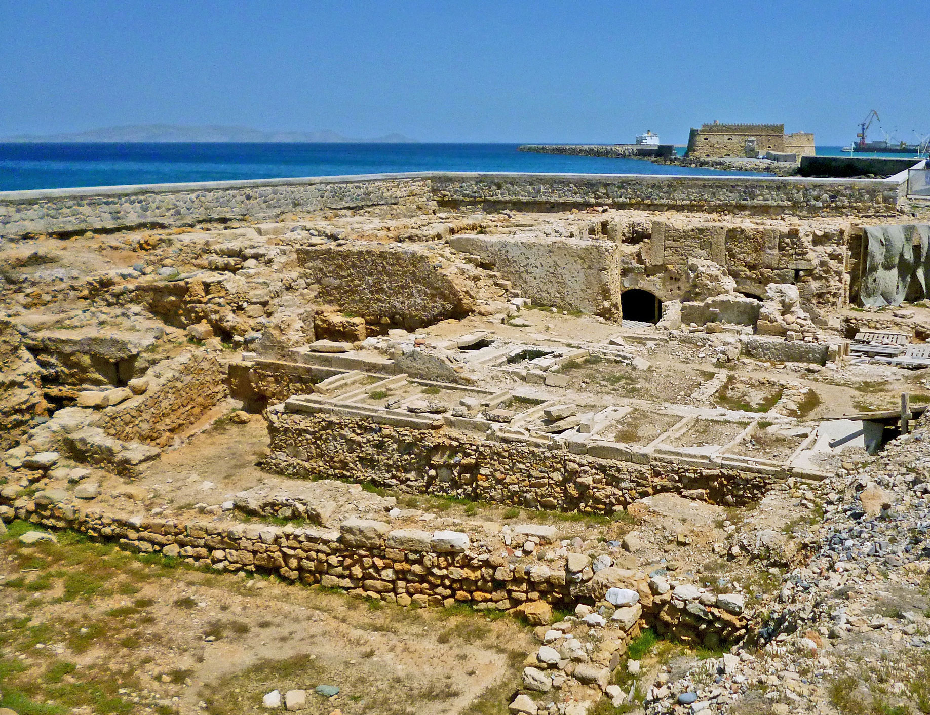
In the Castle of bygone days, in the place where the city of Heraklion stands today, an early phase of fortifications predating Arab rule, has lately been discovered. A recent excavation on the site of Bendenaki brought to light a section of the sea front fortification, belonging, most probably, to the Proto-Byzantine city (fig. 7). It consists of a monumental, square tower like building, with halls on the inside and cisterns built like the fortifications of Cydonia. Till now, the few sources available could only let us guess the appearance of the city, prior to Arab rule. This important excavation, however, combined with the discovery, in some other spots, of sections of early Christian walls, allows us to form an impression of the early Christian city, where Heraklion stands today.
During this same period, as shown by ongoing surveys, it seems that some early Byzantine coastal cities survived the difficult times prior to Arab rule, precisely because of fortifications having been constructed. Some such places are the following: ancient Levin (today’s Lendas), Inatos (today’s Tsoutsouros, and Cherronisos ( today’s Harbour of Chersonissos) in the Heraklion district, Itanos in Sitia, Oaxos (or Oxa) in Merabelo (on a hill exactly above Elounda, in the place where ancient Olous was situated) and Syia (today’s Sougia) in Chania.
Arab Rule
We do not know many things about the use of fortifications during the period of Arab rule except for Arabic Chandakas (Rhab el Khandaq), an important Arab centre in Crete. Analytical descriptions in texts by Byzantine historians speak of a strong, fortified town with high walls and a surrounding moat. It was thought that the so called Arabic city walls were built in that period, but we should probably revise this hypothesis, following data from the latest ongoing excavations on the northern sea front (Bendenaki).
2nd Byzantine period
The eight month siege and conquest of Arabic Chandakas by the military forces of Nikephoros Phokas in 960-961 highlighted one of the most important historic victories in the Byzantine period. The restoration of Byzantine rule on Crete proved to be a difficult task with controversial results. The Cretans became accustomed to the presence of an urban Arabic population, as a result of the locals living together with the Arabs, over a long period of time. This marked an attempt, difficult to say the least, at restoring the prestige of the central authorities. During the difficult time following Arabic rule, large scale fortification works seem to have been one of the “weapons” of central administration, since the former established both the authority and secure presence of the Byzantine forces, combined with their military troops staying on the island, in an attempt to colonize it. Large fortification works on a monumental scale, costly constructions requiring the toil of many people, spread throughout the island.
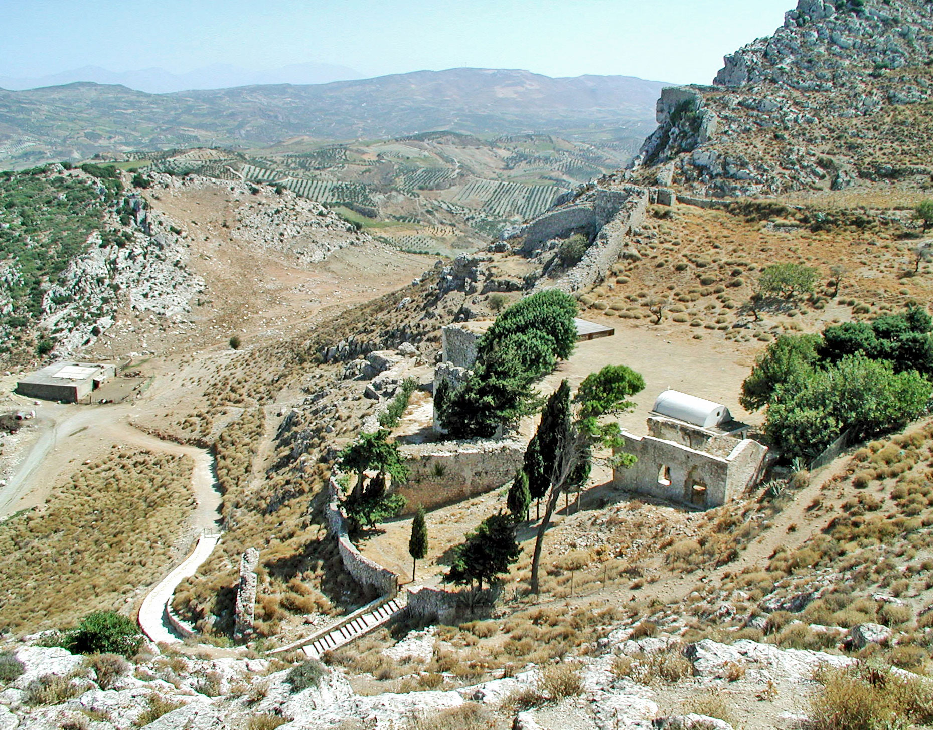
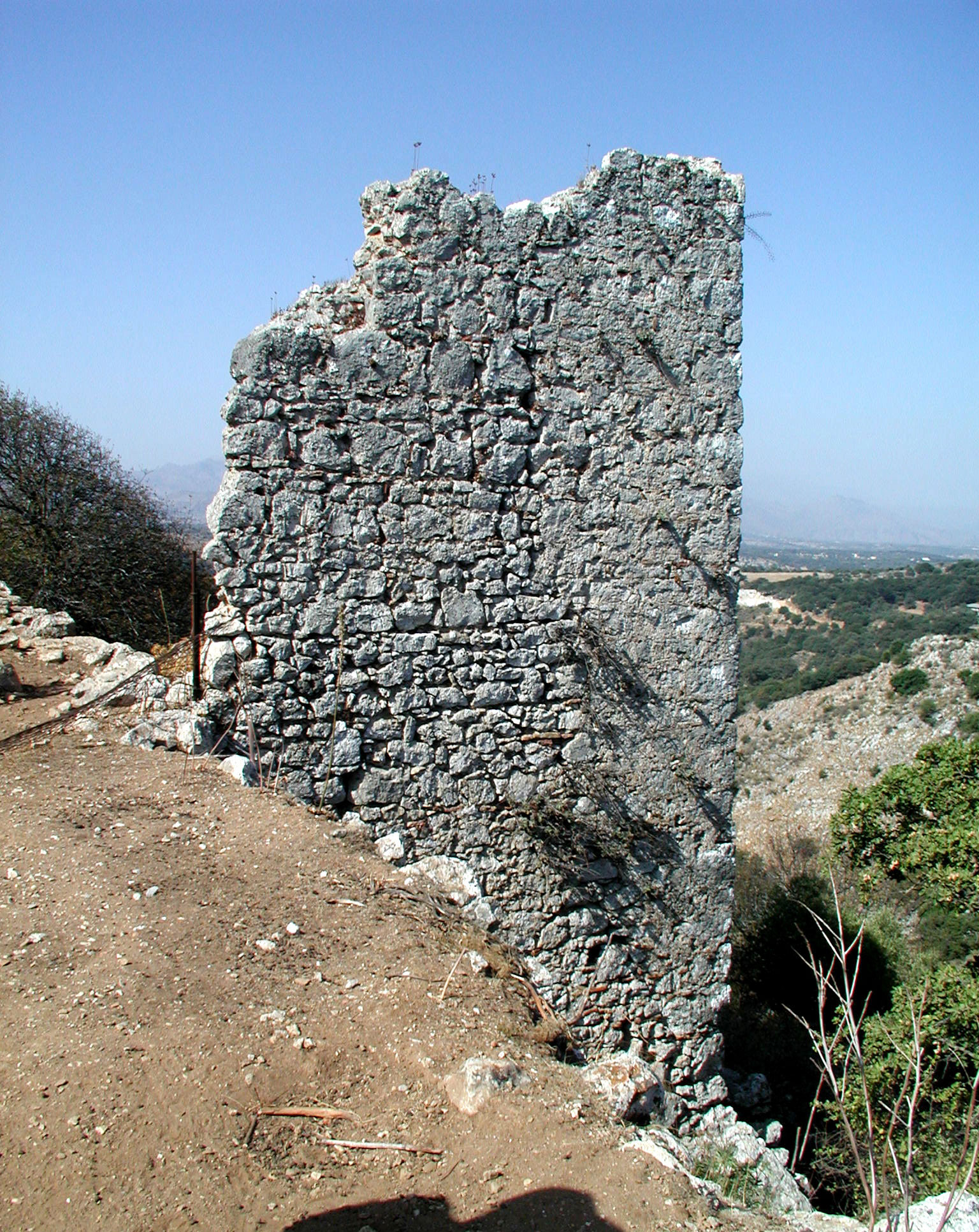
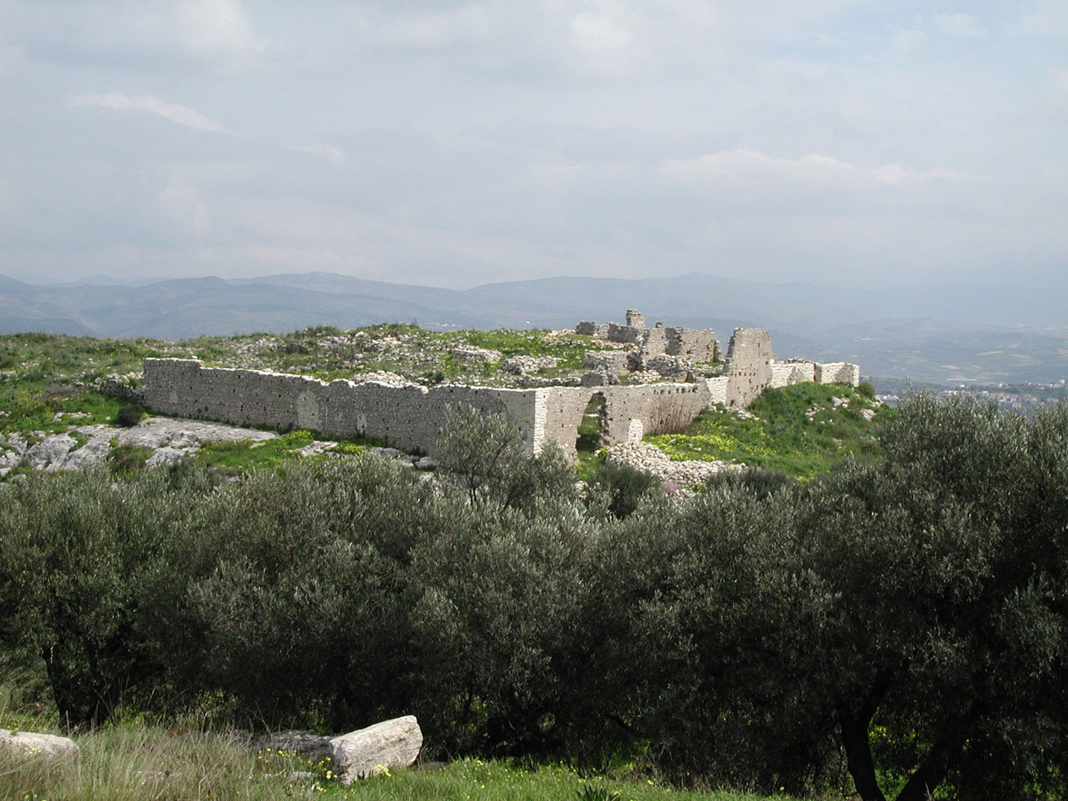
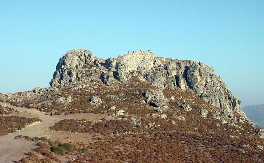
Byzantine presence is established inland, very near the former Arabic city of Chandakas, with the castle town of Temenos (next to today’s Prophet Elias, 15 klms south of Heraklion) as the main fortification. It is a big, complex, fortification construction, with an enclosure that protects an area of approximately 600 stremmata, a fortress built on a hill with twin peaks, with the higher of the two, to the west, being fortified with a very strong citadel, its own fortification enclosure and substantial towers (fig. 8) as well as a castle within a castle, an obvious indication of administrative and military power. The fortification enclosure covers the hill’s perimeter, on the edges of a precipitous slope, with different shaped towers (semi-cylindrical, triangular and horseshoe-shaped). To the north and east side of the Temenos (where the ground slopes gently, allowing easy access), we can distinguish the layout of the castle’s entrance, while on this spot we recognize today a triple line of fortification, where the bulwark and the main fortification enclosure have monumental proportions, comparable with the serious Βyzantine fortification constructions of the 10th century in Armenian Cilicia, the shores of Asia Minor and Cyprus (fig. 9). Apart from scattered water tanks all over the citadel and a water tower, the Temenos’ sufficient supply in water is taken care of by a complicated, rare fortified construction on the west side of the Rokas hill, where a protected tunnel with convenient steps, leads from the top to the bottom of the hill to the hidden cisterns that collect the plentiful running water from a nearby spring. The castle town of Temenos, according also to the testimony of Leo the Deacon, was a personal choice of general Nikiphoros Phokas, Crete’s liberator, who built a strong town inland (“he named the town Temenos”, Leo the Deacon, History, Book 2.8 (ed.-transl.-comments by Vrassidas Karalis, Kanakis publ., Athens 2000, p. 40).
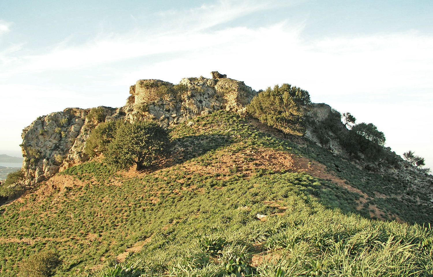
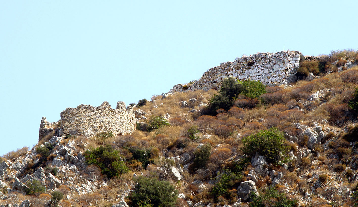
On the west side of Crete, very close to Chania, we encounter the big fortification structure of Varypetros. A very strong fortification enclosure with a robust bulwark on the northern side of the fortress hill, as well as a monumental fortification enclosure with huge bastions on the south side (fig. 10) form an easily protected area of over 400 stremmata in the hinterland of Cydonia. This can oversee the plain of Alikianos and all the coast of the Chania bay. More to the west, in Kissamos, we encounter an important fortification construction on the citadel of Polyrrenia (fig. 11). The central hill of the ancient town, already secured against attack in Hellenistic times, has a monumental enclosure and big, square and cylindrical towers as its fortifications. Inland of Kissamos, facing the mountainous part of Selinos, to the south, we come upon the castle of Malathyros (fig. 12), a strong fortification construction with bulwarks and a strong main fortification enclosure on the south side of a rocky, precipitous hill. The area does not seem to have been used in the period following Venetian rule, thus preserving notable features of the post byzantine period.
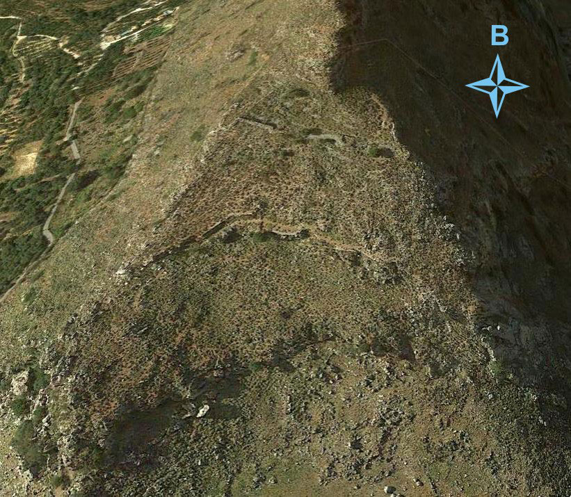
Inland of Rethymnos, not far from its coast, is the castle at Monopari. On the northern accessible side of a steep hill, that is surrounded by a torrent forming precipitous slopes with no need of fortification, walls survive with square towers (fig. 13) with the typical morphology of Post-Byzantine fortification works. Inland of Rethymnos, moreover, at the entrance of the Amarios valley, we encounter a castle town, unknown till now, at the top of the Veni hill, where a strong enclosure surrounds a level, flat expanse of approximately 525 stremmata.
Apart from the Temenos in the Heraklion region, we encounter the big castle in Monofatsi, where there was a castle town, continuously inhabited up to the 18thh century, in a largely fortified area with a strong enclosure and big square towers. Situated to the south, in eastern Messara, are the ruins of the great fort of Rizokastro (later known as Belvedere to the Venetians). This was a place also inhabited till the 18th century, full of water reservoirs, churches and traces of a strong fortification enclosure. It has the exceptional strategic advantage of controlling the greater part of the fertile Messara Plain.
On the east end of Crete, in the Lasithi region, we encounter two fortification constructions with clearly smaller proportions than the ones we have already referred to. East of Sitia, on a steep hill by the sea, in Liopetro, tracesof a castle survive with walls protecting the east and south side that bears square walls. There is a striking presence of many vaulted reservoirs made of rubble, in an effort to secure large quantities of water. A smaller construction, both in terms of size and range, is situated in Mesokastela, to the north and west of Ierapetra with a wonderful view of the entire south coast, where two similar rocky hills are crowned with a fortification enclosure in the spots where access was easy. During this period, it seems that, combined with the newly built constructions, there had been use of the pre existing fortifications of Lyktos, that oversees Pediada, the crowded and fertile hinterland of Heraklion and the citadel of Gortyna that oversees central and western Messara.
Keraton (today’s Keratokambos) is a fortified construction of particular importance, on an inaccessible hill of 600 metres, exactly above the large beaches of Arvi, Keratokambos and Tsoutsouros. It is a strong fortress with water reservoirs, square towers and walls on the few spots that are not precipitous. It is the place where contemporary research places the landing of the Arabs of Abu Hafs Omar around 824/826. The memory of colonization and the Arab threat lead to the fortification of this isolated spot by the Byzantine authorities, so as to oversee the nearby and accessible southern coast.
Duringthe 2nd Byzantine period, Crete was also influenced by more general socio-political changes in Byzantium such as the appearance of a local aristocracy and an increased economic activity. Legends, traditions but also written sources speak of colonization by great families of Byzantium in the Komnenian period.
The countryside of Crete acquires a larger population that gathers round the following large fertile regions; Pediada, Messara and Malevizi in Heraklion, the plain of Rethymnos and Argyroupolis in Rethymnon, Apokoronas, and Kissamos in Chania, as well as the isthmus of Sitia–Makris Yialos in Lasithi. At this time, the form of Byzantine forts on Crete has a different morphology to that of large middle byzantine fortifications. Built in accessible stretches of country side with mild slopes, very near arable lands and settlements, forts are small scale, clearly square in several cases, with lower, narrower walls, while there are fewer fortification towers that are placed at the entrance or in the forts’ corners. These forts usually have a donjon, while they are often close to winepresses carved in the rock, for the extraction of must and olive oil. Such constructions are mainly encountered inland of Heraklion. Inside and around the Pediada plain, the place with the largest population in the middle byzantine period, we encounter the small fort of the Tholous with an enclosure and a central tower, that oversees the plain of Alagnio. The Kastelos Meleson is placed at a strategic pass that links the north coast of Heraklion with the main area of Pediada. It is a small sized hill fort with a living area and donjon. Kasteli Pediadas, a squarefort with cornerstone towers, is built in the plain, to the west of the Lasithiotika mountains in the greater Arkalochori-Pediada region. At the latter’s centre is the square shaped Galatas fort with a strong fortification enclosure, three cornerstone towers with a central building and donjon. It oversees the Pediada-Arkalochori pass, from the northern coast of Heraklion as well as the greater plain of Vonni–Apostoloi . On the borders of Pediada and Messara is the fort of Vitsilia that oversees all the southern fertile expanse lying below, right down to the Messara Plain. Standing on the borders of Pediada–Τemenos is the fortress of Katalagari (fig. 14), an exemplary construction with all the features of this type of fort; it is square shaped, small, with a central tower building, nearby winepresses carved in the rock and in the vicinity of large areas of vineyards. The fort of Melisa issituated in Malevizi, a strategic spot near today’s village of Aghios Thomas. It has a similar construction to the fort of Katalagarios: a square enclosure, a donjon in the centre, cornerstone towers and winepresses carved in the rock. To the north is the Malevizi fort, next to an abundance of olive trees and vineyards in the northern part of Malevizi, overseeing all of the north coast of Heraklion and its hinterland. Today, however, only a tiny amount of traces can be recognized.
In Chania, in the district of Apokoronas, is the castle of Kyriakoselia,very close to the terrain already recorded. A fortification enclosure crowns a low hill with a few square towers. The different construction phases of the western outer tower in the entrance makes it evident that, most probably, the fort had been built during the 1st Byzantine period (fig. 15).
At the east end of Crete, in the isthmus of Sitia-Makris Yialos, there is an imposing fort called Mont Forte (its Venetian name survives), with an enclosure on the west end, small towers and traces of a central tower building (fig. 16). It oversees large, rich, arable lands.
At that same period, the population seems to have returned to large cities so that byzantine Castle (today’s Heraklion) acquires fortifications, built, for the most part, on the town’s earlier walls. These consist of a great fortification enclosure, with regular spaces demarcated by square towers, along the lines of fortified byzantine cities. Moreover, at Kasteli in Kissamos, where we do not have an accurate picture of fortifications, the population mans the urban centre. We are not certain about habitation at Kasteli in Chania, known as Cydonia at that time, because excavations reveal traces of re habitation only after the 13th century.
Concluding this concise presentation of Byzantine fortifications in Crete, it is worth noting that over this long period of Byzantine presence, interrupted by the troubled times of Arab rule, the great fortification works of the 1st period are completed by the big constructions after 961 and the later forts of the Komnenian period, forming a whole that, because of the nature of the terrain as well as increased defence needs, constitutes a distinct fortification network extending over the entire island. Visibility among the important fortifications and auxiliary supervision of the area at large are both important defence advantages, proving that fortifications contributed to the Byzantine presence on Crete being permanently established, until the beginning of Venetian rule in 1206. The Venetians used Byzantine fortifications as central control points, while an important issue concerning dates arises from some Venetian chroniclers asserting that 14 large fortifications were built from the ground up by the Genoese pirate Enrico Pescatore who ruled Crete from 1206 to 1211. This is an unfounded allegation, in the effort of later conquerorsto conceal that the administrative and economic structures of early Venetian rule relied precisely on the Byzantine organizational network of the island which had developed, to a great extent, around Byzantine fortifications.
Nikos M. Gigourtakis
Archaeologist, Classicist
PhD candidate in Byzantine Archaeology, Department of History and Archaeology of the University of Crete