Within the depths of the lower Cape Fear and Brunswick rivers lie remnants of the region’s history of rice cultivation and the enslaved West Africans and their descendants, the Gullah Geechee, who worked the fields. A team of researchers is attempting to document that history.
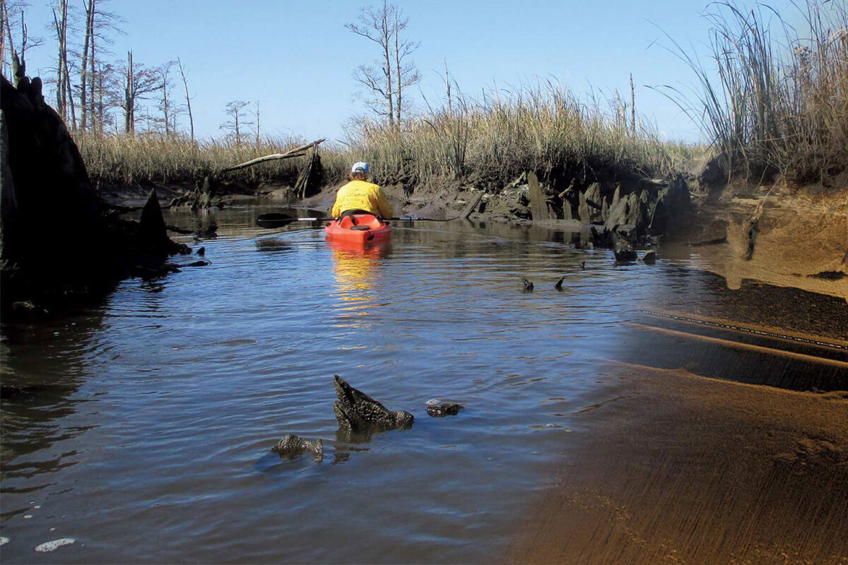
Mark Wilde-Ramsing, underwater archaeologist and former director of the Underwater Archaeology Branch of the North Carolina Office of State Archaeology, and Joni “Osku“ Backstrom, environmental sciences assistant professor, have traversed the waters for the past two years searching for archaeological evidence of the fields once situated along the rivers’ banks. Their goal is to inventory extant rice cultivation remains on the northern end of Eagles Island, a 2,100-acre expanse located in Brunswick and New Hanover counties.
“We may lose some of these features due to climate change and development,” said Backstrom. “If we can show the importance of what we have within the region, hopefully we can prevent overdevelopment that may impact these artifacts. It’s about preservation, education and highlighting the knowledge of the Gullah Geechee people.”
These sites were the work of enslaved West Africans whose knowledge and skills made them critical to the success of rice cultivation from North Carolina to Florida. Their isolation in these marshlands resulted in distinct language, religion and lifestyle traits that created the Gullah Geechee culture.
“While the rice was the cash crop of the coastal Southeast, along with Sea Island cotton and indigo, Gullah Geechee ancestors provided both the brain trust and physical labor needed to change the landscapes into spaces that created commercial yields of the crop,” said Sean Palmer, director of UNCW’s Upperman African American Cultural Center and a board member of the Gullah Geechee Cultural Heritage Corridor Commission. “The children of West Africa, who came to be known as Gullah Geechee, were agricultural engineers who, like the rice, were harvested for their vast knowledge.”
Researchers divided the northern end of Eagles Island into 10 subsections. Navigating the narrow, shallow, obstructed creeks and canals was a challenge for the team. While rowing in the area during low tide, Wilde-Ramsing spotted a network of floodgates, bulkheads, landings and complex canal systems.
“This research has really stemmed from Mark’s keen archaeological observations and interest in historical rice cultivation while rowing in and around Eagles Island over many years,” said Backstrom. “The visual observations at low tide complement the subsequent high tide sonar surveys, and vice versa.
With the use of a side-scan sonar and positioning systems, researchers receive almost photographic imagery of the seabed. Large areas of the canal systems are mapped, then the sonar images are reviewed to identify sites to revisit. “We’re able to see things like structures, features, different kinds of sediment types; we can identify sand and mud. We can also get accurate GPS positions to know exactly where artifacts are and what they look like. “
The team is also utilizing aerial drone surveys, particularly at extreme low tides, which has shown potential sites for additional investigations, said Backstrom. Researchers plan to share their findings with Eagles Island preservation groups in their effort to conserve and manage the natural and cultural assets of Eagles Island, as well as with the Town of Navassa, a community within the Gullah Geechee Cultural Heritage Corridor.
“The main goals of this research include formally registering the specific artifacts with the NC State Underwater Archaeology Branch; supporting the initiatives of the Eagles Island Central Park Task Force, including establishing a Gullah Geechee trail; liaising closely with the town of Navassa, and supporting ongoing studies and environmental initiatives to educate, protect and preserve cultural and historical aspects of the Gullah Geechee people,” Backstrom added.
