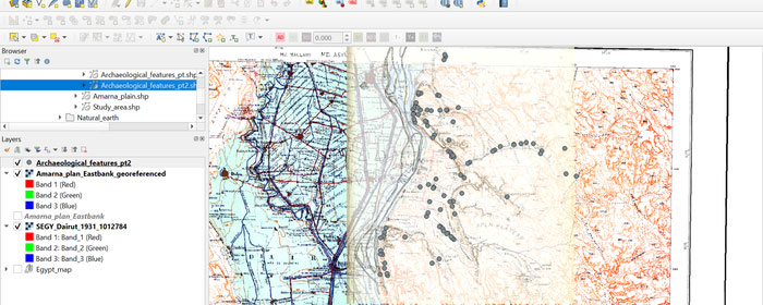
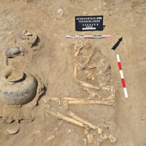
This short course of three 1.5-hour sessions, set over three weeks, will give participants a basic understanding of the nature and operation of a GIS and how it can be used in Egyptian archaeology. In each session, we will cover an aspect of GIS, before practising relevant skills using participants’ computers and the open-source GIS software QGIS. Participants can also complete the tasks asynchronously, with the help of the instruction manual and videos.
By the end of the course, participants will understand the principles behind GIS; how GIS look and work; how to load, style, label, select and export existing vector and raster data; how to import, georeference and compare relevant raster sources; and how to edit, create, merge and query vector shapefiles.
At the end of each session, participants can export a product for submission to the tutor, demonstrating their skills. On submission of all three products, participants will earn a completion certificate.
Tutor: Hannah Pethen is an independent researcher and Honorary Fellow at the University of Liverpool, with over 20 years’ experience in British commercial archaeology, Egyptology, archival and collections research. She specialises in the contextualisation of archaeological material in the field, the museum and the archive through Geographic Information Systems, satellite remote-sensing, and digital methods of presentation and interpretation. She teaches GIS courses for the EES and at Southend University.
Prerequisites
For the practical part of the course participants will need a basic understanding of computing and a modern laptop computer running a Windows 10, Mac OS High Sierra 10.13, or Linux operating system, with a minimum CPU speed of at least 2.2GHz, at least 8GB of RAM and at least 1GB hard drive. QGIS does not currently operate on Chromebooks or tablets. Please note that these are the minimum specifications and if you have access to a choice of machines a higher specification computer will perform better.
Course Dates
Online lessons will be held live at the following times (UK):
Wednesday 17 April 2024, 13:00-14:30
Week One – Introduction to GIS – make a simple map
Tuesday 24 April 2024, 13:00-14:30
Week Two – Coordinate systems and georeferencing
Tuesday 1 May 2024, 13:00-14:30
Week Three – Working with Vector data
Recordings of the live sessions will be made available to attendees following the weekly session for those unable to attend in person or wanting to rewatch them.
Tickets
Members of the Egypt Exploration Society can book at a discounted rate. If you’re not yet a member but would like to join in order to receive this discount, please ensure that you have joined here.
Event tickets are only refundable if notice is provided at least two weeks prior to the event start date.
