
The Heraion of Argos is situated on a small hill at the northwestern side of mountain Evia on the road which connects Mycenae with the city of Argos. The view from this site is excellent as it overlooks the lowland of Argos and the ancient acropolis of the site called Larissa.
Historical data
According to Pausanias the temple is situated 15 stadia far from Mycenae.
The archaeological excavations at the surrounding area of the temple have revealed a variety of findings dated to the Hellenistic and Neolithic period such as vaulted and chamber tombs. The findings prove that the site was used before the temple’s foundation. It is supposed that at the same site there was a Mycenaean acropolis or a palace. The first temple of Hera was built around 680 BC.
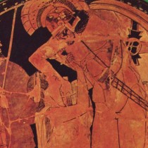
After the destruction of Prosymna by the Argians in the 6th century BC, the Heraion came under Argian rule. It became the main cult site of Hera in Greece. Homer refers to the goddess as “Argive Hera”, “Hera Argeia”, as the city of Argos was the starting point for spreading the worship of Hera all over the country.
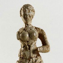
It is proved that during the Roman period the worship of Hera has been continued as many imperial offerings were found during the excavations. Moreover Romans extended the sanctuary by erecting annexes at the site.
The Heraion of Argos was excavated in 1831 by the British colonel Gordon. Since then many researchers and archaeologists have worked at the site, as C.W. Blegen and P. Amandry who were the most significant of them.
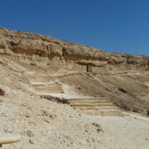
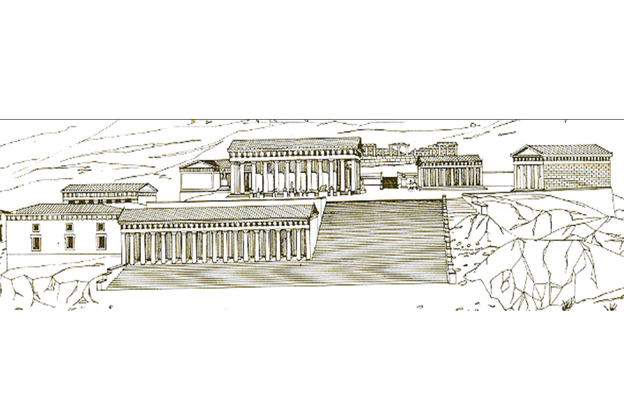
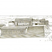
Figure 2 presents a drawing of Heraion in its flourishing period. On this drawing, the temple of the 5th century, the newer level of Heraion and the large stepped retaining wall leading to the temple can be seen. At the older higher level the ruins of the first Geometric temple can also be seen.
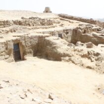
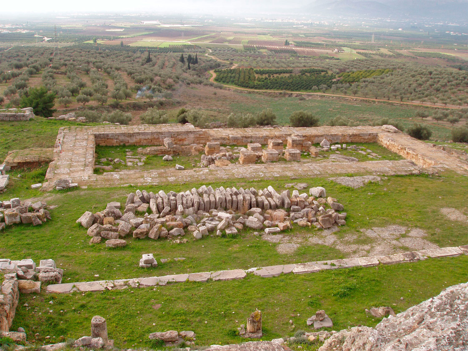
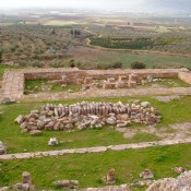
Figure 1 presents the present status of the 5th-century-temple.
Previous studies on the Heraion’s astronomical orientation
The Heraion’s orientation has been studied by many scholars. At the end of the 19th century the British architect Francis Penrose (1817-1903) had studied the orientation of both the old (7th century BC) and the new temple.
He determined its orientation equal to 107° 50′. Penrose also dated the foundation of the old temple. According to his research the temple’s orientation is related to the rising of Antaris (a Scorpii) on October 24th, 1830 BC or the setting of Stachis (a-Virgin) on February 1300 BC.
As it concerns the new temple Penrose calculates its orientation equal to 105° 59′ and its foundation date on February 21st, 425 BC (Penrose F.C., 1897).
The temple’s geometric documentation
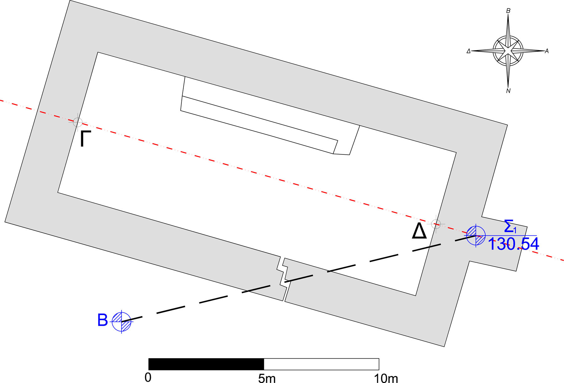
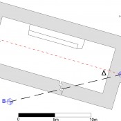
The geometric documentation of the monument is carried out by applying geodetic measuring and processing methods for the plan’s creation. By using a reflectorless total station angles and distances were measured for the determination of the appropriate points’ coordinates. These points determine the shape of the monument with an accuracy of ±3mm. The plan is created digitally in a CAD software. Figure 3 illustrates the groundplan of the monument.
The astronomical orientation of Heraion
The following procedure is applied for the determination of the temple’s astronomical orientation.
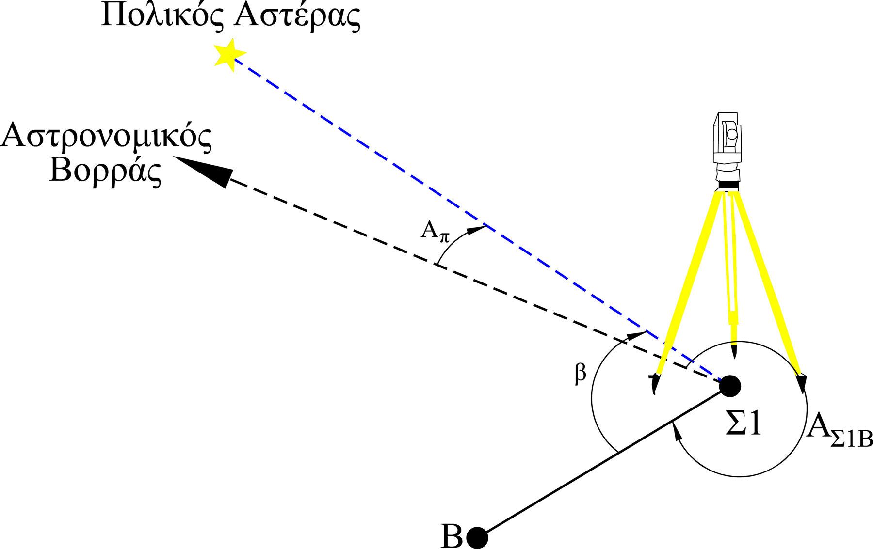
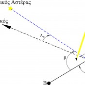
Initially the astronomical azimuth of the line between the points S1 and B, which are situated near the temple, is being determined. The determination of the astronomical azimuth AS1B is realized by observations of Polaris (a Ursa Minoris), using a geodetic total station and applying the hour angle method (Lambrou E./Pantazis G., 2008). The universal coordinated time UTC is measured at every observation of Polaris. Thus the astronomical azimuth AP of Polaris at the time of each measurement is calculated. By using the registration of the horizontal angle measurement b (fig. 4) towards the direction S1B, the astronomical azimuth AS1B is determined (Lambrou E./Pantazis G., 2004). Some tens of observations of Polaris are carried out within ten minutes, so the mean value of the astronomical azimuth AS1B is calculated as well as its uncertainty. To the calculated value the reduction of the motion of the earth’s pole is applied.
The geodetic coordinates φ, λ (φ = 37° 41΄ 31΄΄, λ = 22° 46΄ 31΄΄) of the point S1 are also calculated by using GNSS receivers. These coordinates are necessary both for the astronomical azimuth calculation and the dating of the temple.
As the direction S1B is part of the monument’s geometric documentation the produced plan is oriented in relation to the astronomical north. Thus the determination of the astronomical azimuth of any line on the monument’s plan can be achieved.
The most characteristic line of a monument’s construction is the main longitudinal axis as it is the symmetry axis of the monument. This axis is defined either by two characteristic points of the monument or by the best fitting line to more characteristic points. In this case the basic longitudinal axis is defined by:
– point G, which is the middle of the north western side of the monument
– point D, which is the middle of the southeastern side of the monument.
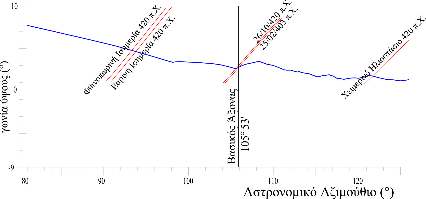
Finally the astronomical azimuth of the line between the points GD is calculated equal to 105° 53′ with uncertainty of ±3′.
The Dating
Dating of a monument is defined as the determination of the foundation date of the monument, i.e. the day, the month, and the year by using only geometrical data. According to the presented methodology for this determination the following elements are combined:
– The line which presents the astronomical azimuth of the basic longitudinal axis
– The line which presents the shape of the perceptible horizon and
– The line which presents the path of the sun at a concrete date.
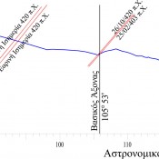
The three aforementioned lines are presented in a common diagram, which has as axis the astronomical azimuth and the altitude (fig. 5).
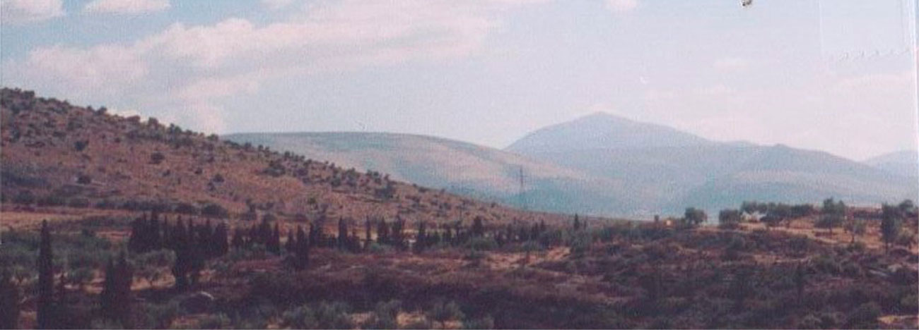
The line of the perceptible horizon is defined as the projection of the mountains or buildings, which are situated in front of the monument on the direction of the main longitudinal axis of the Heraion, on the celestial sphere. Substantially these mountains or buildings block the visibility of an observer standing at this position towards the celestial sphere and the celestial bodies (sun, stars), to the east (Pantazis G., 2002). The east side of the monument is the most significant because this is whre the main entrance of the temple is situated, supervising the site. According to historical sources the famous worship statue of the goddess is situated at the façade of this side.
The shape of this line is computed from pairs of horizontal and zenith angles’ measurements by using a total station. The pairs of the measured angles are transformed to astronomical azimuths and altitudes. In this case the measurements were carried out from point S1.
Figure 6 presents the camera documentation of the perceptible horizon.
The dating of the monument is being done as follows:
The date (day-month-year) of which the sun’s path coincides or has the minimum distance from the point where the line of the perceptible horizon and the line of the main longitudinal axis’ astronomical azimuth coincide, defines the foundation date of the temple (Pantazis G., 2002).
For this reason several sun’s paths (azimuth, altitude) are calculated for different years, months and days. The digital planetarium Skymap pro8 is used for this purpose. As input data are used the coordinates φ, λ of the monument.
Based on the appropriate investigation, the path of the sun which satisfies the aforementioned concept is February 25th 403 BC. The dating uncertainty is calculated as the ratio of the orientation’s uncertainty to the annual change of the sun’s position. In the case of Heraion the orientation uncertainty is equal to ±3.1′ as the daily change of the sun’s position on the February 25th is equal to ±8″, thus the dating uncertainty was found to be ± 23 years.
Discussion
This paper presents a special geodetic and astrogeodetic methodology of measurement and a procedure for the determination of the astronomical orientation and the dating of Heraion in Argos.
The astronomical orientation of the main axis of the 5th century’s temple calculated equal to 105° 53′. Also the foundation date is February 25th 403BC with uncertainty of ±23 years.
By using the presented methodology the astronomical orientation and the dating of any monument is feasible. The application of the methodology requires the use of the following instrumentation:
– a total station for the geometric documentation of the monument, the determination of the astronomical azimuth and the allocation of the line of the perceptible horizon,
– a GNSS receiver for the determination of the coordinates φ, λ of the monument’s position.
The uncertainty of the determination depends mainly on the size of the monument and the provided uncertainty by the used instrumentation, and it can reach ±10 arcsec.
The methodology is independent from other historical or archaeological data, which are usually used for the monument’s dating. In this way the archaeological dating researches could be supported where other methods either are not effective or have large uncertainty due to data lack.
Dr George Pantazis
Assistant Professor
National Technical University of Athens
School of Rural and Surveying Engineering
Department of Topography, Laboratory of General Geodesy