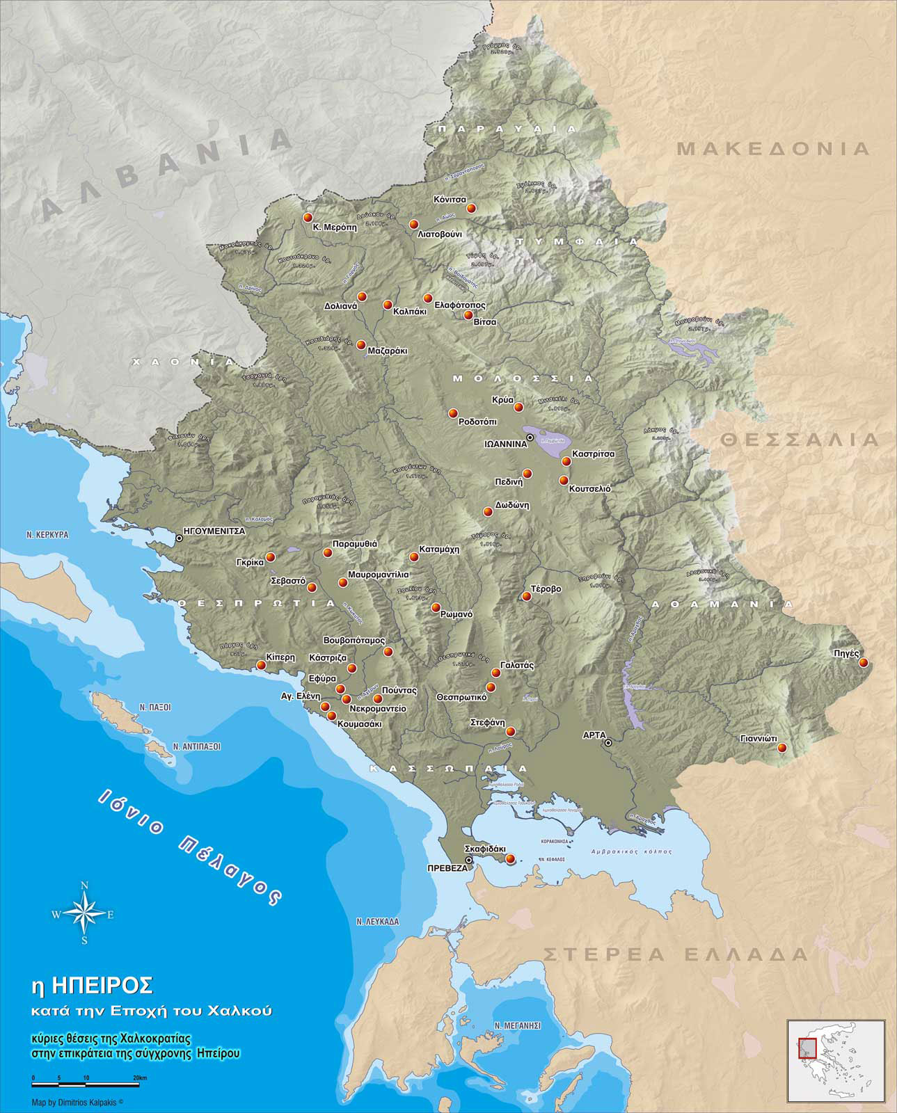
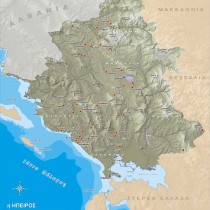
Epirus forms part of the west coast of the Greek mainland, namely its northwestern corner. On the northeast, it borders with the administrative districts of Kastoria, Kozani and Grevena, all part of western Macedonia. On its central eastern side, Epirus borders with the districts of Trikala and Karditsa, which are part of western Thessaly. To the southeast of Epirus lies the district of Aitoloakarnania, which is part of mainland Greece. The Ambracian gulf opens onto and washes the southern coast of Epirus, flowing into the Ionian sea via the straits of Preveza. Recently, an underwater tunnel was constructed, linking Preveza to Actium and leading within a short distance to Leukas. Southwestern Epirus is washed by the Ionian sea and is very close to the island of Corfu, north of which the straits of Otranto open onto the Adriatic sea, near the Italian peninsula, leading to central Europe. To the northwest, Epirus borders with southern Albania, together forming part of the Balkans in southeastern Europe. In contrast to its mountainous landscape jutting out in stark relief, Epirus’s advantageous geographical position has contributed decisively, from the Palaeolithic age through to modern times, to development of the human factor and to the economic orientation of the region.
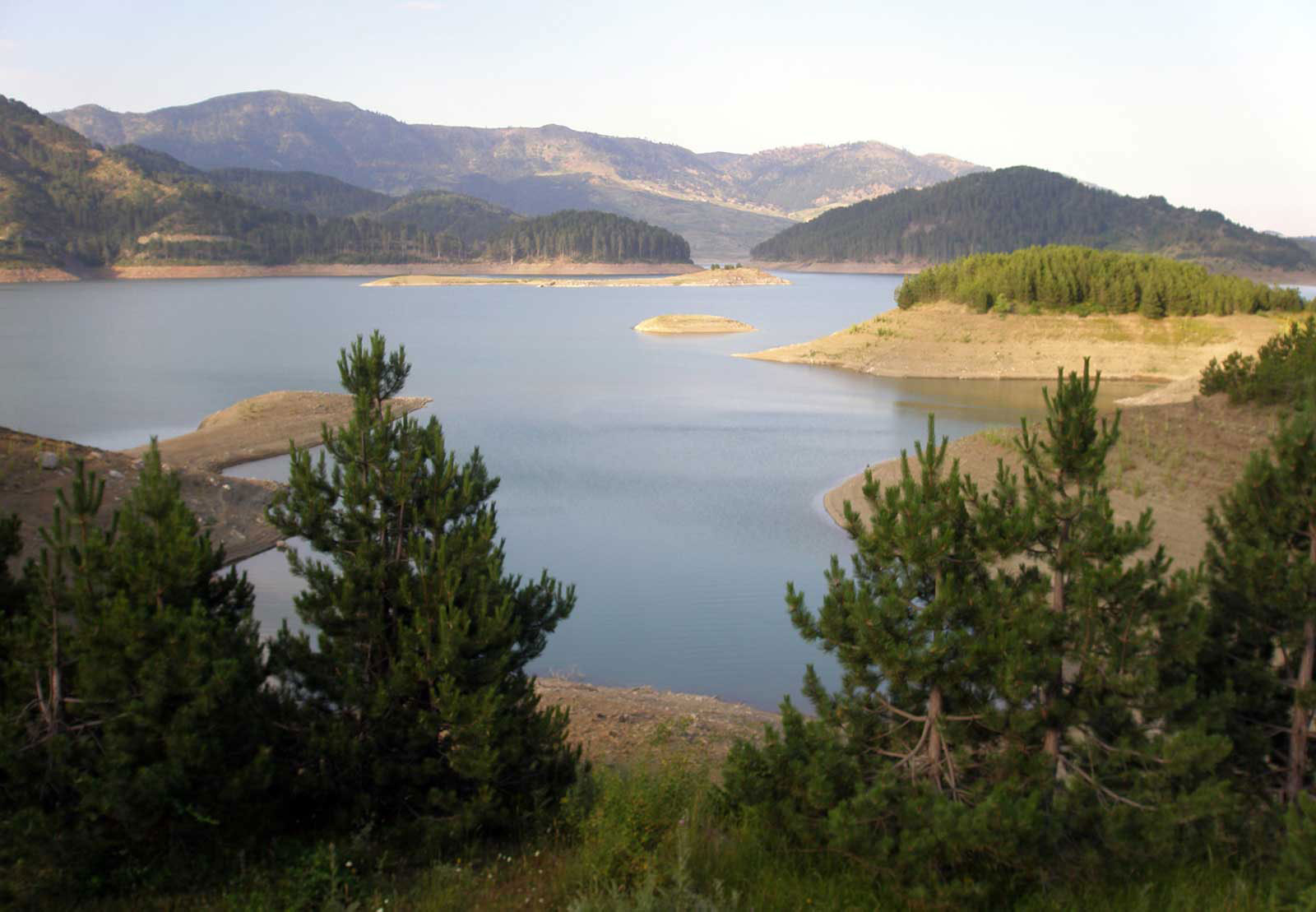
A diverse rugged landscape is typical of Epirus (fig. 2). Inland, the many hills and mountain ranges make it difficult to travel from east to west in the winter months. Frequent rainfalls west of mount Pindos make grass grow plentifully at lower altitudes, while the mountains themselves grow green in the summer-time, providing rich grazing all the year round. Out of the many Epirus’s mountains one should mention Grammos (2.520 m), Smolikas (2.637 m), Gamila-Tymphe (2.497 m), Dousko (2.198 m), Koutsokrano (1.324 m), Kasidiaris (1.329 m), Mitsikeli (1.810 m), Peristeri-Lakmos (2.295 m), Olytsika-Tomaros (1.971 m), which belong to the administrative district of Ioannina, the Tsamanta mountains (1.806 m), the mountains of Paramythia (1.658 m), the mountains of Souli (1.613 m) in the district of Thesprotia, mount Xirovouni (1.614 m), the Thesprotika mountains (1.274 m) in the district of Preveza and the Athamanika mountains or Tzoumerka (2.469 m) in the district of Arta. There are sudden changes of scenery as steep mountains become hillsides, which in turn are interrupted by flowing rivers that create fertile valleys, viable ecosystems and several geomorphological outlets used as natural crossings.
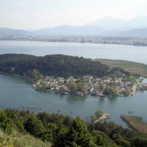
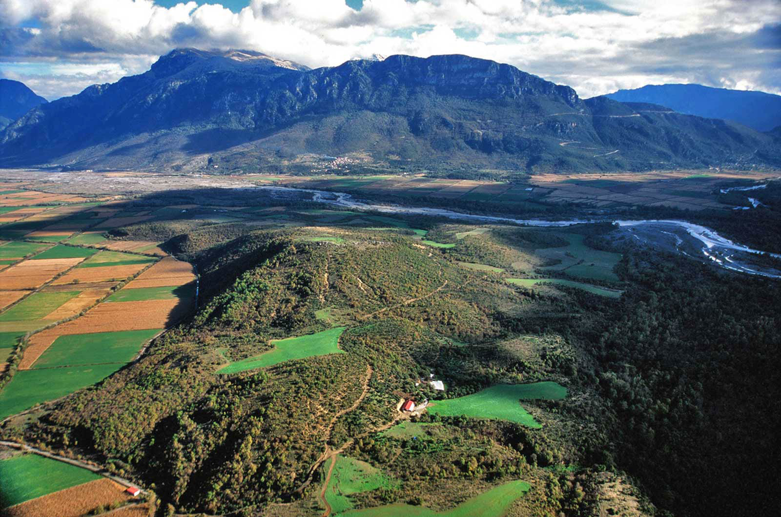
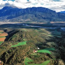
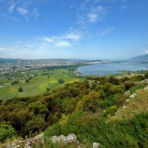
The river Aoos springs at Metsovo (fig. 1) and joins two other rivers, the river Voidomatis and the river Sarandaporos further north, irrigating the valley of Konitsa (fig. 3). This area has abundant water, arable land and pastures. At least twenty archaeological sites (note 1) have been found here, all inhabited during a long period of time over the centuries. Aoos meets up with the river Drinos on Albanian soil and flow into the Adriatic sea. Further west, in the Pogoni district, the valley of the river Gormos was a place of burgeoning habitation (note 2) towards the end of the Late Bronze Age and primarily during the Early Iron Age. Further south, at Kalpaki originates the river Kalamas. There are important prehistoric sites at this area and after many kilometres the river flows into the Ionian sea. From the mountains of Souli and Paramythia spring tributaries of the river Acheron, which finally flows into the gulf of Fanari (Glykys Limin, meaning Sweet Harbour) on the Ionian sea. The basin formed by the mouth of the river served as the area for the most important surface survey to be carried out in Epirus (Nikopolis Project, note 3), resulting in useful conclusions concerning the prehistory of the area, while similar research has been recently carried out in the valley of the river Kokytos (Thesprotia Expedition, note 4). The rivers Arachthos and Louros flow into the Ambracian gulf, creating a huge valley at the mouth of the gulf, which today is exploited for agriculture and fish farming. Some of the region’s rivers must have been navigable to a certain extent in antiquity. River routes and natural passages open onto the Ionian sea and the Ambracian gulf, creating possibilities for exchange of commodities and ideas.
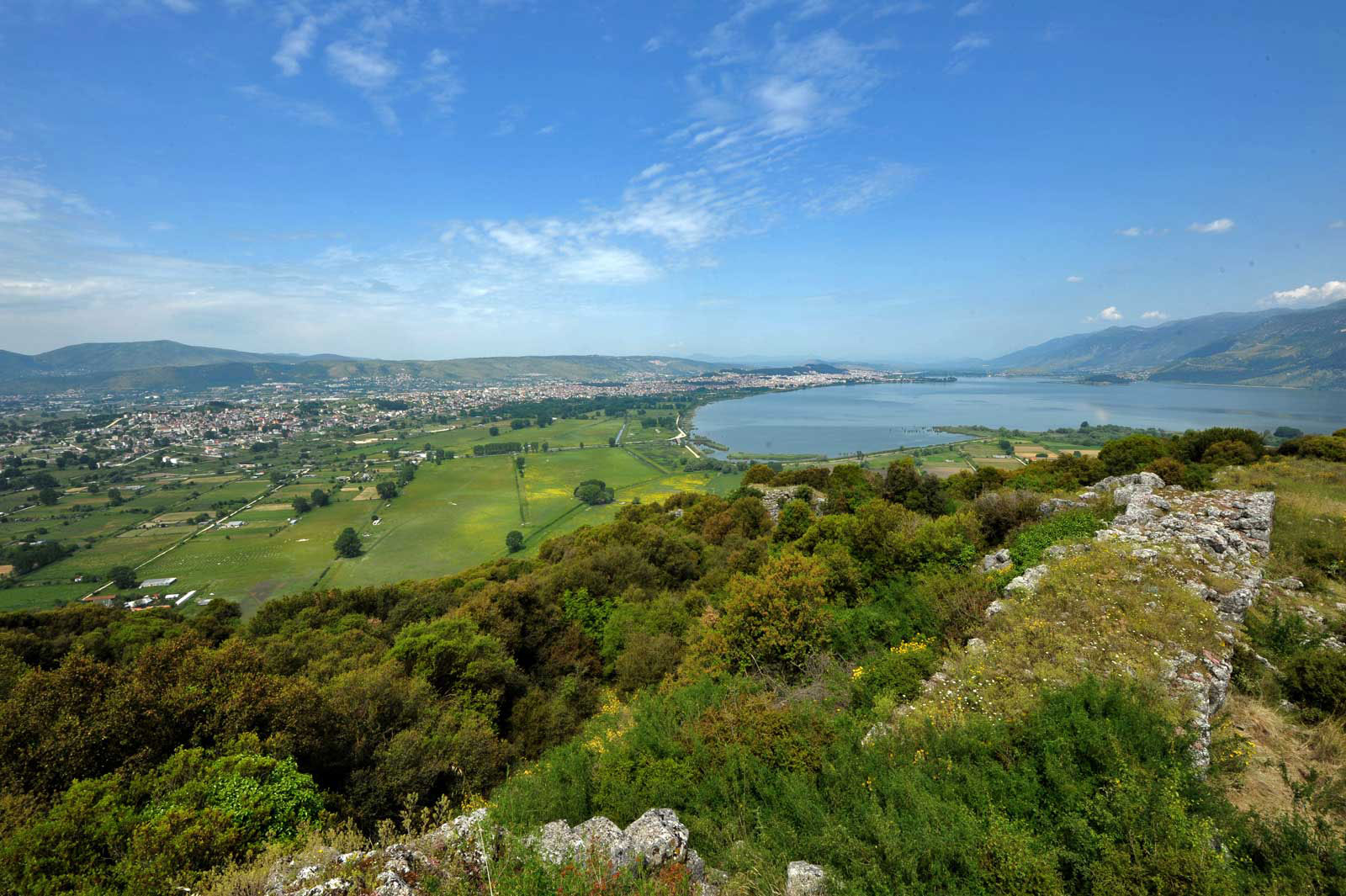
The enclosed basin of Ioannina (fig. 4), lying at the heart of inland Epirus, provides us with a typical example of an area that was inhabited constantly through the ages. Lake Pamvotis and the drained lake Lapsista combine with the massive bulk of mount Mitsikeli to create an important ecosystem, which promotes shepherding, agriculture, fishing and hunting. The importance of this place is further proven by the existing network of archaeological sites (note 5).
It seems, therefore, that Epirus offers the necessary conditions coupled with limitations that ensured the development through the ages of a self-sufficient and frugal economy. The diverse landscape helps create fertile expanses of land and pastures for animals to graze all the year round. Thus, basic production could be maintained, ensuring the inhabitants enough food for sustenance and also for trading in kind. The steep jutting features of the land combined with the demanding way of life spent in agricultural activities are what led to the “rough” character of the region’s material culture, as described in this article, based on the archaeological data so far brought to our attention.
The Early Bronze Age and Middle Bronze Age
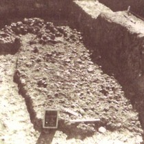
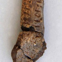
The transition from the Neolithic period to the Early Bronze Age is mostly known to us through the study of the finds from Doliana in Ioannina (note 6). The site is located in the basin formed by the river Kalamas and drained lake Grammousti. This is where the floor of a rectangular hut was found, measuring 3,5×4,5 m (fig. 5), having two consecutive phases, as well as hearths, handmade pottery, clay spindle whorls, flint artifacts, fauna remains (note 7) and archaeobotanical residues. Measurement with radioactive carbon of four samples taken from the two layers of habitation showed the absolute chronology spectrum to which they belonged (3770-2925 BC). This dates them at the last phases of the Chalcolithic period and at the beginning of the Early Bronze Age in Epirus. The pottery corresponds with samples coming from the Attiki-Kefala culture and from the Rachmani phase at Pefkakia in Thessaly. Mainly, however, it corresponds with pottery from the lake settlement of Maliq (phases IIb-IIIa) in neighbouring Albania. Some “lids” of the Bratislava type commonly found in the Balkan region are of special interest. This singular phase of the Chalcolithic period took on the name “Doliana culture”.
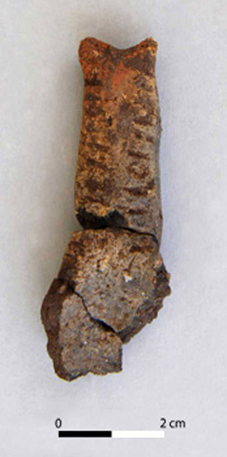
The Early Bronze Age as it evolved in Epirus appears only in the recent surface research and excavations, which were carried out by the Finnish Institute of Athens at Sevasto in Thesprotia. The settlement (note 8) is located on a low slope, upstream of the river Kokytos. The settlement layer is about 20 cm thick, where plenty of handmade pottery was found, of which sherds of the “corded ware” stand out, as well as clay spoons (fig. 6). These finds are similar to those coming from Pefkakia in Thessaly. Other finds are what was probably a hearth, clay spindle whorls, flint artifacts, many animal bones and bone pins, pointing to productive and domestic activities. Several radiocarbon samples that were taken allow the absolute dating of the site to the Early Bronze Age (2920-2470 BC: in phases contemporary to the Early Helladic I-II period). There was no sign of imported goods from the south and this places Sevasto to a greater network of archaeological sites in northern Greece and the Balkans. This lack of imports makes especially difficult to date the pottery and to divide chronological phases. For the same reason, more recent classifications made by researchers of other Early Bronze Age sites in Epirus must be regarded with scepticism, seeing that such classification is entirely based on the study of handmade pottery. This was, broadly speaking, produced and used within Epirus from the Neolithic or Chalcolithic period down to Late Classical times or indeed in even later times with minor changes made to the technology of manufacturing pottery.
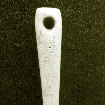
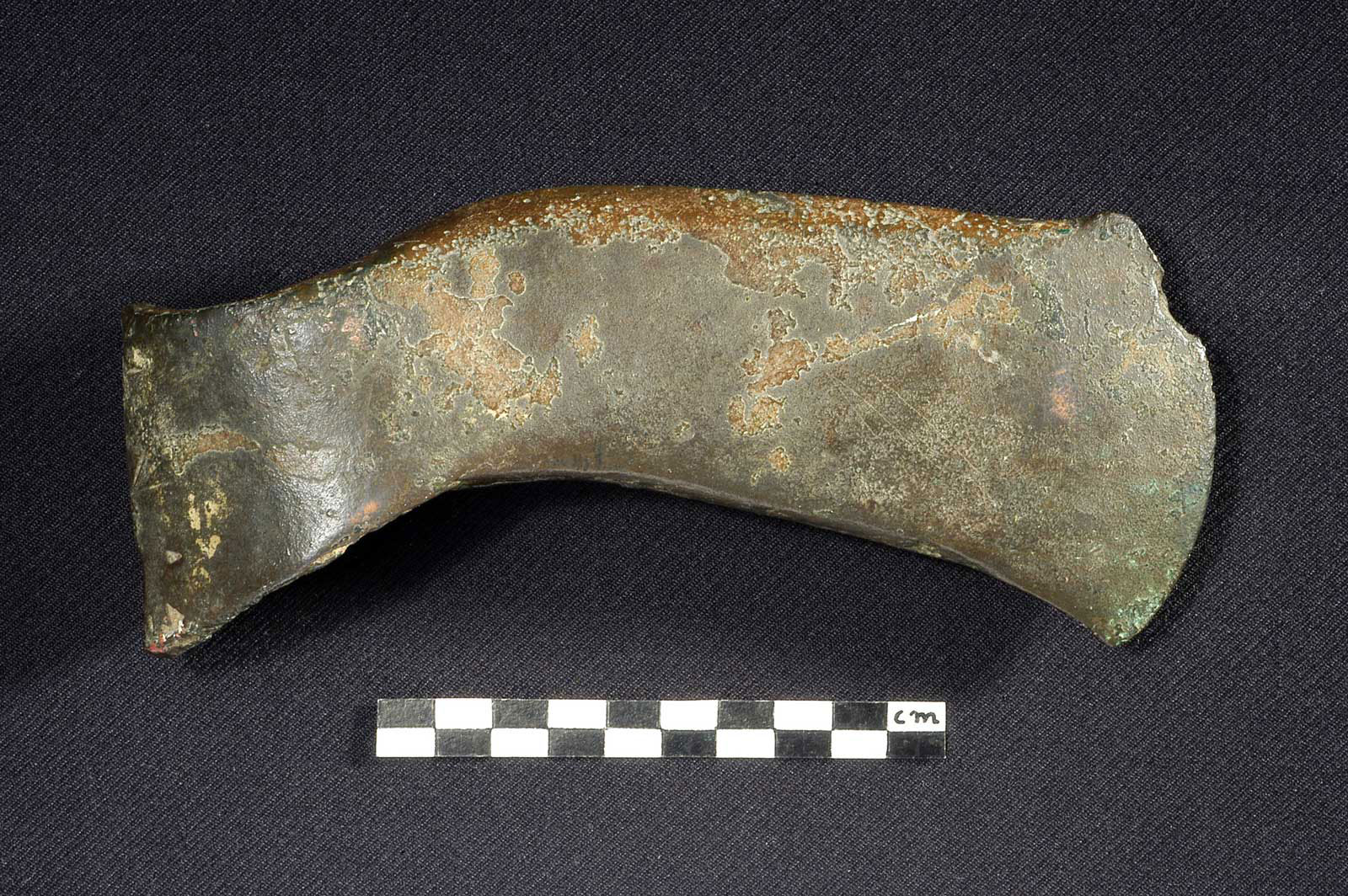
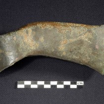
A group of twelve bronze one-edged axes (fig. 7) originating from Epirus has conclusively been traced back to late stages of the Early Bronze Age (note 9). These isolated finds have no safe archaeological context. The axes were cast in bivalve stone moulds or perhaps they were fashioned in clay moulds with the lost-wax technique (investment process). They have round holes for the shafting of the handles and sharp blades. They are in the tradition of a single-bladed axe type that is to be found scattered in districts of Rumania, Bulgaria, Albania, Macedonia and frequently in Epirus. Analysis of the chemical composition of some samples (EDXRF) showed a copper alloy with a small arsenic content. This alloy achieves maximum hardness after cold hammering, as is shown after metallographic examination under an optical microscope. Signs of intense use on the axes points to their having been used for chopping down trees in the rich forests of the region and more generally as carpenters’ tools.
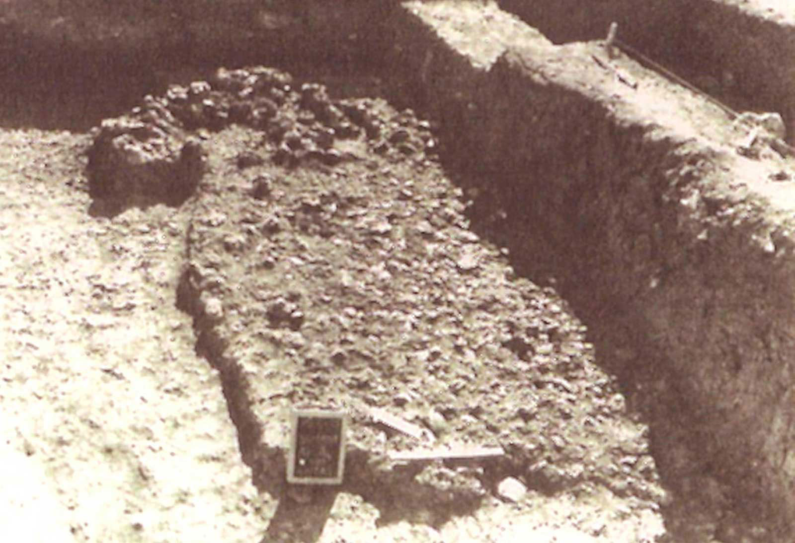
There is also very little archaeological data available about the Middle Bronze Age in Epirus. The border between the district of Arta and western Thessaly, marked by the river Acheloos, is where a settlement was found at Piges. Here, foundations of apsidal buildings were found together with a large quantity of handmade pottery. Similar finds were reported on the opposite bank of the river Acheloos, at the sites Petroto and Karya (note 10) in the administrative district of Karditsa. A cemetery (note 11) at Sevasto in Thesprotia is also of special interest, chronologically marking the transition from the Middle to the Late Bronze Age. On the settlement layer of the Early Bronze Age a pit had been dug, where a cremation burial was carried out (1980-1755 BC), accompanied with a clay vessel and a bone pin. At a later date, a tumulus had been raised (1780-1610 BC) with a stone enclosure measuring 9-10 m in diameter. It contained a central cist grave, where two adults were buried, also two children graves and a child burial of a later date. A short distance away to the south a burial complex was located (1690-1490 BC), consisting of five stone circles measuring 3-4 m in diameter, at the centre of which there was a large cist grave. A smaller circle nearby contained a child cist tomb. The absence of grave offerings points to the graves being used as ossuaries for secondary burials (they contained many human skeletons).
Finally, one has to mention the radiocarbon date of a sample (1710 BC) taken from a section of a settlement (note 12) at Skafidaki in Preveza, a site that controls the entrance of the Ambracian gulf. At a short distance from the settlement a cist tomb was found (note 13), containing two burials. This grave was dated by its offerings to the transitional period from the Middle to the Late Bronze Age. The latter will be further explored in the following part.
Dr Christos N. Kleitsas, Archaeologist
12th Ephorate of Prehistoric and Classical Antiquities
Archaeological Museum of Ioannina