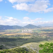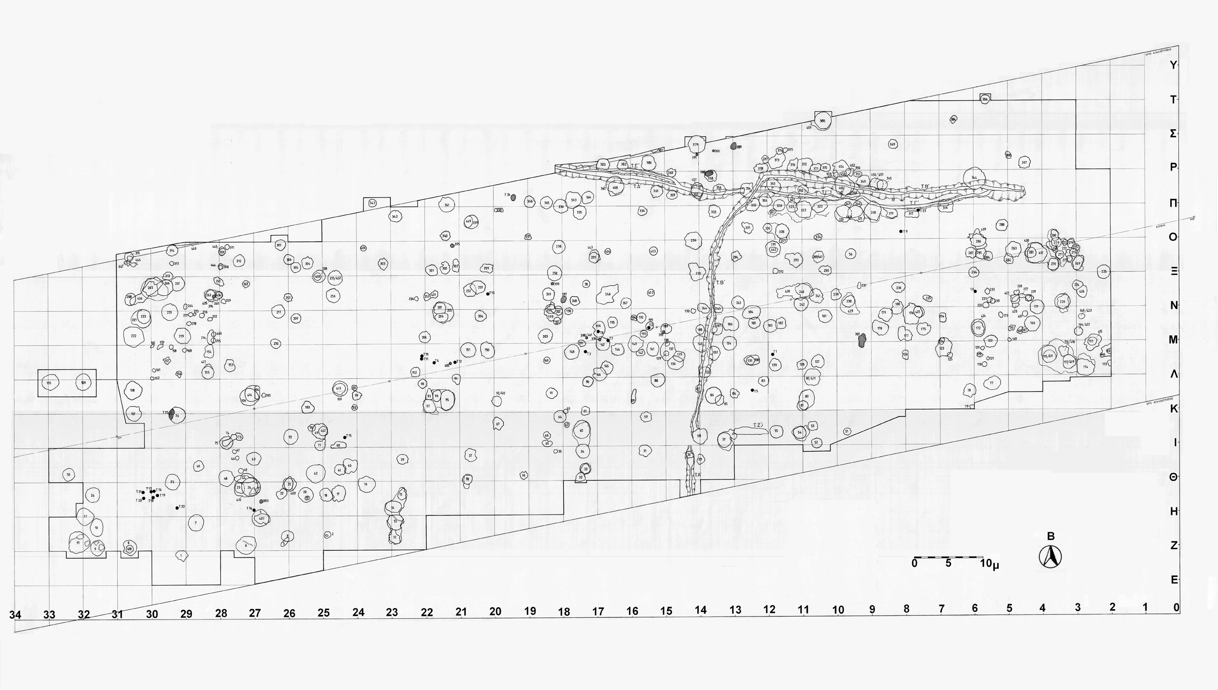
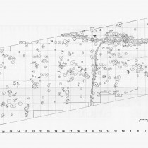
The rescue excavation of 1998-1999 in Toumba Kremastis Koiladas was dictated by the construction of the Egnatia Road. It evolved on the north eastern limit of the tell, outside the limits of surface diffusion of the material, in an area of 7 stremmata and 150m along the road. 462 pits were located and excavated in this area (note 1) (fig. 1).
In the analysis carried out, all pits were treated as separate units and studied in connection with four parametres; dimensions, construction features, inside stratigraphy and content. Data was analyzed in units, with the pits both as a whole and also in relation to their dating, i.e. the stratigraphic-temporal phase they belong to. They consist of pits in layers A, B, C, D, with layer D being the earliest. The conclusions reached, however, should not be perceived as clear and rigid features of each phase, but more as information on exploring more general trends and variations through time.
Dimensions of pits
The greatest diameter/length of the pits is 0.30-3.75 m. Given that pits with a diameter of over 2 m could be buildings (houses or auxiliary spaces), these were classified into two basic categories:
1st Category: Small pits with a diameter of up to 2 m (0.30-2 m): 355 (77%)
2nd Category: Large pits with a diameter over 2 m (2.05-3.75 m): 106 (23%)
In all the area’s phases of use, the greatest proportion of pits, around 80%, belong to the 1st category, while the proportion of those with a diameter over 2.50 m, increases from the earlier to the later phases. It is an interesting fact that the two more extensive pits in the earlier layer D (aa 344 and aa 27 with respectively a diameter of 3.20 m and 2.60 m), are connected with deposition of material and burials, suggesting that the area’s original use is not related with habitation.
The point of appearance of the maximum diameter/length of the pits is a key element in their construction, as they are not uniform throughout their entire depth but show discrepancies which in many cases are particularly serious.
Thus, a pit’s maximum dimension can be seen at its mouth (201 pits/43.6%), at its bottom (111/24, 1%), slightly above it (43/9, 3%), or in its belly (106/23%), the minimum, correspondingly, being at the mouth or the bottom.
It is interesting that many of the big pits, especially those of the two earlier layers, have their maximum diameter at the bottom, diverging as much as 1.80 m from the mouth, making their use as houses unlikely, which again suggests the area’s function being other than habitation.
With few exceptions, the depth of a pit is calculated by the depth of its initial limit that also reflects its surface opening. It constitutes a very important parameter, given that this is also used for the pit’s stratigraphic integration and consequently its dating.
The depth of pits is between 0.10 and 2.90 m. In order to recognize possible underground or semi-underground buildings, two basic categories were distinguished:
1st Category: Shallow pits, up to 1 m deep (0.10-1 m): 335 (72.7%)
2nd Category: Deep pits, over 1 m deep (1.05-2.90 m.): 126 (27.3%)
Shallow pits appear in by far the greatest proportion in all the area’s layers of use, while the deep ones are far fewer. In the two earlier phases (D, C), the largest percentages of deep pits are encountered, as well as pits with depths exceeding 1.50 m. In the two later periods (B, A) however, their percentage gradually decreases, with layer A having no pit deeper than 1.50 m. Consequently, regarding possible buildings, most underground constructions seem to have been made during the two early phases, whereas in the later ones they decrease or die out.
All data of the dimensions shows a gradual decrease in depth and a corresponding increase in the pits’ area, from earlier to later periods.
Construction features of pits
The shape of pits in profile view results from combining the largest and smallest points of their diameter/length. The following shapes can be distinguished:
Bell shaped or honeycomb pits (119/25.8%), hemispherical (206/44.7%), oval (8/1.7%), cylindrical (60/13%), conical (2/0.4%), convexo-plane (26/5.6%), other shapes (40/8.7%).
The pits’ basic shape is that of the hemisphere, found in a high percentage in almost all the phases of the area’s use (with the exception of A), the highest being in layer B (60%). Bellshaped pits feature mainly in the initial phase, with their percentage dropping gradually in the subsequent two, and finally vanishing in the last phase, while cylindrical pits appear in quite small numbers and similar percentages in all phases. Convexo-plane shaped pits, which in very many cases are probably a concentration of material and not pits, make up the dominant category in the final phase in the area’s use, while conical and oval pits appear in very small numbers and not in all phases. Oval and bell shaped pits are the deepest, while the hemispherical ones cover the largest area.
In many cases, the pit’s initial shape is subsequently modified, either by being re dug, or by erosion, while some pits are disturbed by later ones or by ditches, suggesting a continuous use of the space. Several pits (60) have been redug intentionally between the stages of their use, or from another surface, in the same or later period. The greatest tendency to reuse older pits is found in layer B (29.5%), the smallest being in C (2.8%). This practice of redigging and reusing earlier pits requires not only visibility, the possibility of locating them, but also the wish to re use them.
The appearance of pit walls varies. Slanting ones are found, either inverted or protruding, as well as vertical, curved (50.3%, being the greatest percentage) and other subcategories.
The shape of pits in plan view is calculated by their mouth. Thus, the following can be distinguished:
Circular pits (306/66.2%), ellipsoidal (117/25.3%), asymmetrically circular (21/4.5%), asymmetrical on the upper part (due to erosion), circular on the bottom (2/0.4%), other shapes (16/3.5%).
The circle is the dominant shape in all the phases in the space’s use, with the ellipsoid appearing in a considerable percentage. In all the phases, a few asymmetrical circular pits are also encountered, with an increase in percentage of asymmetrically shaped pits from the earlier to the later phases, possibly due to erosion.
The pit bottoms were analyzed in terms of form and composition.
a) Regarding form, they can be flat (204/44.3%), concave (75/16.3%), irregular (111/24.1%) and of various other subcategories.
Flat bottoms are dominant in all the phases of the area’s use, while the very few showing elements for interpretation of respective pits as structures, belong to the second phase (layer C), suggesting change in the area’s use. The specific pits should be identified with dugout buildings or underground spaces of surface buildings. They do not exceed 3.20 m. in diameter, while on their outside they have 1 or 2 dugout steps. They are located in the south west part of the excavated area, connecting the place of their development with the tell limits
b) Regarding composition, most bottoms (330/71.6%) are formed on the layer of the region’s natural yellow clay, or on a layer of hard yellow clay differing from its natural counterpart only in its hard irregular appearance. A great number of pit bottoms are located in a brown coloured backfill, or in the backfill of previous pits without a layer of clay coming between.
It is thus ascertained that in all cases (including floors of hard yellow clay found in 164 pits (24.5%), the bottoms’ composition is directly related to the depth of their formation. With the exception of a handful of cases, no traces of burning are found, suggesting that the burnt backfills were transferred there from another area.
Stratigraphy inside the pits
Four parameters of the pits are analyzed in connection with their stratigraphy; Number of episodes of use, composition of backfill, direction of layers of use and existence of finds above the original limit/their cut surface.
Number of episodes of use: The pits were checked for the number of episodes of use, whether or not they had been sealed after each use and the existence or not of intervening erosions. Thus, the following were found:
a) Pits for single use: 300 (64.9%)
95 (31.7%) pits were sealed and 205 (68.3%) were open. The sealing could be either intentional, done right after the pit was used, or accidental and resulting from the content of a later pit, or from some other use.
Pits for single use, which in many cases is not connected with a deposition but only with the pits’ opening, make up the greatest percentage and are distributed in all layers of the area’s use. They were used once and then abandoned, while some seemed to have been sealed intentionally. The greatest percentage, i.e. 50% of sealed pits, is encountered in first layer D, followed by a gradual decrease in number. A particular use of the space is again suggested during its initial phase of use, which seems gradually to become limited or change its form, while at the same time, for a number of pits, the excavated material seems to remain in place. Moreover, the undisturbed surface of the sealed pits reflects a frequency in the use of space.
b) Pits for two uses: 85 (18 %)
c) Pits for many uses: 77 (16.7%)
In both the above cases, the greatest percentage (57.6% and 70.1% respectively) belongs to pits that are open after each use with or without their clay walls having eroded. There is also a considerable percentage of pits that are open after the first use or between uses and sealed at the end (32.9% and 23.4% respectively), some with clay from the erosion of their walls between uses. There are also pits that are sealed with a different backfill after each use or after some uses.
Pits for two uses are distributed in all layers, with their greatest percentage being in C. There is an increased number of sealed ones in first layer D, while the fact that their number gradually decreases, supports the conclusion reached on pits for single use.
Pits for many uses are absent in more recent layer A, while their greatest percentage appears in C. Since the number of episodes of use is usually directly related to dimensions, distribution of these pits suggests that pits of a higher capacity belong to the area’s second phase of use, as well as the practice itself of opening big pits for repeated use. Pits that are open during their use are dominant in all three layers, with them being finally abandoned or sealed. The backfill that seals them seems to have been used intentionally, given that it is usually higher than their opened up surface. Apart from the interest in deposited material, this act also suggests the intent to mark the pit’s position by creating an earthen “tumulus”. Moreover, the frequent presence of layers of clay from erosion of the walls, mainly in the region of the big pits, indicates a filling up over time and a makeshift covering during their use.
Regarding the episodes of use, we should also note that in all the pits, 916 layers (from use, erosion, or covering) were recognized and recorded, that seem to correspond to 763 uses, in this specific part of the settlement, in a period of over 400 years
The composition of the pits’ backfill, usually clearly differentiated from the rest of the profile view, can be uniform or different in each layer. In general, two categories can be distinguished, namely those either with or without burnt residues.
176 pits (38.1%) and a total of 275 episodes of use (36%), contain backfill with burnt residue, while 286 pits (61.9%) and a total of 488 episodes of use (64%) have none.
In all their layers, most pits contain a brown or brown grey coloured backfill, without burnt residue or broken up fired clay, while many show differences in every layer. Pits with burnt residue are mainly related with C and D, the two earlier layers. No walls were noticed in any of them that had been subjected to fire, indicating that the burnt backfill had been transferred from another part of the settlement. Some pits appear to have been either completely full of corrosion materials or just their deepest part, suggesting that the reason they were opened up is perhaps connected with the extraction of clay. Moreover, the fact they were not used in a secondary capacity for the disposal of waste, despite some having large dimensions, supports the hypothesis that pits were used for different functions which were fixed from the start. At the same time, their concentration in a specific area implies differentiation in the use of space.
The layers are different in gradient and form, as they can cover all the pit or, in the case of a large one, only a part of it and they have a vertical or horizontal layout. The way the material is deposited, namely the direction of the layers of use, suggests the direction from which it came and its relation to space inside and outside the pit. In pits with more than one layer, the direction of the first usually influences and accordingly shapes that of the newer layers, which can be identical or different.
Thus, the surface of the pits’ backfill can be flat (344 pits/74.5%), convex (54 pits/11.7%) or with an incline that indicates the side from which the backfill was deposited.
The presence of archaeological material on top of the pits’ original limit that cannot be related to its more recent use, perhaps suggests pits that were covered by a “tumulus like” backfill indicating their position. These pits are distributed in all the space’s layers of use, with layer C having the greatest percentage.
Content
The pits are very different in their content which seems also to define their use to a great degree.
Basic content: The great quantities of material were identified as follows:
Ceramics (note 2) make up the dominant category:
17 pits (3.7%) contain whole vases, 66 (14.3%) large parts of vases, 313 (67.7%) contain a quantity of large shards, many of which belong together and 117 (25.3%).have few small shards.
The handful of whole vases are mainly related to C and D, the two oldest layers of use in the space, while the next two categories belong mostly to layer C. In all layers simultaneously there are a number of pits with few to minimum ceramics.
The site’s ceramics are homogeneous. There are examples of vases of a large or small capacity with an impressive variety of shapes and categories. Conservation data shows that each pit’s content or use episode was formed in a different period of time and is connected with a different event, while the lack of ceramics outside the pits indicates that they were made and transported from another part of the settlement.
The dominant category are blacktopped ceramics, bicoloured or tricoloured on their outside surface and reddish brown on the inside. They are mainly keel shaped, bottles with a flat base or a tall conical foot, skyphoi, small closed vases, large or small storage pots and quite a few conical bottles. The black topped jars are unique for the greater area, preserving only their upper half, which suggests that the rest of them have remained in their place of use, where they must have been put into pits inside the floors. Monochrome grey or reddish brown, polished ceramics make up an important category and the greatest percentage: Bottles, basins, jar shaped vessels, as well as the ‘’amphora’’ type, with or without the shoulder, constitute the most usual types. Also identified were quite a few shards of vessels shaped like “baking pans”, as well as stoppers of vases. Decorated ceramics are rare.
The second largest quantities of excavation material is made up of the zooarchaeological (note 3). It is found in large or small amounts in 410 pits, while it is absent from the remaining 52. The following groups of material can be distinguished.
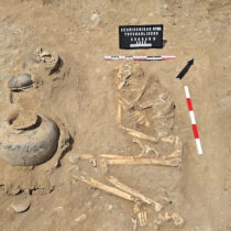
Burials of entire animals are encountered in 3 pits (0.6%: two dog burials in pits aa76 and 110, and three goat burials in pit aa225), burials of parts of animals (skulls or large pieces of goat and one pig) (0.9%), large quantities of animal bones in 252 pits (54.5%), and small amounts in 158 pits (34.2%).
Burials of animals or parts of them, as well as pits with the greatest amounts of bones, date back to the two earliest layers, D and C, indicating, once more, some special use of the space. The rest of the finds in layers containing them (usually large amounts of ceramics, animal bones and stone tools) indicate the assemblages’ spatial connection with the settlement’s habitation area.
The small number of animal burials obliges us to connect these with few and perhaps exceptional events in the Neolithic community. We believe the former should be seen in the context of the latter’s ritual activities and be interpreted as blood sacrifices during burial ceremonies, as well as rituals connected with the completion of the life cycle of buildings or with more secular events such as festivals. The relevant rituals seem to have included the offering of whole animals or parts of them, most possibly combined with the participants consuming pieces of the meat offered. The great quantities of animal bones must be connected to similar rituals, indicating the simultaneous slaughter of many animals, not justified in the context of everyday domestic consumption.
Archaeological remains (fired clay) mainly from the superstructure of buildings and rarely of floors, were found in 154 pits (33.3%).
Most pits are located in layer C, while regarding the total of pits in each layer, the greatest percentage is found in layer A, where we seem to have a more intensive use of space for depositing large quantities of fired clay from demolished buildings and possibly a more extensive use of clay in constructions.
Relative data shows that, throughout the settlement’s life, the same building techniques were used, with clay and wood being the basic materials. Wattle and daub buildings with clay floors are constantly being built. Posts are used of various thicknesses, as well as planks and there are indications of two storey buildings being constructed. The material as a whole shows traces of burning, which indicates the destruction of buildings by fire. The possibility of the deliberate, controlled burning of buildings at the end of their life cycle should not be excluded.
The practice of depositing considerable quantities of fired clay inside pits, some of which appear to have been opened specifically for this reason, especially in the two later phases, was carried out from the start and throughout the use of the specific space. The necessity that dictated inhabitants to “remove” part of the burnt architectural remains from the dwelling area and deposit them in pits, must be sought in the sphere of ideology.
Other than the groups of finds mentioned above, pits were recorded containing collections of stones in the two later phases, or other materials, that point to part of the area being used earlier on as a workshop.
Furthermore, there are human bones among the content of some pits, while normal burials are also present (note 4) with findings in two of them that give them the character of a burial (note 5).
There is little archaeobotanical material (note 6) on the site and it is mainly related to processing waste. Burnt seeds were found in a handful of pits, with aa314 being an impressive example, where a storage jar was found full of burnt vetch seeds. The vase with its content had been deposited there, after the building containing it had been destroyed by fire.
Ways of combining the basic content of the pits
In relation to the basic content, there is a predominance of pits containing large amounts of ceramics, while there is an important percentage with a large amount of zooarchaeological material, in contrast with pits that contain great amounts of fired clay. Their distribution in the space’s four layers of use, makes later layer A the dominant one in terms of ceramics and fired clay, while the earlier three are more important regarding ceramics and bones.
The basic content presents the following combinations:
Pits with a large amount of ceramics, zooarchaeological material and fired clay: 72 (15.6%),
Pits with a large amount of ceramics and zooarchaeological material: 250 (54.1%),
Pits with a large amount of ceramics and fired clay: 86 (18.6%),
Pits with a large amount of zooarchaeological material and fired clay: non existent
In all the above cases, the greatest percentages are found in layer C. These combinations suggest materials and objects being specifically connected or excluded, not only during deposition with an implied separation of waste, but through activities preceding deposition, that reflect various different sources and ways in formation of pit contents
Small Finds
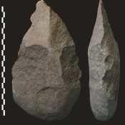
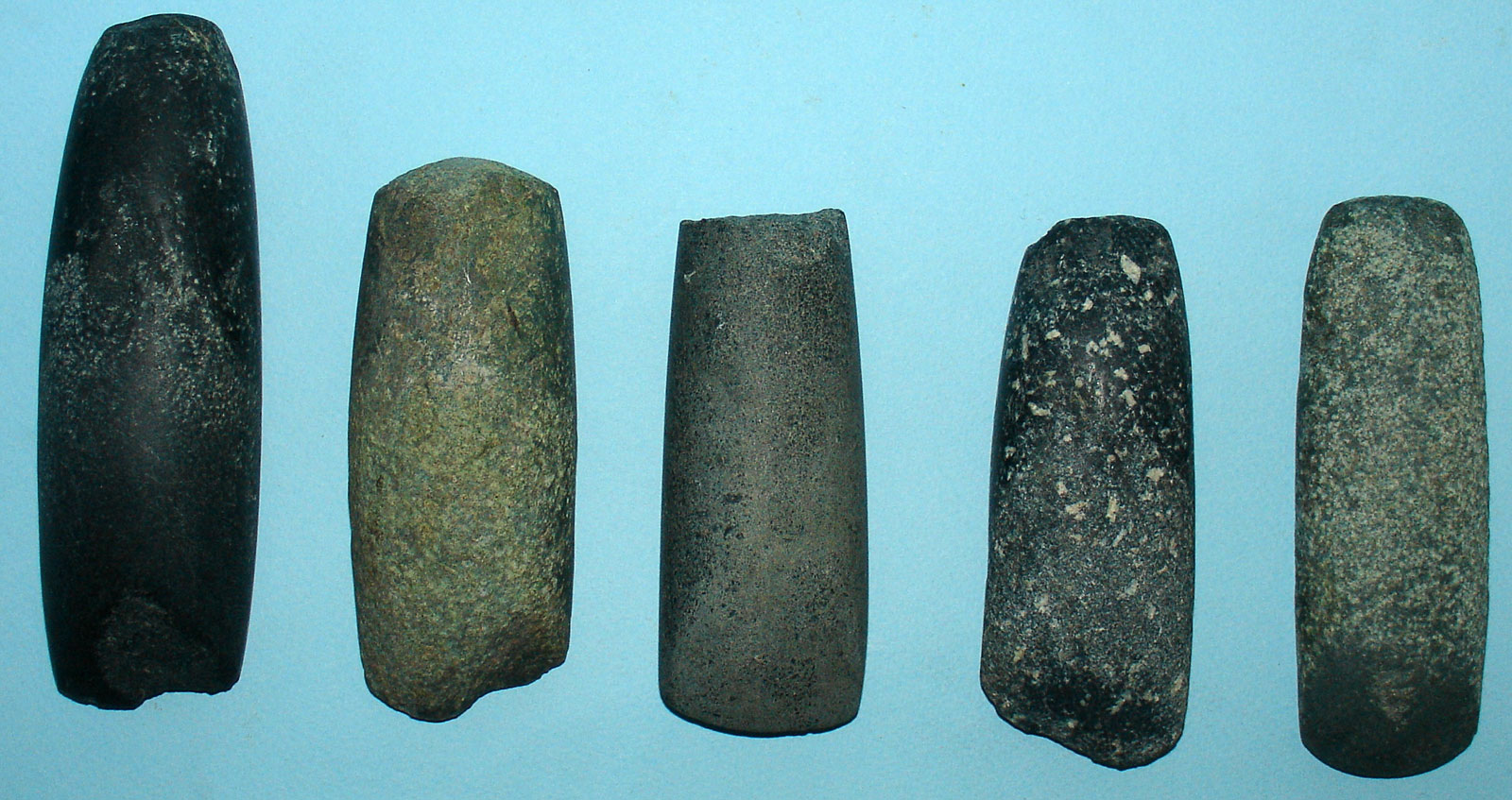
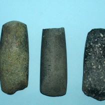
Mill stones are the dominant category of small finds (462 in number, whole or in pieces, including some grindstones) followed by rock samples (most of them by products of ground stone carving). There are considerable numbers of ground stone tools either for cutting (431 axes, adzes, chisels and hammers) or not (362 shaped tools or natural cobbles and pebbles with traces of use).The total number of recorded products of ground stone carving amounts to 2,699 objects (note 7) (fig. 2).
The distribution of 22 intact or almost intact millstones is worth noting, as these do not come from pits that could be interpreted as buildings (dwellings or work places), but from smaller ones where it seems they ended up either as refuse (12 of them) with other fragmented objects, or as articles that have been deliberately deposited (10 of them), with assemblages of miniature objects and bones of animals (as well as human in one case) in the context of some ritual. This data, unique to Greece and the greater area, confirms that apart from a millstone’s practical role in the economy, it participated in a series of activities and events of an ideological content, because perhaps of its important contribution to the settlement’s economy.
There are several flint or quartz tools, as well as the by products of their processing, mainly of quartz. 1037 flaked stone products were recorded, 638 (62%). of which were tools.
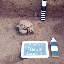
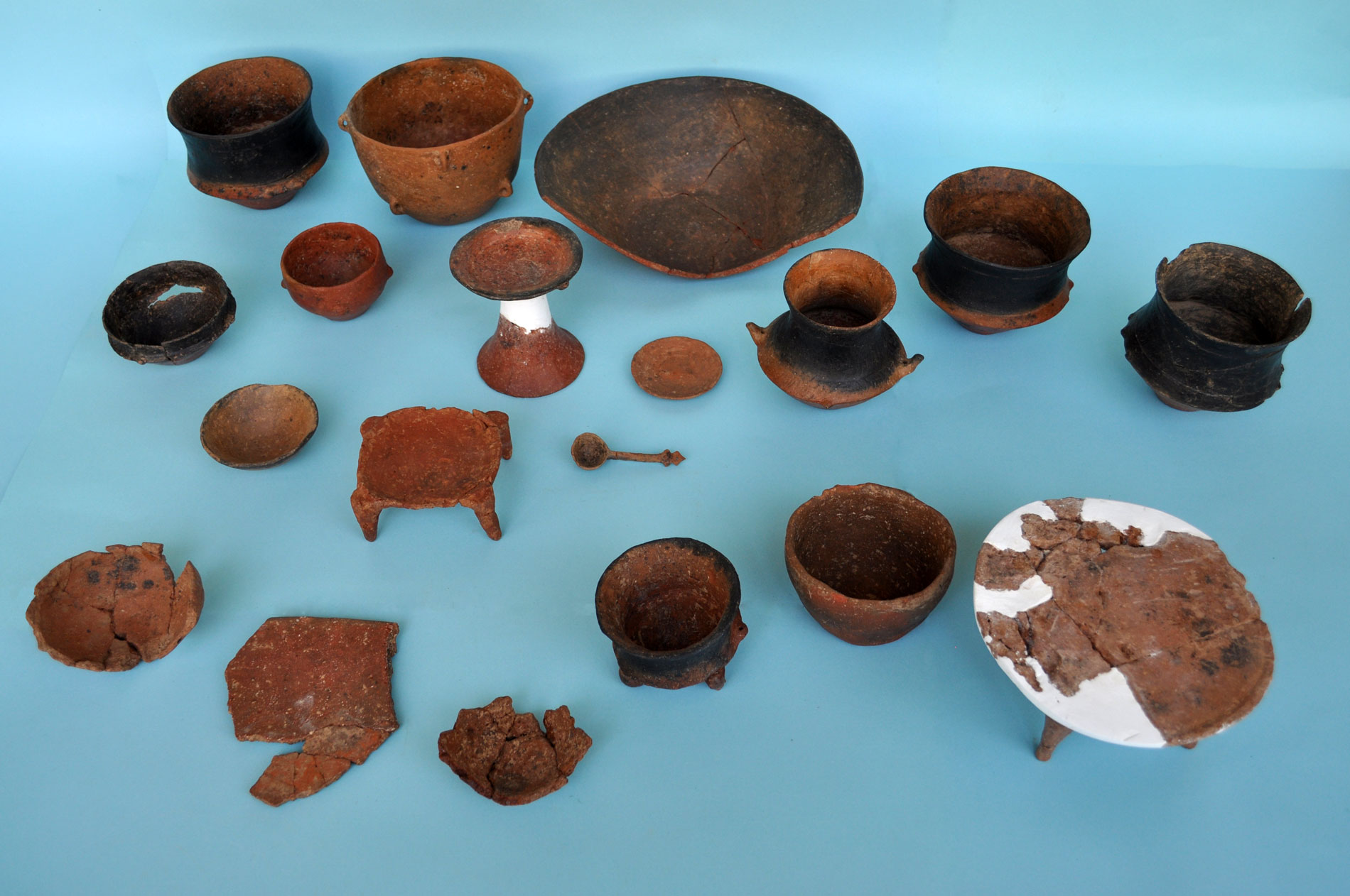
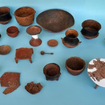
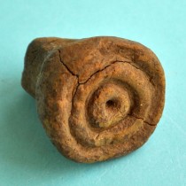
Clay objects are few, with miniature vases being the dominant category. These make up the basic content of 15 pits, found in groups sometimes together with normal sized vases (fig. 3).
This is one of the excavation’s most important finds, as referred to above, regarding the millstones. 105 miniature vases have been recorded, bottles being by far the most and 30 table legs, with an expected increase in the final number. The vases are roughly made with rudimentary space inside them.
The miniature vases in Kremasti are unique and important because they were found in some of the places of their final destination, thus confirming their link with a ritual activity, as thought possible by the research. The vases seem to have been used for the offering of dry food. This included meat (indicating blood sacrifices) as well as millstones (possibly for grinding the fruits offered), while in one case (pit aa387), a human bone was found. The link, proved by research, between miniature vases, storage spaces and the cooking of food, could guide us towards special symbolic practices connected with the securing and multiplication of food. The presence, however, of the human bone points towards burial rituals related to the recently deceased (their disposing), or the community’s ancestors. It is also important to find that almost all the assemblages are formed not only of whole, but parts or shards of pottery, while the deliberate cracks on their surface indicate the great importance of the practice of fragmentation in the settlement’s various rituals. This supports the relative theory formulated about Neolithic South Eastern Europe (note 8). The differences in technique of individual assemblages show a connection with different social groups or households and perhaps with different habitation nuclei or settlements (note 9).
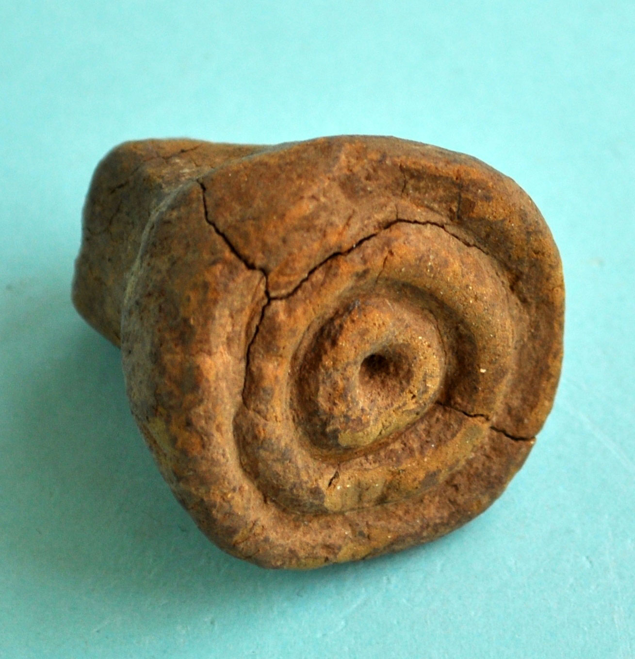
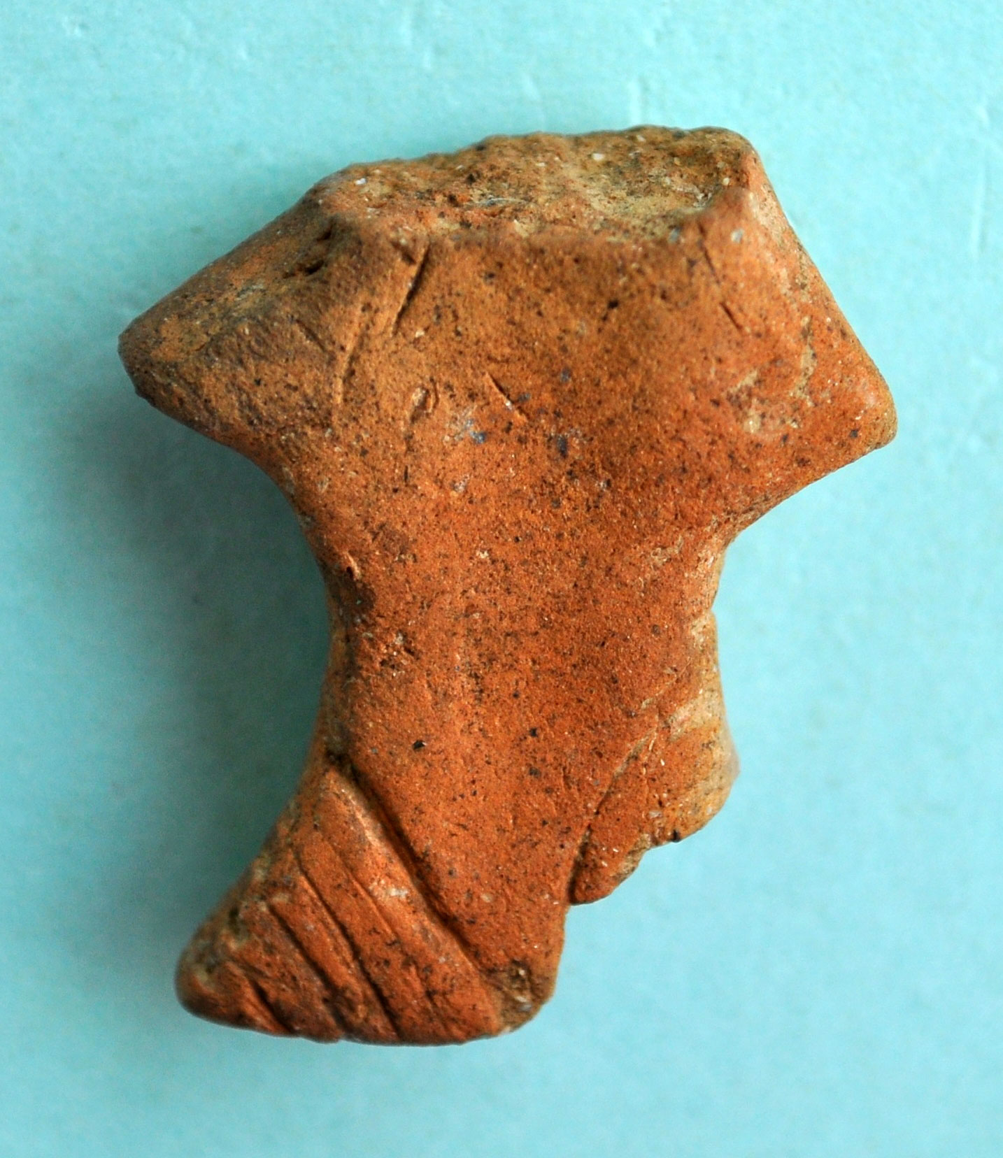
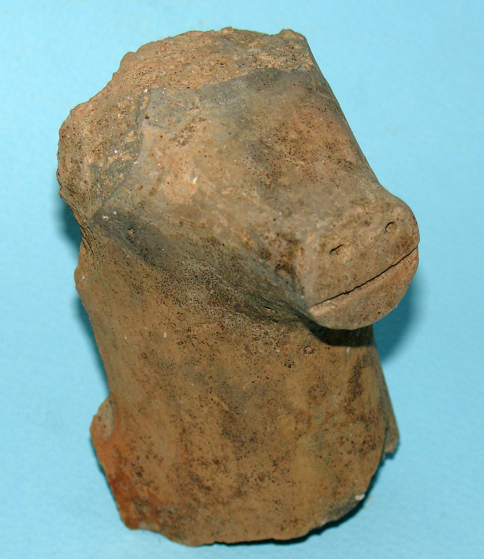
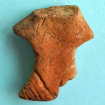
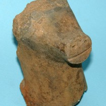
The clay finds include 8 clay seals (fig. 4), 38 parts of anthropomorphic figurines (mainly clay or stone and stylized for the most part) (fig.5) and 40 of zoomorphic (separate figurines of cattle or sheep, bird like heads or heads of four legged creatures attached to utensils, and pieces of zoomorphic vases with a pig’s head among them) (fig. 6). Regarding the interpretation of figurines, data in Kremasti leads to the connection of the anthropomorphic with domestic space and their possible use in rituals and the zoomorphic to a similar use but in a different context. Moreover, an ideological connection can be made between zoomorphic figurines (cattle), models of buildings (or architecture) and miniature vases –perhaps even of millstones.
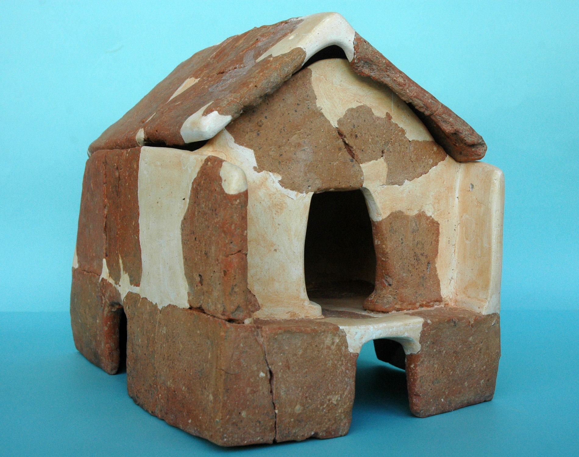
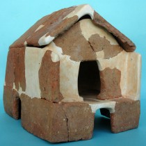
Among the most important finds in Kremasti is a model of a two storey building (note 10).Its large dimensions, the type of building it represents, its good state of preservation and its details of construction make it, to date, unique in Greece and elsewhere.
It represents a two storey rectangular building with pitched roof. The model does not have a floor to it. There are 4 openings/doors on the ground floor, one in the centre of each side. The first floor has an arched entrance in the middle of a narrow side, in front of which a narrow porch is formed. Regarding the function of models, research treats them as offerings and as strong evidence for the existence of “public” buildings, objects used in rituals related to the house (its construction, repair, rehabitation) or as models of sanctuaries (fig. 7).
A biconical spindle whorl and many rounded, pierced seashells resembling whorls, indicate that the art of weaving was practiced in the settlement.
Shells with no trace of treatment are predominant among the rest of the finds, 118 bone tools and 415 shell ornaments (note 11), out of which 128 are connected with habitation complexes and 287 with cremation burials
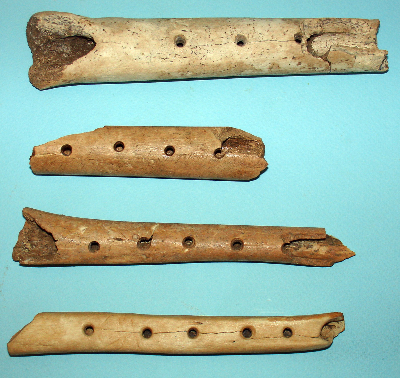
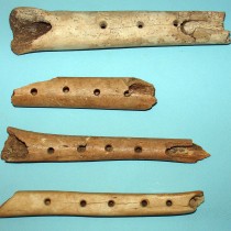
4 bone flutes (fig. 8) are particularly important finds. They are a type of “tube” that have been made of human bone (note 12). Two of them have been almost perfectly preserved while one has a symbol engraved on it (note 13). On the one hand, these finds confirm the development of the art of music during the Late Neolithic period in the region of Kitrini Limni and especially in this specific settlement, in the context of rituals. On the other, they are a valuable source of information on the appearance of Neolithic flutes and music in general, thus essentially contributing to promoting research on the origins of music as a spiritual expression of man.
In regards to the dating of the small finds, there are no essential differences between the layers. It is worth noting the more frequent presence of anthropomorphic and zoomorphic figurines in pits of the two earlier layers, as well as the connection between the two storey building model and layer C (pit aa296). The miniature vases, like their pits of origin, appear more frequently in phases C and B, without being absent from the other two ,which indicates an upward course, initially followed by a decline in their use during the last phase of the space being used.
In regards to the state of the small finds’ preservation, in each case the percentage of broken objects is greater than that of the intact, even reaching 90% in some categories, confirming that the pits as well as the ditches had been filled with “refuse”. Nevertheless, their coexistence with intact or/and unused objects indicates that these were assemblages formed by criteria other than their suitability regarding their use. Moreover, the composition of the assemblages shows that this was not waste resulting from the inhabitants’ daily activities, but rather from the periodic cleansing (real or ritualistic) of spaces in homes or workshops, considerably supporting the hypothesis of the deliberate ritualistic destruction of objects associated with “death”.
Data comparison of small and large pits
A key condition for identifying the excavated part of the settlement as a place of habitation, is to recognize features that resemble homes among the architectural remains of some constructions. Given that space taken up by a construction, in a structured social environment, primarily reflects the functional needs it should serve, we carried out a comparative study, with this in mind, on all data of the large and small pits as determined by their maximum diameter.
According to bibliographic data, when identifying a pit with a home, i.e. a space suitable for a group of people to live in, its area is the key dimension and must be over 2 m. The pits’ depth is linked to the form of the buildings, while the rest of their features make up secondary parameters, connected both with their original use and their less important, differentiated functions.
Relevant analysis showed the presence, in the south east section of the space, of two big pits which could be connected with structures partly and wholly underground, functioning as workshops or in an auxiliary capacity, belonging to the space’s second phase of use.
When comparing the content, it emerged that all the pits were linked with the depositing of materials and objects originating from similar sources, with different or similar ritual activities as well as with anthropological remains.
Lastly, the relation between shape and content was explored, based on the size of the pits (large and small) and in relation to the dating. The aim was to pinpoint possible differences in content compared to shape and in the features of each shape compared to the dating. Any variations could emerge from special, different and perhaps predetermined uses of the pit shapes.
Differences in pit content emerged from the analysis, depending on the shape. In other words, we could support the differences in pit use, basing these on their shape and use this parameter as the starting point in their interpretation. The main distinction is between open and closed shapes. The open ones suggest a greater connection to buildings and the depositing of material (hemispherical pits, some cylindrical and also convexo plane), as well as with places for extracting clay or supporting large vases, perhaps not of clay (mainly cylindrical pits and perhaps conical). Closed pits (bell shaped and oval) are connected to a large degree with human or animal burials and generally with depositing material, which (as in the case of other shapes) seems to have been formed not so much by inhabitants’ daily activities, but during periodic events of special meaning to the community. Rituals are reflected, of a mortuary or more secular nature, as well as rituals round the old and new household (destruction by fire, levelling of remains, their partial deposition in pits, the building of a new house in place of the old). The size of the pits does not play an important part in their function, but most possibly reflects other parameters of Neolithic society. These relate to the social groups of work and their use, or the available time between event and deposition, i.e. whether deposition took place in the context of a planned or special (ritual) activity.
Comparing data from the Kremasti pits with data from Greece and its greater area
The great number of pits in Kremasti and the lack of buildings on the surface of the excavated part of the settlement, combined with the presence of some small dugout buildings, are two key features of the site. Therefore, regardless of the type of settlement or the form of its buildings in its remaining non excavated section, these features oblige us to search for comparative material in Northern Greece, in the network of settlements featuring pits.
Similar finds from the 2nd half of the 6th and the early 5th millennium B.C. come from the flat, extended settlements of Central and Eastern Macedonia, with typical examples being the early phase of Makriyalos, Stavroupolis and Promachonas as well as the settlement of Galini in Thessaly.
In the narrow surroundings of Kremasti, i.e. in the region of Kitrini Limni and the middle Aliakmon valley, as well as the greater area of Western Macedonia, no settlements featuring pits have been found to date. Excavation data from the region, the settlement of Kleitos being the most typical example with a pit zone discovered outside the settlement (note 14), show the construction of surface dwellings and a connection of the opening of pits with auxiliary structures, building techniques of houses and functions of a different nature to that of habitation.
Likewise, the settlements in the Balkans, especially in those areas close to Western Macedonia, do not feature pits during that period.
Interpreting the pits in Kremasti
Based on the data as a whole, we propose to differentiate the use of the Kremasti pits, their predetermined function (connecting construction with content), their limited secondary use (whose nature possibly conceals ideological links with their primary use) and their connection with a series of activities unrelated to the settlement.
The finds reflect uses such as the deposition of a variety of refuse from the site (appearing to have resulted mainly from periodic activities like the renovation of houses and the levelling of remains from demolished buildings), the remains of its inhabitants’ ritual activities (either of a mortuary nature -in the context of secondary burials of recent dead and ceremonies related to ancestors- or of a more secular nature – different festive events in the community )and the burial of the dead (primary or secondary), while the extraction of clay for constructions is also indirectly suggested. The identified buildings are few, while a few more pits, dispersed or in clusters all over the area, could be linked to possible constructions. The buildings’ small dimensions, their structural features, the lack of hearths and of proper floors, suggest a seasonal use for various types of work, without excluding their use to occasionally house a small group of people. At the same time, some clusters of pits could be places for supporting vessels, made perhaps of perishable materials.
Generally, these uses are related to different pits, suggesting variations in depositing (by spatial separation, possibly also ideological, of various issues of material culture and reflected activities) but also in the use of the specific area. There are, however, an important number of pits with more than one use, indicating that remains of different activities coexisted. Moreover, the coexistence of all of them in the same part of the settlement shows they are ideologically related. This connects spatial activities, such as the discarding or depositing of the site’s different “refuse”, or the offering of food (possibly) through deposition in the ground, burials of the dead, storage and extraction of clay for constructions, as well as whatever buildings were related to these activities such as workshops, areas for work, storage and perhaps also for seasonal habitation. The pits’ dimensions do not play a decisive role, since variations in size are small and known uses related to these, variations, are similar. Moreover, any chronological differentiations observed, seem rather to reflect general changes in the ideology of the settlement’s inhabitants and any related practices, than change in the use of this specific place.
Areti Chondrogianni-Metoki
PhD in Archaeology
Director of the Ephorate of Antiquities of Kozani