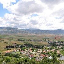
Kremasti is a settlement belonging to the Local Community of Koilada, in the Municipal District of the Hellespont, of the Kozani Municipality (note 1) (fig. 1).
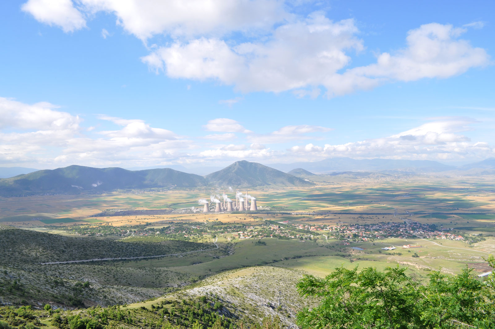
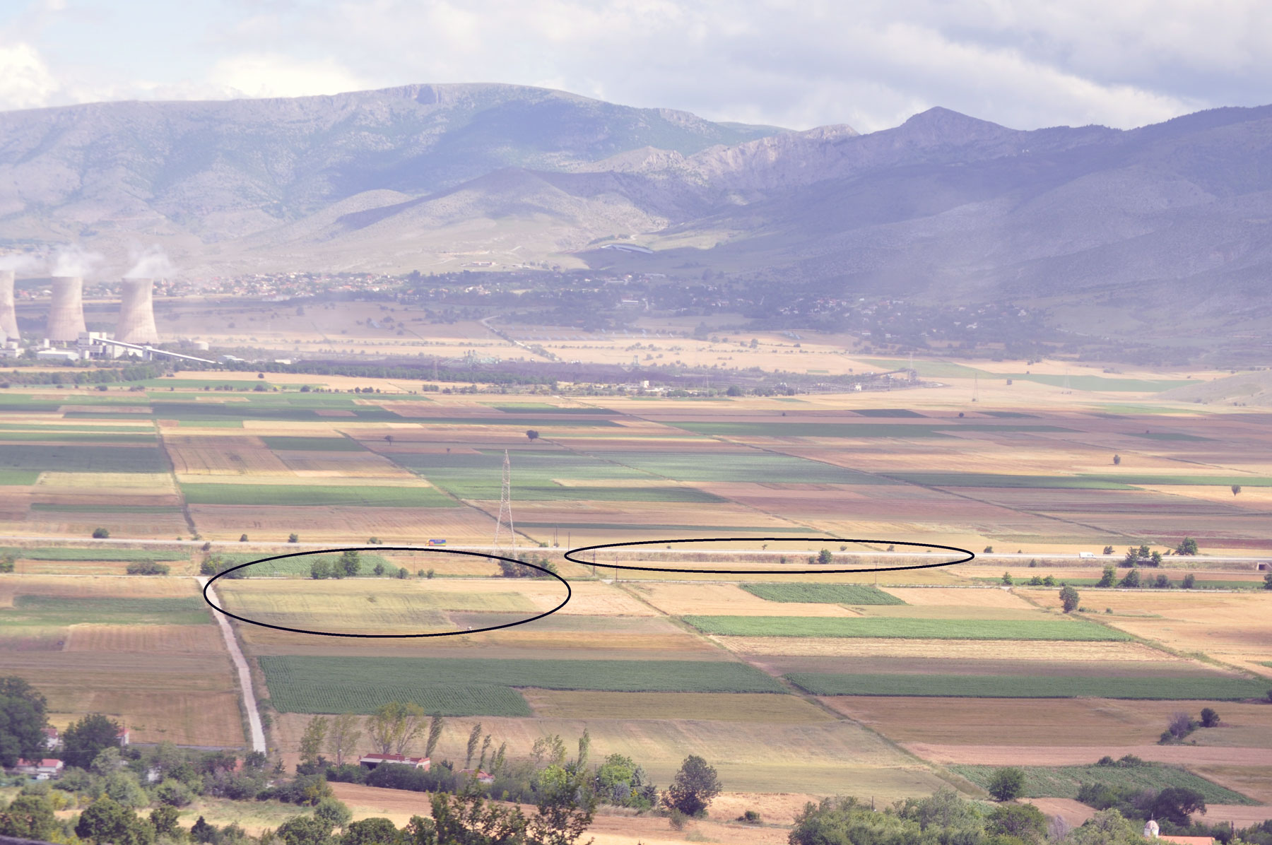
The site was found in 1985 (note 2). It is situated 15klms northeast of the town of Kozani, on the southeast boundary of the basin of Kitrini Limni (Sari Göl) and outside the area covered by the marsh of that name, drained in the 1950s.
A prehistoric survey of Kitrini Limni (Sari Göl)
The valley of Kitrini Limni or Sari Göl, to the north/northeast of the town of Kozani, has an area of approximately 35 sq. klms and an altitude of 656-680 m. It was inhabited all through the Neolithic Age, from the middle of the 7th millenium B.C. and particularly densely during the Later Neolithic era (about 5500-3000 B.C.). In the Early Bronze Age, habitation has been confirmed in only a few locations, while there are particularly limited clues in connection with the 2nd millenium B.C. Reasons for this decrease in population remain unclear, while based on current data, they cannot be linked with certainty to the spreading of marshes on the bottom of the basin (note 3).
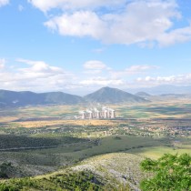
The valley is part of Ptolemaidas’ wider geological basin. Its southern boundaries, where the Kremasti settlement lies, are created by the hills of the Skopas mountain in which a variety of stone is to be found, as in the rest of the mountains around Kitrini Limni. Much of this stone was used by the prehistoric inhabitants of the region, mainly for the making of tools. Two types of deposits are encountered in the valley, namely lacustrine or boggy, in the marsh area and today’s alluvial, torrent river silting that covers the area between the marsh and the surrounding mountains (note 4).
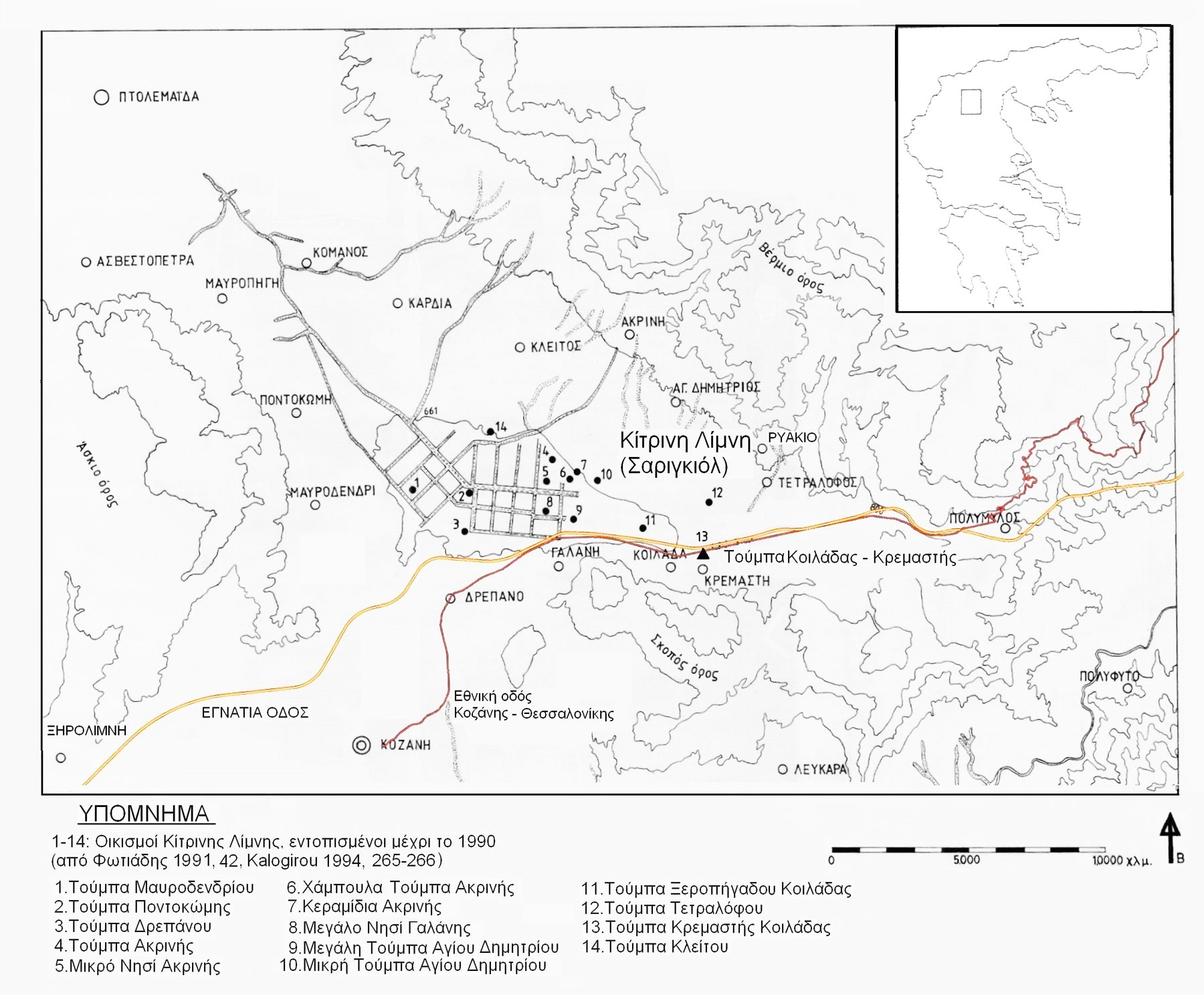
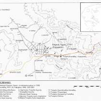
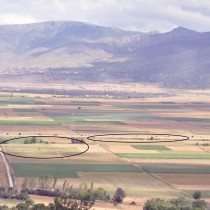
Since 1966 (and 1970), Kitrini Limni has been well known in archaeological bibliography as a region which had been densely inhabited in Prehistoric times. It was in 1966 that the first nine settlements were located by D.H. French as well as some others, after suggestions by F. Petsas, archaeologist of the Service. Later surveys, after 1981, brought to light a considerable number of sites, thus drastically raising their number and expanding the limits of their distribution area. These began with the relocation of places already known (note 5) (fig. 2), followed by extensive programmes of surface and excavation surveys for rescue purposes, as part of modern, large scale projects such as the Egnatia Road, as well as the activities of the Public Power Cooperation (PPC). Thus, today, the total number of settlements is in excess of 35 (note 6), 10 of which are in the area covered by the marsh, the rest being on its outside. Many of these are at risk of extinction, as they are situated in the development boundaries of the PPC’s lignite mines, while, based on current data, it should be considered as certain that many sites have already been lost.
Material from the Late Neolithic period II, to which Kremasti belongs, has been definitely located in 19 settlements. Apart from Toumba Kremastis Koiladas, a limited excavation survey has been carried out in the following settlements: Megalo Nisi Galanis (1987-1989, 1993, 1994 [note 7]), Stasi in Mavrodendri (1999), Mourtzouvades in Asvestopetra (1999) (note 8), Kouri in Ptolemaida (2010) and Isioma in Mavropigi (2010) (note 9), while an extensive excavation was carried out in Toumba Kleitou (1995, 2006-2010 [note 10]), where some important finds were discovered, essential for the understanding of that period, both in the region and in the wider area. Moreover, excavations in earlier settlements of the Earlier and Middle Neolithic periods, such as Fyllotsairi in Mavropigi (2005, 2006), Vrisi (2000) and Souloukia in Pontokomi (2010, note 11) all broadened our knowledge on the Neolithic period as a whole, while, at the same time, shedding light on the cultural background of the Later Neolithic era.
Dating the Late Neolithic period in Kitrini Limni
The Late Neolithic period in Kitrini Limni shows important similarities and differences with all the surrounding areas and cultural groups, found not only in ceramics but also in many other aspects of its civilization. One can observe the blending of cultural elements of different origin and the appearance of a diverse culture with many local features. The synthesis of current chronological data from the region (note 12) gives this specific period two phases:
a) The Transitional phase with characteristics of the Middle and Later Neolithic period. It is located in Megalo Nisi Galanis (maybe also in Kremasti) and is placed around 5500-5400 B.C.
b) The Later Neolithic period: It is found in Megalo Nisi Galanis and in all excavated settlements, with Kremasti as its most representative example. It is known for its blacktopped ceramics and a wide range of monochrome brown red vases. This phase dates to 5340-4930 B.C., according to the radiometric dating of Kremasti (in Megalo Nisi Galanis it dates to 5200-4950 B.C.), with the possibility of bringing it up to 4700 B.C. which is the start of the Final Neolithic at Megalo Nisi Galanis. The four stratigraphic- temporal sub phases, recorded in the excavated section of Kremasti, do not suggest a similar division of the period as well, since they are not accompanied by differentiations in ceramics or in any other of the site’s cultural features.
Toumba Kremastis Koiladas; the site and its excavation survey
The settlement has been founded on alluvial deposits of a light-coloured yellowish clay, at an altitude of 661 metres. It has the shape of a very low, almost indiscernible mound, with the existing high way of Kozani to Thessaloniki passing through its northern part.
The mound is between 1 and 1.50 m high and with a surface area of 35 stremmata, while according to excavation data, its original height is estimated as being 2-2,50 m and the settlement’s total area at 80 stremmata. The specific height of the backfill is as expected, in a type of settlement described in relevant bibliography as a “low mound (toumba)” and its estimated area makes it one of the largest settlements in Kitrini Limni and the Region of Kozani in general.
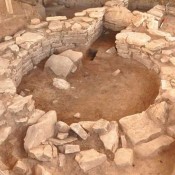
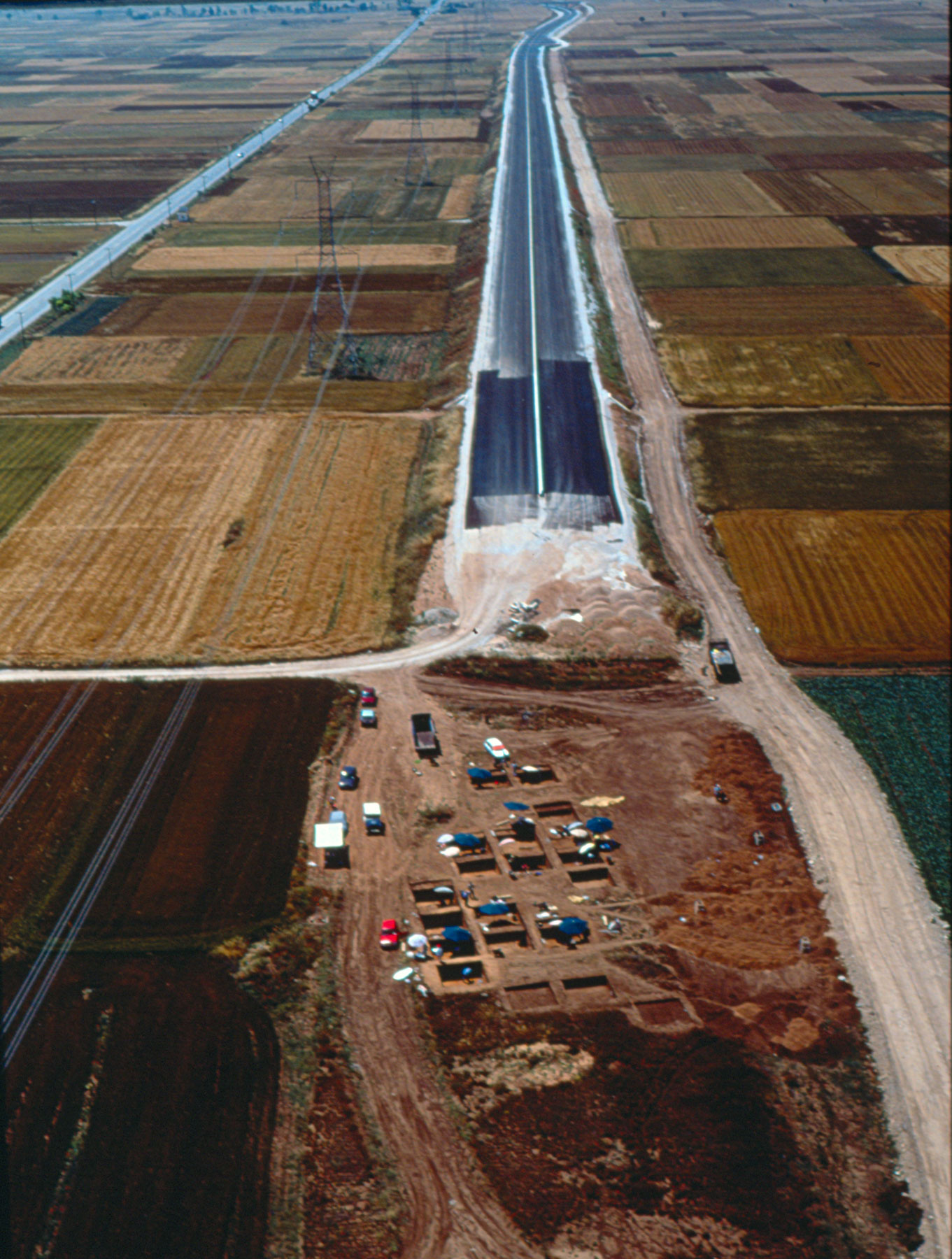
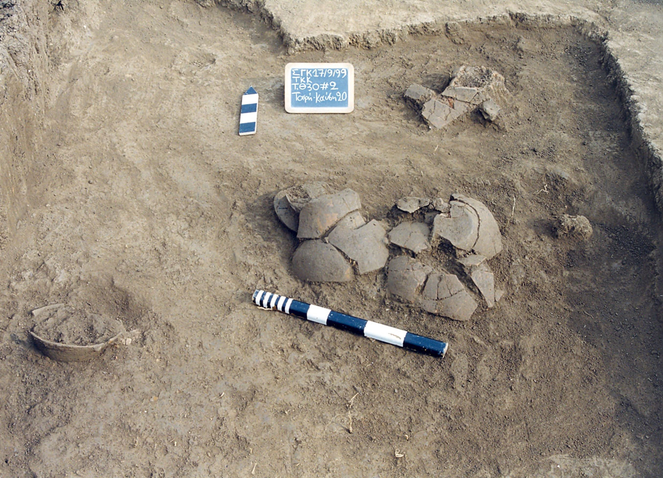
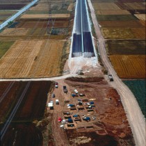
The rescue excavation of 1998- 1999 was dictated by the construction of the Egnatia Road. It evolved on the north eastern edge of the mound, outside the limit of the material’s surface dispersion, in an area of 7 stremmata and 150 metres along the road (fig. 3).
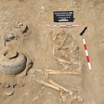
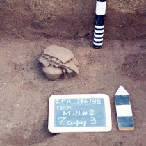
462 pits came to light, as well as 5 trenches or their sections, 23 cremation burials and two pit burials (note 13). The excavation finds, the mound’s surface material as well as whatever resulted from the limited 1996 excavation (note 14) on its northern section, through which the Egnatia Road initially passed, date to the Late Neolithic period and according to radiometric dating to 5340-4930 B.C. A handful of evidence testifies also to the existence of the Bronze Age, probably in an adjacent district.
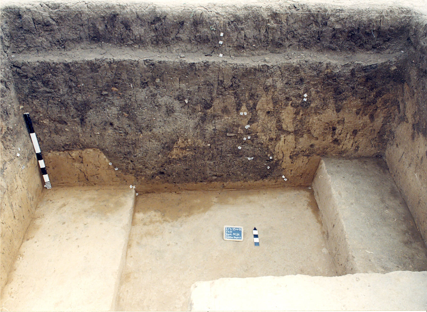
The stratigraphy of the settlement’s excavated section
On the whole, the site’s stratigraphy is uniform. Two basic layers can be distinguished on top of the natural one; the first being a cross between yellow and yellow brown, covered by a second that is grey brown. Based on a series of criteria, these in turn are divided into five thinner layers: The one on the surface, followed by A, B, C and D. The surface-arable one belongs to a later time, the others dating to the Early Neolithic period. There is no great difference in their thickness, all ranging between 10/20-35/50 cm, fluctuating significantly in different sections or areas and even within the same section.
The surface initially used was not entirely flat, displaying both shallow depressions and raised points. It sloped slightly towards the side of the basin and remained this way throughout the area’s use, with the backfill increasing evenly all over, by approximately one metre.
There are very few finds originating from the sections that cannot be linked to some individual unit (pit, trench or burial), with the exception of the south western part of the excavation, found closest to the mound. This applies to the entire archaeological material (ceramics, animal bones, baked clay and small finds), whose features indicate intense mobility in the region and to its having been transported far from the area of its original deposition.
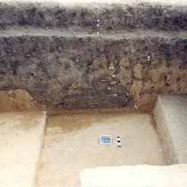
No clear and extensive surfaces for use are detected in the stratigraphy of the excavated site. The four prehistoric layers detected by us, are dictated more by the various depths of the pit and trench openings as well as the depth at which the cremation burials were found, reflecting the existence of many different surfaces. The latter are more evident as individual sections or more extensive areas, where a clear time sequence appears among the many structures and uses. On the other hand, the correlation of time in the excavated region as a whole presents particular difficulties (fig. 4).
Therefore, the stratigraphic integration of individual excavation units (pits, trenches, burials), based on the depth of their initial limit and occasionally the depth of the finds, is questionable in some cases. A surface to be cut open and a pit’s content can be, according to the stratigraphy, a) identical, b) the content can be at a lower level, indicating empty or half full pits, often sealed with a barren layer, and c) the content can be higher than the surface to be opened, due to its mound like form. Additional difficulties arise, because much of the content of many pits and parts of trenches have little to do with the time of their making, since, in many cases, facts are ascertained such as their repeated use, the time lapse between their construction and initial use, as well as the possible presence of material preceding their construction.
The site’s stratigraphy indicated the continuous although occasional use of the settlement’s specific region, with a parallel small, horizontal shift in activity and a change in the site’s use. There were successive episodes of use and abandonment, with areas of more intense activity, without some part of it ever having been completely abandoned at some point. Less continuity in terms of space and more discrepancies are observed between the two earlier and two later stratigraphic – temporal phases in the site’s use (namely between layers B’/A’ and C’/D’), indicating the existence of two clear, longer periods, namely the Earlier and Later.
Dating of the finds and constructions
The absence of burnt residue, therefore also of radiometric dating, from the backfill of the sections outside the pits and trenches, does not allow a direct exploration of the relationship between the site’s temporal and stratigraphic sub phases. At the same time, the origin of 19 samples of carbon from inside the constructions and not from one of their elements, connects the radiometric dating mainly to their content, since it does not directly reflect the construction’s dating. In each case, even though we cannot know the time lapse between the formation of matter and its deposition, overall data shows that this is not great, while in many of the pits for one use, it seems they are identical.
Subject to the above restrictions and from the correlation of available data, the following four stratigraphic-temporal phases emerge for the excavated part of the settlement of Toumba Kremastis Koiladas:
ΤΚΚ 1 = Layer IV = 5340-5200 B.C.
TKK 2 = Layer III = 5200-5060 B.C.
ΤΚΚ 3 = Layer II = 5060-4930 B.C.
ΤΚΚ 4 = Layer I = There is no corresponding dating = after 4930 B.C. and before the start of the Final Neolithic period before 5340-5200 B.C.
The time frame is therefore 5340-4930 B.C. (note 15), a period identified with the Early Neolithic I, that, as a whole and for Northern Greece, can be placed between 5400/5300 and 4700/4500 B.C. (note 16).
The site belongs to the same period as the following settlements a) Northern Greece: Makri II, Promachonas I-II, Sitagroi I-II, Dikili Tas I, Stavroupolis I, Makrygialos I, Dispelio, as well as the second pre-Dimini phase Arapi in Thessaly, b) the Balkans: AnzaIV, DivostinII, SelevacI.
Conclusions – Interpretation of data from Kremasti
While studying the material from Kremasti, the two basic questions that preoccupied us had to do with the approach towards interpreting the finds from the settlement’s excavated area. These indicated uses of space not connected to habitation and this part of the settlement as being spatially and functionally integrated into the habitation web as a whole, an issue directly related to its habitation type.
The material has characteristic features such as the many closed spatial and temporal units and the various combinations of materials and objects showing repetition and in some cases standardization. According to the views of a “contextual” theoretical approach, similar data could provide a suitable archaeological basis for the specific, “historically” determined and therefore unique frame of reference.
A contextual theoretical approach
“Contextual archaeology” or “archaeology of contexts” refers to the theoretical direction that, for some years now, has been dominant in archaeology’s way of thinking, at an international level. It is not just one school of thought, but many approaches with a variety of interpretations, dependant on each researcher’s perspective. All, however, have a common ideological framework, that of archaeology as a social science (note 17).
According to this theoretical approach, we interpret material culture by understanding it. That is, we must find the symbolic principles and ideological patterns (the underlying “structure” [note 18]) that connect its different observable aspects and which, by various activities and practices, give an entire culture its own unique characteristics. We cannot reach human thoughts, but we can recreate public and social perceptions (note 19).
By determining a network of similarities and differences, the meaning of each aspect of the data can be understood within its context and relevance. At the same time, many frames of reference, due to their spatial coexistence, constitute a frame of reference themselves (note 20).
A generalization can be achieved in two ways; in the manner various symbolic or structural principles widely encountered (such as the opposites clean/unclean, male/female, life/death, pure/corrupt), are combined in every cultural environment, giving the latter its particular characteristics as well as its social and ecological strategies, through the way it uses these principles. Since, however, these two parameters are subject to modifications, each cultural entity is unique and its characteristics are unpredictable (note 21).
Interpreting the data from Kremasti
In this specific part of the settlement, it was found that two types of constructions were used, namely pits and trenches, all functioning in very many different ways, as well as coming from different periods, with the pits being the earlier of the two. At the same time, a series of cremation burials certifies the area as being used for that purpose during its final phase. A series of practices of a social, economic and ideological nature are reflected in the content of these structures and in the burial remains, while correlations and differentiations discovered in various categories of finds and the places they have been deposited, echo not just spatial and temporal pre depository connections, but also some structural, ideological patterns. These seem to have led to the shaping of various subjects and to have determined the manner and place of their deposition, with visible results in the settlement’s organization of space and the form of the relevant constructions.
In the excavated part of the Kremasti settlement, one encounters features of both types of settlement, namely the mound shaped kind and the flat extended one. An extensive settlement is outlined with permanent dwellings built on piles, surface and rectangular, possibly renovated while inhabited, an actual practice in many settlements of the period in northern Greece and the country at large, directly linked to the rectangular surface houses (note 22), as well as to catastrophes by fire at the end of their life span. The remains or a part of them are removed from the inhabited area of the settlement and are buried in pits, located in a specific place, a practice that perhaps symbolizes the destruction of whatever is old and unclean and the making sacred of that which is alive and new (note 23). This data suggests (relative) stability in the place of the dwellings and differentiation in the use of space, regarding the axis of centre-periphery-limits, leading us to the conclusion that it is a settlement in the form of a low mound, resulting from the deliberate cultural choice of its residents. The type of dwellings suggested point to permanent habitation, a developed level of technology and restricted living space (note 24), for reasons that appear to stem from ideology, since, according to available data, the terrain’s geomorphology would have allowed the site’s growth.
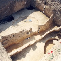
We estimate that the dwelling space of the settlement (probably the starting point of its habitation) must be placed in the area of the mound and the excavated section and identified with its limits, given the uses reflected in the finds and which can in no way be linked with certainty to habitation. The specific area was used occasionally and all through the settlement’s existence, for work connected to storage, workshop use, the extracting of clay, depositing a variety of waste from the site and burial of the dead. Similar uses and constructions such as the pits and trenches determine the boundaries of the settlements, while the possible use of some pits as homes at some point would suggest a fluctuation in the size of the dwelling area, a fact also characteristic of settlement boundaries (fig. 5).
The ideological beliefs of the Neolithic inhabitants of Kremasti
The approach to interpreting the use of the excavated area and its finds was based mainly on pit analysis, in whose data are reflected the following possible ideological beliefs of the settlement’s inhabitants:
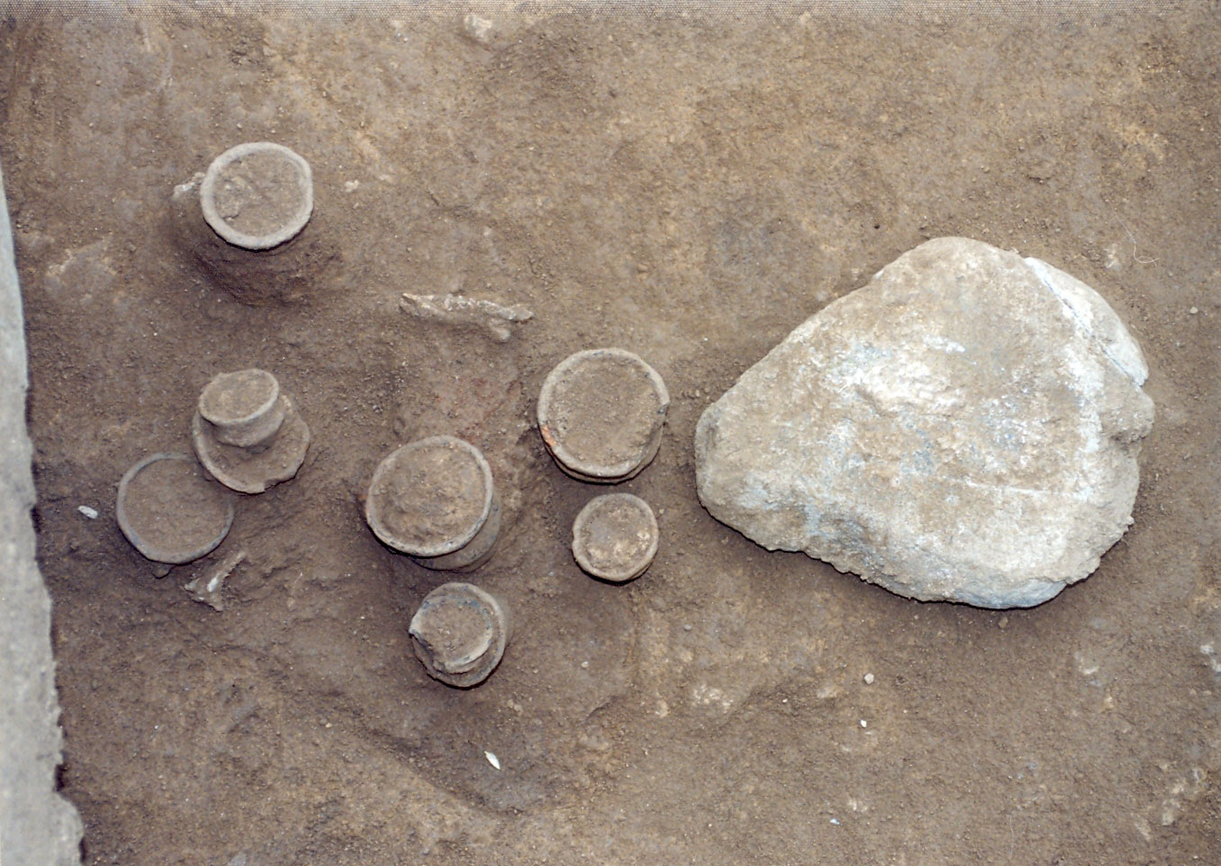
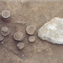
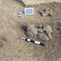
a) From the overall characteristics of the pits (dimensions, construction features, internal stratigraphy, content) and the correlations between them, it follows that the common structure, joining the connections as observed, is a belief (much stronger in the early phase of the area’s use) linking fertility with the dead and leading to practices aiming to secure food. As a possible fertility symbol, the presence of the millstone is notable in pits with assemblages of miniature vases that seem to be connected with offerings to the dead, while also being associated with very important events (fig. 6).
b) A second type of similarity and difference can be observed between the shape and the use of the pits, between closed and open shapes, the first being connected with the dead and the remains of related rituals and the others with more secular activities and perhaps their corresponding rituals. These correlations and contrasts, such as open-closed and activities for the dead- activities for the living, could conceal a belief, based on the more general structural contrast between life and death, linking the open shape to life and the closed shape to death, the end , that is, of the circle of life (in relation to humans, animals, houses and objects). This belief, appearing more strongly in the early phases of the site’s use, seems to play an important part in determining each choice of shape, while at the same time reducing the various geometric shapes to symbols of life or death. It is possible that this same belief prompted the use of the open shaped phial in cremation burials found in the later layer, suggesting a change during this phase, not only in burial practices but also in materials used as symbols. In one such case the phial could have been seen as a symbol of rebirth.
c) In regard to their content, the pits are linked with the deposition of a great series of “dead subjects” with the latter feature most probably being their common factor. Individual connections reflect the events that produced them and in some cases, also the place of the subjects’ initial function. The common structure emphasised in this case could be related to the reason leading to the formation, at a primary level, of the varieties of physical subjects and their partial removal from the place of their formation. Relevant beliefs define the settlement through its entire life span and seem to lead to practices that symbolically connect the habitation area with that used for the burial of remains, leading to the creation of similar assemblages in two regions with different functions and meanings, eliminating the boundaries between them.
d) At the same time, a separation becomes apparent in the depositing of various subjects, a practice that can conceal ideas of purity and cleanliness. It is however possible that these relevant beliefs may extend beyond this activity or the event that produced them and are connected with various social groups, indicating a tendency to project identities at a level of different households. These beliefs link humans and animals (especially in the early phases of the place’s use), by the former and latter sharing the same space in the same pit and at a second level, through the use of similar constructions for their deposition. In the same manner, the use of similar constructions-pits for depositing a great number of subjects, with whatever social differentiations, connects them in some way, perhaps through ideas of social equality. These beliefs are characteristic of the settlement, throughout its life span.
e) By connecting anthropomorphic figurines of the settlement area and zoomorphic figurines of the burial area and the contrast between life and death, a differentiation is suggested in the use of these two categories, that is more intense in the earlier phases. The link between animals (cattle)-houses-miniature vases is perhaps based on ideas related to fertility, that in this specific case also reflects a common area of functions, preceding the one used for deposition purposes.
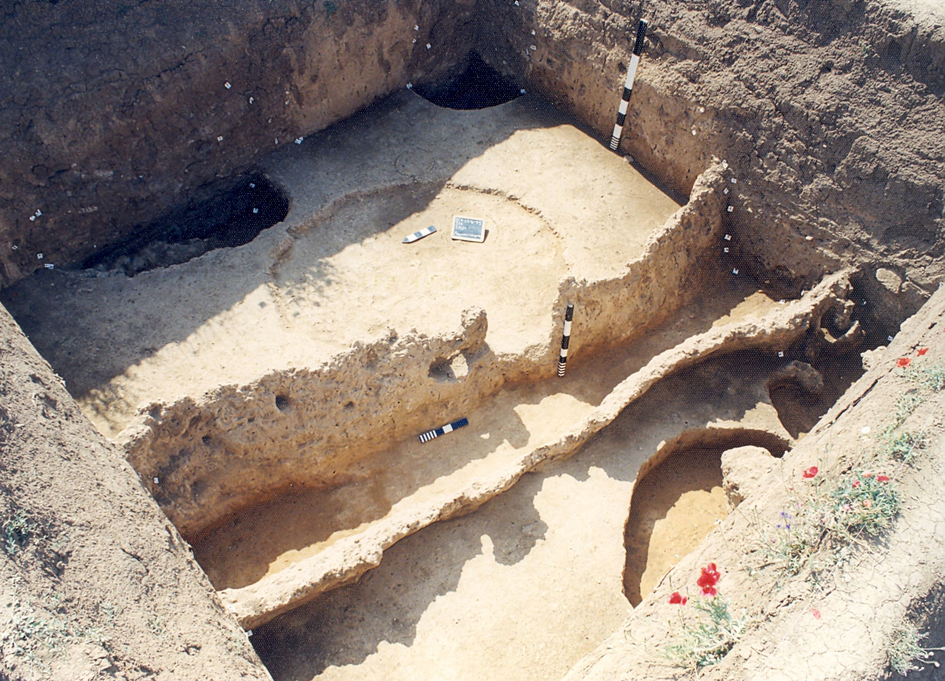
The trenches belong to open type constructions. Regarding their interpretation, the fact we consider most important is mainly their morphological contrast with the pits, particularly the closed ones from which they also differ as to their content. This connects them with life related activities and depositing, also because of the scant presence of anthropological material in their content, with their possible initial use being the extraction of clay for new buildings. Moreover, their linear and sectional form coupled with their orientation based on the cardinal points could reflect ideas of continuity and renewal, including the concept of time and various other cosmological beliefs in similar ideological patterns (fig.7).
Cremation burials, constituting the final phase of the area’s use, seem to lie in the wake of a long period of burial functions, resonating changes both in these practices and perhaps in the ideology concerning death. Their presence supports the hypothesis of the burial character of many previous uses, since their spatial coexistence is in itself a frame of reference in which material culture could have a similar meaning, while, the incorporation of human bones in various assemblages could influence their interpretation by giving them features of a burial (fig. 8).
The structure in the deposition of material in Kremasti (note 25)
The features of the contents of both pits and trenches with the observed connections and exclusions, suggest the existence of a structure in deposition reflecting the different courses and ideological connections made, prior to deposition, between objects and materials. The concept of structured deposition is considered by contemporary research as the basis in the approach to interpreting Neolithic archaeological remains and as currently the most important route for investigating Neolithic ideology. It appears that Kremasti is one of the best examples of structured deposition in the region of Greece and the Balkans.
The structure in the deposition of waste, but also in the assemblages of complete objects in Kremasti, is found in the way the various objects and materials do or do not connect, in the activities that produced them, the activities taking place in the region, the type of objects used, the places of deposition as well as the objects’ biography. Remains of daily or more periodic activity end up in a specific place, implying powerful rituals extending to all aspects in the life of the settlement’s inhabitants. The home and practices related to it, the burial of the dead and rituals relevant to them, as well as various other celebratory events of the settlement seem to be the main sources of origin for the content of Kremasti’s pits. Despite their appearance leaving no doubt as their being waste, the recognition of structure in their deposition confirms that they are deliberate depositions of activities important to the inhabitants’ ideology, that took place in another region of the settlement. At the same time, their state of preservation supports the view on the great importance of the practice of fragmentation in prehistoric societies of South eastern Europe (note 26) and naturally in the settlement of Kremasti.
This intense ritualistic activity that had largely the features of a burial and perhaps not always of the recent dead but of the settlement’s ancestors, its public character and connection with the settlement boundaries, seem to be its particular characteristics. Similar practices reflect the need for social unity and stability, preservation and reproduction of the social structure as well as protection of the limits of the settlement from various real and symbolic dangers (note 27). At the same time, its limits are found to be indicated and emphasised by a series of structures and activities which seem to feature in Neolithic sites of Northern Greece, independently of their type of settlement, suggesting a community of practices and perhaps of ideas.
The possibility of linking this intense ritualistic activity with more than one settlement should not be ruled out, perhaps combined with the settlement’s location on the basin’s limit and the attempt to eradicate or restrict real or symbolic dangers, thought to be contained in border regions, for the life of settlements or groups of habitations such as Kitrini Limni. This common activity, however, and the possible symbiotic economic relationship and interdependence among the settlements does not eradicate, according to ethnographic parallels, the need for a symbolic expression of their differentiations.
Based on the entire data, we could support the non habitation use of the area in the excavated part of the Kremasti settlement, its location on the limits of the settlement, its periodic use and function for a series of activities, many of which perhaps had a seasonal or occasional nature. Furthermore, since in nearly all these cases of deposition, “dead” material is used or implied (humans, animals, buildings, objects), this combination may be founded on ideas based on life, death and rebirth. There are no clear ideological and spatial boundaries between life and death or the living and the dead, since in each case, part of the remains stay in the place they was shaped and vice verse; the place supplies material for the continuation and renewal of life, in a singular exchange between the living and the dead. At the same time, reflected in the spatial distribution of the material are ideas of purity and cleanliness, coupled with social equality.
These perceptions lead to practices such as the deliberate destruction of buildings at the end of their life span, the deliberate “killing” of objects by their deposition or fragmentation during rituals, animal sacrifice on the occasion of exceptional events in the community, the offering of food by depositing it in the ground and removing part of the remains from where the act took place. In these practices, material symbols are used, such as millstones and miniature vases, most probably symbolizing fertility, while a symbolism related to life and death seems to be attributed to various geometric patterns and possibly to figurines.
Material symbols such as millstones are found to be used in all these practices and all of these have a direct and visible result in the organization of space in the settlement, with differences in the function of its various areas and a particular place on the limits being used for deposition. Dead humans, animals, buildings and objects receive the same treatment, thus constituting a singular cemetery; a public place for “the dead”, common to the whole community.
Non habitation uses of space in Neolithic settlements
It is an especially complex issue recognizing uses of space other than for habitation in an archaeological sequence and pinpointing their position in relation to their modern counterpart. This is because none of the relevant activities and uses of terrain, such as recorded in the Kremasti settlement, can be absolutely or necessarily separated from the living areas of the inhabitants of a Neolithic settlement, while several of them are often part of these areas. There are no general rules governing their location, but the way they are organized is directly related to the particular and historically defined ideological patterns determining all aspects of the social, economic and ideological life of each society.
At the same time, these activities vary in their scale of development, ranging from the household level to that of the community, often with material remains similar in quality and quantity. On the other hand, there are activities that almost by definition are connected to regions outside the settlement, often impossible to locate.
Their usual connection with the settlement limits results from their particular character stemming from the great importance of border regions in the lives of the inhabitants of a settlement or a wider area, since these not only define and mark the sites they surround in various ways, but provide their natural and symbolic protection from real or/and symbolic dangers.
The general tendency to place settlements within boundaries during this period, detected not only in the region of Northern Greece but all over the rest of South eastern Europe of that time (note 28), seems to reflect the development of some ideology related to limits. This, however, should be seen in each particular spatial and temporal context, since we cannot know the way in which different symbolic principles connect to each social formation and give the organization of space the forms we observe.
To conclude, based on the data of Kremasti as well as the rest of the settlements of Kitrini Limni, we should expect diversity in the material culture of the region as well as in forms of boundaries and uses of space, with perhaps a strong sense of differences between the settlements, but also social economic interdependence and possible ritualistic activity at a collective level.
Areti Chondrogianni-Metoki
PhD in Archaeology
Director of the Ephorate of Antiquities of Kozani