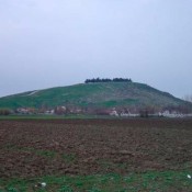
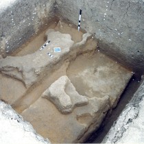
The excavation on the “limits’’ of the settlement of “Toumba Kremastis Koiladas’’, which were defined by surface scattering of archaeological material, also revealed, through the finds, the variety in this area’s uses, reflecting a series of issues related to spatial definition, such as the form,function and meaning of settlement limits (note 1) (fig.1).
Research in the specific settlement showed above all the lack of correspondence between surface scattering of material and the real extent of settlement backfills, proving that they had extended beyond the limits of surface dissemination. At the same time it raised two more issues:
The first is related to the type of settlement, since some of its characteristics appear to be less like the toumba, resembling instead more flat extended settlements and cancelling the hitherto definition of the site as a “low toumba’’, while some others reveal practices that find their counterpart in settlements with a vertical development of habitation. Thus, discussion on the issue of burnt Neolithic settlements was dictated not only by the relative findings, but also by the specific practice’s connection with the way the settlement’s habitation space was organized and developed.
The second issue has to do with the spatial and functional integration of the excavated part of the settlement into the whole of the habitation web, since many of the finds show uses extending beyond that of habitation and which can be placed inside the settlements or on their limits. A series of facts led to the assessment that in the case of Kremasti we were on the limits of the settlement (regardless of its type). These facts resulted from the site’s morphology, surface survey, stratigraphy of the excavated area and finds.
The issue of settlement limits
Two important parameters could be used to approach the question of settlement limits: a) Defining the size of the settlement that depends directly on its type and b) recognizing functions placed on the settlement limits (related through the survey with the space’s different cultural uses such as burials, workshops, storage et al.), which could be approached by investigating possible differences in the use of intra community space, at a level that includes centre-periphery-limits.
Two basic settlement types have been recognized in Greece and the greater Balkan area: the toumba and the flat extended settlement (in which, also included as a subcategory, are settlements spreading onto neighbouring plateaus, morphologically resembling the toumba (note 2). The two types clearly have morphological differences, found in the size of the settlements. A toumba (or magoula in Thessaly) is a settlement that has the appearance of an earth hillock, varying in height and limited in its area. Flat extended settlements, on the contrary, feature a much larger area and a lower height. These differences, based on more recent research, do not reflect population sizes but indicate different processes in the formation of habitation backfill. This is due to differences in the organization of intra community space and the method of habitation replacement (horizontal succession in flat extended settlements and vertical in the toumba). They reflect different social and economic conditions, ideological beliefs (possibly competitive) and symbolisms (note 3).
According to recent data, the following differences do not apply; those related to habitation density, use or not of clay in the buildings’ superstructure, permanence and duration of habitation, intensive use of space and horizontal movement of habitation, in which earlier research made a distinction between toumba and flat settlement. The basic distinction between toumba and flat extended settlements is now found in the size of the area, which also reflects the dynamics of a site’s expansion which by definition is far greater in flat settlements. The backfills’ height is not a definitive factor, since it is either directly related to the duration of a site’s habitation, or the result of its inhabitants’ cultural choices. Consequently, in early phases of habitation,the distinction between the two types can only be traced in the settlements’ internal structure and specifically in the reason for built and unbuilt space, as well as the minimum distance existing between the buildings (note 4).
The toumba is by definition a monument with a long history, having had a number of occupants and the “inside” being separate from the “outside”. There are no croplands or pastures on its surface, while the special areas (workshops, sanctuaries, meeting places or ritual areas and places for waste disposal) are (possibly) situated outside the settlement, due to lack of free space within. In some cases, its limits are marked by constructions such as trenches and stone walls. An important ideological dimension is attributed to the toumba being a settlement that is visible from a distance, both during its habitation and after having been abandoned. The same applies to the settlement’s interior, where the building of houses in the same place makes for the symbolic continuity of both house and household, also suggesting a hereditary system of land ownership. The toumba undoubtedly dominates the landscape, while its height is an expression not only of longevity but also of possible cosmological beliefs. Moreover, it is believed that it could and did provide the means for political power, becoming the latter’s symbol at the same time (note 5).
In contrast to the toumba, flat settlements have a thin layer of backfill, making it difficult for them to stand out in the landscape and be located. Houses and arable areas coexist in these settlements, forming small units within the available space, which is a way of organization that gives them plenty of area, combined with the horizontal succession of habitation phases. In flat settlements, space for workshops, waste disposal, storage and rituals develop within the residential web, in the courtyards of houses and in the open spaces between them. These types of settlement, except perhaps in their early phases, did not organize their residential space on a level of centre-periphery-boundaries, with a permanent place for different sections and their functions, as is the case with nuclear settlements. On the contrary, they are distinguished by a freer and constantly changing way of space organization. The horizontal expansion of habitation constantly modifies the limits of habitation space. These features, however, in the region of Northern Greece, allow for the settlements to mark their limits with constructions such as trenches, which distinguishes the flat extended settlements of the region from their counterparts belonging to the Vinca culture (note 6).
Habitation types: General characteristics and sizes of Neolithic settlements in the region of Northern Greece (Macedonia, Thrace, Thessaly)
According to the most recent excavation data, the most dominant settlements in Northern Greece are those in the form of the toumba (low or higher earth hillocks of a limited area). Nevertheless, the constant increase in number of flat extended settlements seems to gradually have changed the picture.
According to most recent data, the overall picture of types of settlements and their areas is as follows:
In Thessaly, the dominant type of settlement is the toumba (magoula), while later finds in the region also point to the existence of flat sites. Their height varies between 0.50 to 15 m. with those of 2 m. (low magoules) being more often encountered. 70% of settlements have an area of under 50 stremmata, there is also a small percentage of very large sites, over 150 stremmata, while there is a handful of tiny sites (note 7). In Eastern and Central Macedonia, small, medium and extended settlements are seem to coexist, with areas respectively of 2 stremmata, up to 20 and over 100 (note 8). The largest areas of 100 to 300 stremmata are encountered in flat extended settlements (note 9).
In Western Macedonia, the areas of Neolithic settlements differ considerably in each region. In most districts, settlements coexist with small or large dimensions and also with high or low backfills, appearing like a high or low toumba, as well as flat settlements. The area of settlements in the region of Florina is 4 to 10 stremmata (note 10), in Avgi Kastorias the Neolithic settlement extends over an area of 30 stremmata (note 11), while in Grevena, the sites are very small, under 10 stremmata and with a thin layer of backfill, appearing like flat settlements (note 12).
Particularly in the case of the region of Kozani, initial facts from all settlements indicate that in most districts (outside Kitrini Limni), Neolithic settlements do not exceed 30 stremmata over their life span, while much smaller ones are also encountered with a short life span. Most of them have the form of a low earth hillock, varying in height, while there are also settlements from the Middle Aliakmon valley with the form of a high toumba (over 5 m.). A typical example for the region outside the valley of Kitrini Limni are the settlements of the Middle Aliakmon valley, where it is interesting to observe the type of horizontal movement, with habitation transferred to neighbouring plateaus, from one period to the next, or from foot hills to hill tops and vice versa (note 13).
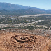
Differences appear in the valley of Kitrini Limni, to which the settlement of Kremasti also belongs and where the largest Neolithic settlements in the region are gathered. An incline in the terrain can be observed (not entirely unrelated to alluvial deposits), with small, medium and large settlements ranging between 30 to 90 stremmata, the largest of which (according to recent data) being the Megalo Nisi Galinis (note 14). This area, regarding the large number and dense formation of settlements (the distance between them being approximately 1 klm) as well as their shape as a low toumba, was initially related to dense habitation and an increase in population (note 15). Nevertheless, despite the survey’s progress, speculation remains as to the settlements’ form, given their relatively large area as well as the latest excavation data; the most important example being the settlement of Kleitos, where big houses are found, with empty spaces between them, while the area of the early Neolithic settlement of Kleitos 1 is not over 20 stremmata (note 16). This indicates considerable diversity in intra communal organization of space within the settlements, not only from one period to the next, but also between sites of that time.
Excavation data from research on settlement limits in Greece and the greater Balkan area
Although recent archaeological research now recognizes the need for excavations both on settlement limits and in the region outside them, very little has been done in that direction. And while we know a lot about the situation within settlements, it is common knowledge that other important issues are unknown to us, such as areas for the production of ceramics, waste disposal, the celebration of rituals and possible worship et al.
To date, excavation data from research in Greece and the greater Balkan area, gives a series of constructions and functions as well as stratigraphic features related to settlement limits and encountered in the toumba or flat extended settlements. These are as follows:
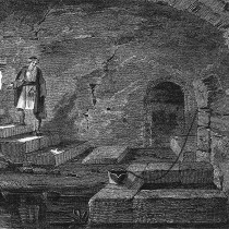
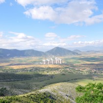
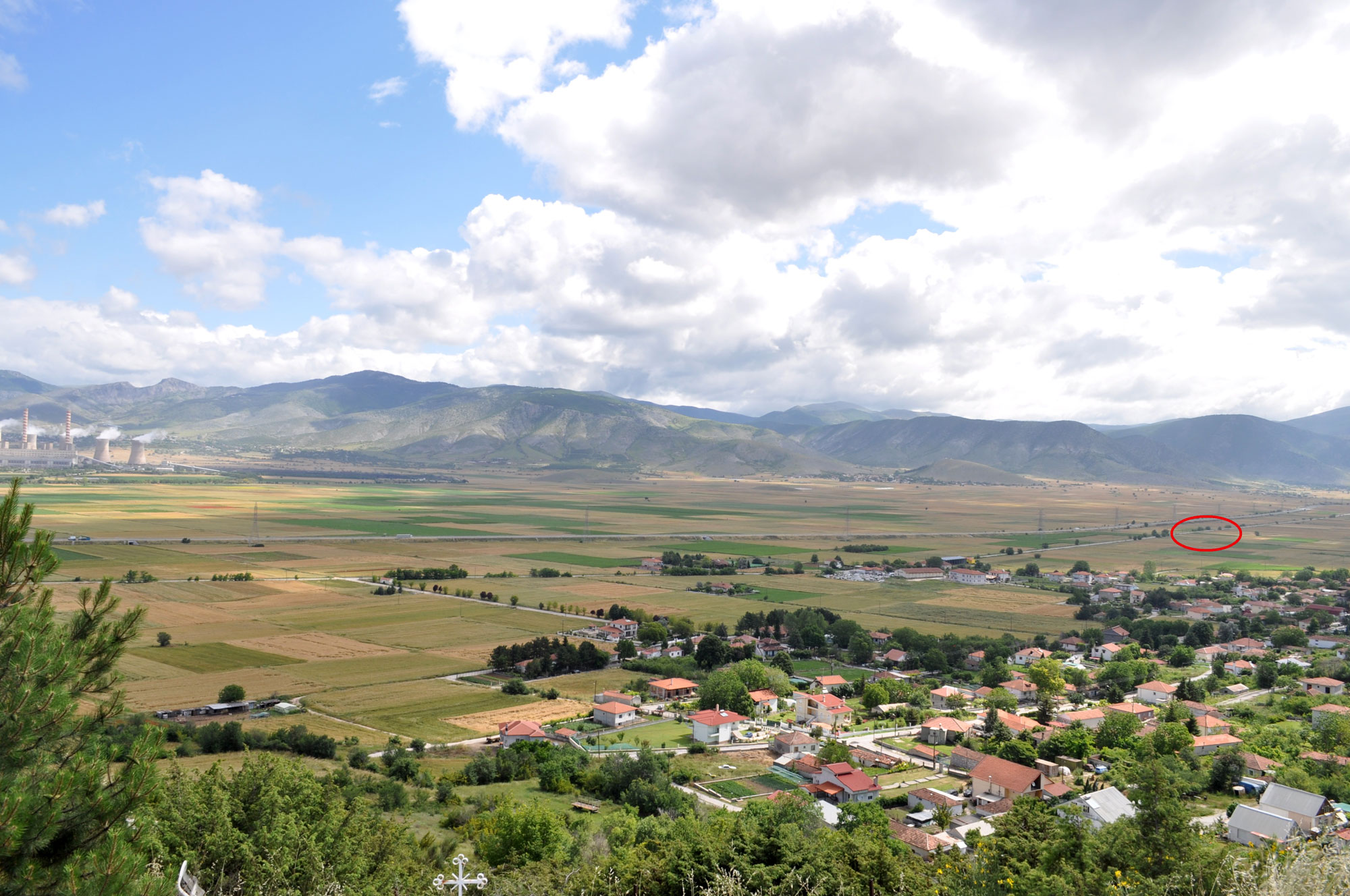
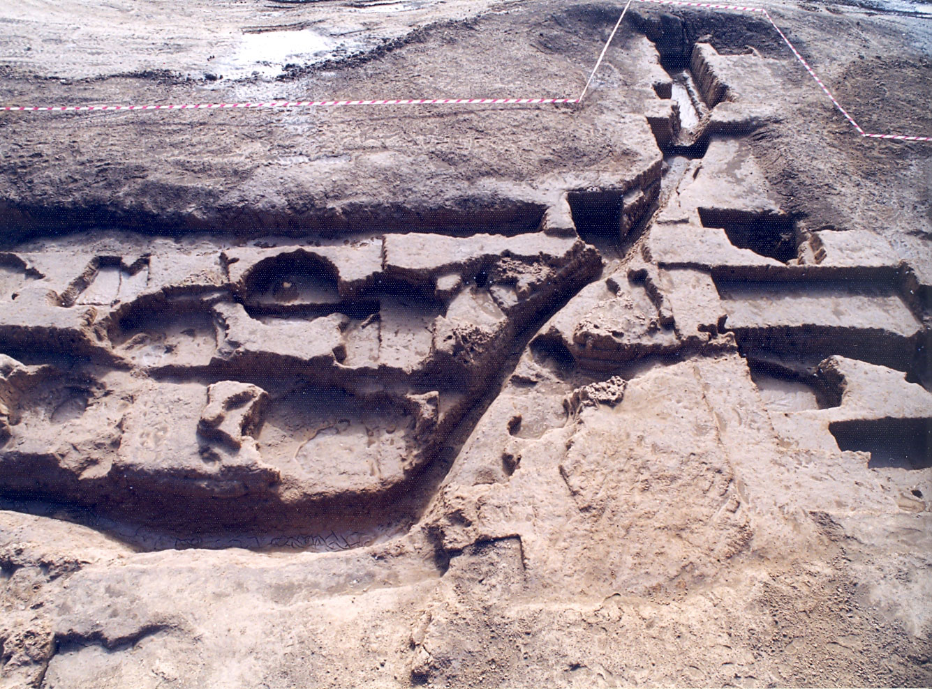
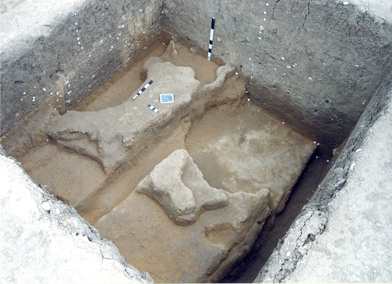
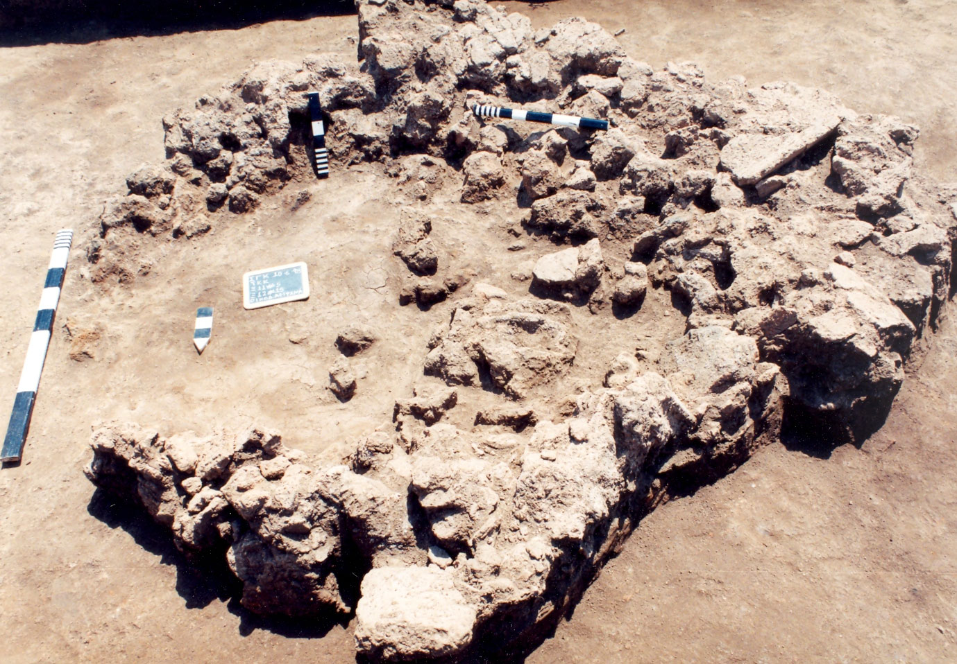
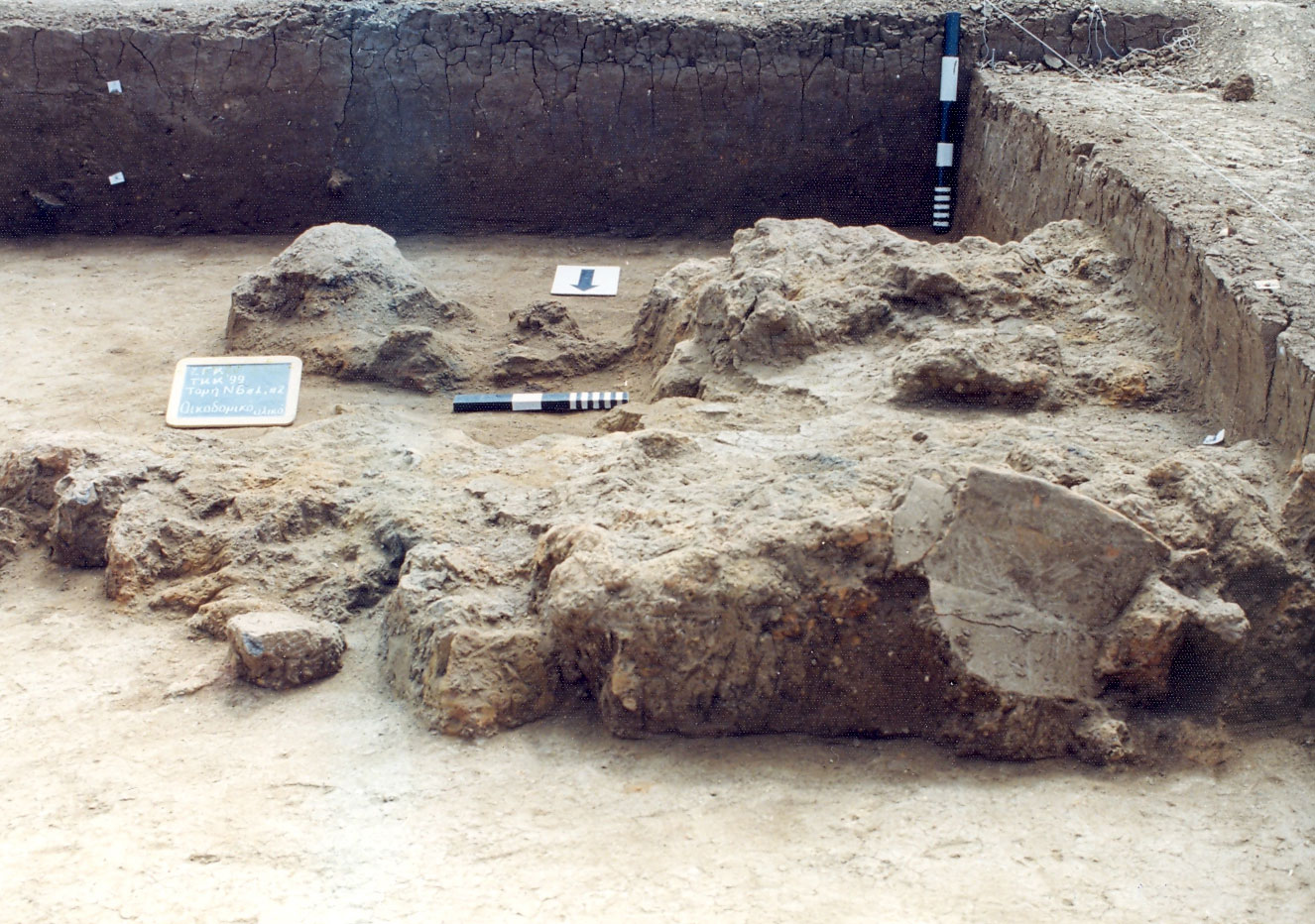
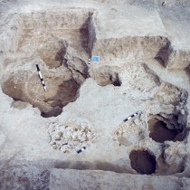
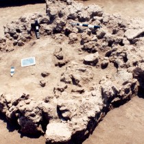
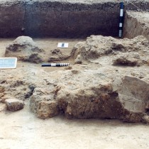
a) Constructions that artificially mark the area’s limits, such as trenches, fences, embankments, stone or mud brick walls. Often these various types were found in combinations. In Greece, the marking of limits in various forms is encountered in many Northern Greek settlements. In the rest of the Balkans, this practice is a feature of regions more to the north, in contrast to those of the south, where settlements are open. In very many cases, places of habitation are defined by parts of the landscape such as rivers or forests (figs. 2, 3).
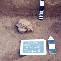
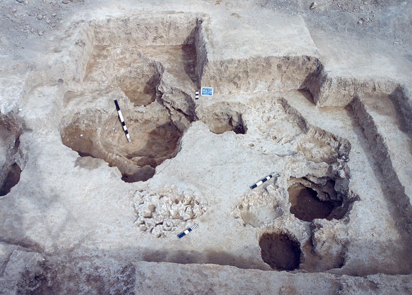
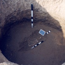
b) Pits, whose features reflect uses other than habitation, such as the extraction of clay and the disposal of waste (fig. 4).
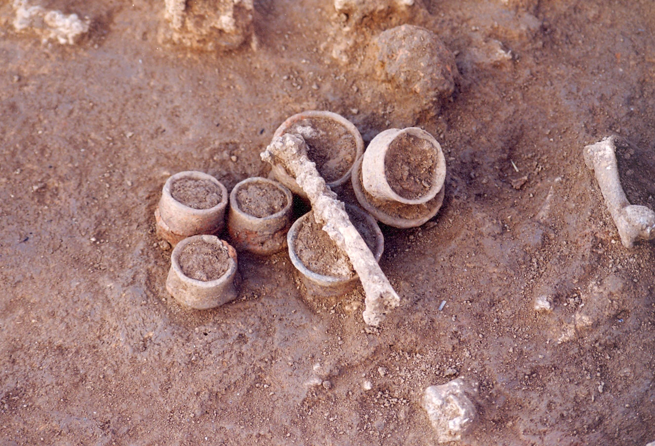
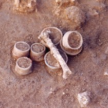
c) A zone with waste and places of seasonal as well as ritual activities (figs. 5, 6).
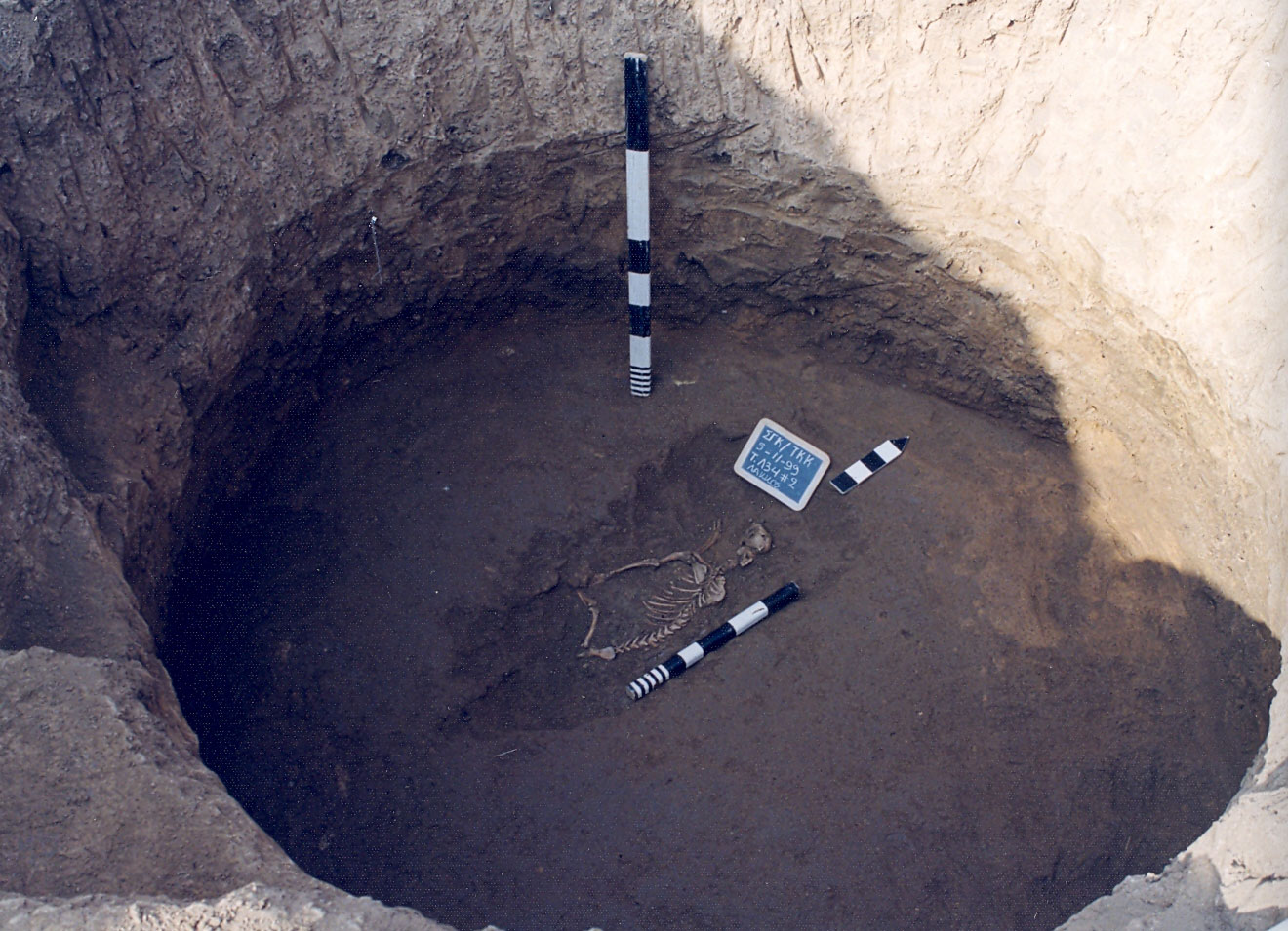
d) Cemeteries.
e) Open spaces.
Methods of estimating the area of settlements
In most cases, the area of settlements is estimated by the surface dissemination of material, despite the serious problems presented by this method. Regardless of the degree of intensity of a surface survey, this often proves inadequate and misleading, for reasons related more to geophysical factors such as silting or erosion, and less to human intervention such as ploughing, embankments and backfilling.
The correlation between surface dissemination of material and underground embankments can generally present three alternative versions: a) Covering of the settlement periphery with silt that accumulated there after it, the settlement, had been permanently abandoned, resulting in the area of underground embankments being greater than its surface dissemination, b) identification of surface dissemination and underground embankments and c) expansion of the surface dissemination beyond the actual limits of the settlement, because of erosion of the higher spots and the movement of material towards its periphery. The actual situation, however, can only be recorded by an excavation, as it seems to be more complex (note 17) and unique, perhaps, to each settlement.
Attempts were made in several sites in Northern Greece to determine or confirm the limits of settlements as these are indicated by surface dissemination of material. A variety of geo archaeological methods were used, such as electromagnetic prospecting, carrot drilling as well as excavation surveys.
Settlement limits. A theoretical approach
The area described as the “limit” of a settlement, is an integral part, in terms of space, of its physical place defined as “communal” (note 18). The features of this habitation section, whether suggested or emphasized, organized and functioning, follow the rules defining the entire organization of intra communal space in each settlement. Since, however, it is a transitional zone, dividing and simultaneously linking the habitation area with its surrounding space, the determination of the position and nature of the limits also requires investigating the relationship between landscape and settlement, particular to each of the latter (note 19). Limits have a function that is both physical and symbolic, since often they are not present in a physical sense but rather in the mind.
On the one hand, the placing of buildings and various activities within the habitation space, including its limits, reflects functional needs, aiming to properly organize financial activities and social relations (note 20). On the other, it expresses the ideological perceptions of each society in relation to the way the world is organized (note 21) and these impose their own special rules.
The organization of space reflects a society’s social organization and is used to produce and reproduce social order. At its foundation are a series of social principles based on discriminations of gender, class and age (note 22). Symbolic principles, attributed to space, are also reflected by particular connections and meanings and also by elements of cosmology (note 23). Behind the organization of space, there is a series of general structural contrasts, such as clean/unclean, life/death, male/female, that determine all aspects of material culture, while the attitude of societies towards the issue of symbolic or real “dirt” or “cleanliness’’ is reduced to an important factor of spatial organization. Ultimately, habitation space (and its limits) is a “symbolic construction” that should be understood as a unique creation (note 24). By dividing up an area naturally, we classify and control space and relationships to it more easily, by forbidding or allowing its access. We create spatial and ideological contrasts, such as inside/outside, holy/secular, male/female, public/private, friendly/hostile, elite/bourgeois, initiate/profane (note 25).
On the other hand, the area outside Neolithic settlements has an economic, symbolic and social meaning for the latter. It has been estimated that the country side was full of movement and life, with impermanent regions of activity and ephemeral constructions. Namely, one could encounter houses related to the activities of Neolithic farmers and, in general, areas less recognizable than places of habitation, but also connected to the economic exploitation of the region, such as those used for the grazing of cattle or their slaughtering, as well as places for the safekeeping of animals. It is also perhaps not unlikely that some special spots in the landscape were used for rituals (note 26).
Consequently, we should expect significant differences in form and function of areas on the limits of the settlement, not only between places of that time (regardless of their habitation type), in the same or different geographic zone, but also between different habitation phases of the same settlement.
To sum up, it is particularly difficult in archaeology and almost impossible in some cases to define the limits of a settlement in terms of space, given that it is a transitional zone between the habitation area and its surrounding landscape. At the same time, a variety of constructions, activities and functions resulting from economic, social and ideological factors and perceptions, can be placed or carried out in these areas, making it difficult to recognize the latter.
The issue of burnt Neolithic habitations
One of the features of the excavation of Kremasti was the presence of a large amount of burnt clay or daub, located in small or larger quantities inside pits of different sizes , less often in parts of trenches and on the surface of the site ,either in very shallow or barely visible pits. They originate from the superstructures of wattle and daub buildings, without their volume corresponding, in any way, to the whole of the remains of a burnt habitation of that type, while it is very rare to find the pieces that could be linked to floors. They are encountered, mixed among other objects such as shells and parts of vases, bones of animals and humans on occasion, millstones and various small finds, without them forming a uniform, compact surface covering some area. In no case were any undisturbed architectural remains ever found under them, such as clay floors, holes for piles or other constructions, or objects in situ such as vases, neither were burnt remains or burnt surfaces as would have been expected (figs. 7,8).
The picture of the excavated burnt architectural remains of Kremasti, reminds one more of secondary material that has been removed from its original place than in situ constructions, regardless of their use, suggesting, for a start, a space with an obvious “disposal’’ function, or more likely, a space designed for disposal or deposition of materials and objects unsuitable for further use. For this reason, discussing the issue of burnt Neolithic wattle and daub buildings and the understanding of the logic behind the practice of their remains being partially deposited in pits (through stratigraphy research and the specific material’s functional relationship with the pits or trenches where encountered) could be a basic fact in determining the use of space in this particular part of the settlement. At the same time, this would contribute to the discussion that has begun on the issue of burnt Neolithic settlements in the Balkans.
Burnt Neolithic habitations in Northern Greece
In Greece, similar finds to those of Kremasti are known from many Neolithic sites. Burnt architectural remains of buildings or whole settlements have, of old, preoccupied prehistoric research, giving rise to theories that link the phenomenon with population movements and warfare (note 27).
The latest data from Northern Greece show the extent and timelessness of the phenomenon, with the most ancient examples of burnt wattle and daub buildings dating to the Earliest Neolithic period (about 6500-6000 B.C.).
Specifically in West Macedonia, the first examples can be placed in the late 7th and early 6th millennium B.C. The intensity of the phenomenon in various periods cannot be determined based on existing data, however, it seems to have appeared quite often both all through the Neolithic era and during the early Bronze Age. It is worth noting the complete absence of a series of Neolithic buildings (at least in the form of a great volume of materials inside the habitation area). This fact could imply the coexistence, in the same regions and during the same periods, of different building techniques or/and different ways of abandoning and replacing habitations and as well as different practices related to the management of burnt architectural remains.
The data from Northern Greece indicate a wide spread phenomenon, both in space and time. Its basic characteristics, as formed in this phase of the research, are as follows:
a) From the early 6th millennium B.C. and during the entire Neolithic and Late Neolithic period (as well as in the Early Bronze Age), that is over three millennia, many Neolithic wattle and daub houses, as well as habitation phases, are destroyed by fire. The earliest examples are located in the North West part of Central and Western Macedonia where they are a frequent phenomenon.
b) Even though, based on existing data, we cannot know the intensity of the phenomenon in various regions and periods, it is clear that in no phase of the Neolithic period is the burning of wattle and daub buildings applicable to all the settlements in Northern Greece. The phenomenon seems to be linked more with settlements shaped like a toumba or sites with small dimensions and a low backfill, a (very) low toumba (with a short or long life span), located mainly in the west but also in the eastern part of Northern Greece. It is not, however, found in flat extended settlements of Central Macedonia, at least not in those that have been certified in excavations. These possible spatial unities and particularly the latter’s concentration in a specific restricted geographic region, combined with the timeless practice of abandoning buildings without the use of fire, all through the Neolithic period, indicates a possible connection of the phenomenon with specific places in Northern Greece. This reflects possible local traditions in the practice of abandoning and replacing habitation.
c) The management of burnt architectural remains, directly related to the manner of habitation replacement, seems to differ more between settlements or regions than between periods of time. Based on recent data, three ways of managing them could be recognized: a) Their levelling, while simultaneously moving a part of them to pits inside the habitation space and the putting down of foundations over them. b) Abandoning the burnt habitations and building new ones in another, perhaps neighbouring site, a practice that includes some sort of horizontal moving of habitation. c) A vertical development of habitation, combined with the removal of remains from the habitation area. The excavation picture of these settlements shows a very small volume of material inside the habitation area and the presence, at the same time, of various quantities of pits inside the settlement or on its periphery. A similar picture, however, could also emerge from other technological and social practices, such as the limited use of clay in architecture, or differences in the way building were abandoned or replaced, including their incomplete burning. Therefore, this specific version, just as the one of horizontal movement, requires research on the existing material, as well as further investigation through excavations supported by special research programmes. d) The presence of a considerable number of movable finds under the burnt architectural remains, some of which are found in situ.
The phenomenon of burnt Neolithic habitations in the greater Balkan area
The burning of settlements is believed to be a phenomenon featuring throughout all the Neolithic period, over all of North Eastern Europe, from southern Hungary to Thessaly. Particularly for the settlements of the Vinca culture, the uniformity found in the way settlements were constructed and destroyed by fire led to linking this phenomenon to a particular episode of prehistory, dating from the Middle Neolithic up to and including the Early Final Neolithic (5300-3800 B.C.) and known as the “Burned House Horizon”. It is believed that it represents important changes in social and economic organization featuring in this specific period of time and specific culture (note 28).
An interpretation of the phenomenon
Earlier interpretations chose two approaches; The first was that of accidental fires due to crowding and increased use of fire inside the habitations (possibly also because of earthquakes) that could send the entire settlement up in flames. The second was that of intentional catastrophes due to internal conflicts, social upheavals, raids or invasions, that resulted in individual or all buildings of the settlement being burnt. Other interpretations linked the traces of fire with intentional burning for the strengthening and waterproofing of the clay habitations, or the burning of old buildings to use their materials. Based on ethnographic testimonies, it is also believed there were several practical reasons for intentionally destroying the buildings, such as an attempted protection from diseases, insects or parasites, as well as burning the habitation following the death of a member of the family. There is also testimony of intentional burning or abandonment due to damage, danger for the occupants or because of the fear of ghosts (note 29).
According to later research and to all the scholars of burnt buildings of the Later and Final Neolithic of South Eastern Europe, the burning of Neolithic wattle and daub habitations is an intentional social practice aiming to destroy them in a ritualistic manner at the end of their life span, as an act symbolizing the end of the “household”. It is the consequence of the great importance attached to houses during the Neolithic period, with which this practice is interwoven. At the same time, the exclusion of all its future use made it a symbol for the social group, functioning in various ways regarding the use and ownership of land, as well as social cohesion, in the context of personal and collective memory. Burning the habitation is the last stage in a process that starts with its construction (note 30).
Other dimensions of interpretation
Contemporary research does not treat habitation just as a place for housing a group, with eating and sleep as its main activities, or as a refuge that protects man from the elements. Instead it is seen as a place with multiple activities and meanings, as a ‘’living ‘’ entity with a beginning and end, a social memory and sense of continuity. Houses, being active members of society, have “biographies” and “genealogies”, as well as “life stories” rather than a “period of use” (note 31). Moreover, in many cultures, within the context of “animism”, a house is compared with the human body (note 32). Likewise, in others it acts as an image of society or the universe, symbolically representing the world and the harmony of life within it (note 33).
A habitation’s “death”
By analogy, therefore, with the human life cycle, societies transfer some basic concepts to material culture, such as birth, maturity, old age and death. Thus, objects, sites and buildings acquire their own biographies (note 34). The “death” or “end of a house’s life cycle” is not just a simple event but is accompanied by many dramatic changes in social life (note 35).
According to research, in archaeology there are two recognizable and accredited ways for a house’s “death”; its abandonment followed by collapse and its destruction by an accidental event, hostile act, or intentional social practice. A habitation can “die” because it was abandoned, gradually or suddenly, with or without its contents, or it can be abandoned because it “died” (note 36). The “death” of a habitation is often connected with the death of one of its occupants, while the fear of being contaminated by the deceased’s belongings and the need to protect society as a whole, may be among the reasons for their destruction along with the habitations (note 37).
To sum up, the phenomenon of burnt habitations in Northern Greece features their early appearance, long duration and only a partial presence in the settlements, setting them apart from the Vinca culture. The questions raised are no different than those concerning the greater area of South Eastern Europe, while the interpretation of the phenomenon in Greece requires investigation through research programmes, as in the case of the Vinca culture. Some first data on the issue, from the Serbian settlement, specifically from floors of habitations, suggest accidental fires rather than the former being intentionally burned for stability reasons (note 38).
Areti Chondrogianni-Metoki
PhD in Archaeology
Director of the Ephorate of Antiquities of Kozani