The history of research
The beginning of the prehistoric research in the Middle Haliakmon valley dates back to 1930 when the excavation of the “prehistoric settlement of Servia” was conducted by W.A. Heurtley. The settlement had been spotted in 1909 by A.J.B. Wace on a lakeside plateau to the right of the Haliakmon river flow (note 1).
Later on, the construction of the Polyfytos Hydropower Project by the Greek Public Power Corporation (PPC), dictated a major series of salvage interventions that were carried out in two phases:
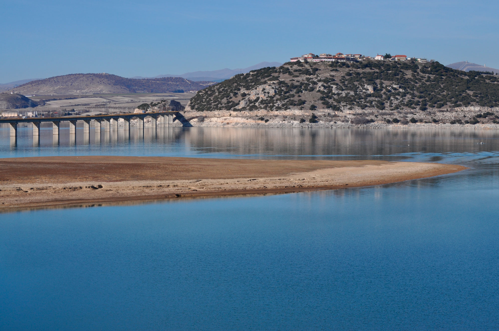
During the first period, 1968-1980, the focus was on the area near the bridge of Servia and included a) the second excavation of the “settlement of Servia” (1971-1973), which was afterwards submerged in the waters of the artificial Polyfytos lake (note 2), b) the surface survey of the surrounding area, during which a Neolithic settlement in an adjacent plateau and a cave with Neolithic habitation in the eastern slope of the hill of Profitis Ilias were discovered (note 3), and c) the excavation of a Hellenistic settlement on the top of the same hill, where the former riverside settlement of Neraida, also inundated by the lake waters, was relocated (note 4) (fig. 1).
After 1980 and the 7-year-long erosion of the riverside region as a result of the fluctuating level of the artificial lake, the first fragmentary antiquities started coming to light, indications of the enormous cultural destruction that had already begun (note 5). In 1984 the location of two eroded prehistoric settlements was reported (note 6), while in 1985 the handing-in of vessels originating from destroyed graves in the area (note 7) confirmed the destruction of a significant number of archaeological sites (note 8).
In face of this irreversible situation the 17th Ephorate of Prehistoric and Classical Antiquities of Edessa and, since 2003 the 30th Ephorate of Prehistoric and Classical Antiquities of Aiani, launched an extensive and still on-going salvage program, in order to rescue any surviving antiquities of the riverside region and the elements that comprised its culture. This project is characterized by its direct dependence on the rapid erosion rate and the level of the lake water, which falls for a short period of time at a season unsuitable for research, usually during November and not always to the same level, whatever this entails.
This salvage program includes: a) locating archaeological sites, with intensive fieldwork and b) excavation in the most important of the directly affected areas, provided that they preserve part of their deposits and are located outside the lake, for as long as required by small scale excavation, without this having to be forcibly aborted, although this is not always avoidable.
The fieldwork: the area of research and study
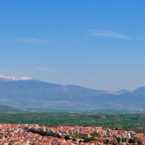
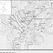
The field research in the Middle Haliakmon valley was started in 1985 by the archaeologist G. Karamitrou-Mentesidi and has been continued more intensively since 1990, by the author (note 9). To date exploration of the whole lakeside area for a length of approximately 60 km has been completed (fig. 2). The width varies from 50 to 500 m (extending as much as the flooded area of the dam) along the greater part of the south shore, 1500 m along the north shore and in a small area in the south and for 5 km in the region of Roditis. As a result of this work, the area systematically surveyed alongside the lake comprises ca 70 sq. km. In this area two more systematically surveyed regions should be added: a) the lakeside area of Aiani, Rymnio and Frourio, from the Bridge of Rymnio as far as the small valley of the Ilarion Monastery. This area was examined in the context of the construction of the Middle Haliakmon-Ilarion Dam by the PPC; b) the area surrounding Lava, including the equivalent part of the crossing of the Sarantaporo river. This survey was conducted recently during the excavation at the Kasiani site (note 10). Fieldwork has also been conducted during site visits and after suggestions by archaeophiles in several land-plots or other areas scattered around the Kozani-Servia basin. This research, including the thoroughly investigated Aiani area, renders the Kozani-Servia geological basin and especially the area of the Middle Haliakmon valley one of the most surveyed regions in Greece, at least at a site-location level.
Research to date in the area, especially along the artificial lake shore, brought to light a very large number of archaeological sites, settlements and cemeteries that testify to the development of a very ancient continuous culture, with the riverside region as its main axis. From a chronological standpoint they belong to all prehistoric and historic periods, with the beginning of habitation dating back to the Early Neolithic, to approximately 6430 BC, as the radiocarbon date (note 11) from the Neolithic settlement at Varemeni Goules has shown. The discovery, however, of a (possible) Paleolithic hand-axe near the Rymnio Bridge and of a Paleolithic site nearby, places initial habitation at an even earlier period (note 12).
In this paper an attempt is made to present for the first time the sites located so far in the valley (note 13), in chronological order, noting the most important settlements or residential complexes, based on how long they were occupied in conjunction with their geographical and geomorphological position. Given the preliminary state of the study, some future modifications should be expected regarding the dating of certain sites, after completion of the pottery analysis and possible enrichment of the sample available with more distinctive material, and in consequence the absolute numbers of settlements in each chronological period. In contrast, major changes are not to be expected as far as numbers and general spatial distribution of sites in the region are concerned. Moreover, the existence of other sites within the limits of the area flooded by the dam, especially in the vast flat region to the right of the Haliakmon river, must be considered certain, as well as the continuous rise of their total number as research progresses.
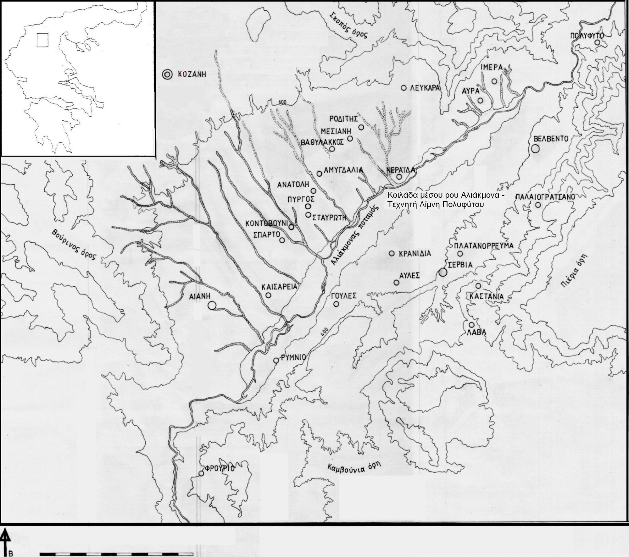
The data included in the analysis derives mostly from the lakeside regions of the different local communities of the municipalities of Kozani and Servia-Velvendos, and to a much smaller degree from the rest of the region (fig. 3). More specifically, the following settlements or areas have been included: a) the lakeside area of Aiani, Kaisareia, Rymnio and Velvendos, b) up-to date data from Sparto, Stavroti, Pyrgos, Anatoli, Amygdalia, Vathylakkos, Mesiani, Roditis, Lefkara, Imera, Avra, Neraida, Polyfytos, Servia, Kastania, Palaiogratsano, Platanorrevma, Kranidia, Goules and Lava, c) the area of the Ilarion Monastery, especially the sites at Kampos Frourio and Ververi Aiani. For comparative purposes, this analysis takes into account the available data from the non-lakeside area of Aiani (the subject of a special study), the wider region of Kozani and the settlements south and east of the city, the non-lakeside area of Velvendos as well as the mountainous settlements of the municipal unit of Kamvounia (note 14).
The survey data analysis
According to the analysis of the topographic data, 216 sites of archaeological interest, settlements and cemeteries have been identified in the area surveyed and still under survey, as defined above. 112 are situated on the shore of the Polyfytos artificial lake and are affected to varying degrees by the lake waters, while another 25 have been disturbed by contemporary activity.
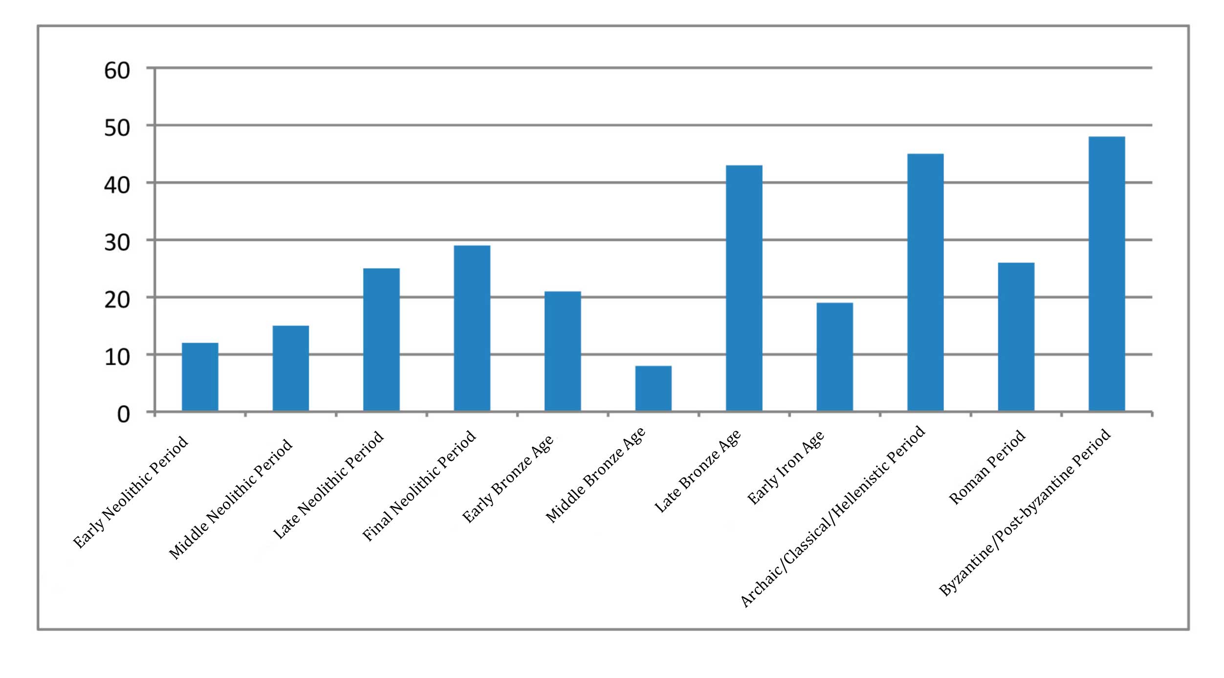
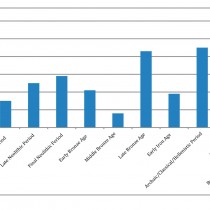
Their chronological distribution is as follows: of a total of 216 sites 158 are prehistoric (7th-2nd millennium BC) and 134 are historic (1st millennium BC until Ottoman times). Of the latter 75 are dated to the Archaic, Classical, Hellenistic and Roman periods and 59 to the Byzantine and Post-Byzantine periods (note 15) (fig.4). In more detail:
A. Prehistory
The 158 prehistoric sites include 152 settlements. Cemeteries or isolated burials, of the same, earlier or later-periods, were also identified in some of them. There were also 5 (or 6) separate cemeteries. In 35 of these sites habitation during historic times is also detected, more specifically in the Archaic / Classical / Hellenistic or/and Roman eras, while at another 14 cemeteries were also detected. Similarly the Byzantine and Post-Byzantine eras are detected in 34 sites, while at another 3 cemeteries were also discovered.
These sites are distributed in individual time periods as follows:
Neolithic Period (7th-4th millennium BC): Fifty-eight sites. All are settlements with contemporary burials found in two of them.
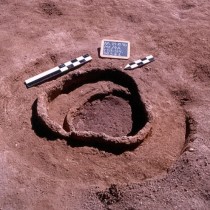
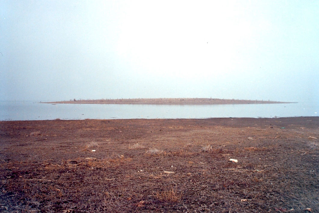
Twelve (note 16) settlement sites belong to the Early Neolithic (ca. 6500-6000 BC, note 17). Most of them are located on top or very close to natural passes or river crossings as for example the settlements Kasiani Lava, Kryovrysi Kranidia, Varemeni Goules (fig. 5) and the “settlement of Servia”, while a small number, like Paliampela Roditis, were founded in the foothills of the surrounding mountains.
By the end of the period almost half of them were abandoned, while the other half, among them Varemeni Goules, Kryovrysi Kranidia, Ververi Aiani, Ampelia Lefkara and Paliampela Mesiani continue into the Middle Neolithic (ca. 6000-5500 BC). This period yielded a total of 15 sites. The new settlements of this period, almost half of the total number, were established in similar geographical and geomorphological environments, often near the previous sites. By the end of the period, two thirds of the settlements were abandoned.
A total of 38 sites belong to the Late and Final Neolithic (5500-3000 BC). The division of this long period into two phases results in 25 sites for the first (pre-Dimini phases, ca. 5500-4700-4500 BC) and 29 for the second (Dimini phases, ca. 4700/4500-3000 BC). Out of a total of 25 settlements of the Later Neolithic only 5 continue from the Middle Neolithic, testifying to limited habitation continuity, in 30% of the sites. These are sites close to or on river crossings, such as Varemeni Goules, Ververi and Palla Rachi Aiani, Rema Glyko Nero Roditis and the “settlement of Servia”. At the same time, 20 new settlements were established (they represent 80% of the total number of sites of this period), in sites of similar geomorphological and geographical environments, most of them beside the river. The number of settlements is almost double of that of the previous periods is evident, (though possibly speculative for a number of reasons) as well as the very large scale abandonment and relocation of the previous sites.
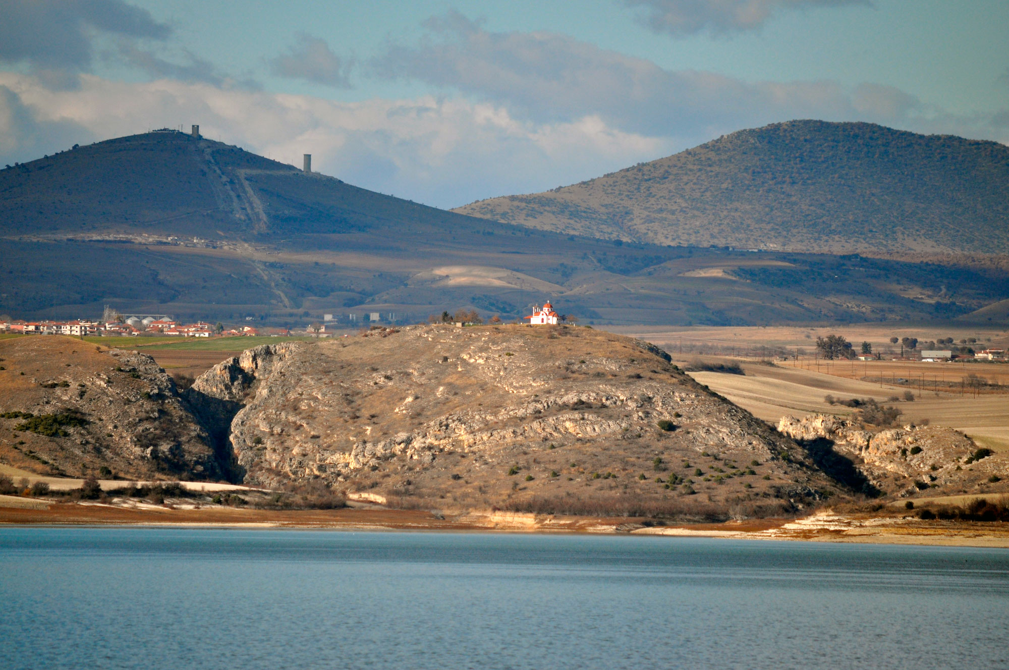
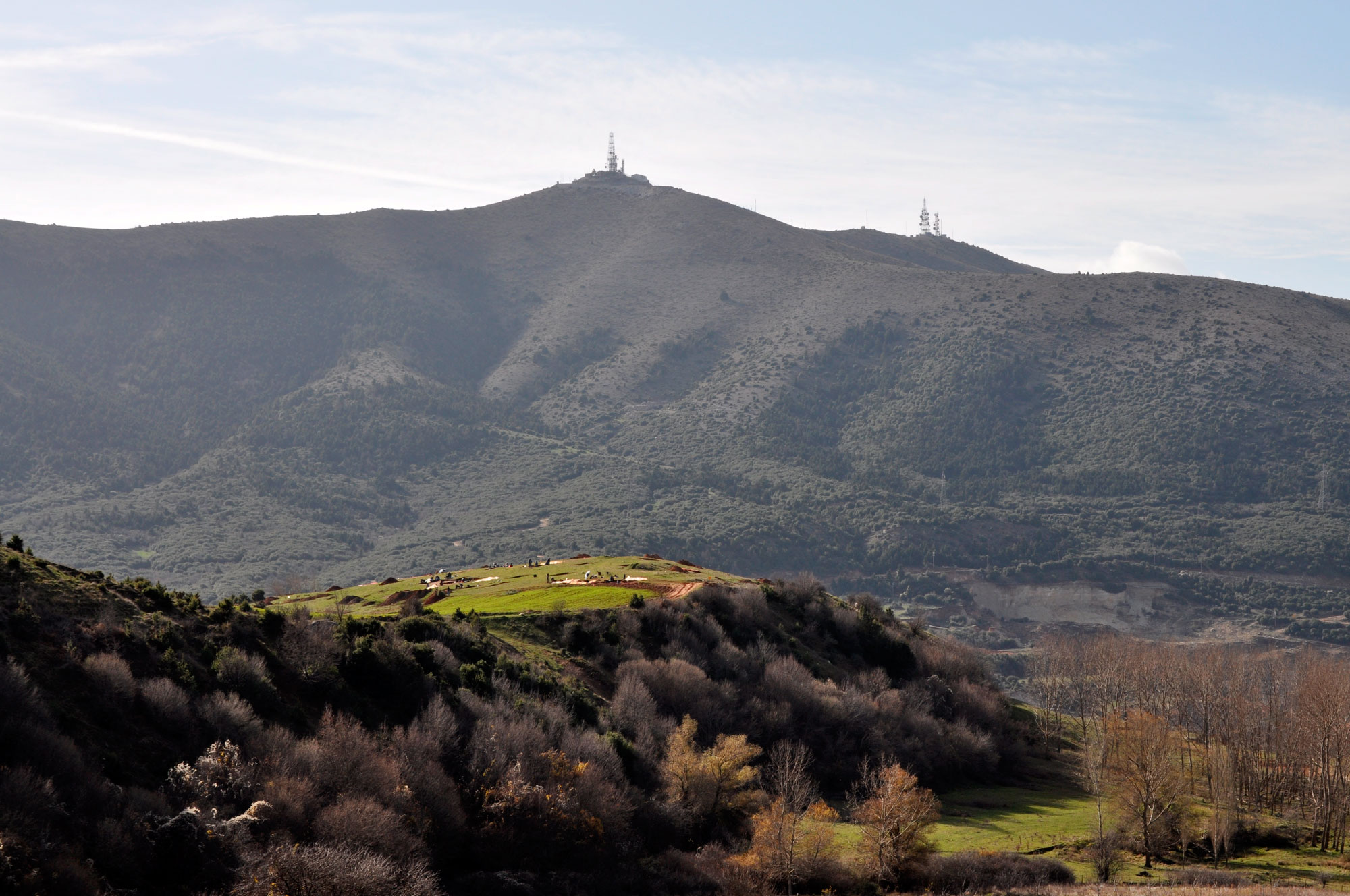
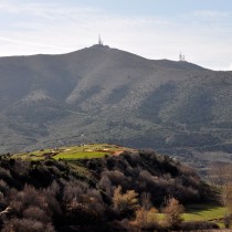
In the Final Neolithic habitation continues in 15 settlements of the previous period, i.e. 60% of the sites (two of them show continuous habitation since the Middle Neolithic, while two others since the Early Neolithic), in three sites of the Middle Neolithic, from which the Late Neolithic is absent, while 10 new settlements are founded, that represent a third of the 29 sites of this period. The biggest continuity of occupation during the Neolithic period is observed between the late and final phase, although this cannot be confirmed with the available data, due to the long duration of the latter period. Continuity continuity of habitation is detected in riverside sites, including those at river crossings, such as Varemeni Goules, Kryovrysi Kranidia, Palla Rachi Aiani and others, as well as sites such as Vasilara Rachi Velvendos, Paliampela Amygdalia and Pente Alonia Aiani that are located on low hillocks, relatively far from the river. However during this period some very high defensible hills, both beside the river and further away, are inhabited for the first time, with the riverside settlements of Neraida, Metamorfosi Mesiani (fig. 6), Profiti Ilia and Psili Rachi Kaisareia, and Agios Eleftherios Kozani-Drepano as characteristic examples. In the same period the cave of Neraida is inhabited, and probably the second cave found at Paliochori in the same district. Our research has not yet satisfactorily explained this diversity in the settlement sites of this period, nor the reasons for choosing the naturally fortified hills that later on during Hellenistic times, are normal settlement locations.
On the basis of this evidence but mainly because of the long duration of life of certain settlements, that seem to exceed a millennium, Varemeni Goules, Kryovrysi Kranidia, Ververi and Palla Rachi Aiani, Paliochori Neraida and Rema Glyko Nero Roditis can be characterized as important Neolithic settlements. Many more settlements that were inhabited during the Late and Final Neolithic, seem to have similar or greater longevity and to be of similar importance. The most significant of these is Vasilara Rachi Velvendos. The areas where intensive Neolithic occupation is observed may also be characterized as important, with shifting to neighbouring sites, with a typical confirmed example the settlement of Analipsi Kaisareia (note 18). All these settlements have important geographic positions, beside passes or river crossings, a characteristic that probably played a role in their selection, and also in their longevity.
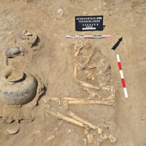
Bronze Age (3rd-2nd millennium BC): Ninety nine settlement sites and three cemeteries. Seventy of the 99 sites are new, while 29 are located on already existing Neolithic ones, testifying to the limited continuity of habitation between the two periods, in only one third of the sites.
Out of a total of 99 Bronze Age sites, 21 settlements belong to the early phase (ca. 3000-2200 BC), 8 settlements and two separate cemeteries (the one inside an Early Bronze Age settlement) to the Middle (ca. 2200-1600 BC), and finally, 43 settlement sites and five cemeteries belong to the Late Bronze Age (ca. 1600-1100 BC).
Almost half of the Early Bronze Age settlements -10 out of 21- continue on Neolithic sites and eight of them on Final Neolithic sites, revealing relatively long continuity of habitation, in approximately 30% of instances. However, only in three sites are the early phases of the period detected with certainty.
In the Middle Bronze Age very few of the sites of the previous phase continue to be inhabited -only one has been confirmed- while 7 new settlements are founded.
In the Late Bronze Age occupation only continues in one site of the previous phase, while 43 new settlements are founded. Some of them are sited in the location of earlier, mainly Neolithic settlements, two in Early Neolithic sites, two in Middle Neolithic ones, five in Late and 8 in Final, and only one in a site of the Early Bronze Age.
What is notable in the Bronze Age is the marked discontinuity in the habitation of the sites from one sub-phase to the next. During the Middle Bronze Age a tendency is observed for favouring lower altitudes, in contrast to the Late Bronze Age, when sites of high altitude were preferred, as was the case in the Late and especially in mainly the Final Neolithic. One more feature of this period is the high level of dispersal and the small size of the Late Bronze Age settlements. In some areas these appear to be clustered implying differentiations in the social organization.
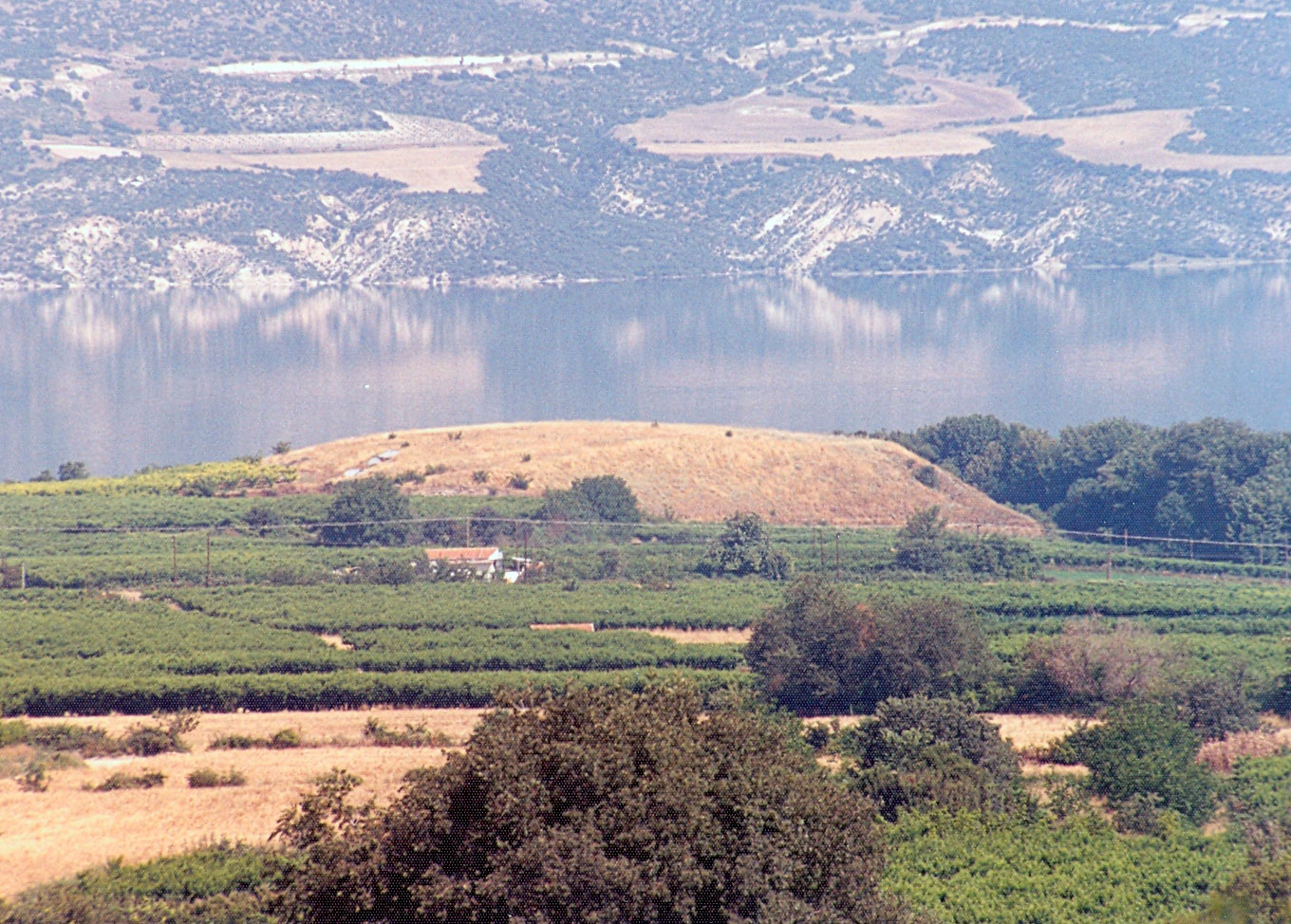
The Bronze Age settlements are scattered across the valley and are fairly unremarkable. The settlements Polemistra Aiani, Psili Rachi Kaisareia, Faraggi Mesiani, “settlement of Servia”, Vasilara Rachi Velvendo (fig. 7), Kasiani Lava and Xerolakkas Avles are characteristic of the early phase. For the middle phase the settlements at Polemistra Aiani, Paliochano Sparto, Rema Glykoneri Pyrgos, Gefyra Servia and Tourla Goules are typical. For the later phase the settlements of Kryovrysi Kranidia, Perasma Stavroti, Agios Konstantinos Kaisareia, Kato Bravas Velvendos, Kolitsaki Servia, Kampos Frourio, Skamnies Servia and Merotopos Sparto are representative.
Early Iron Age (1100-700 BC): Nineteen settlement sites belong to this phase. In four settlements cemeteries have also been detected, while three more separate cemeteries have been found at a (probably small) distance from the settlements. Out of the 19 sites, 11 are new, five continue from the Late Bronze Age, showing limited continuity of habitation between the two periods, in approximately a quarter of the sites, while three had been previously inhabited during the Late and/or Final Neolithic.
This period is mainly known through its cemeteries, whose extensive number and small size suggests a similar social organization, probably kin-based. A typical trait of this period is also the expansion of habitation into the mountainous zone which had previously been unexploited, a fact probably associated with a new diversity in the economy and the development of a large number of stockbreeding settlements. There are, however, some relatively large settlements in the riverside area, like Paliokastania Servia, with a possible central role in the lives of the wider community. Other notable settlements of this period are at Kampos Frourio and Merotopos Sparto, an area with intensive habitation during both this and the previous period while Paliouria Polyfytos constitutes a typical mountain site.
B. Historical times
The Archaic, Classical, Hellenistic and Roman period (700 BC-300 AD): A total of 74 sites belong to these periods – 63 of them are settlement sites and 12 cemeteries. Six of them belong to the Roman period. Thirty-five out of 63 settlements were founded on top of sites with prehistoric habitation, 28 do not seem, according to the surface material, to have a prehistoric component, although this possibility cannot be entirely excluded.
Of a total of 63 settlements, 45 belong to the Hellenistic period, with possible use also in earlier periods, during Archaic and/or Classical times. Spatially these settlements show very little relation to the prehistoric ones, since only seven are detected on Neolithic sites -in fact this number is reduced even further if individual chronological phases are considered separately. The relationship with the Bronze Age is greater, almost twice as frequent; however it is still limited and only concerns the early and late phase. There is complete absence of correlation with Middle Bronze Age sites and only a marginal one with the Early Iron Age ones. The prehistoric sites that are selected are those located on natural routes, like the settlements of Kasiani Lava (fig. 8) and of Kryovrysi Kranidia.
The Hellenistic sites can be divided on the basis of size, and also in residential complexes. They are distributed throughout the basin of Kozani-Servia and in a variety of geological and geomorphological environments. Settlements of great extent founded in vast flat areas or riverside plateaus that could represent central settlements are located at the sites of Kampos Frourio, Perasma Stavroti, Paliokklisi Amygdalia, Faraggi Mesiani, Lefkara, Kryovrysi Kranidia, Ai Lias Lava, Kato Bravas Velvendos, Faraggi and Skamnies Servia, Keramopiio and Platania Goules and others. Among the important sites one can also include Kasiani Lava and Neraida, settlements that spread to adjacent plateaus on high hills. The most important towns in the wider region are founded on hills of similar shape, but larger in size, such as Aiani, capital of the ancient province of Elimia, Palaiokastro Velvendos, which is associated by many researchers with the ancient settlement “Fylakai” mentioned by the written sources, and the settlement on the hill of Agios Eleftherios Kozani-Drepano. An important settlement of this period must have been associated with the Classical cemetery of Kozani (note 19) and is possibly located in the region of the modern city.
Twenty-six settlements date to the Roman times. Eight of them continue from the Hellenistic period, while the remaining 18 are founded in different locations, suggesting a significantly small level of continuity in occupation. The spatial relation of these settlements with the prehistoric sites is very limited and only with the Late / Final Neolithic, Late Bronze Age and Early Iron Age, while continuity of habitation into the Byzantine period is not attested with certainty, with the exception of two sites.
Palaiokastro Kaisareia, Paliochano and Merotopos Sparto, Paliokklisi Amygdalia, Kolitsaki Servia, the settlement of Lefkara and others appear to be noteworthy settlements of this period. They are large and have, possibly, an important role in the life of the region. All of them are located near rivers or mountain passes.
Byzantine and Post-byzantine Period (300 AD onwards): Forty-eight settlement sites belong to this period. Thirty-five are possibly from Byzantine times and 19 are Post-Byzantine. There are also 10 cemeteries. The settlements of this period, mostly the Byzantine ones, show a significant spatial correlation to the prehistoric settlements of all periods. In contrast to this, the correlation to Hellenistic sites is low, since only 6 of them seem to have been chosen again for habitation.
Observations – Conclusions
The Middle Haliakmon valley was densely populated since the Early Neolithic and throughout prehistoric and historic times, while the human presence in the area dates back to the Paleolithic period.
High mobility within the limits of the valley is evident in all periods, with frequent change of the habitation site, often to neighbouring plateaus or hillocks, where one can, often quite easily, detect continuity of habitation.
The locations chosen for the foundation of the settlements differ from period to period and from era to era, with limited, greater or complete lack of spatial coincidence between them. Moreover the level of continuity of habitation between the different phases or eras shows important differences.
How a location was selected a different periods is an intriguing question, especially for the prehistoric period for which written sources are absent. The economy, social and political conditions but also the ideology, probably in conjunction with the demographic composition of the different settlements, may have provided some of the factors that at times influenced the distribution of the settlements in the valley decisively.
The areas on or near natural routes and river crossings demonstrate longer duration of habitation. However the longest uninterrupted use of a settlement does not exceed a millennium, while many more settlements were only inhabited during one particular period, for 300-500 years. Moreover, in no case has the uninterrupted continuity of settlement been confirmed through excavation, while in some cases the seasonal habitation is very likely.
The concentration of settlements of all periods and phases in certain areas, especially on natural routes, suggests their special significance for the region’s population and indicates that settlements there were especially important, possibly with a central role in the life of each area.
Dr Areti Hondroyianni-Metoki
Archaeologist, 30th Ephorate of Prehistoric and Classical Antiquities, Ministry of Culture and Sports
* Acknowledgements
I would like to express my sincerest gratitude to Danai Chondrou, MA in Archaeology and PhD student in the Department of History-Archaeology in the Faculty of Philosophy of the Aristotle University of Thessaloniki, for her significant contribution to the translation of this article.
We also owe special thanks to Dr. Ken Wardle, Senior Lecturer in the University of Birmingham.