
So far, archaeological research in riverside and mountainous settlements of the Middle Haliakmon valley has brought to light a large series of archaeological discoveries and information that outline a picture of settlement in the area from the prehistoric period until the end of antiquity.
Most of the settlements are located on elevated riverine plateaus or hillocks, very often near large streams, which supplied them with water. Dense and continuous occupation is observed in areas located next to the main road arteries, always in conjunction with river crossings (note 1).
All of the excavations were occasioned by the needs of rescue. The majority of cases involve sites that suffered varying degrees of erosion by the waters of the artificial Polyfytos lake (note 2). The data below are presented from southwest to northeast, on the left side of the river, along which most of the settlements thrived.
a) Excavated settlements to the left of the Haliakmon river
Municipality of Kozani, municipal section of Aiani, Polemistra site. Under a thick layer (4 m.) of alluvial deposits, on the escarpment created by lake erosion lay an Early Bronze Age settlement and a later cemetery (note 3) of the Middle Bronze Age. The cemetery is related to a settlement that developed on smaller neighbouring plateaus during the same period. Some parts of the region at a higher altitude were inhabited during the Late Bronze Age and Roman era.
Systematic fieldwork and stratigraphic research at the site along with the excavation of one of the two buildings located were conducted in 1994.
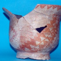
The building, the initial phase of which was destroyed by fire, had stone foundations and its stone footing preserved to a height of 0.80 m was built according to the “herring-bone” technique, quite widespread in the first half of the 2nd millennium BC. The upper part was made of mud-bricks. It had an rectangular floor-plan, with a length up to 11 m., based on the preserved length of 9 m. of one of the long walls, and a width of at least 3 m., a porch in the one (north) narrow side, with dimensions 1×3 m., and possible north-west orientation with its entrance to the north. In the southwest corner of the porch a pithos-burial of a young child was found. Part of a later circular stone enclosure was salvaged above the destruction layer of the building. Radiocarbon dating places the finds between 1968-1765 BC.
Municipality of Kozani, municipal section of Aiani, Palla Rachi site. The site was inhabited during the Middle, Late and Final Neolithic period, Early Bronze Age and also Hellenistic and Roman times.
In 1999, during the construction of the highway Kozani-Rymnio, a rescue excavation was conducted which brought to light fragmentary prehistoric occupation deposits (note 4).
Municipality of Kozani, municipal section of Elimia, local community of Sparto, Dasillio site. In 1995 research was conducted in the fragmentary occupation deposits of the Middle Bronze Age and Byzantine era. The initial phase includes a concentration of burned building material and pot-sherds, while the Byzantine one includes two rubbish pits.
Municipality of Kozani, municipal section of Elimia, local community of Sparto, Paliochano site. This is an eroded settlement of the Middle Bronze Age era. The site was also inhabited during the Early Neolithic, Roman and Byzantine times.
In 1996 part of a subterranean or ground floor structure of the Middle Bronze Age, which had been destroyed by fire, was located and excavated. It had a rectilinear plan and was constructed out of wood and clay. On the natural sloping ground that formed the floor of the preserved space, several small conical pits had been dug for direct storage or for the support of storage vessels. Six of them were preserved, one of which included charred acorns. Below the destruction layer two clay “kantharos”-shaped vessels, loomweights and parts of pithoid pots were found. Radiocarbon dating places the building between 1880-1746 BC.
In the same area a fragmented pithos-burial of the same period was located and excavated whereas in 2001 a possibly contemporary burial and two rubbish pits of the Byzantine era were investigated.
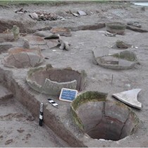
Municipality of Servia-Velvendo, municipal section of Servia, local community of Messiani, Faraggi site. In 1998 research was conducted in the occupation deposits of a settlement, eroded by the lake waters, of the Late and Final Neolithic and beginning of the Early Bronze Age. The site was also inhabited during the Classical and Hellenistic era.
Eleven pits, most of them of the Early Bronze Age, one Late Neolithic and one Hellenistic, were excavated, as well as six pithoid storage structures of the Final Neolithic or (most probably) of the Early Bronze Age.
Almost all of the Bronze Age pits served as rubbish dumps, while one possibly also had a funerary use. They contained a large number of finds, such as pot-sherds, animal bones, small artifacts and architectural remains. A rectangular pit with total dimensions of 2.50 x 3.50 m. and 0.25 m. preserved depth, has a rather different character, reminiscent of a dwelling space.
The function of the partially excavated Neolithic pit has not been clarified. It was probably the subterranean part of a building with a secondary use for discarding rubbish.
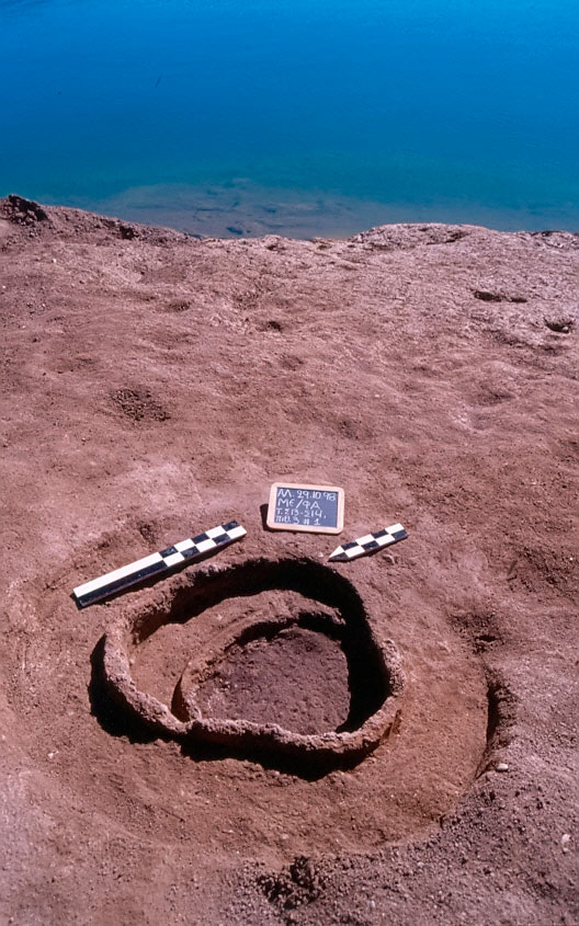
The pithoid structures are dug into the bedrock and have a cylindrical shape with a flat bottom. Their walls bear a thick coating of orange colored clay (ca. 10 cm thick). Their outer diameter is 0.60 m., their preserved height 0.30-0.50 m. They are interpreted as storage areas (fig. 1).
The settlement is considered to be of special importance due to its habitation at the end of the Neolithic period and the beginning of the Bronze Age. The Early Bronze Age pottery, which is not typical of the Haliakmon valley, but rather of the Baden culture of Hungary and Bulgaria, is particularly interesting.
Municipality of Servia-Velvendo, municipal section of Servia, local community of Roditis, Paliampela site. This settlement has the form of a very low mound with a size of 0.3 hectares. It is located at the north margin of the valley, 5 km from the Haliakmon River, on a plateau at the foot of a mountain to the left of a major stream. The limited rescue excavation revealed Early Neolithic architectural remains, while the surface finds from the wider area suggest habitation throughout the Neolithic period and during part of the Bronze Age.
The architectural remains suggest three phases of use that are associated with household activities. There are three small circular floors, dug in the natural bedrock, with 1.70 m. maximum diameter and 10 cm depth, with postholes in their perimeter and also a smaller circular structure with intense traces of burning. Between the floors and on them a mass of building material, from successive layers of clay and ash, was explored. The context is disturbed by a large pit of later date with substantial amounts of archaeological material. At the bottom of this was a small pit for the burial of an infant.
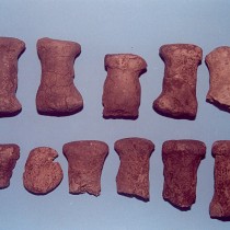
A group of 10 large terracotta spools stands out among the movable finds. Probably loomweights, they were found on one of the floors and testify that weaving flourished in the settlement and in this room in particular (fig. 2).
According to radiochronology the finds belong to 6220-5900 BC.
b) Excavated settlements to the right of the Haliakmon flow
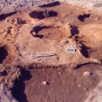
Municipality of Servia-Velvendo, municipal section of Kamvounia, local community of Frourio, Kampos site. The construction of the Middle Haliakmon (Ilarion) Hydropower Project by the PPC in the small river valley at the western boundaries of the basin dictated a survey and rescue excavation in the years 1994-1996. It was found that the area was inhabited during the Late Bronze Age, Early Iron Age and Hellenistic era.
In the excavation site were found workshop areas of Roman times, a kiln and a square building. This had been constructed in the same location as two rock cut tholos tombs with long entrance passages (dromoi) of the Late Bronze and Early Iron Age. A large number of vessels, the grave offerings were used to fill a natural cavity. In the same area a rubbish pit was excavated. According to radiocarbon dating this dated back to 786-549 BC and is associated with the neighbouring Early Iron Age settlement.
Municipality of Servia-Velvendo, municipal section of Servia, local community of Avles, Xerolakkas or Kaminia site. On the northern edge of a settlement dated to the beginning of the Early Bronze Age eight kilns were located, of which two were excavated. They have a circular plan with a diameter of 2 m., with a long corridor to the northwest, bounded by a clay wall of 0.70 m. preserved height. Their date remains uncertain.
Municipality of Servia-Velvendo, municipal section of Servia, local community of Kranidia, Kryovrysi site. The site has been almost completely eroded by the lake waters. It was explored in the years 1986, 1992, 1993 and 1997. Surface material is spread over two plateaus and dates to the Early, Middle and Final Neolithic period, as well as the Late Bronze Age, Geometric, Hellenistic and Byzantine times.
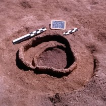
On the current surface of one of the plateaus, there is a large number of pits, dug in the natural bedrock, as well as a ditch. Excavation was also conducted in the Early Neolithic deposits, in a natural cavity as well as 5 pits of different periods. Two of them date back to the Middle Neolithic and could be characterized as rubbish pits, just like a similar one of the Byzantine period. Two smaller ones, for storage, with few finds and walls coated with clay date to the Late Bronze Age.
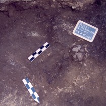
In the cemetery located in the same region eight cist graves were excavated, most of them disturbed, while the two Mycenaean vessels recovered suggest a date at the end of the Late Bronze Age.
A group of 11 intact or fragmentary, stone anthropomorphic stelae, with very schematic representations of the human form were reused for the construction of four of these graves. Their original date is not certain, but this is likely to be at the end of the Neolithic era. Similar finds from three more sites in the valley demonstrate the existence, at some period of time, of a widespread tradition of manufacture of anthropomorphic stelae in the region, while making this assemblage the largest in Greece.
On the second plateau, excavation located parts of three Geometric burial jars, three more vessels probably of similar use and one pot-burial. Moreover, excavation revealed a rectangular kiln with a long corridor for firing roof tiles in the Hellenistic period and demonstrated the existence of another three, circular, contemporary ones.
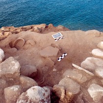
Municipality of Servia-Velvendo, municipal section of Servia, local community of Goules, Varemeni or Nisi site. It is a riverside Neolithic tell settlement with an area of 0.3 hectares. During the Roman times the site was used as a cemetery.
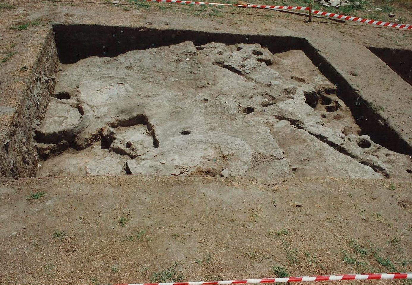
In 2001 research was conducted in settlement layers dating back to the early Middle Neolithic and Early Neolithic. Plans of post-framed dwellings of the Middle Neolithic, a cremation burial of the Early Neolithic, and ten pits of the Middle and Late or Final Neolithic were brought to light. A series of radiocarbon dates places the finds in 6430-5670 BC and the cremation burial in 6070-5920 BC.
The buildings revealed have a rectangular plan and northeast-southwest orientation (fig. 3). Their dimensions are small, ca. 1.5 x 3 m., according to the floor that was revealed in its entirety. The walls are 30-40 cm in width, formed by posts of 10-20 cm diameter, set closely together, some 10-20 cm apart, in a foundation trench, which was afterwards filled with rocks and soil. Pits, some for storage lie in the interior.
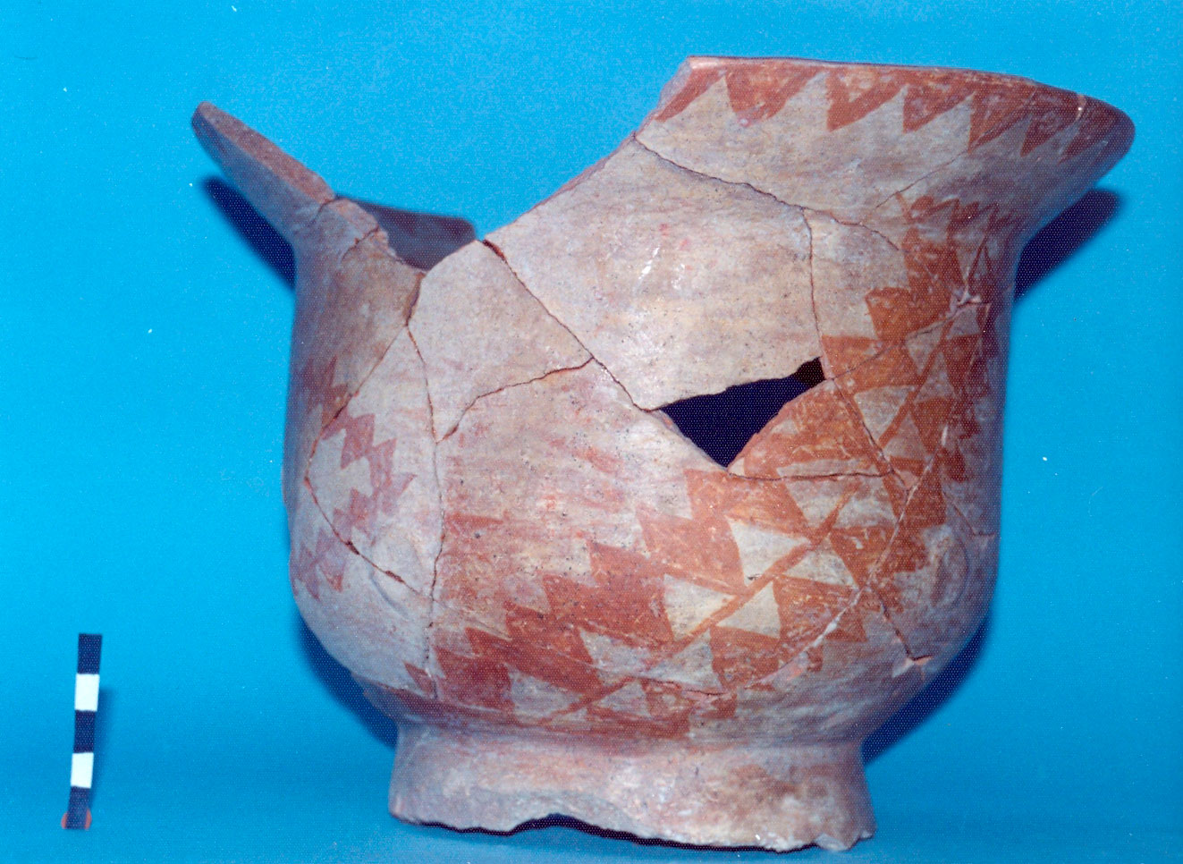
Among the architectural remains numerous clay vessels were found, some with painted decoration (fig. 4). Also included among the movable finds are stone and bone tools, anthropomorphic and zoomorphic figurines, jewellery and other small finds.
Municipality of Servia-Velvendo, municipal section of Servia, Skamnies site. In 1996 research was conducted in ruined settlement deposits of the Late Bronze Age and Hellenistic times.
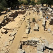
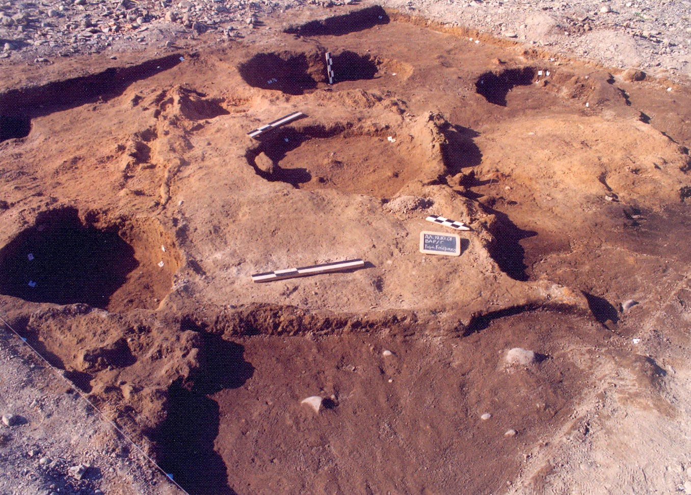
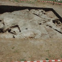
Municipality of Servia-Velvendo, municipal section of Servia, Paliokastania site. Situated on an elevated riverine plateau eroded by the lake, the site was excavated in 2000, 2004 and 2010.
The research brought to light a granary and a building of the Early Iron Age, rubbish pits of the Roman era, associated with the contemporary settlement located on an adjacent plateau, and a clay thermal structure of the Final Neolithic (ca. 4500-3000 BC) that belongs to a neighboring settlement. During Byzantine times, the site was used as a cemetery, of which one grave was excavated.
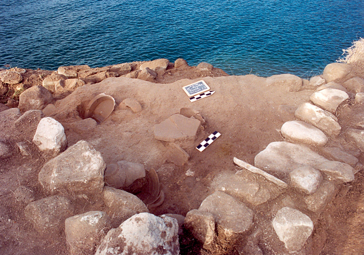
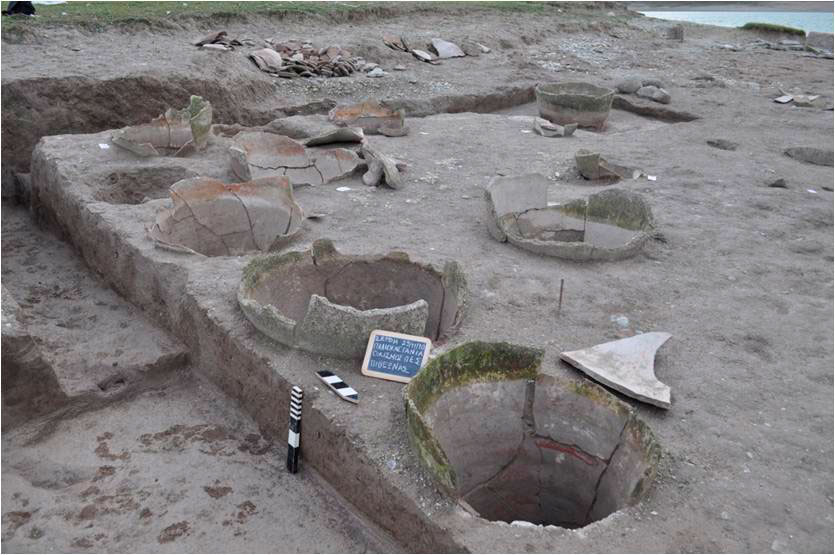
Of the three located storage areas, the biggest, or perhaps best preserved, comprises 20 pithoi. All of them are placed inside pits, dug in the natural bedrock. They are oval in shape with a pointed base and a brownish surface. Most are preserved from the belly down and some from the shoulder. Three sizes can be distinguished, with 1.50 m. maximum height and 1 m. maximum diameter. Some bear incised decoration on the rim or the belly. They were covered with stone lids (fig. 5).
Three stone-piles were detected in the area, of which the southernmost was researched. It belonged to an apsidal stone-built structure, possibly of the Iron Age, founded on the natural bedrock. It has a southwest-northeast orientation, with the southwestern short side curved and the entrance probably located in the northeastern. Its maximum preserved length is 11.60 m., while its width reached 6.40 m. The exterior walls have a thickness of 60 cm and are built from stones. The building was divided into two spaces lengthwise, while the preserved floor of the apsidal end consisted of slabs coated with clay.
The data set deriving from the settlement suggests an early Iron Age date, around 1100 BC. This settlement is the first to be excavated in Western Macedonia, whereas previously only cemeteries were found dating to this period. Its features testify to its being an important settlement with a central role in the life of the residents of the wider area.
Municipality of Servia-Velvendo, municipal section of Servia, Gefyra site, “prehistoric settlement of Servia” (note 5). The site is currently at the bottom of the Polyfytos artificial lake. It was excavated in 1930 and 1971-1973. It was inhabited during the Middle and Late Neolithic period, Early Bronze Age and Byzantine era.
The excavation brought to light Middle Neolithic post-framed buildings, which in certain phases probably also had an upper storey. The use of planks of wood is attested in the construction of the floors, in contrast to the clay-plastered floors of the Late Neolithic. The hearths and ovens were located in yards outside the dwellings.
Middle Neolithic and Bronze Age ditches were also revealed, as well as pits from all habitation phases of the settlement, used for storage or rubbish disposal, but also for supporting.
Municipality of Servia-Velvendo, municipal section of Servia, local community of Lava, Kasiani site. The settlement is located in the highest point of the natural pass of Sarantaporo. The excavation was required for reasons of rescue, since the site was threatened with collapse, which later followed, due to its immediate vicinity to the lignite mine of LARCO Company, which funded the research.
It is a high hill with natural plateaus, that was inhabited during the Early Neolithic, Early Bronze Age and Hellenistic periods. Archaeological deposits, mostly disturbed, of the last two periods of use of the area were explored, as well as to a small extent, an undisturbed Early Neolithic layer.
The architectural remains indicate the construction of light structures of wood and possibly thin clay daub, during prehistoric times, as well as stone-built structures or structures with stone foundations and post-framed walls during the Hellenistic era.
In one of the low plateaus of the site, a small rubbish pit and a Hellenistic pithos were revealed. Among the most important movable finds of the excavation are the perforated sherds that belong to small Early Bronze Age vessels of unidentified use.
The special importance of the excavation at the Lava site lies mainly in the fact of the detection, in the same geographical position, of a settlement of the Early Neolithic, since, apart from being the only settlement of this period so far identified at such a high altitude (950 m.), it is also located on the only natural passage that century after century connected Thessaly and Western Macedonia.
The Hellenistic settlement is also notable, since it is perhaps related to guarding two natural pass identified in the region, that at Servia Castle and Steno “Portes”.
Municipality of Servia-Velvendo, municipal section of Velvendo, Kato Bravas site. In 1996 research was conducted in the deposits of a Hellenistic settlement, ruined by the lake waters. Occupation in the Late/Final Neolithic as well as in the Late Bronze Age was also detected in the excavated part of the settlement.
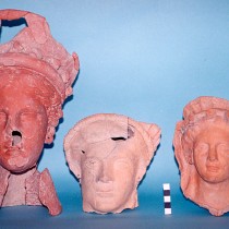
The excavation brought to light parts of subterranean or ground-floor areas that served as storage rooms for large, possibly two-storey buildings, as well as ground floor structures with hearths located in their interior. The latest building was destroyed suddenly, possibly by an earthquake, in the mid-2nd century BC. In the destruction layer, besides pithoi placed in pits, dug in the bedrock or into earlier layers of habitation, numerous large vessels were also found, some fallen from the storey above (fig. 6).
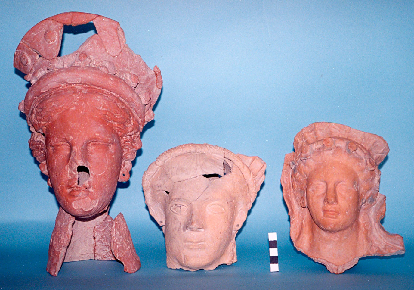
Of particular interest is the deposition of some sacred items in pits that were opened after the destruction of the building. Eight terracotta, possibly votive, figurines were preserved, impressive in size and artistic accomplishment depicting heads or busts of female figures, probably goddesses or nymphs, almost in natural size (fig. 7). These finds, the pottery data and some chance finds from adjacent properties suggest the building may have been associated with a possible sanctuary site dedicated to the worship of Zeus Hypsistos.
Municipality of Servia-Velvendo, municipal section of Velvendo,Vasilara Rachi site. The site was inhabited during the Late and Final Neolithic period, as well as in the Early and Late Bronze Age. The settlement developed on the southwestern slope and the top of a small hill between two streams. It has the form of a high trapezoidal tell and an area of ca. 20 acres. During 1994-1996 a rescue excavation was conducted, due to the damage the site had suffered from time to time.
The excavation, organized in five sections, brought to insubstantial architectural remains mainly of the Early Bronze Age. These were post-framed dwellings with floors made of clay, hearths, platforms and, in one occasion, a small domed oven (fig. 8). The floors of the hearths and ovens were made of clay, on top of which lay a surface of sherds from large vessels coated with another layer of clay. In one section the architectural remains are interrupted by a large later pit containing a big amount of stones, among which numerous grinding stones.
Part of a burned, circular floor 1.30 m. in diameter with three successive phases, and intense burn marks, probably belongs to a thermal structure (perhaps a kiln) of the Final Neolithic.
The movable finds consist of a large number of pot-sherds, a few intact vessels, stone and bone tools, numerous loom weights, clay figurines, jewellery etc.
Observations – Conclusions
The size of the settlements varies sharply in almost all periods, with simultaneous co-existence of small and much larger, possibly more important, settlements. Periodical clustering of small residential facilities is observed, which most probably constitute unified residential complexes.
The architectural remains of the Neolithic period confirm the construction of post-framed buildings, with rectilinear plans, floors made of clay or wooden planks and interior or exterior auxiliary structures. There are also indications of two-storey buildings. The dwellings of the Early Bronze Age are also similar, though with larger dimensions and clay structures in the interior. During the Middle Bronze Age a change is observed, when in certain settlements rectangular dwellings with a porch and stone foundations are constructed, while others have two-storey buildings with subterranean or ground-level storage areas. In the Late Bronze Age and Early Iron Age the scanty evidence indicates buildings of mostly perishable materials, although, during the Early Iron Age, stone-built structures, including big storerooms (pitheones), are also present.
In the Hellenistic era the architectural remains indicate stone buildings (they are normal in this period), but also post-framed structures, in some upland settlements, such as Lava, perhaps with a different function. Indications for places of worship are provided by the settlement of Kato Bravas.
A characteristic of all periods, from the Early Neolithic until the Byzantine period, is the digging and use of pits within the settlements or at their limits, for clay extraction, discard or deposition of materials and artifacts of possible special importance or origin, for direct or indirect storage using pots), burial of the dead (during the prehistoric period) etc. The cutting of ditches was common during the Neolithic for similar reasons.
The prehistoric pottery of the Middle Haliakmon valley in the main follows the Thessalian shapes and decoration. Of particular note is the presence, during the Late Neolithic, of pottery typical of Central and Eastern Macedonia, as well as, at the beginning of the Bronze Age, pottery of the northern Baden culture, in both cases in settlements on the north bank of the river.
For the historic periods, the finds do not differ typologically from the contemporary settlements of the wider region. They include both local and imported products.. However a detailed study has shown differences in the quality of the pottery. That of better quality to be found in the settlements on the north bank of the Haliakmon (note 6).
Among the small finds of the various settlements we would like to highlight the clay loom weights and spindle whorls of various shapes that show the development of the craft of weaving from the Early Neolithic, in the 7th millennium BC.
All the data of the settlements of the Middle Haliakmon valley confirm the development of an important and long-lasting culture, with a dynamic presence in the life of the wider area, due largely to the benefits provided by the natural passes and river crossings in the area, and by the economic, social and ideological contacts of the inhabitants with those in the wider area.
Dr Areti Hondroyianni-Metoki
Archaeologist
30thEphorate of Prehistoric and Classical Antiquities
Ministry of Culture and Sports
* Acknowledgements
I would like to express my sincerest gratitude to Danai Chondrou, MA in Archaeology and PhD student in the Department of History – Archaeology in the Faculty of Philosophy of the Aristotle University of Thessaloniki, for her significant contribution to the translation of this article.
We also owe special thanks to Dr. Ken Wardle, Senior Lecturer in the University of Birmingham.