A new online digital resource has been launched to bring to life one of Scotland’s most important prehistoric settlement landscapes.
Led by the University of Glasgow the new digital resource aims to widen public engagement with the ongoing archaeological research in Perthshire.
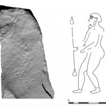
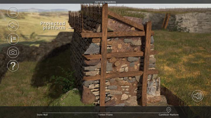
Supported by a grant from Historic Environment Scotland, the SERF Project app was developed in collaboration with the 3DVisLab at the University of Dundee. It incorporates 3D images, enabling the user to grab, rotate and closely examine some of the artefacts which have been unearthed at the hillfort sites. It also features drone aerial footage of the hillforts, superimposed with artist’s reconstructions of what the sites may have looked like.
Dr Tessa Poller, Director of the SERF hillforts project and an archaeologist at the University of Glasgow, said: “This app is about wider public engagement surrounding the work we are doing, to not only show people the geographical area where these hillforts lie but to also explain how, throughout the various discoveries we have already made, we are able to challenge perceptions about what life must have been like back then.
“The drone photography and artistic reconstructions puts everything into perspective and will hopefully bring the research we are doing to a much wider audience. It can be used as an education tool for schools and in fact we have already had a lot of pupils coming to visit us on the sites, with local schools very keen to get involved.”
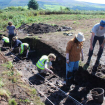
The Strathearn Environs and Royal Forteviot (SERF) Project began in 2007 in a diverse archaeological area of eastern Strathearn, located in the heart of Scotland. Archaeologists from the University of Glasgow have been exploring and excavating the ten hillforts which lie within the rural and remote landscape. The results of the long-term research will be published in a series of academic papers and a monograph.