An Online GIS database for Egypt’s Theban Necropolis has been relaunched after reconfigurement.
According to a recent announcement by the Satellite Survey of Theban Tombs project and the Santee-Cooper GIS Laboratory of the College of Charleston, University of Charleston, SC, the Online Geographical Information System for the Theban Necropolis (known in short as OLGIS-TN) has been reconficured and relaunched.
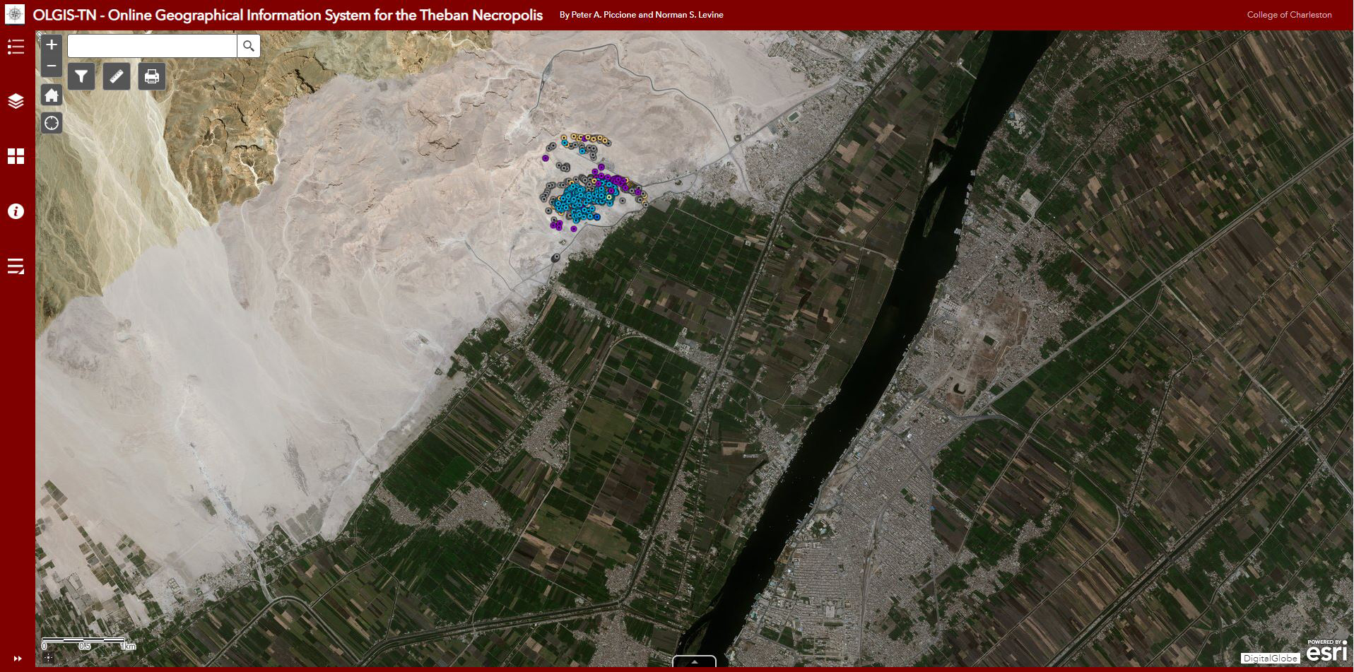
While an early version was already a thing in 2004, an augnmented and corrected database was launched in 2006, when 700 tombs were mapped on the ground using survey-grade GPS. That database was available in beta version on the OLGIS-TN website until the time the College of Charleston closed its mapping servers and migrated their data. Now, in 2019, the database is accessible again, with new maps and more data and imagery. The project is certainly a significant contribution to the ever-growing field of digital mapping in archaeology (for more on the subject read here).
What is the OLGIS-TN?
The Online Geographical Information System for the Theban Necropolis (OLGIS-TN) is a fully-entailed historical and archaeological database of the non-royal tombs of the Theban necropolis, integrated with GPS-based maps and interactive mapping features.
The purpose of the OLGIS-TN is to provide tools for archaeological site management, historical preservation, research, education, and a multi-disciplinary understanding of the Theban cemeteries.
The OLGIS-TN database itself, is not merely a tomb finder, but a powerful reference tool for studying the necropolis using maps of very high resolution; for finding and identifying tombs and their associated data, and for managing the site and its antiquities. It is useful for understanding the essential relationship of tombs to topography– and cemeteries to landscape; for exposing issues of stratification and sedimentation in Theban geology, and for revealing any number of patterns (social, geographical, archaeological, etc.) in the distribution of the tombs and features throughout the necropolis.
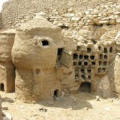
So far, the system contains data on 734 non-royal tombs and burials in central Sheikh Abd el-Qurnah out of a total estimate of over 1700 tombs and burials throughout the entire necropolis. It remains a work in progress; the team of researchers plans to return to Thebes and complete mapping the more than 1700 remaining tombs and burials, while using LIDAR to scan all the hillsides. In this way the team will complete the survey of all the private tombs of the necropolis of nearly 510 hectares (5.1 km sq.). and will add them to the database. The team also works to improve the accuracy of tomb locations by running more differential corrections and to continue adding topo-maps, images, bibliographies, revisions, and new data. At present, they develop a new app for smartphones to allow users to enter search parameters for tombs into a more simplified query page.
How does it work?
The OLGIS-TN database and maps run–both in the field and in the office–on any computing device that receives Internet data, including: desktop and laptop computers, tablets, iPads, notebooks, and smartphones. To navigate through the Theban necropolis in real-time also requires GPS capability in the same device. Laptops and tablets without GPS capability can still function by employing mobile WiFi (MiFi) or by blue-toothing smartphones with GPS to the computing devices.
Any scholars running ArcGIS on their own computers can download data and open it as layers and maps in their own local software.
All users can download search results and maps for printing and storage, and at high resolution for publication in academic studies. They may also load them into spreadsheets for purposes related to research, education, site management and historical preservation. However, it is not possible to dump or clone the entire database with its critical list of the tomb coordinates on to other servers and computers. Similarly, OLGIS-TN does not authorize any mirror sites or translations. Similar restrictions apply to images of the tombs and the necropolis which are copyright by their owners; Peter A. Piccione and Norman S. Levine (under the aegis of the University of Charleston, S.C., College of Charleston).
Layered on top of the base map is the historical and archaeological database of the tombs. In this way, tombs can be searched in reference to any or all of the maps and satellite imagery according to any historical and archaeological criteria (e.g., tomb nos., owner, date, reigning king, family, usurper, publication, etc.), or they can be searched according to their physical location and geography, even using real-time GPS (for any person actually standing in the necropolis). Search results can also be shared directly to the Internet though email, Facebook and Twitter.
Detailed help and information pages exist within the database, and they can be accessed from the central Map Viewer. They provide essential data to get started in using the GIS, as well as detailed instructions.
Direct link to the “OLGIS-TN Help and How To”-page here .