A major archaeological discovery has just been made at Cap d’Erquy, on the coast of the Côtes d’Armor. The remains of a circular Iron Age village have been unearthed using revolutionary satellite imaging technology.
Developed by INRAE (National Research Institute for Agriculture, Food and the Environment) this LiDAR technology uses laser to scan the ground and create reconstructions with unparalleled precision. This process makes it possible to detect buried structures invisible to the naked eye without resorting to invasive excavations.
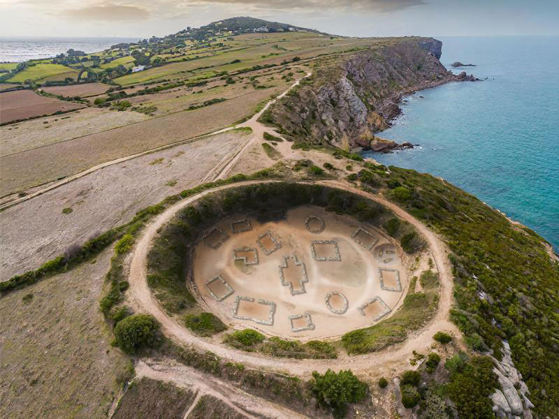
A forgotten Gallic village
The village discovered at Cap d’Erquy is made up of around twenty circular huts arranged around a central square. Archaeologists estimate that this village was occupied between the 8th and 5th centuries BC by a Gallic community.
“This is an exceptional discovery which allows us to better understand the daily life of the Gauls at the time of the early Iron Age”, explains Jean-Yves Peskebrel, archaeologist at INRAE.
A promising technology
The discovery of the village at Cap d’Erquy illustrates the potential of LiDAR technology for archaeology. This technology opens the way to major new discoveries and makes it possible to explore archaeological sites inaccessible through traditional excavations.
“LiDAR is a real revolution for archaeology”, Jean-Yves Peskebrel says. “This technology will allow us to discover important parts of the history of humanity. Of course, we are tempted to draw a parallel between these discoveries and the adventures of Asterix the Gaul. Fans of the saga will undoubtedly see it as confirmation of the costarmorican roots of the Irreducible Gauls. The craziest thing is that the images and reconstructions based on the research at Cap d’ Erquy made it possible to reveal incredible details of life in the Iron Age. We were able to observe that the menhirs constituted decorative elements, that fish were often used as projectiles, and that a huge pot must have been in use”.
*Oh… and happy April the 1st!