Using laser-guided imaging to peer through dense jungle forests, Tulane University researchers have uncovered vast unexplored Maya settlements in Mexico and a better understanding of the ancient civilization’s extent and complexity.
The new research, published in the journal Antiquity, was led by Tulane University anthropology doctoral student Luke Auld-Thomas and his advisor, Professor Marcello A. Canuto.
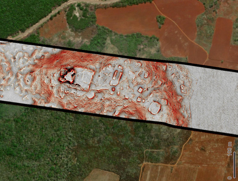
The team used lidar, a laser-based detection system, to survey 50 square miles of land in Campeche, Mexico, an area largely overlooked by archaeologists. Their findings included evidence of more than 6,500 pre-Hispanic structures, including a previously unknown large city complete with iconic stone pyramids.
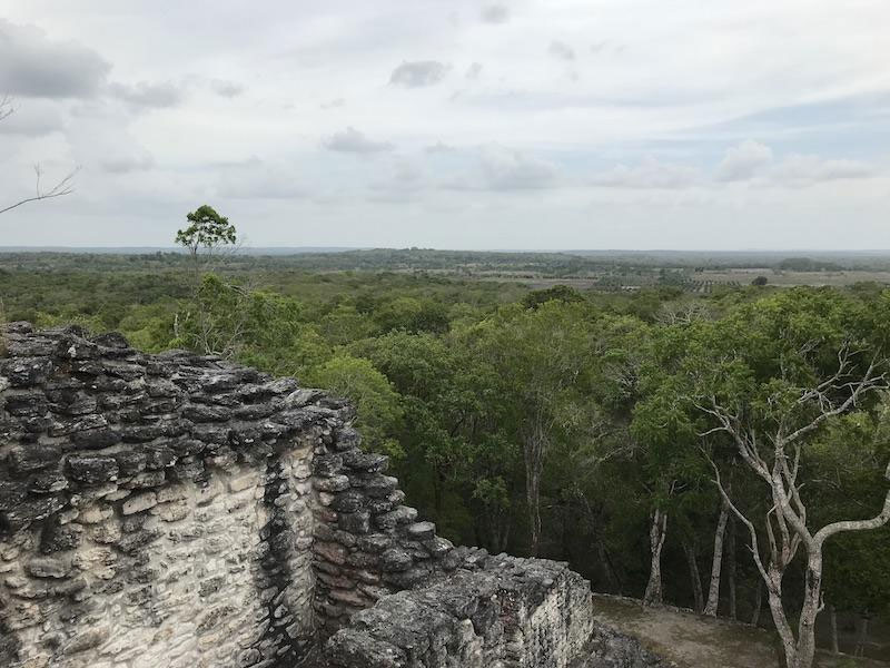
“Our analysis not only revealed a picture of a region that was dense with settlements, but it also revealed a lot of variability,” said Auld-Thomas, a doctoral student in Tulane’s Anthropology Department and instructor at Northern Arizona University. “We didn’t just find rural areas and smaller settlements. We also found a large city with pyramids right next to the area’s only highway, near a town where people have been actively farming among the ruins for years. The government never knew about it; the scientific community never knew about it. That really puts an exclamation point behind the statement that, no, we have not found everything, and yes, there’s a lot more to be discovered.”
The Middle American Research Institute (MARI) at Tulane University has been pioneering the use of lidar technology in archaeological research. Over the past decade, MARI has built a state-of-the-art Geographic Information Systems (GIS) lab, to analyze remote sensing data, such as lidar. The lab is managed by Francisco Estrada-Belli, a research professor in Tulane’s Department of Anthropology.
Lidar technology uses laser pulses to measure distances and create three-dimensional models of specific areas. It has allowed scientists to scan large swaths of land from the comfort of a computer lab, uncovering anomalies in the landscape that often prove to be pyramids, family houses and other examples of Maya infrastructure.
“Thanks to generous funding from the Hitz Foundation, MARI has been at the forefront of the use of lidar technology in archaeological research over the past decade,” said Canuto, director of MARI. “Now our efforts are expanding from data analysis to data collection and acquisition. The work conducted on these data from Campeche represent how MARI’s ‘lidar footprint’ is expanding.”
This research may also help resolve ongoing debates about the true extent of Maya settlements.
“Because lidar allows us to map large areas very quickly, and at really high precision and levels of detail, that made us react, ‘Oh wow, there are so many buildings out there we didn’t know about, the population must have been huge,’” Auld-Thomas said. “The counterargument was that lidar surveys were still too tethered to known, large sites, such as Tikal, and therefore had developed a distorted image of the Maya lowlands. What if the rest of the Maya area was far more rural and what we had mapped so far was the exception instead of the rule?”
The study highlights the transformative power of lidar technology in unveiling the secrets of ancient civilizations. It also provides compelling evidence of a more complex and varied Maya landscape than previously thought.
“Lidar is teaching us that, like many other ancient civilizations, the lowland Maya built a diverse tapestry of towns and communities over their tropical landscape,” Canuto said. “While some areas are replete with vast agricultural patches and dense populations, others have only small communities. Nonetheless, we can now see how much the ancient Maya changed their environment to support a long-lived complex society.”
