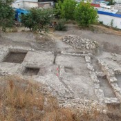
The Khadzhybey Castle has been found. The discussions about its localization, which lasted for almost 200 years, have been put to an end. They were exacerbated by the lack of reliable cartographic data and written sources, as well as traces of this defensive structure, which was blown up by Russian troops shortly after the assault of 1789, and later dismantled for building materials. Until recently, we did not know whether there were any chances at all to find the remains of the castle, since the structure stood on the very edge of the coastal plateau, and the nature of landslide processes in the area of Prymorsky Boulevard is disappointing. Already in 2020, following the results of our first joint expedition, it became clear that the search for the castle should be narrowed to the territory of the semicircular square. Therefore, in the summer of 2021, we set up three excavations there, north of the Duke monument and several more pits along the alleys. This year, the work continued to the east of the old sites and brought the long-awaited result. Thus, the castle was located between the semicircular building No. 8, the funicular, the Duke and the alleys of the southern part of the boulevard, occupying a square of approximately 40×40 m.
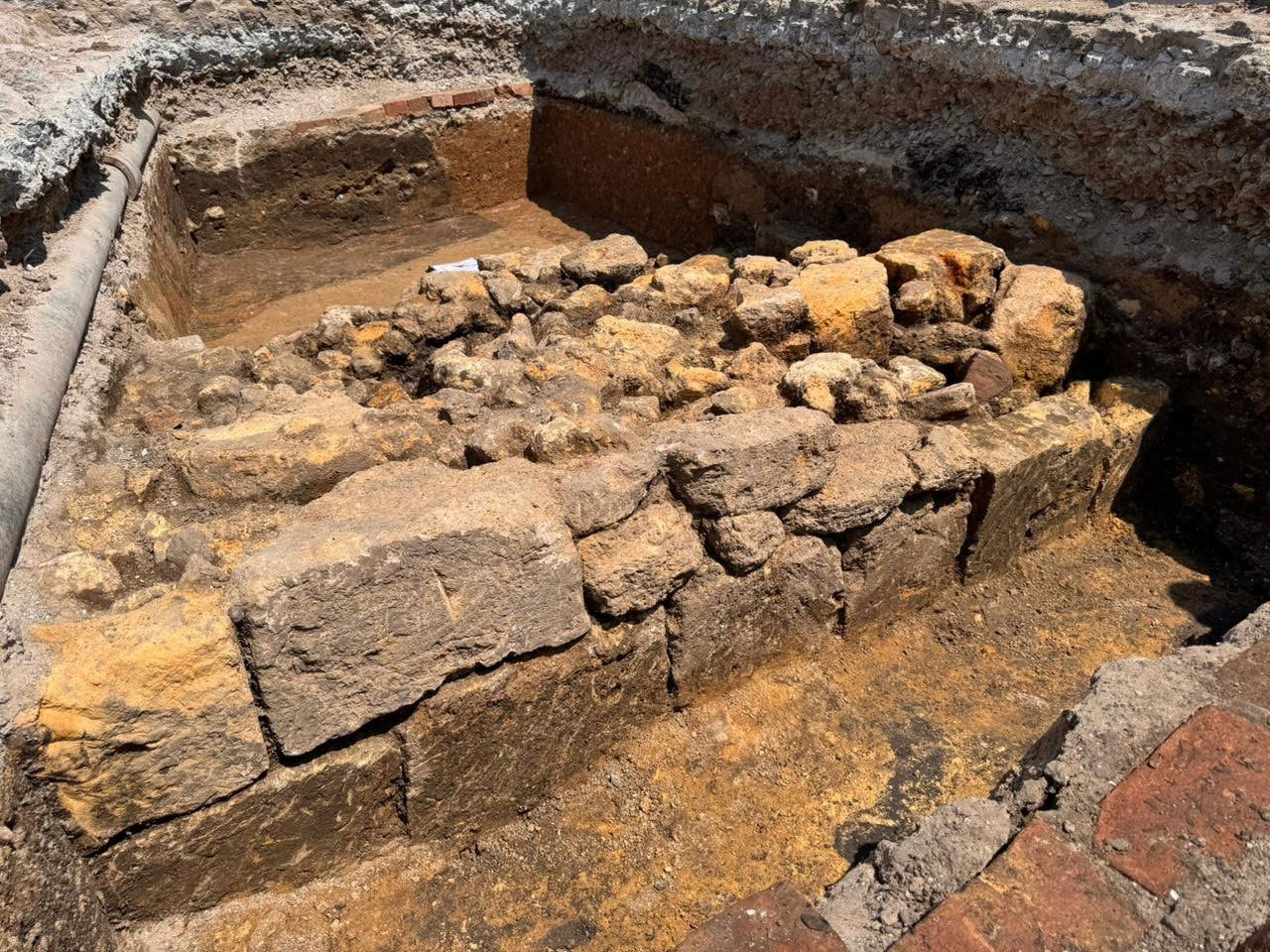
In two excavations and two pits, we found the front wall of the artillery coastal battery, which was added to the castle from the shore, as well as traces of the dismantling of the curtains. We managed to record the angular intersection of this wall with the side wall, which covered the battery from the southeast. The structure is present on various plans and images of the castle of the late 18th century. It is distinguished by its unique structural features and the specific location near the cliff. The attribution is facilitated by the accompanying finds of ceramics and bronze products of Ottoman origin. The battery was an open area, fenced by a wall up to 1.5 m high and 90 cm thick. It held a low earthen embankment on the front, on which cannons were placed, directed towards the sea.
Both the remains of the artillery embankment on the inner side and the edge of the cliff from the end of the 18th century are clearly visible in the stratigraphy of the excavations. The battery wall stood literally two meters from the coastal cliff – in order to increase the effectiveness of fire control over the harbor.
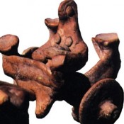
Traces of dismantling the walls and destruction were recorded in all excavations of this season. Particularly indicative in this sense is the corner joint of the masonry of the two walls of the battery, completely dismantled, down to the foundations. From the southern, side wall, only a foundation trench with the remains of rubble and fragments of Ottoman ceramics remained. One can only imagine the damage inflicted on other parts of the castle, in the area of its capital structures (towers, curtains, internal buildings). The scale of the castle’s destruction is evidenced by the finds from the excavation near the Duke, where we discovered a pile of stones and blocks pulled from the castle walls, among which were massive Ottoman-type pylon capitals.
The base of the castle battery wall is embedded in the antique layer of the 5th century BC. This is the first time that it has been possible to trace the cultural layers of the ancient Greek settlement of Istrian Harbor within its northern border. Previously, it was assumed that its border lies somewhere in the Duka area. But now we can say for sure that it was defined by a small ancient ravine, which we managed to record in one of the excavations of 2021 in the northern part of the semicircular area. This natural barrier also formed protection from the north-western, ground side for the Hadzhybey Castle, determining the choice of its location. In addition, it is here that the highest part of the Prymorsky Boulevard plateau is located (+32 m above sea level), which gives the fortification object its advantages in controlling the harbor and approaching the mouth of two bays at once, limiting the plateau (Military and Quarantine), in one of which the Turkish port of Hadzhybey was located.
This ravine is marked on one of Devolan’s plans and on the 1766 diagram of “The City of Hadzhybey ” by the Russian explorer Isleniev. By the way, the latter shows us that the left bank of this ravine was adjoined by a coastal square bastion of an earthen fortress that was not built by the Turks. We also discovered the unfinished ditch of this bastion in the area of the junction with the front line of fortifications in one of the excavations of 2021. The fact that the fortress was not completed, and the ditches were left unfinished, is evidenced by one of the contemporaries who visited Hadzhybey in 1784. After a Russian bastion fortress arose in this part of the coastal plateau in 1793, these ditches were filled with urban household garbage. Therefore, now we can accurately tie the Turkish bastion fortress from Isleniev’s plan to the area, determining its approximate dimensions.
Finally, about dating. The battery itself was built by the Turks and, in my opinion, later than the castle itself, which, by its constructive and planning features, is a model of archaic, medieval fortifications of a clearly pre-artillery era. The battery appeared no earlier than the local garrison had long-range cannons for its time at its disposal, capable of somehow reaching the harbor with their fire. Perhaps the creation of this battery was an alternative to the unfinished fortress from Isleniev’s plan, which was clearly created for the same purpose. The time of the foundation of the castle itself will still have to be found out. Having located it and tied the plans to the terrain, it is now not so difficult to mark the search area for its main, capital buildings. Some intrigue in these searches is caused by ceramics and numismatics of the 14th century, the finds of which are now the norm in excavations on Prymorsky Boulevard. Thus, one of the fragments of an imported Byzantine bowl of this period was found in the same stratigraphic context as the aforementioned capitals of pylons, albeit in a re-deposited state, however… Archaeological artifacts of the 14th century, as is known, mark a completely different historical period, associated with the Italian Ginestra factory. And there is nothing surprising in such a rich and ancient historical context in which modern Odesa found itself (unexpectedly for some), as a city that exists in extremely favorable geographical conditions for maritime trade.