
This text presents the antiquities identified in the last few years of excavation on the island of Antikythera. It is for the first time that we are led to historical conclusions regarding the relatively unknown (note 1) until today small island after having analysed them along with literary and epigraphic data. It seems that the island played an important role in the history of the Greek world during the Hellenistic period, from the beginning of Alexander’s the Great campaign, in the late 4th century BC until the repression of the “Cretan Revolution”, with which the conquest of the whole Greek land was completed by the Romans in 69-67 BC.
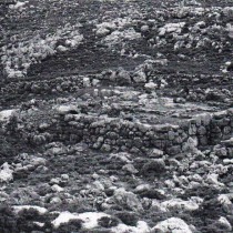
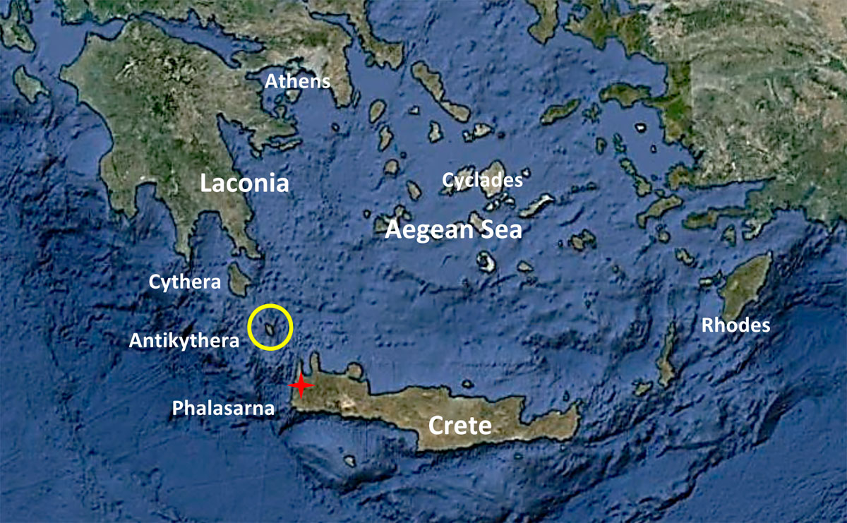
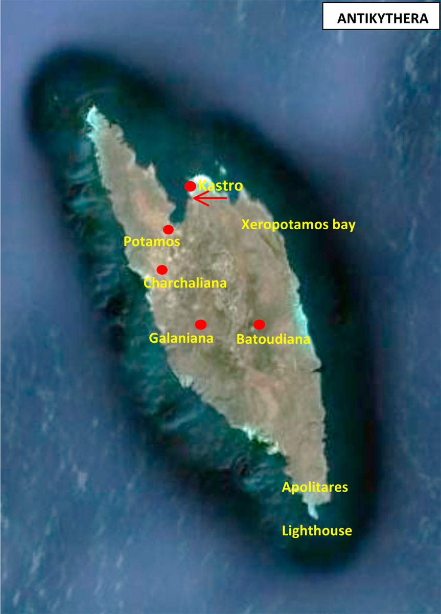
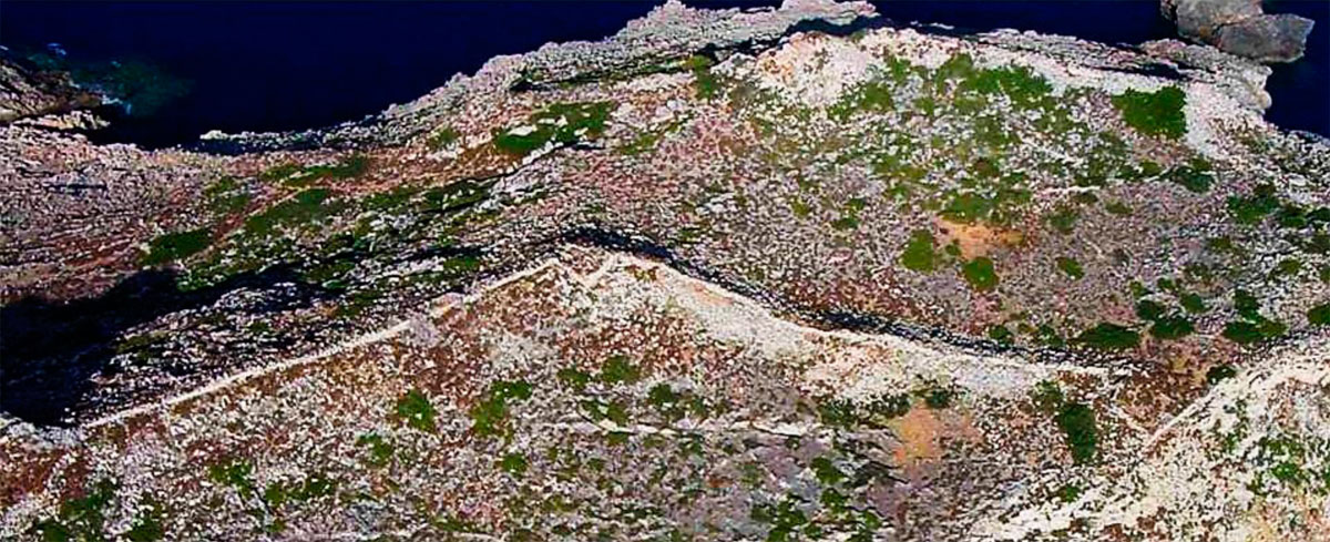
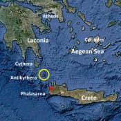
Antikythera (fig. 1) is a small island, almost 20 square kilometers, located in the hazardous sea area between the islands of Kythera and Crete. Despite its strategic position that controls the sea passage from the Aegean and the Black Sea to the Western Mediterranean, it is very difficult for large groups of inhabitants to survive on the island, and thus it was left in relative obscurity during almost the whole antiquity.
Only few are the references of ancient writers to Antikythera. The island is mentioned as Αἰγιαλία in Plutarch (note 2) and as Αἰγιάλεια in Stephanus Byzantius (note 3). In several manuscripts (codes) of Claudius Ptolemy (note 4) the island is mentioned as Αἴγιλα, Αἴγυλα, or Ἔπλα (from the written ΑΙΓΙΛΑ in capital letters; where the αι was spelled as ε, as it happened usually in the late years of antiquity, and the letters Γ and Ι were incorrectly read as Π) and in Pliny (note 5) as Aigila, Aigilia και Aeglia. In the inscriptions described below the island is mentioned as Αἴγιλα, while the adjective Αἴγιλιεῦς refers to Αἰγιλία. The names of the island that have survived up to date are Lioi in Kythera and in the Peloponnese, and Sigilio or Siglio in Crete, names that originate from the ancient name. During the Venetian period, and after the conquest of Crete by the Ottomans, the official name of the island became Cerigotto or Cecerigo originating from the Italian name of the island of Kythera that was Cerigo. The current name “Antikythera” that was established with the discovery of the shipwreck in 1901, is due to the Cephalonian radicals who restored the name of Kythera instead of the Italian Cerigo and established a new name for the island of Antikythera which that period was the most remote part of the British held Ionic State.
Many Cephalonian and Zakynthian radicals were exiled to the remote island in the 1850’s. Along with the other islands of the Ionian Sea, and after the consistent fight of the inhabitants of the islands, it was “offered” to Greece in 1864. Since then, and until the unification of the island of Crete with the Greek state (1912-1913), Antikythera was the southern and most remote part of Greece.
The antiquities of the island are known since the 19th century, while the radical Cephalonian Ilias Zervos-Iakovatos (note 6) makes specific reference to the antiquities in his book.
Antiquities from Antikythera were firstly published in Archaeologiki Ephemeris in 1862 by Athanasios Rousopoulos (note 7), who also “exported” the antiquities he had discovered and published (note 8)!
The visible today antiquities on the island are the Hellenistic fortified city in the old settlement called “Kastro”, above the gulf of Xeropotamos, and the graves that are dated to the late antiquity, in the settlements of Potamos, Charchaliana and Batoudiana. Movable findings of the Hellenistic, the early, and after a break, middle Byzantine period and finally of the late Venetian period, have been discovered on the island after a survey that took place under the direction of the Canadian Archaeological School and the 26th Ephorate of Prehistoric and Classical Antiquities (note 9). The areas of the island from which historical conclusions are deduced are presented in chronological order below.
The bay on Xeropotamos inlet, the ancient harbour and the Apollo Sanctuary
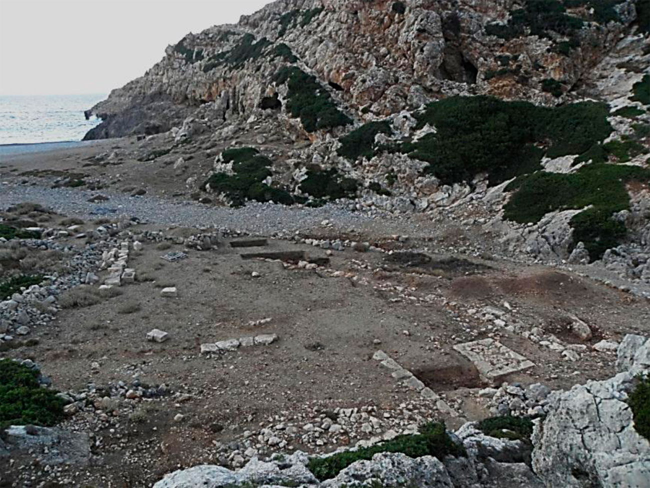
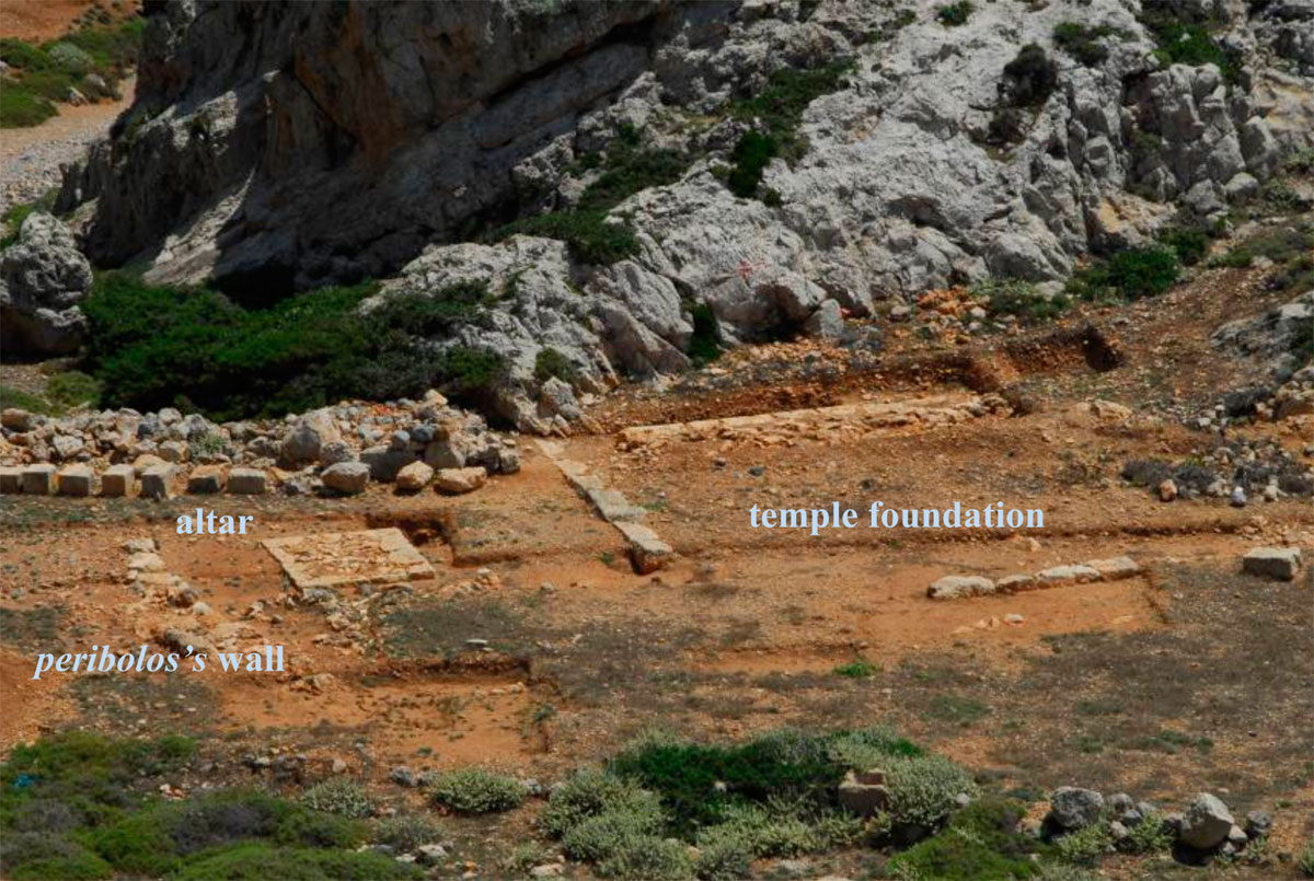
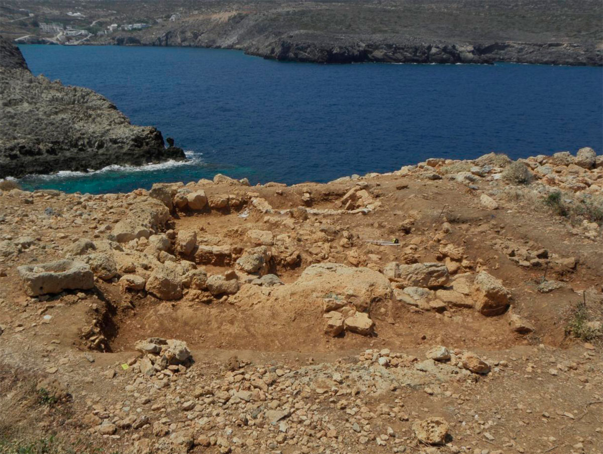
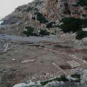
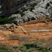
On the side of Xeropotamos stream where it almost meets the sea, north to the homonym little gulf, a by-the harbour sanctuary dedicated to Apollo and Artemis operated since the second half of the 4th century BC.
In antiquity, the sea entered the gulf deeper, forming a “hidden” harbour, protected from the strong northern winds. The strong earthquake that hit the island in 365 AD, uplifted the island ca. 2,80m giving the coastline its current position (note 10).
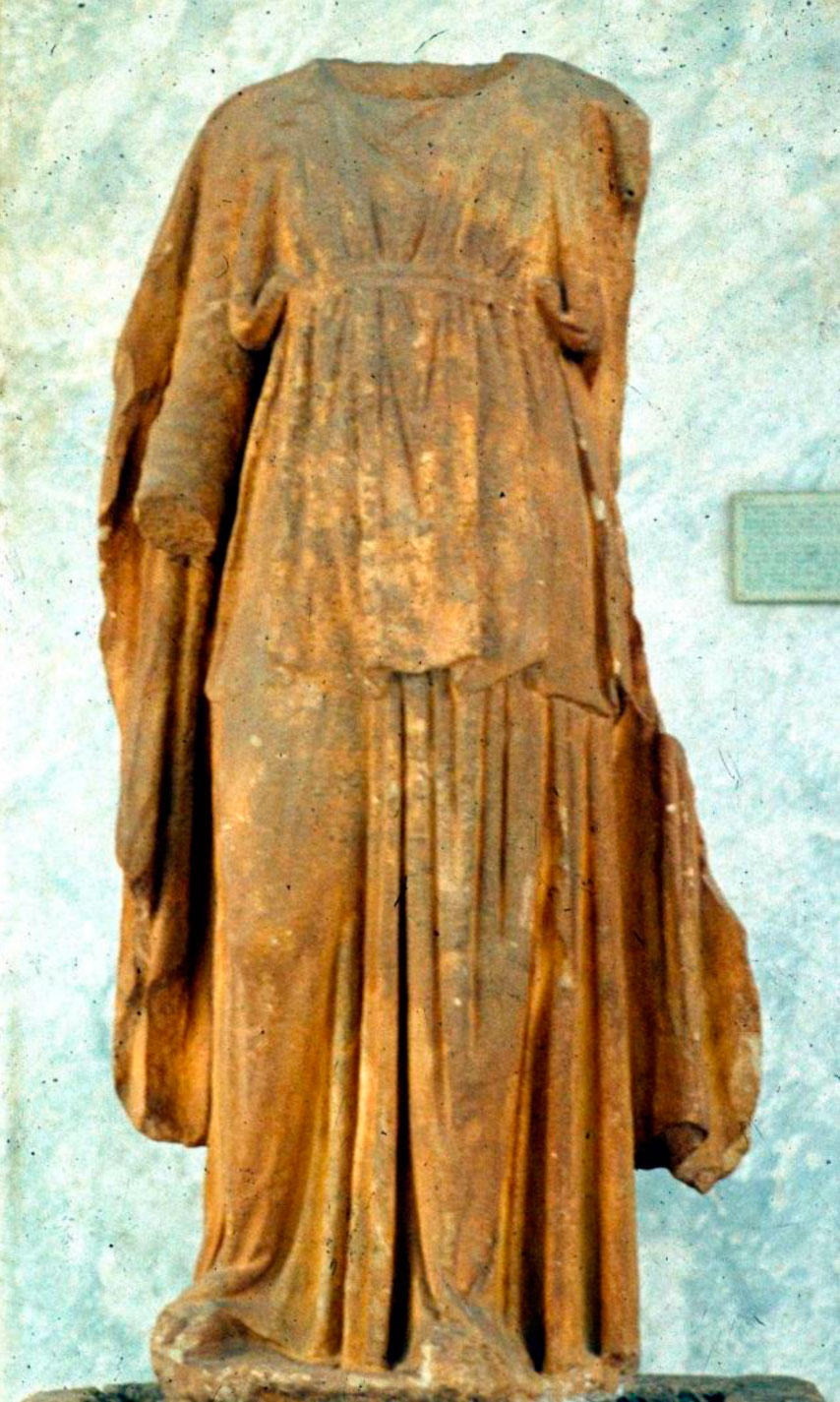
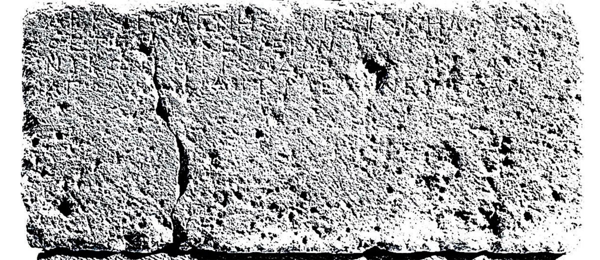
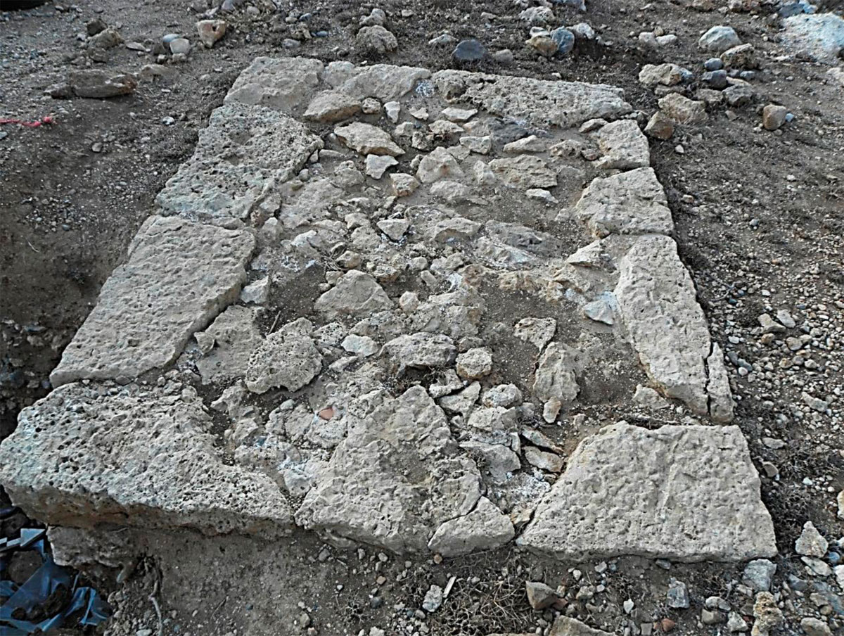
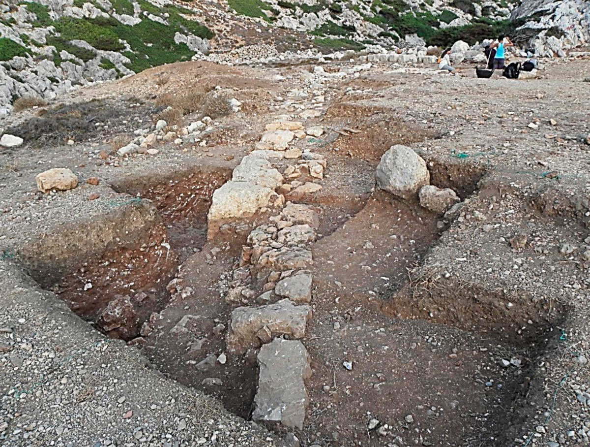
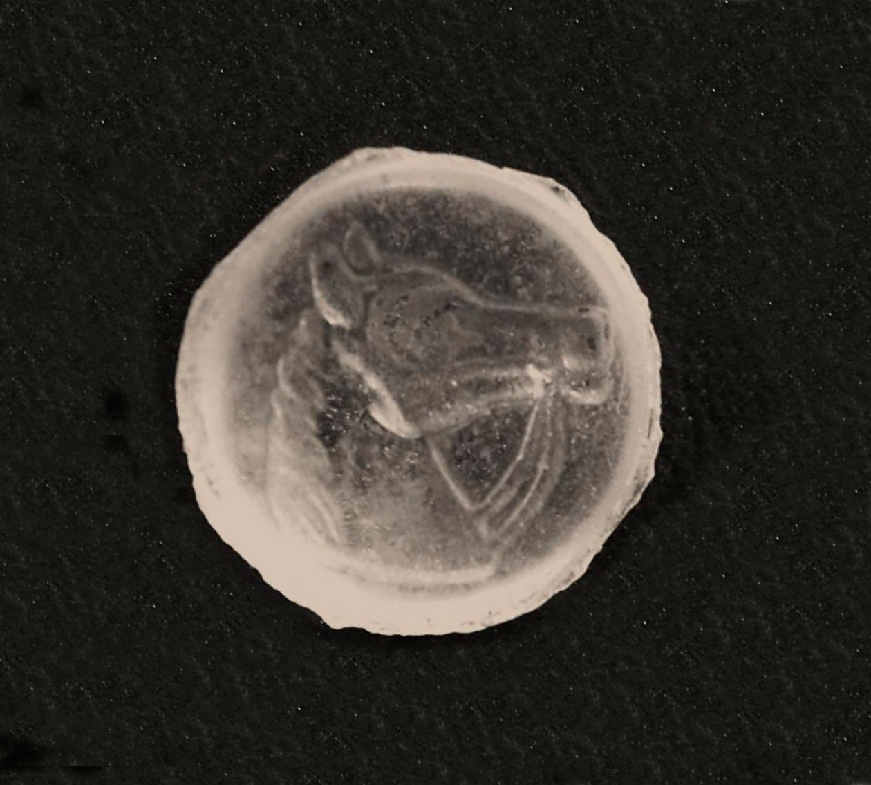
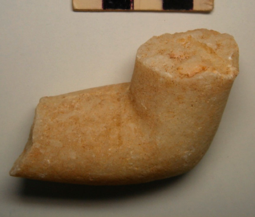
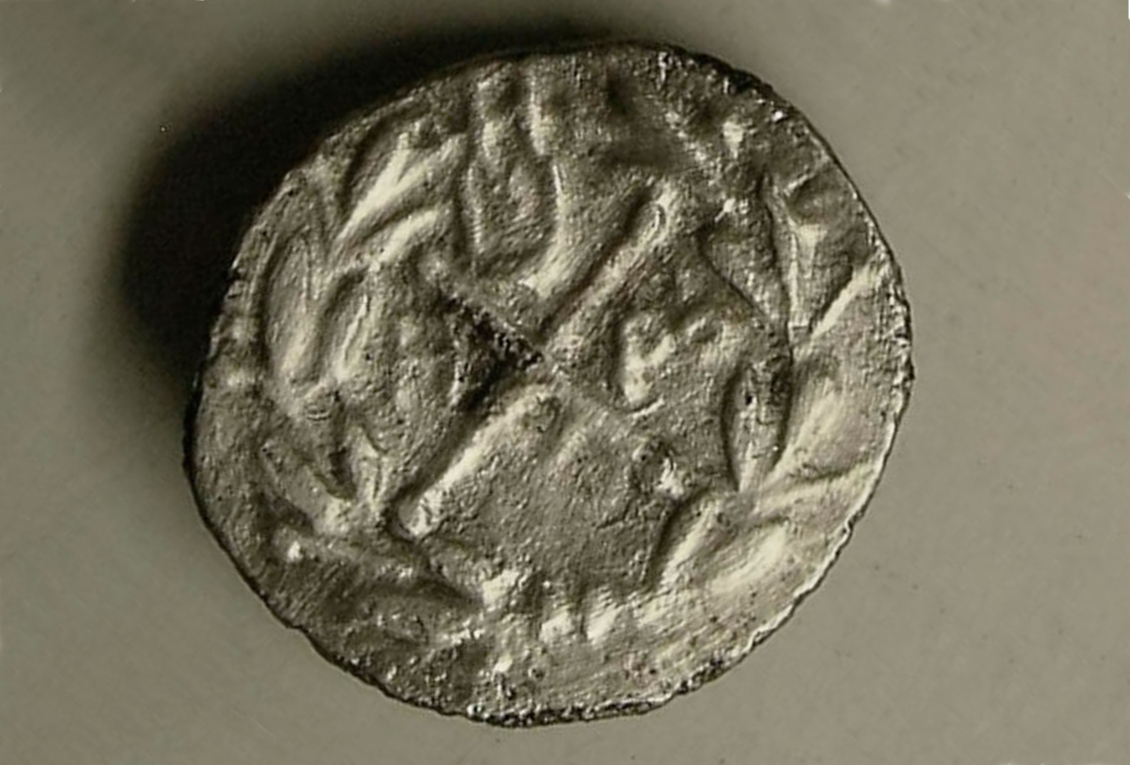
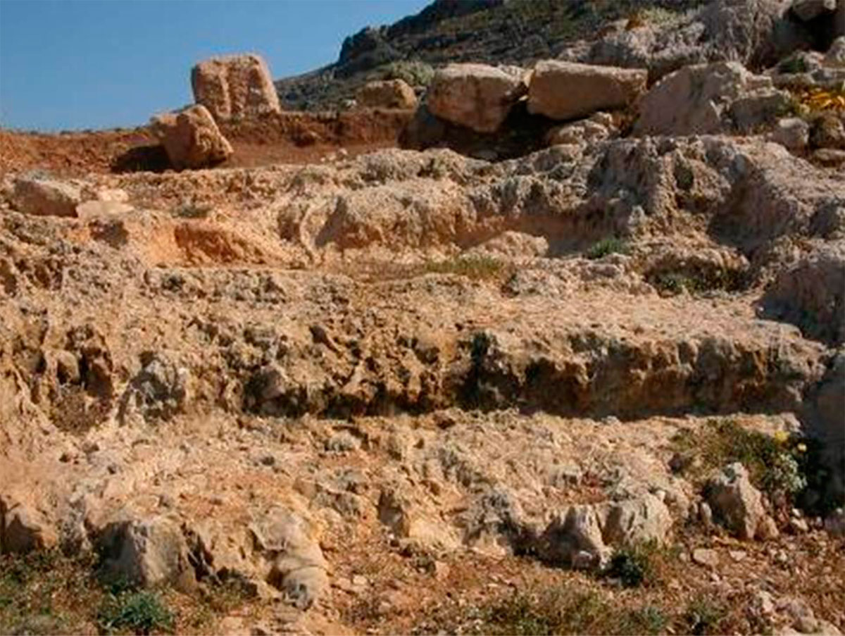
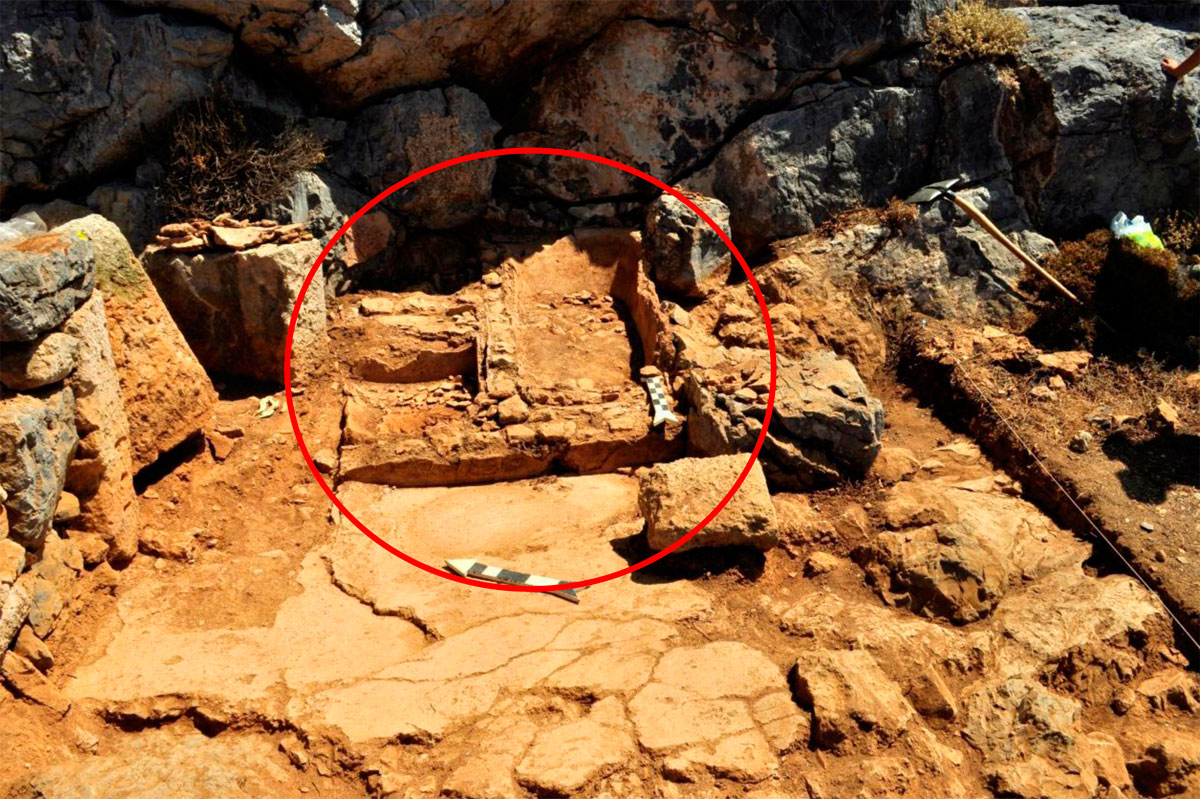
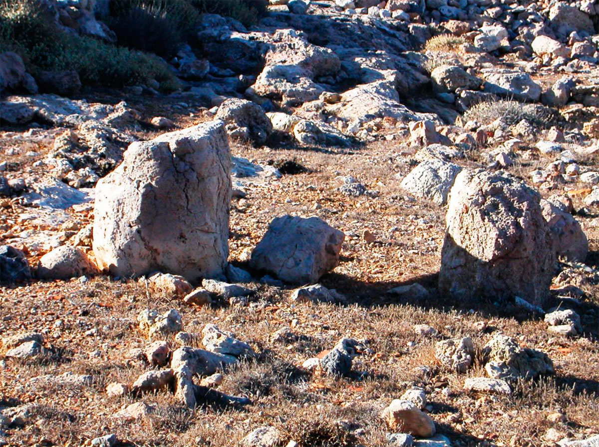
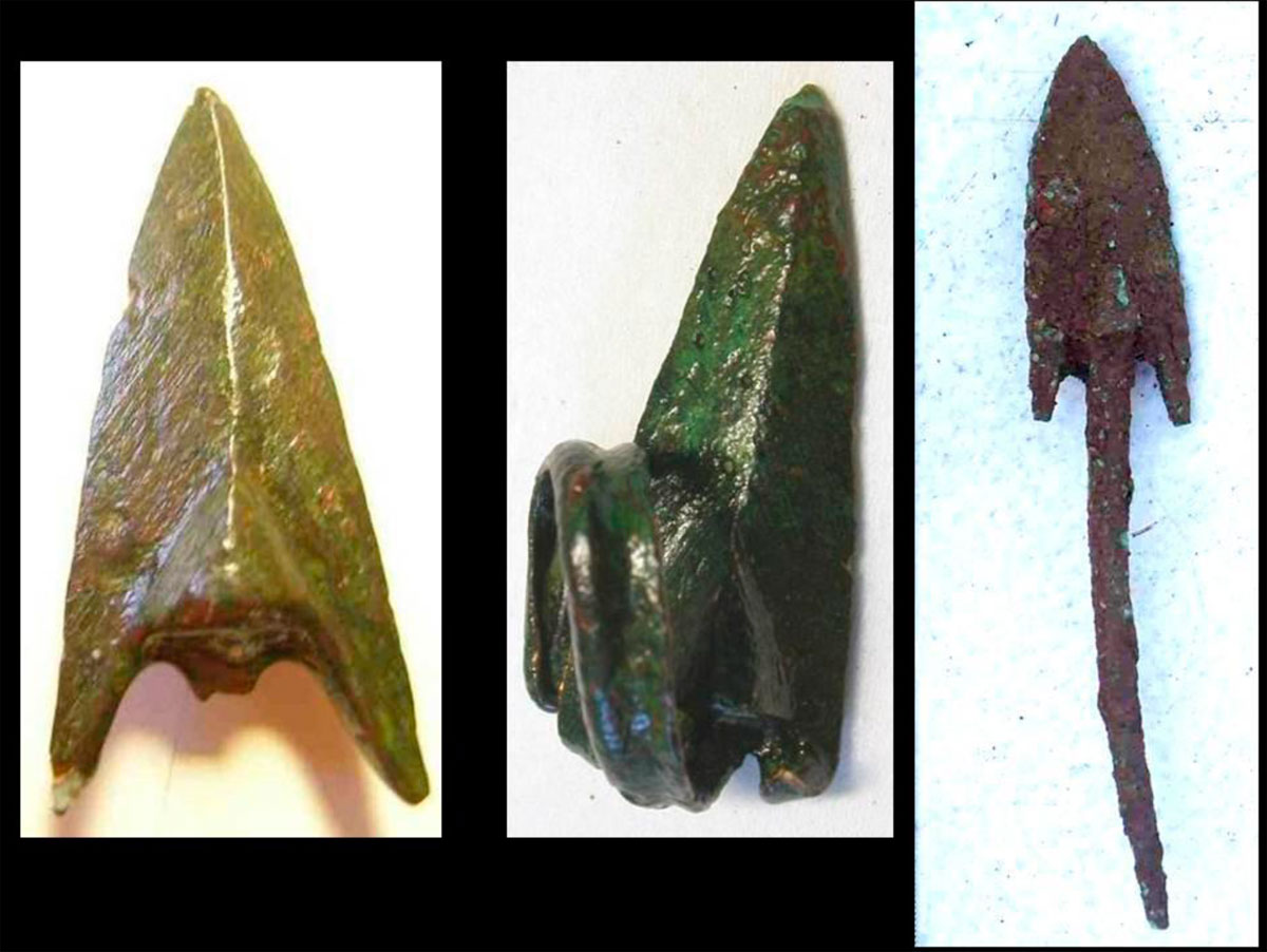
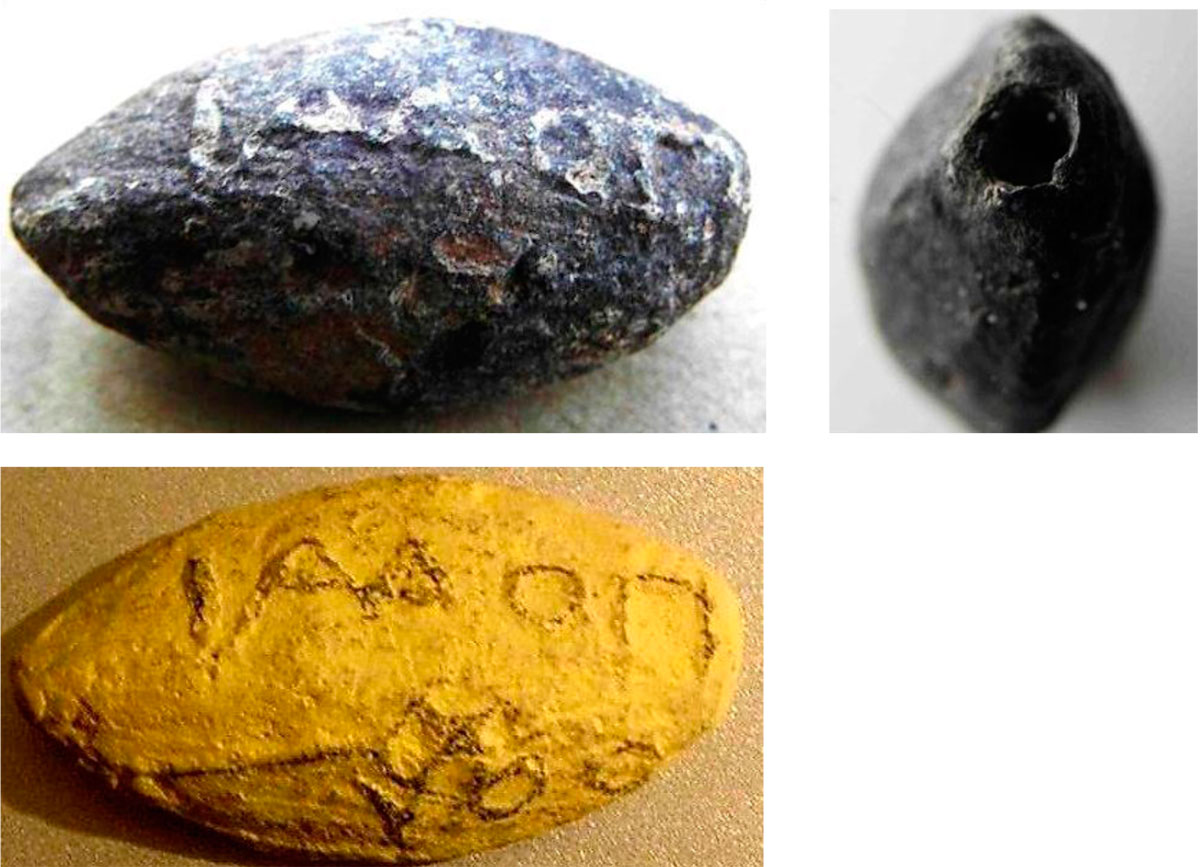
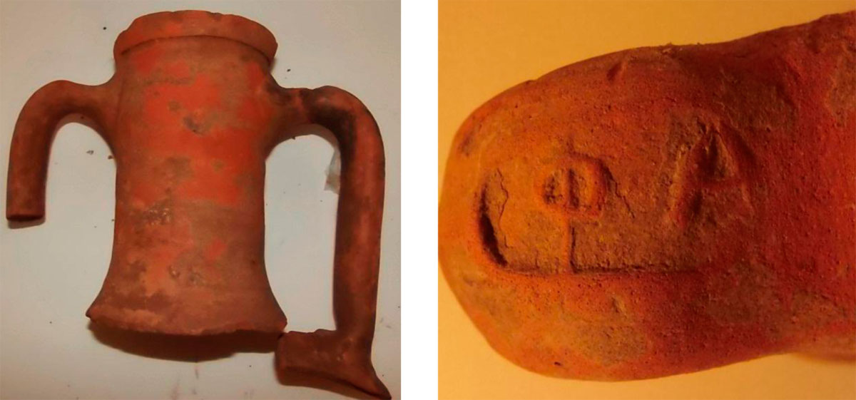
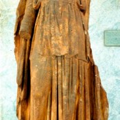
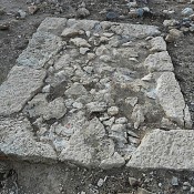
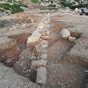
In 1888, agricultural works in the area, uncovered a headless statue of Apollo, in the type of “the Guitar-Player” (fig. 2). Research carried out by Valerios Stais (note 11) uncovered an inscribed base of a monument (possibly of a statue) dedicated to «Αἰγιλιέα» Ἀπόλλωνα (Apollo of Aigilia) by Ἀριστομένη Ἀριστομήδους Θετταλό ἐκ Φερῶν and Νίκων(α) Κηφισοδώρου Ἀθηναῖο (Aristomenes, son of Aristomedes from Pherae and Nikon, son of Kephisodoros from Athens) (fig. 3). From the two monuments (note 12), it can be seen that a sanctuary dedicated to Apollo and Artemis functioned during the whole Hellenistic period (fig. 4). Excavations that took place in 2004 and 2005 uncovered the foundations of the ancient temple, in the shape of οἴκος, and the foundation of its altar (fig. 5). The axis of the temple is with direction S-SW to N-NE (450), directed towards Delos. The peribolos (precinct) of the sanctuary is very strong as it was in close contact with the harbour (fig. 7). Apart from the statue and the inscribed base, pieces of marble statues and vessels (perirranterio= basin for cleansing) have been found along with many arrowheads, because it is known that Apollo had taught the Cretans the art of “arching”, as well as many coins with representations of Apollo and Artemis, jewellery, gem stones and earrings (fig. 8, 9, 10, 11).
Another, very important information provided by the reading of the above mentioned inscription, was the origin of the two persons mentioned; the first was a Thessalian and the second an Athenian. Stais, who published the inscription, thought that these two were shipwrecked, they were saved on the island (note 13) and afterwards they felt the need to express their gratitude to the god-protector of the island for their surviving. Below, after the presentation of the whole archaeological site and the results of the excavation, the conclusions will be discussed for the significance of the two names and the role they played in an important time in the history of Hellenism.
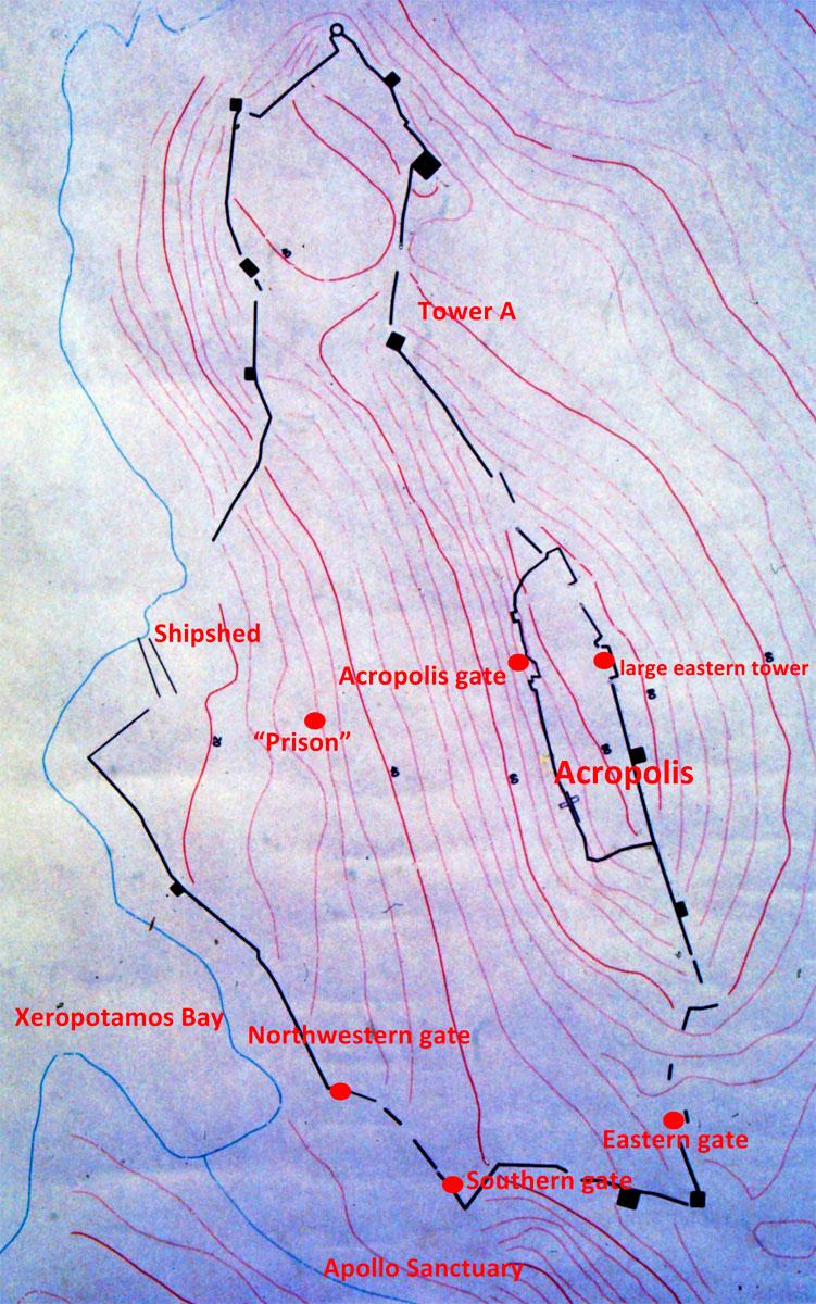
“Kastro” (the fortified city) (fig. 12)
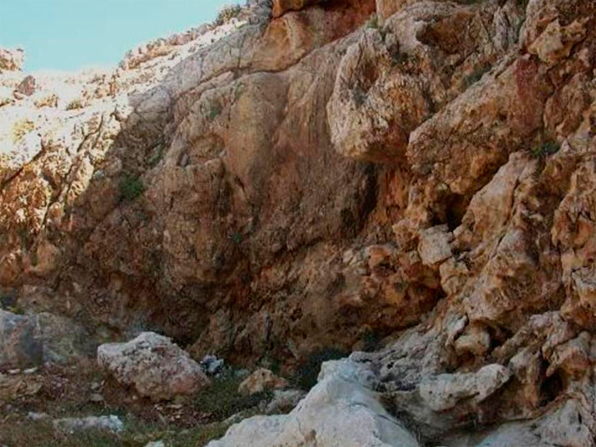
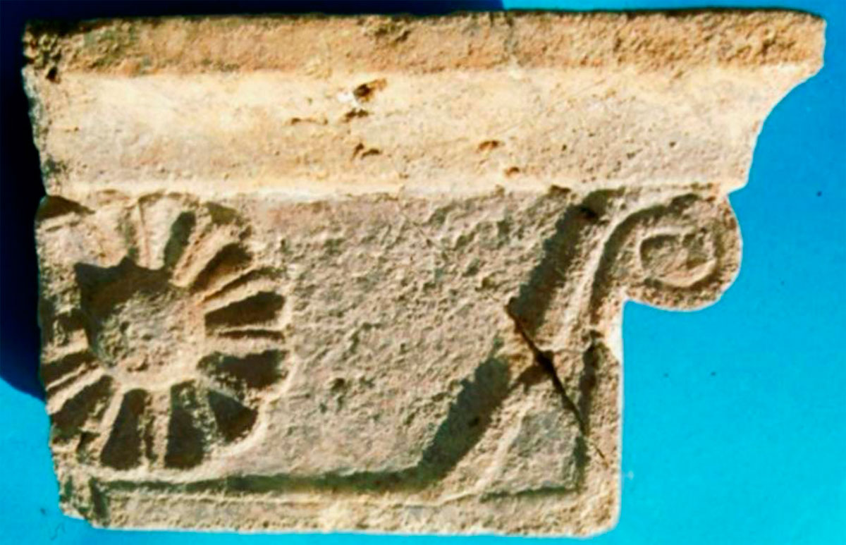
On the eastern bank of Xeropotamos stream two paths lead to the fortified settlement of “Kastro”. The western path –very close to the bay– has been significantly damaged due to time; it was narrow and no carts could pass. In many parts, the protective retaining wall can be seen as well as rock cut or built with stones steps. Almost 10m south of the gate that leads to the city, on the rock, where the above mentioned path has been constructed, a rock sanctuary has been preserved with two niches and one bench (fig. 13). It is a sanctuary outside the gate that led to the eastern bank of the harbour, for those who would leave or return after a sea voyage. The gate of the fort at the end of the path, that we called the “Southwestern Gate” was relatively well constructed and decorated – judging from a number of architectural members that were found in the area (fig. 14, 15, 16).
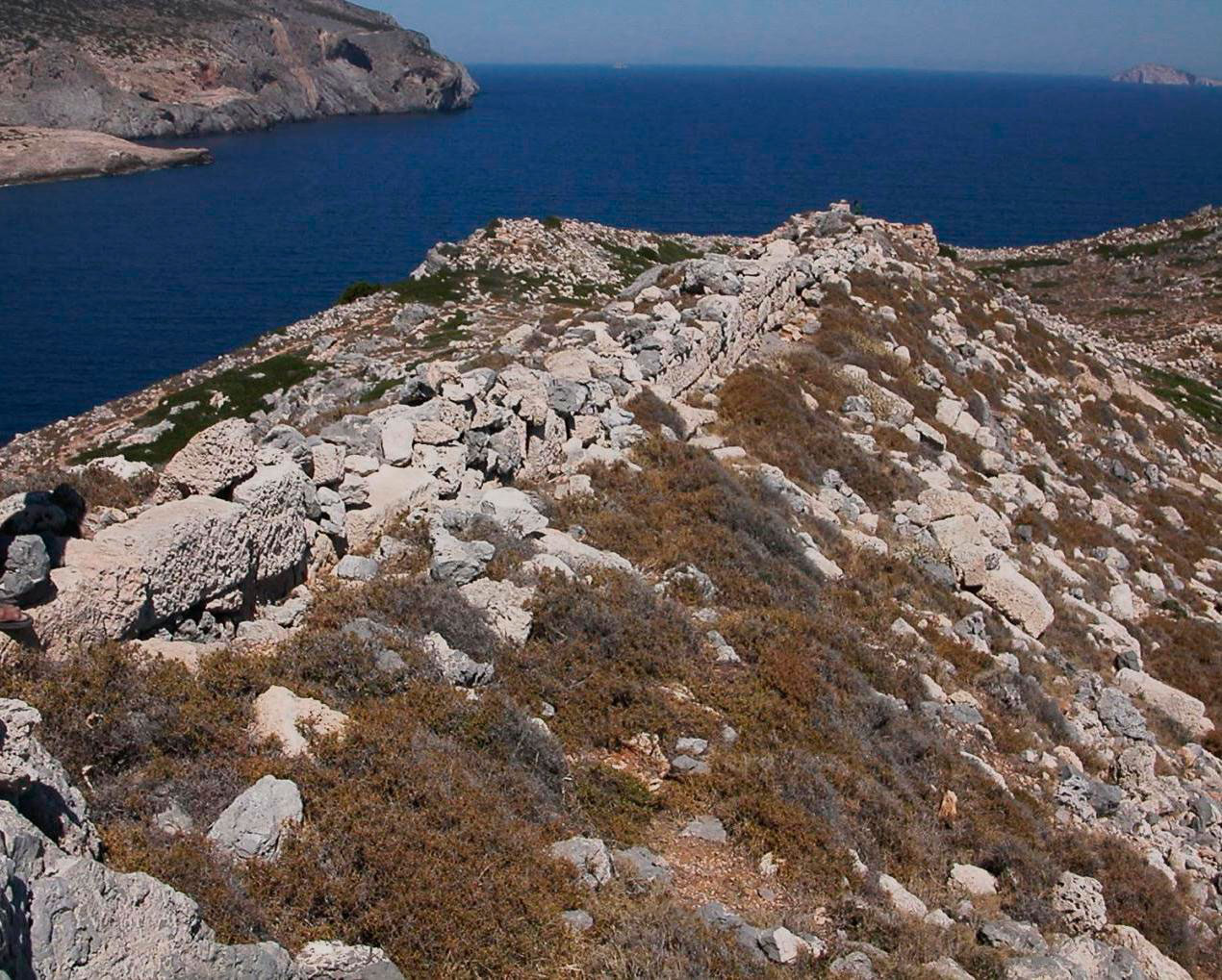
The ancient city was built on the western slope of the peninsula of “Kastro” (fig. 17). In the southern part of the fortification walls that looked towards the mainland of the island and was accessible from there, a second gate was constructed, which we call the “South” where the other path, east of the harbour, was leading (fig. 18).
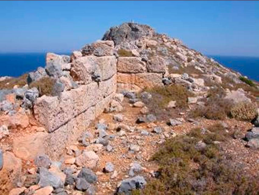
The fortification walls covered the whole western slope of the peninsula, from the rocky coast to the west and north until the mountain ridge to the east (fig. 19). A second line of fortification walls, on the highest point, limited the administrative center of the city, the “Acropolis”. On the Acropolis, the house of the “chief” of the city was also situated, protected from the strong rock located higher to the east (fig. 20), while the gate of the “Acropolis” towards the city was monumental too, but it seems that from the beginning of its function, it had been destroyed by external attack and its repair took place under a different plan (fig. 21).
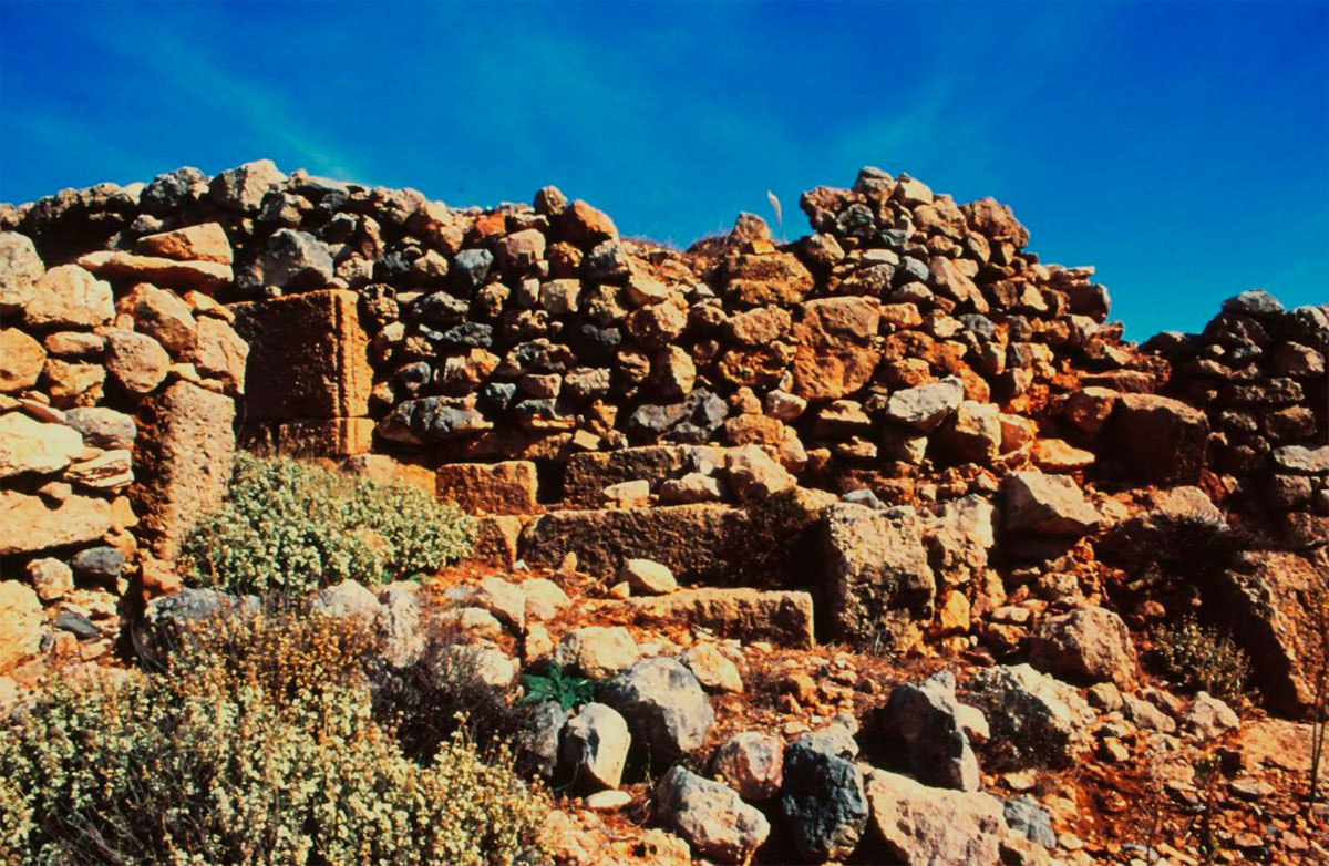
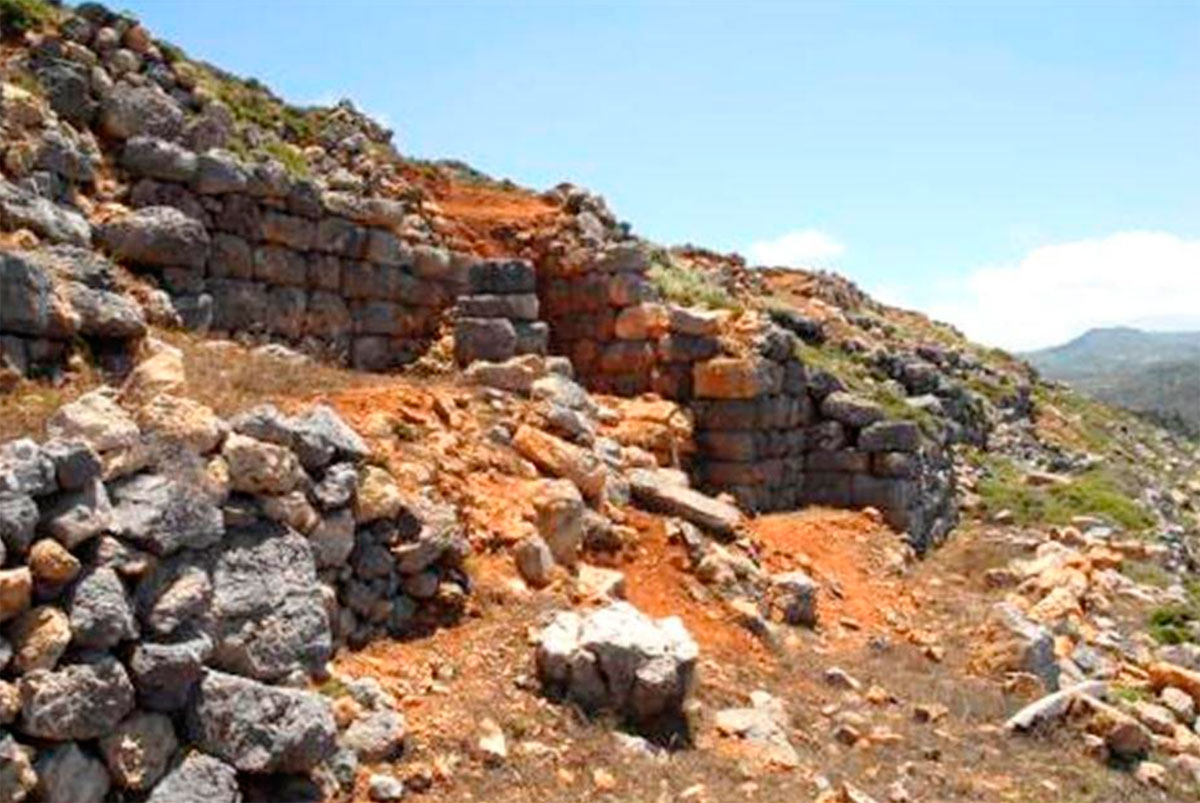
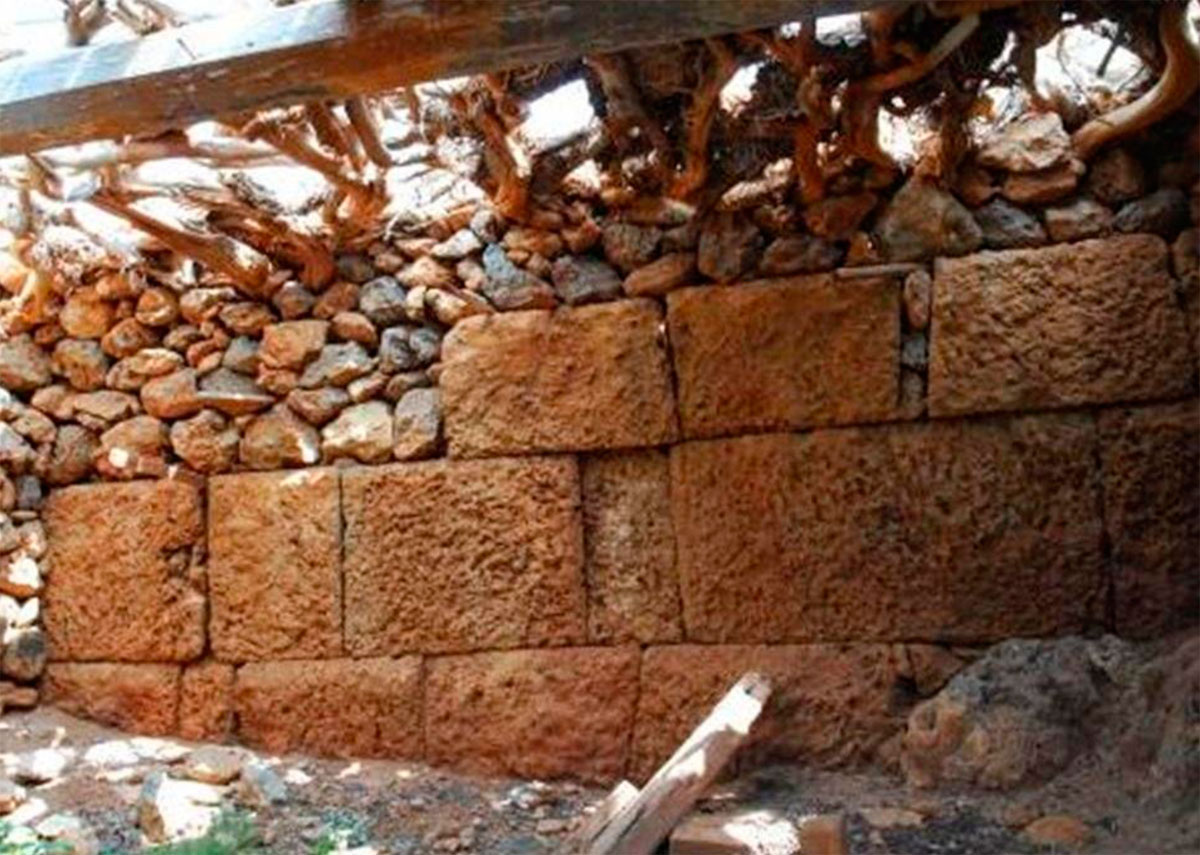
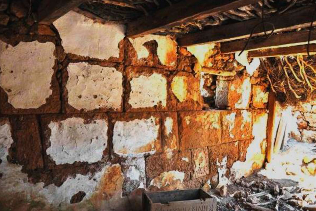
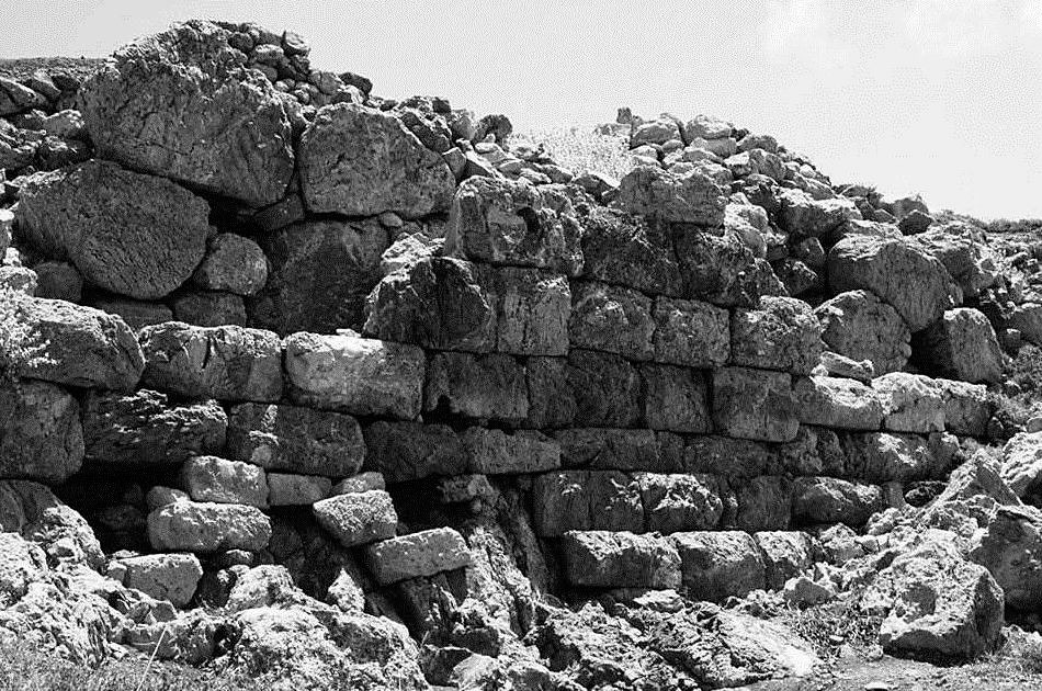
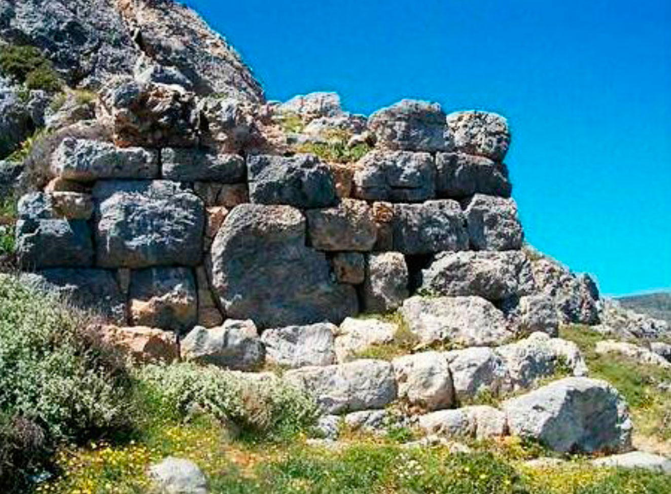
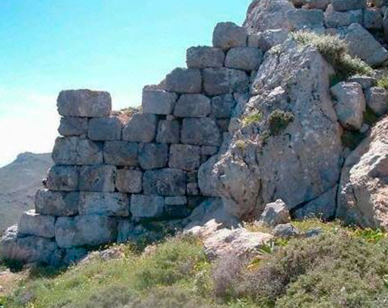
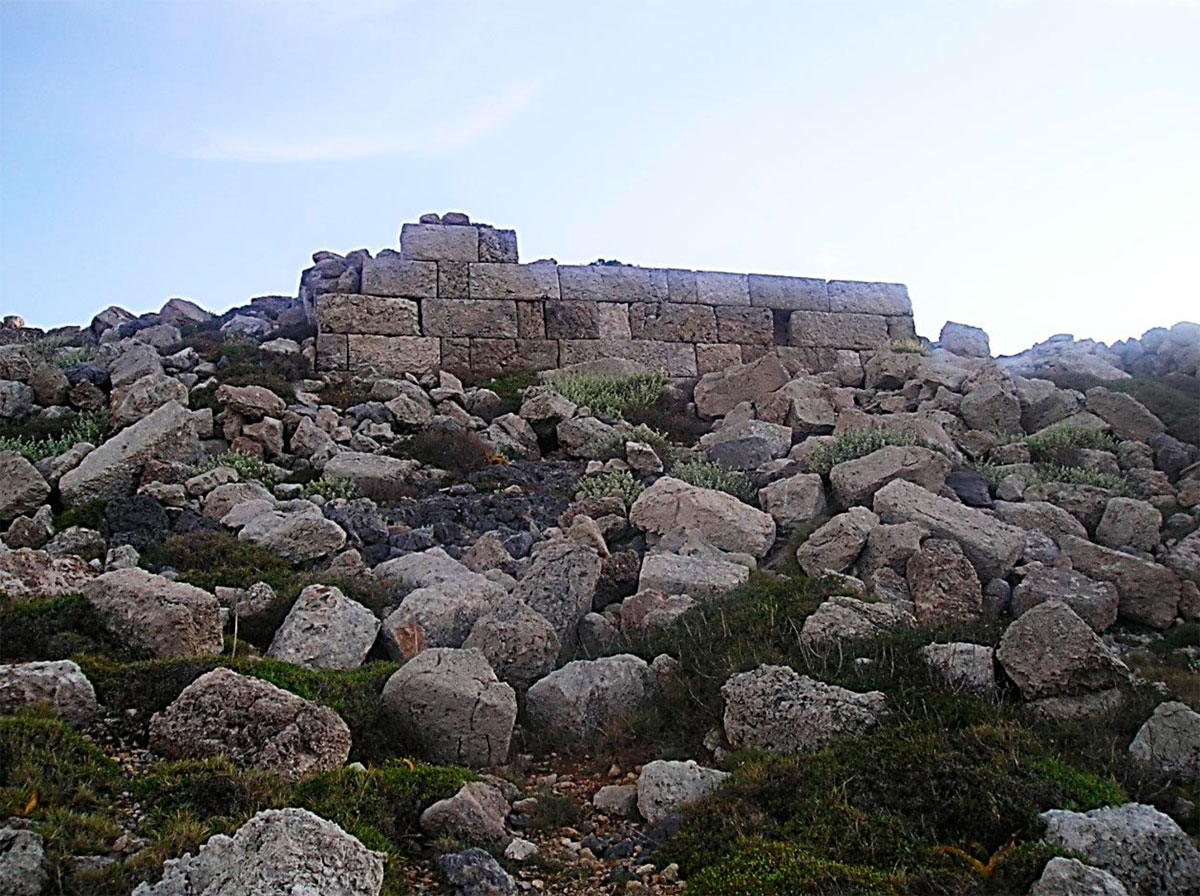
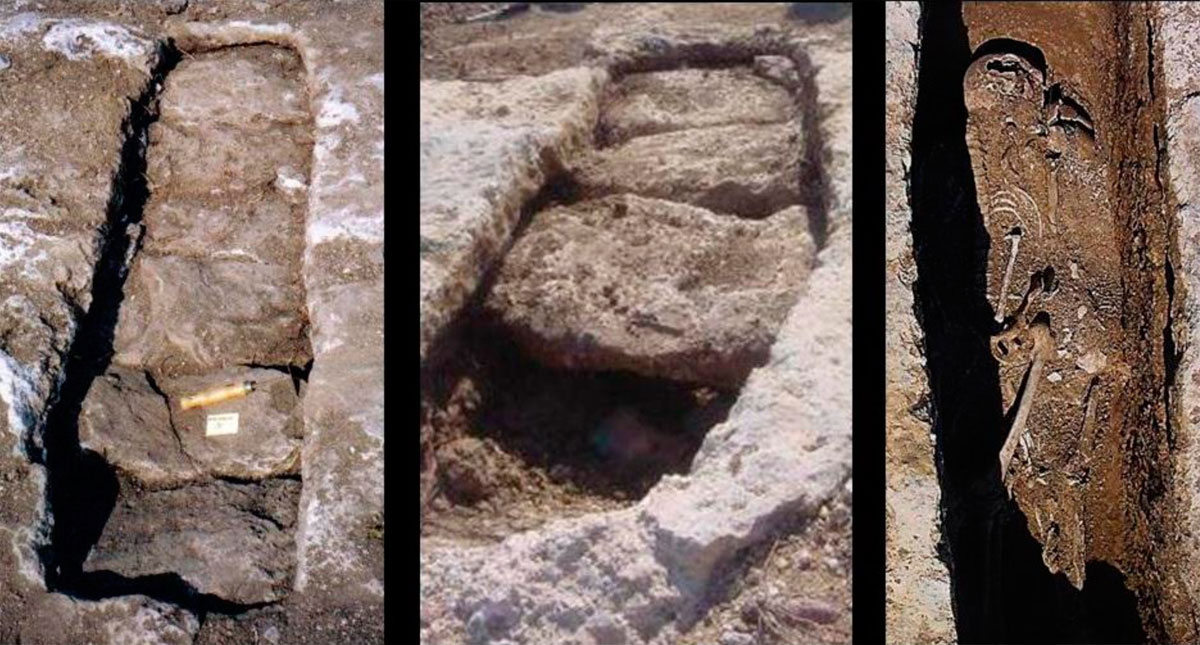
The fortification walls are visible almost along their whole length (fig. 22), constructed differently depending on the local material. At the parts where soft limestone was accessible, the fortification walls consist of well-cut and worked blocks built in the isodomic way (fig. 23, 24, 25, 26). At the parts where the local material was hard – and difficult to work – limestone, the rough polygonal building was preferred. This type of construction was also used for many forts in Crete, during the Hellenistic period. It seems that the first constructors took care only of the appearance and the stability of the exterior side, while, in the interior, the wall that separated the Acropolis from the city, was primarily constructed in somehow untidy polygonal way and later (it is unknown when, but not long after its primary construction) it was covered with a pseudo-isodomic series of stones (fig. 28). Along the whole fort, rectangular fortified towers protrude (fig. 29, 30, 31).
On the northern side of the fort, a significant area had been left without houses or other constructions. This happened in places that were often attacked and these areas were occupied by inhabitants, who found shelter and protection there or for armies to camp (fig. 22).
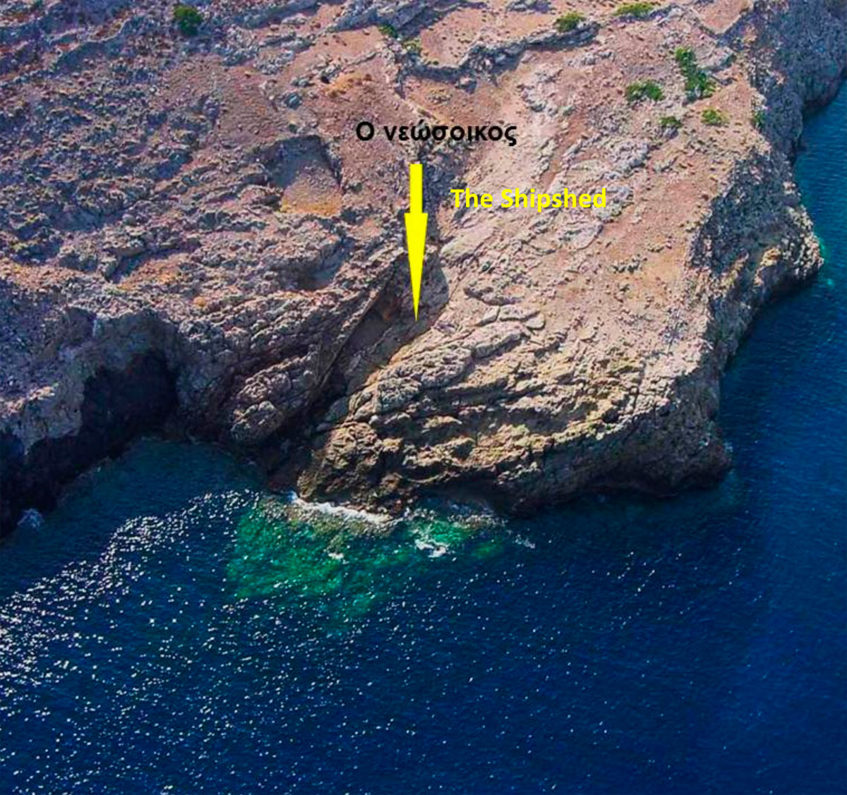
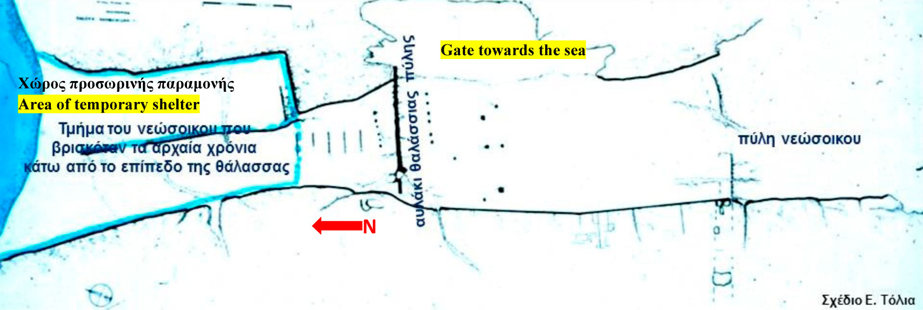
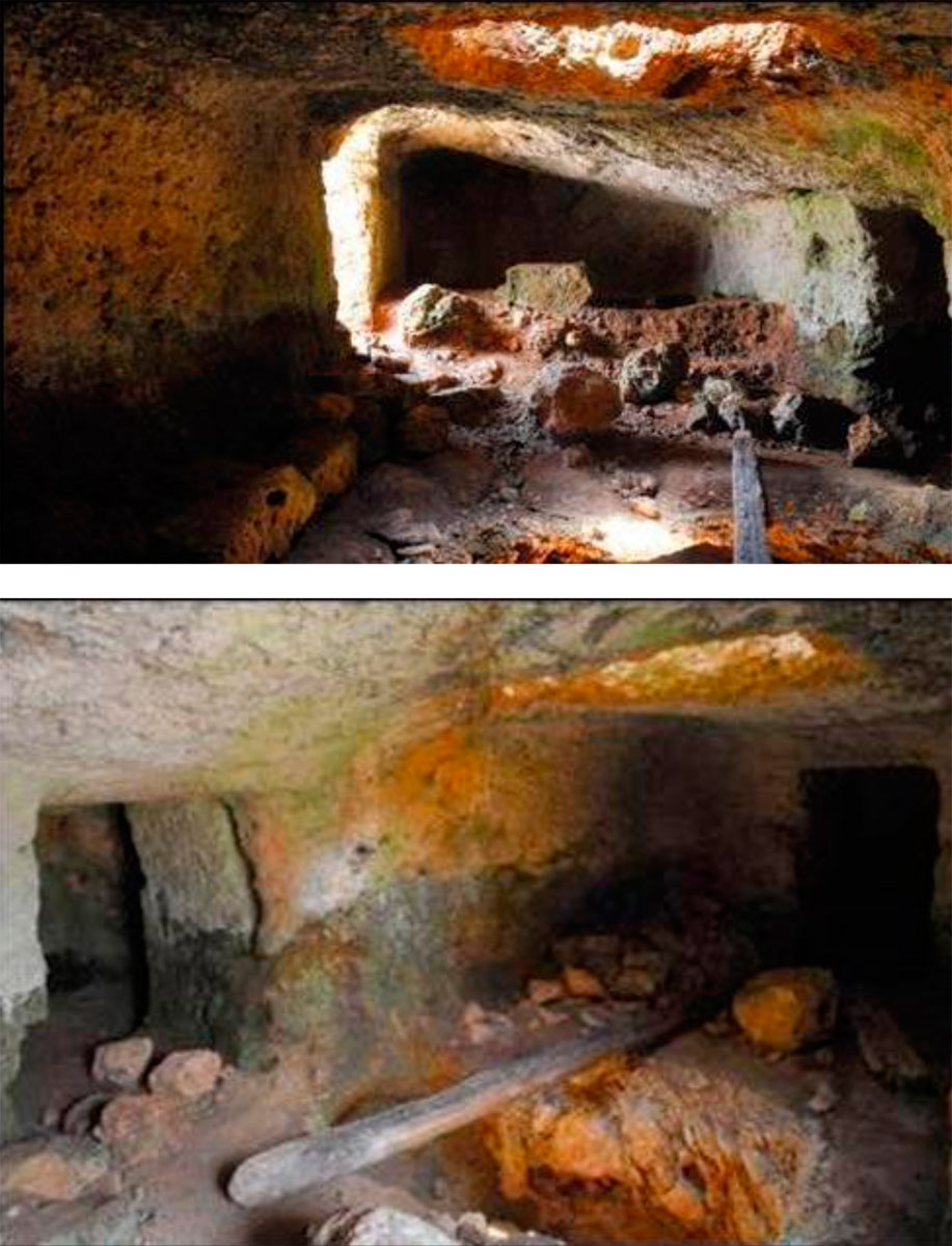
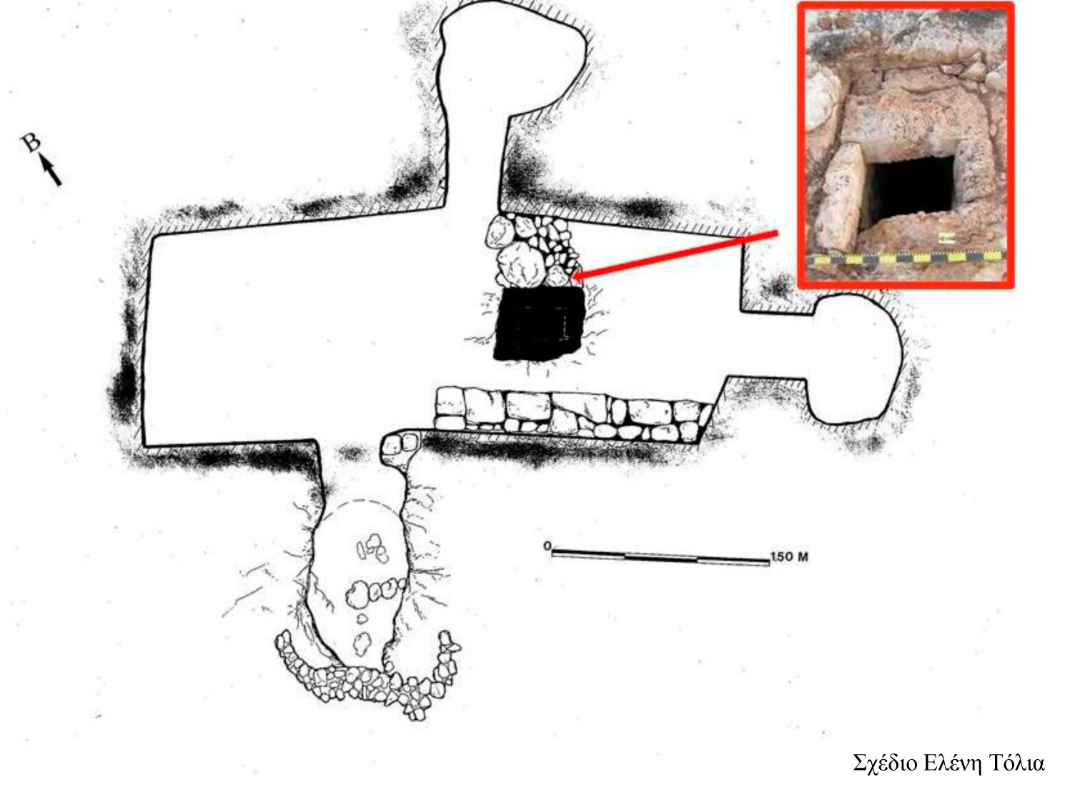
Two other monuments preserved almost intact inside the citadel are a shipshed and an underground rock cut sanctuary – the “Prison” as it is called by the current inhabitants.
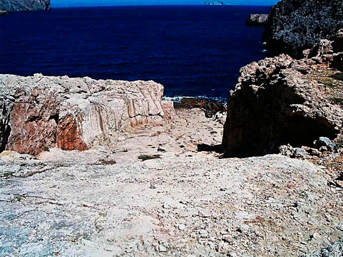
The whole length of the shipshed, almost 30m long, is visible today due to the uplift of the island mentioned before. Today, visible also are the rock cut parts that in antiquity were located under the sea water (fig. 32, 33). The usable length of the shipshed is 18m. Still preserved on the natural rock is the ditch, where the strong blocking gate would be placed that would receive all the pressure from the northern winds, which in winter time are very strong (fig. 34).
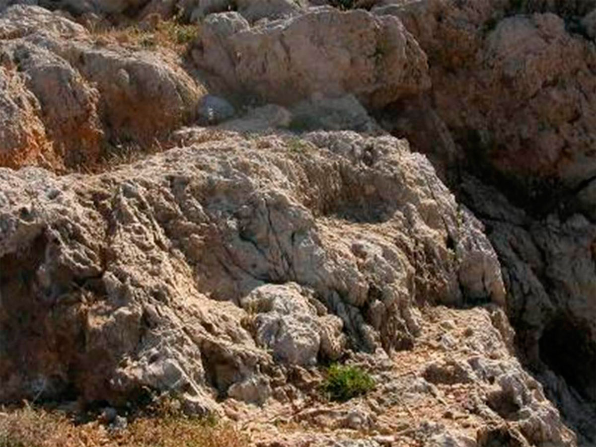
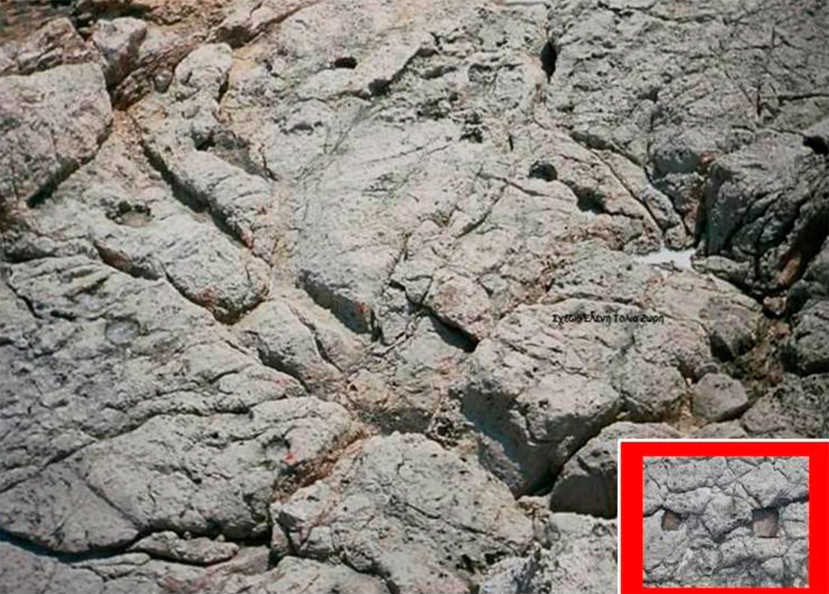
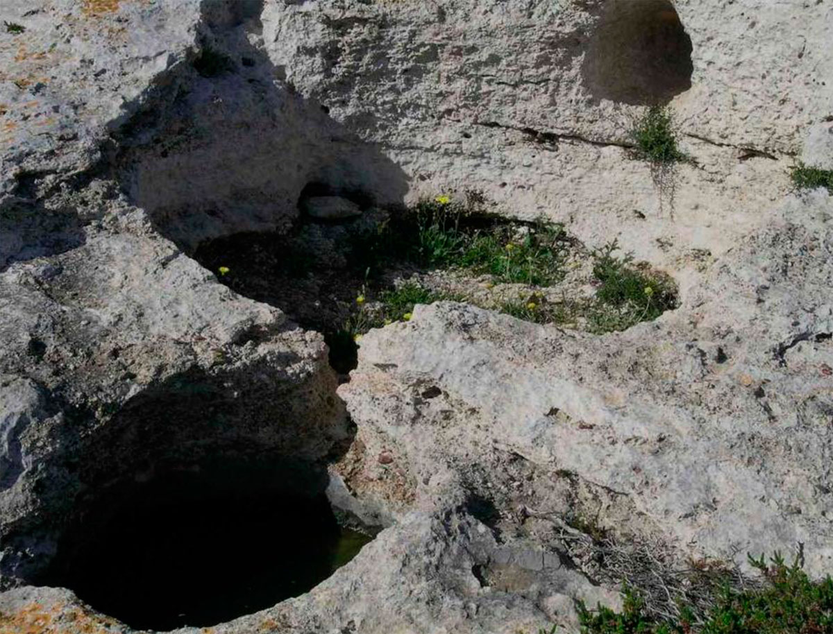
The so called “Prison” is located in relatively close distance to the shipshed in the center of a large quarry of porous stone (fig. 35). It is a rock cut rectangular area with direction N-S and with two small chambers on the sides, one located east opposite to the entrance and the other south. Along the western side, south of the entrance, there is a built bench and in front of it a dug in the rock pit for offerings. Above the pit and cut on the rock, there is a skylight from where offerings would be thrown in the pit as dedications to the deity (fig. 36). The name of the chthonic worshipped deity is not known.
The whole fortified area was covered with houses. The agricultural terraces built by the modern inhabitants have covered the ancient constructions, but in many areas traces of ancient houses, walls and parts of floors can be distinguished. In the western part of the city, which is flat and rocky foundations of ancient houses are preserved (fig. 37, 38), many of which have been constructed in absolute contact with the western part of the fortification walls.
From the movable findings is deduced that the fortified city lived during the Hellenistic period, and more specifically from the late 4th century BC until the first half of the 1st century BC. Apart from a small piece of a stone Minoan vessel, a number of blades and arrow heads of obsidian and local flint (note 14), no other item in the citadel is dated to before the late 4th century BC. No findings are dated to after the second quarter of the 1st century BC either. This is a closed complex that is dated only to the Hellenistic period, which sets matters of historical interpretation due to the monumentality and the strategic position of the island.
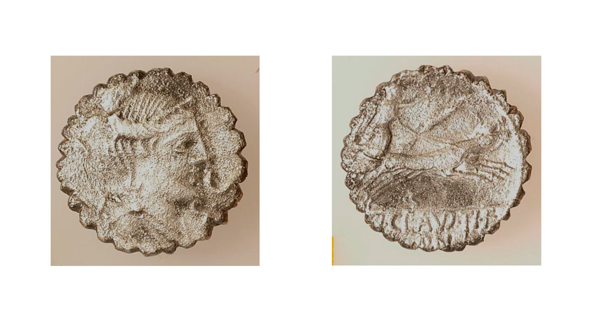
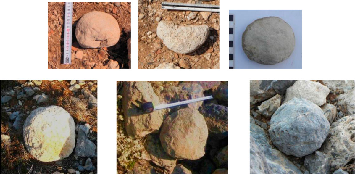
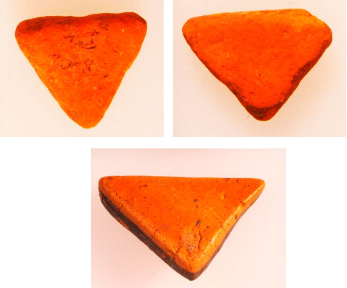
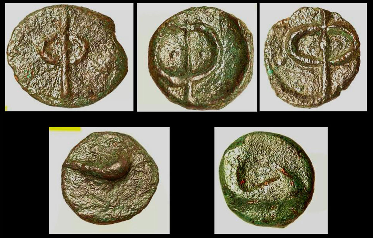
Before the discussion concerning the reasons and purposes that led to the construction of such an ambitious and magnificent fort (Stais states that “The construction of such fortification walls on an insignificant small island, hardly mentioned by ancient writers seems to me paradoxical”, note 15), we should note that among the movable findings are warfare objects, arrowheads and spearheads (fig. 39), sling bullets (fig. 40, 41, 42), as well as catapult balls of many different sizes (fig. 43). All these are findings indicate a society in constant military activity (fig. 44). It should also be noticed, based on coins (fig. 45) and on a number of ceramic findings (fig. 46) that have been found, that the island during the largest part of its “life” consisted part of the Cretan city, Phalasarna.
Historical conclusions
Valerios Stais tried for first time the historical interpretation of the site, after the rapid excavation he carried out on Xeropotamos bay. Stais thought that the fort was constructed by the Athenians during the Peloponnesian War, at the end of the 5th century BC: “It seems that due to its geographical position, it became useful during the Peloponnesian war, when it would experience the fate of Kythera that was conquest by the Athenians (he mentions Thucydides description)…Possibly, the city was fortified during the Peloponnesian war, similarly to Kythera” (note 16).
In 1961, Helen Waterhouse and Richard Hope-Simpson (note 17), based on parts of walls constructed in the “polygonal” way, without attempting any historical interpretation, dated the construction of the fort to two phases; the first during which the “Acropolis” was constructed, in the early 5th century BC and the second phase during which its western wall was covered with isodomic construction (fig. 28) and at the same time the whole settlement was fortified.
The archaeological-excavation data do not justify these two hypotheses, as it is mentioned above. The polygonal way of construction is “rough”, as it usually occurs in the late Classical and early Hellenistic period and it is imposed by the local material, while from the movable findings no sign of habitation results dated before the third quarter of the 4th century BC.
The question still remains however; “who, when and why” proceeded to the construction of such an expensive work? Which were the income sources of the population on an island that did not have enough croplands in order to feed its inhabitants and also to create sufficient surplus for allowing such an expensive fortification to be constructed? The first sensible answer is that a foreign power built it, that would be interested in controlling the southern Aegean and that would participate directly or indirectly into subsidizing the rulers of the island.
Of course, in the second half of the 4th century BC, when the Greek, but also the world history changed course, the strategic position of the small island would interest some powers to have the control over it. But even when the big Greek cities were free (note 18), before the Battle of Chaeronea and the destruction of Thebes in 338 BC, their interest was turned towards the northern danger, Macedonia of Philip and Alexander. On the other hand, Macedonians turned towards the East and not towards the Aegean. Another great power that could be interested in controlling the island of Antikythera would be Persia that not long before had recovered Egypt and had anticipated the antipersian plans of the Macedonians.
The answer is given by the inscription found in Xeropotamos. The first dedicator mentioned on the inscription is Aristomenes son of Aristomedes, Thessalian from Pherae, who is known from literature. One Aristomenes is mentioned as “general” in the Persian fleet in the Aegean, after the entrance of the Macedonians into Asia Minor. One Aristomedes, Thessalian from Pherae participated, leading 20.000 barbarians of Persian army, in the Battle of Issus. As it is known, after the conquest of Thessaly by Philip, many Thessalians that belonged to the leading group that was expelled by the Macedonians sought refuge at the Great king as mercenaries with the hope to return home (note 19).
We also know that after the defeat at the Battle of Granicus, the Persians took the island of Chios and tried to be associated, via Spartan mediation and great quantities of gold, with the Greek cities that did not participate in the campaign of Alexander the Great (note 20). Cretan cities belonged to this category and it seems that the attempt of Agis III, who was loaded with many gold talents from the Persians, was directed towards this prospect (note 21). The appearance at the second half of the 4th century BC of a great number of strong and very expensive forts on the island of Crete may be explained with the inflow of Persian gold, in the attempt of the empire to organize its counterattack. The remarkable advance of Alexander who acted wisely cutting off, on time, the access of the Persians into the Mediterranean cancelled all the plans of the counterattack. We know that after the battle of Issus, Alexander was occupied with the fortune of the island of Chios, imposing thus the return of the democrats who were the main exponents of the anti-Persian (philo-Macedonian) party (note 22). As far as remote Crete is concerned, however, in cities where the same political processes (note 23) would have taken place, there is no evidence of Alexandrine intervention, but his early death and the controversies of the successors seem to have exempted Cretan cities from punishment for their attempt to support the Persians.
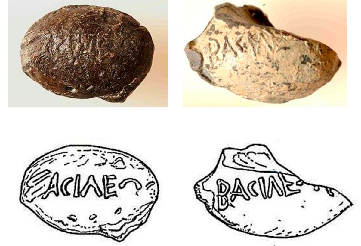
Exactly after the disappearance of the Persian power the well-equipped and fortified Phalasarna taking advantage of the strategic position of the island began to practice piracy (note 24) and from very early it disturbed the developing commercial activity of the Rhodians, and also of other weaker islands which were protected by Rhodes with the appropriate compensation. Two inscriptions from Rhodes indicate exactly this activity (note 25). The first concerns an honorary decree from the Rhodian demos for some citizens who were distinguished in the campaign of the Rhodians against Aigilia. The inscriptions are dated to the first half of the 3rd century BC and this matches with the dating of the extensive, in many parts of Kastro, destruction layer. In the same layer, a number of catapult stones were found that seem very likely to have been thrown under the custody of the above mentioned on the inscriptions specialized in catapults (in charge for throwing catapult stones) named Polemarchos, son of Timakrates, from Casarea!
The same Polemarchos son of Timakrates, who was later promoted to syntagmatarhes (colonel), is mentioned on a second, funerary, inscription along with his brothers and it seems that they all three were killed in campaigns against pirates in many places in the Mediterranean. His older brother who was ship captain, according to a restoration on the inscription, was killed in Aigilia, in the campaign for which Polemarchos was honoured, if we – of course – accept that the Rhodians attacked Aigilia only once.
Antikythera is mentioned as the place, where the rebel (revolutionary) king of Sparta, Cleomenes the III, resorted after his defeat in the Battle of Sellasia in 223 BC on his way to Egypt (note 26), the king of which, Ptolemy the Benefactor, would support him in order to return to Sparta. On the island of Antikythera, Cleomenes III came into conflict with his follower, Therykion, because the latter considered unacceptable as Spartans to have abandoned Sparta instead of returning and falling in battle. After the reply of Cleomenes that his goal was not to prove futile heroism, but to return in order to change the social structure of Sparta, Therykion committed suicide on the island.
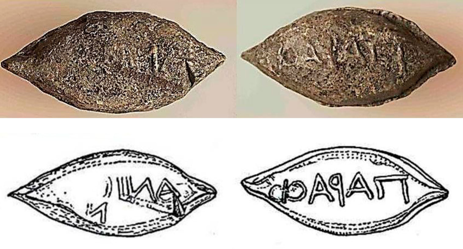
A few years after the arrival of Cleomenes, Antikythera was found in the midst of conflicts between Cretan cities, but also of the attempt of the powers that were trying to control the area of the southern Aegean and the sea passages towards the West, where the power of Rome had already appeared. Two pretenders seem to have participated in the Cretan affairs during that period, Philip V of Macedon and Nabis of Sparta. They would both have attempted to control the small island, the first because had found as an excuse the “invitation” to Crete by the Polyrrhenians (note 27), rivals of Phalasarna, and the second because had practical engagement in the affairs of western Crete (note 28). Material evidence from the visit of Nabis on the island constitute many inscribed sling bullets of Laconian type, found in the area of Kastro, with the title “of the king”, a title that Nabis gave himself the last years of his power (fig. 41).
The 2nd century BC seems to have been a century of development for the settlement. The first indication is provided by the construction (or reconstruction) of the by the harbour sanctuary dedicated to Apollo and Artemis, also mentioned above. The area occupied by the temple “was filled” in the 2nd century BC with the construction of the strong peribolos (precinct) around the sanctuary that restricted the channel that led to the “hidden harbour”. The second indication of the relative growth of the settlement of Aigilia is based on the stratigraphy provided by the excavation in the area of Kastro. The higher layer of the houses and the last, as it seems to have been, is dated to the 2nd century BC.
What are the reasons, however, of the relative prosperity that is being observed? Of course, the answer occurs in the incomes from the pirate activity of Phalasarna (note 29). Rome had dynamically entered the history of the Aegean area and the commercial transactions between the eastern and central Mediterranean presented exceptional growth. The involvement of the island into the Cretan conflicts is also noticeable in the excavation data. A series of inscribed sling bullets found in Aigilia bear names of Cretan officers from Cretan cities that were allied with the city of Phalasarna (note 30) (fig. 42).
Aigilia suffered the vengeance of the Roman general Metellus who suppressed with brutality the “Cretan Revolution” in 69-67 BC. The life in “Kastro” ceased exactly those times. At the same time Phalasarna was destroyed by the Romans too.
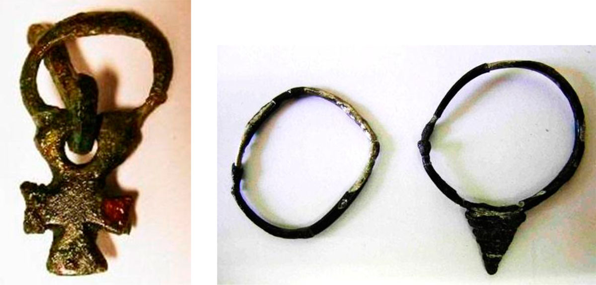
Human presence is again testified on the island after the 5th century AD (fig. 47, 48, 49), when life in the Aegean Sea was normalized with the power of the Byzantine fleet, until almost the beginning of the 8th century AD, when Arabic attacks began and it seems that Antikythera lost its population again (fig. 50). The inhabitants returned in the middle Byzantine period, a while after the Arabs were driven away from Crete. After the 4th Crusade and until the Napoleonic wars the island belonged along with the other islands of the Ionian Sea to the possessions of Venice.
Nowadays, the island goes through a new period of desolation, which does not appear to reverse. Something can change only if antiquities “will be used” through programmes of alternative tourism, which will constitute an attractive element and will elongate the touristic period on the island (note 31).
A programme of archaeological tourism has already been proposed that will not only turn “Kastro” into a well-organized and elegant archaeological site in which, however, the visitor will remain simply a passing spectator. The proposal is based on the creation of an alive, and I insist an alive Archaeological Park, where visitors will have the chance to be active, and from simple spectators to become participants in action. An archaeological site is exhausted by the visitor in one or two-day visits. But, as it is proposed, in the “living archaeological park” the visitor will participate in the archaeological work, in the organizing, promotion and presentation of the archaeological site. In southern Greece, especially, the days of sunshine that allow outdoor work begin in mid-March and last until the end of November. This allows an archaeological activity to be programmed for the whole aforementioned period.
This archaeological activity is incorporated in a wider framework of alternative tourism program. The interested visitors-tourists will come, not for a single visit, but to participate in the process of uncovering antiquities and in the enhancement of the archaeological site. Thus, the visitors-tourists will work as “workers” and at the same time they will be taught the excavation process and all the other activities required for the creation and function of an Archaeological Park, such as the uncover the antiquities and their restoration, the opening and maintenance of paths in areas of special interest and the guiding around the site. In the evenings, the visitors-tourists-workers will be taught lessons concerning 1) the history of the archaeological site of “Kastro”, 2) the way historical conclusions are deduced by excavation data, 3) the objectives of the archaeological research in general and specially in Antikythera, 4) the conservation and drawings of movable and not movable findings and 5) the ways the visible and unearthed antiquities are presented to the wider audience.
Aris Tsaravopoulos
Archaeologist
Translated by Gely Fragou (archaeologist)
* I would like to note that all the activities mentioned in this article have taken place, all these years, with the valuable volunteering work of archaeologists, conservators, illustrators, topographers, professionals and students, and of other people outside archaeology and related disciplines, who in the best case had their food covered by small scale sponsorships from the Antikythera community and the Kytherian community in Australia. It is impossible to mention here the hundreds of people who worked the last twelve years on Antikythera. I would like however to thank all of them because without them nothing would have been possible.
** Note to fig. 19: The mapping of the exterior fortification walls has been done by the team of the Australian Archaeological Institute consisted of: Cosmos Koronaios, Anthony Miller and Andrew Wilson. The mapping of the interior wall of the Acropolis has been done by the illustrator of the 26th Department of Prehistoric and Classical Antiquities Eleni Tolia and the topographer engineer Panagiotis Protopsaltis with the aid of the rural policeman of Antikythera Manolis Charchalakis. All the above mentioned offered their services voluntarily and the excavation team wishes to thank them.