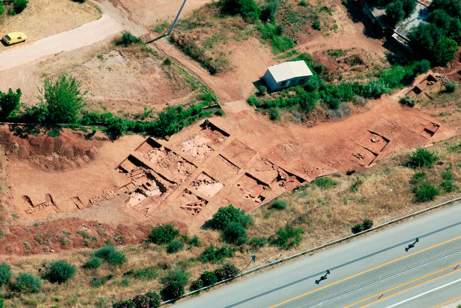
The ongoing large-scale technical works in Achaea during the last five years, i.e. the construction of the Olympia Hodos (Olympia Motorway) and the New Railway Track from Athens to Patras (section Kiato-Rododaphni) prompted extensive archaeological investigations. Initially, hundreds of trial trenches were opened in the course of the Motorway and the New Railway, which generally follow the present road, crossing the narrow seaside lowland part of Aegialeia. In many of the trial trenches ancient remains were located. Most of the excavations, which also happen to be the larger ones, are being conducted mainly in the area of Aegialeia, in the eastern part of Achaea. The region has been continuously and densely populated from the Neolithic times until nowadays. The findings of the current excavations are very important for they change dramatically our knowledge of the area through the discovery of previously unknown sites dating from the Early Helladic period until the first centuries A.D. The most interesting of these excavations, which are still in progress, are presented shortly as follows (note 1).
Olympia Odos
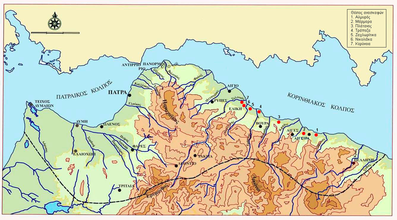
Ι. Marmara (Map, nr. 2)
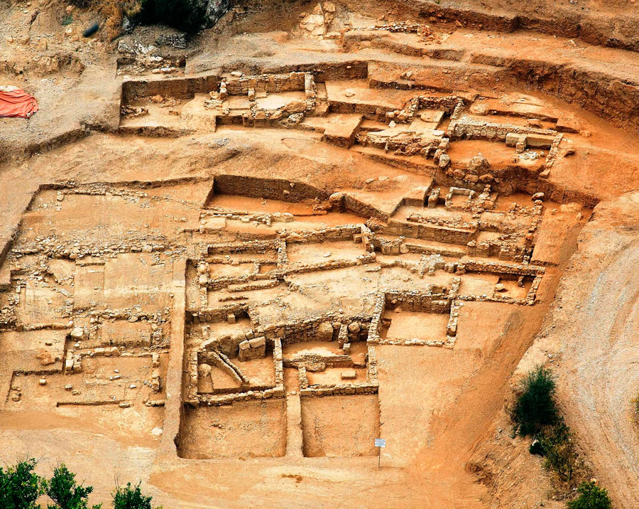
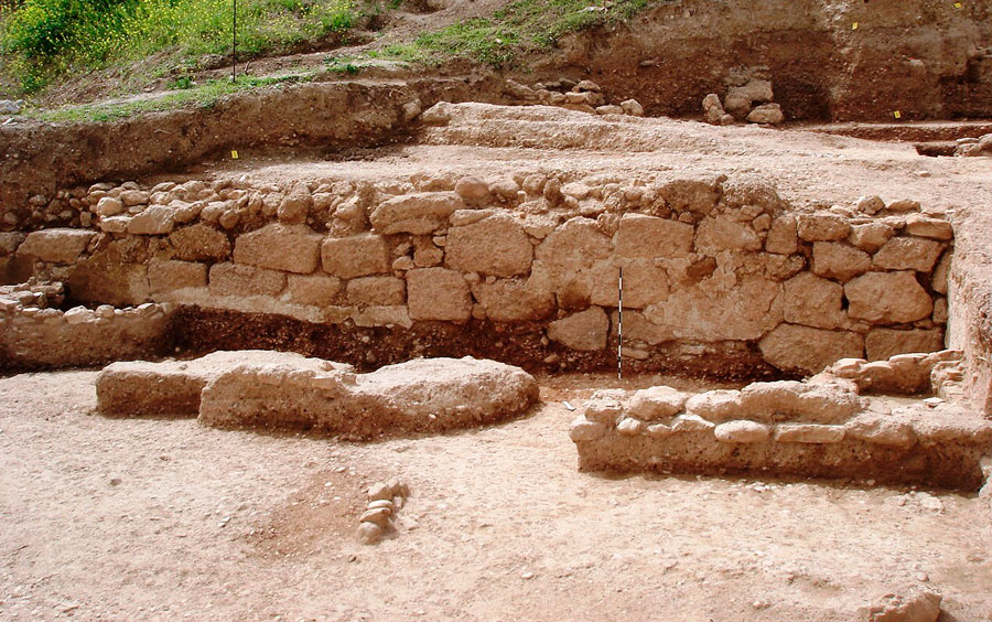
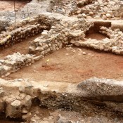
During the investigation of trial trenches in the site of Marmara, Aigeira, the remains of a sanctuary were traced in the place where the opening of the eastern part of the Akrata tunnel 13A had been planned. The latter was to be opened to the west of the archaeological site of Aigeira, in an amphitheatrical area with steep inclination towards the western bank of the Krios river.
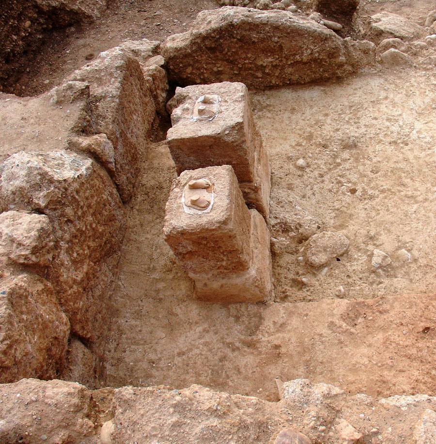
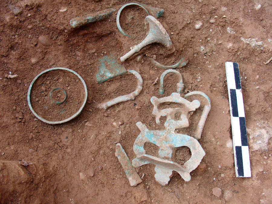
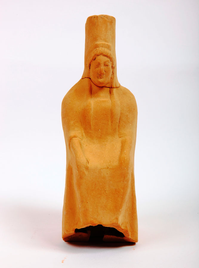
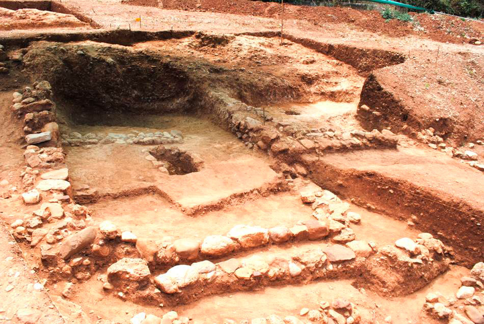
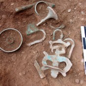
The sanctuary is built in two terraces, since the site has a very steep inclination; it is estimated that its area covered more than 2000 sq.m. The first building found was the so called naiskos, which probably had a cultic character. Its ground plan is rectangular, with a prodomos and cella, while its orientation follows the north-south axis. The walls are built with large rectangular and polygonal stones of the local conglomerate stone. The building blocks are roughly worked, with the exception of their face, which is finely cut. In the middle of the northern narrow wall two stone bases were found supporting the marble statues of two children. The feet of the statues are preserved up to the ankles, their bases having been joined to the pedestals with molten lead. A large number of small finds was found: terracotta vessels and figurines and more than 70 bronze objects (omphalos bowls, handles, figurines, jewelry, a small tripod, a small plaque with two female heads in relief, door implements, pins and a mirror). The finds date mostly to the 4th and 3rd cents. B.C., although earlier finds are not missing either.
The bronze mirror bears an inscription with the name of the goddess Eileithyia, while another object, probably a key, bears an inscription with the name of Demeter. Consequently the sanctuary is dedicated to Demeter and probably to Kore also, while Eileithyia, the goddess of labour, was adored there too. The cult of Eleithyia was generally popular in the Peloponnese (note 2). According to Pausanias, the goddess had been worshiped in the cities of Aegialeia, Aeghion, Voura and Pellene (note 3).
In the same terrace, on the southwestern edge of the sanctuary and 17 m. southern of the naiskos’ entrance, a large ceremonial pyre was revealed. Αn irregular four-sided projection has been constructed on the rock, in the center of the pyre, measuring 2,40×4,10m. It closely resembles an altar in the Thesmophorion of Pella, which is also of an irregular four-sided form and made of successive layers of stone chips and clay (note 4). This simple construction could be classified typologically as an ash altar. Many broken animal bones and finds, some completely burnt, came from the pyre; they included mostly female figurines, jewelry – mainly of silver – and broken pots, dating from the Archaic to early Hellenistic times.
On the lower terrace to the east, small structures with rectangular or trapezoidal ground plans were excavated. They were carelessly built and in their interior built benches were found. Those structures were auxiliary buildings of the sanctuary and they must have been used for common ceremonial meals.
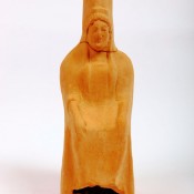
The excavation of the sanctuary brought to light a large number of clay figurines mostly female. The earlier of these are handmade and date to the late 7th-6th cent. B.C., while in the 6th and 5th centuries the type of kore bearing a polos and holding a bird in front of the chest with one hand and fruit or wreath with the other is dominant. The same figure is also shown seated, usually holding a bird on the chest.
Among the bronze figurines are two winged male figures, two bovines, a deer and a rooster.
Much bronze jewelry was found, but also silver, such as an elaborate bracelet in the form of a snake, with a gilded head and tail, as well as earrings, pins, fibulae and many signet or simple rings.
The sanctuary at Marmara is not mentioned by ancient writers. When Pausanias visited Achaea during Roman times, the sanctuary had already been abandoned, according to the excavation evidence. Cultic activity in the area seems to have begun in the 7th cent. B.C., while the site had been occupied since the second half of the 8th cent. B.C. The architectural remains are dated to the 5th and 4th centuries B.C. and the sanctuary must have been abandoned by the 3rd century B.C. The stepped layout of the sanctuary brings to mind the sanctuary of Demeter and Kore in Corinth (note 5). Τhe sanctuary at Marmara probably belonged to the territory of Aigae, an Achaean city whose dominion must have extended to the west of the river Krios (note 6).
ΙΙ. Zachloritika (Map, nr. 5)
To the north of the archaeological site of Aghios Stephanos in Zachloritika the remains of a large building have been uncovered. Architectural members of the building have collapsed within its interior. To the west of these ruins a cemetery of tile-covered graves and a large, built channel were located. Since these remains are dated to the Early Christian period, they fall under the jurisdiction of the 6th Ephorate of Byzantine Antiquities, which was accordingly notified and then conducted the excavation.
ΙΙΙ. Nikoleika (Map, nr. 6)
To the west of Marmara, in the area of the ancient polis of Helike, a Mycenaean settlement covering an area of more than 20.000 sq.m. was found. An extended Mycenaean cemetery with rich chamber tombs dating from LH IIB until the LH IIIC period had been discovered earlier on the outskirts of the Mycenaean settlement on the low hill called Kallithea or Psoriarou (note 7). According to its excavator, M. Petropoulos, this cemetery belongs to Mycenaean Helike (note 8).
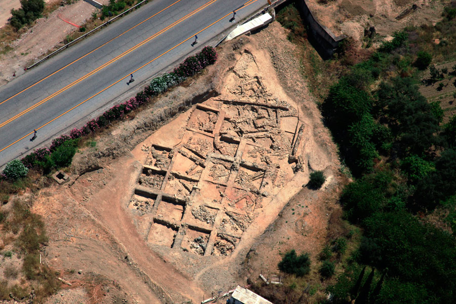
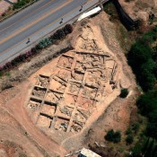
The excavation covered a zone measuring 250m in length and 50m in width, which spreads over along the north side of the new national road connecting Corinth to Patras, on the northwestern outskirts of the hill Kallithea or Psoriarou. The evidence so far demonstrates that we are dealing with an extended Late Helladic settlement, probably arranged in quarters on the plateaus and the less steep slopes of the hill’s outskirts. Because of its location the settlement is directly related to the Mycenaean cemetery that was found higher up on the same hill. The settlement probably extends further to the north, towards the modern village of Nikoleika. It is noteworthy that the distance between the excavated part of the settlement and the apsidal Geometric temple (that was recently revealed in the heart of Nikoleika) is about 250 m. to the north of the Mycenaean remains. The apsidal temple may be dedicated to Poseidon Helikonios, the patron god of Helike (note 9). Consequently, the excavated remains on the outskirts of Psoriarou hill, where the chamber tomb cemetery lies, must indeed belong to Mycenaean Helike.
In many parts of the settlement excavation remains were revealed immediately below the surface. The total extent excavated is about 1000 sq.m. Although the ground plans of the buildings are fragmentarily preserved, it seems that they formed cohesive complexes with smaller rectangular rooms.
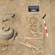
Two building phases can be discerned. The walls are built with river stones and conglomerates, roughly worked or completely unworked. Their thickness is between 0,45m and 0,80m. The upper parts of the walls must have been made of mud-brick. In some areas the natural rock had been cut in order to form floors. Artificial round cuts, revealed on the surface of the natural rock, were probably used for the placement of storage vessels, whereas others received poles for light covers or sheds. Among the finds, the remains of a house consisting of two rooms stand out. A small grave was uncovered on the floor of the northern room, obviously used for a child burial, which comprises a usual Mycenaean practice. In the southern room the rock was cut to form a niche towards the slope of the hill. In this area a large concentration of domestic pottery, mainly chytrae (cooking pots) and kylikes (goblets), were found in situ.
According to the preliminary study of the pottery, it is dated to the LH II and LH III periods. The finds include many clay vessels, such as alabastra, cups, kylikes, cooking pots, pithoi, and pithoid jars, clay discoid weights and loom weights, stone weights, bronze objects, such as daggers, arrowheads, fragments of tools and sheets. Τhe nature of the building remains combined with the movable finds demonstrates the rural character of the settlement.
ΙV. Κeryneia (Map, nr. 7)
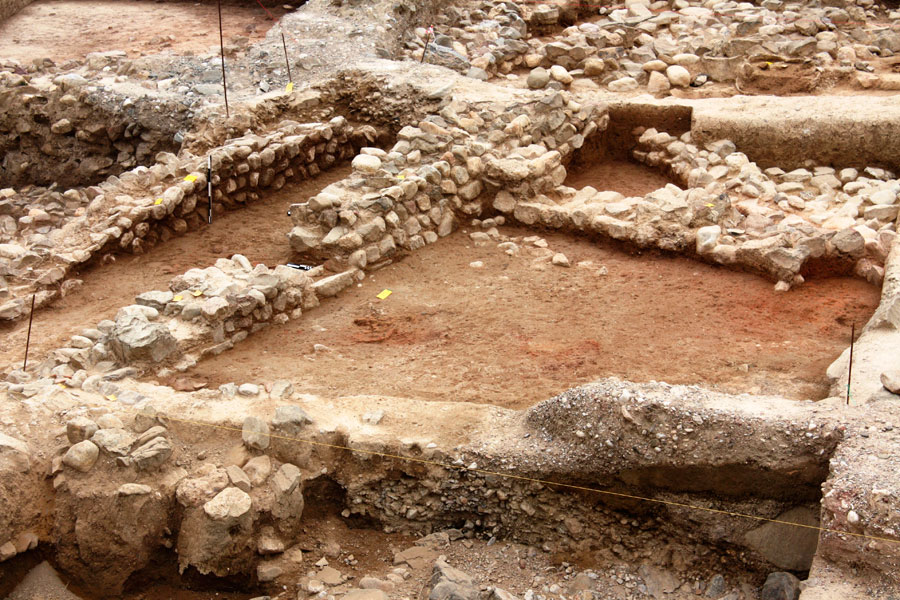
To the west of the Mycenaean settlement, on the outskirts of the hill called Brouma or Aghios Georghios in Keryneia and thought of as the acropolis of Helike (note 10), an extended Early Helladic settlement has been uncovered. The trial trenches at the beginning of the research showed that the remains extended to an area of at least 50.000 sq.m. The settlement may in fact be even larger considering that its limits have not been yet defined. No traces of fortifications, tombs or hints for the existence of a cemetery have been found in the area under research. The archaeological remains seem to cover a wide chronological range, of at least 500 years (EH II and EH III periods). The excavation proves that the settlement had been continuously occupied until the end of the 3rd millennium.
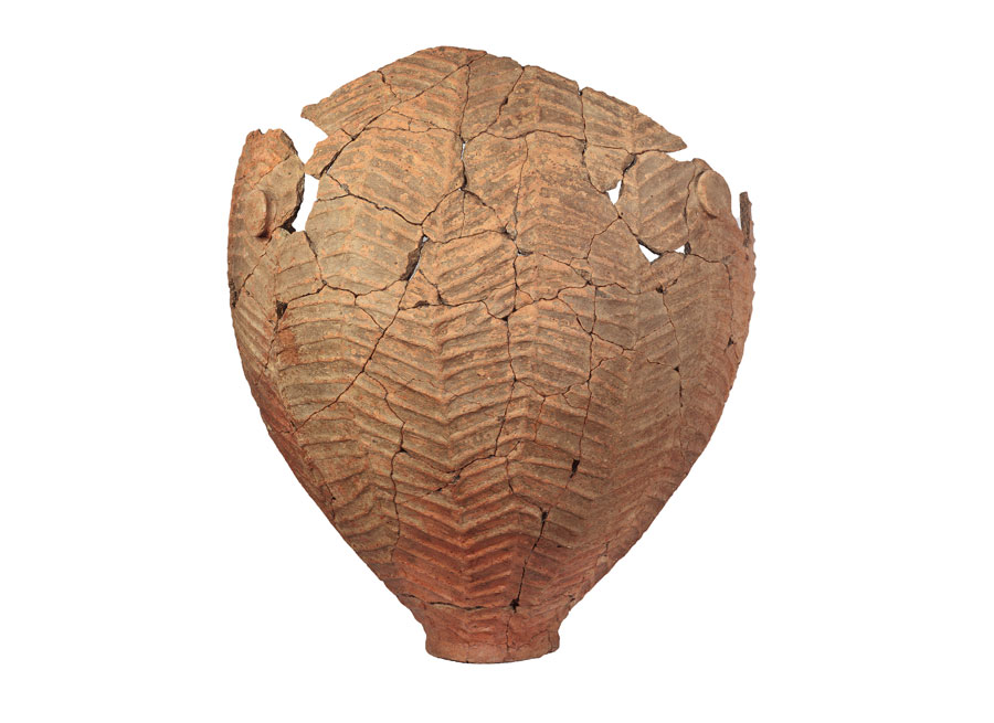
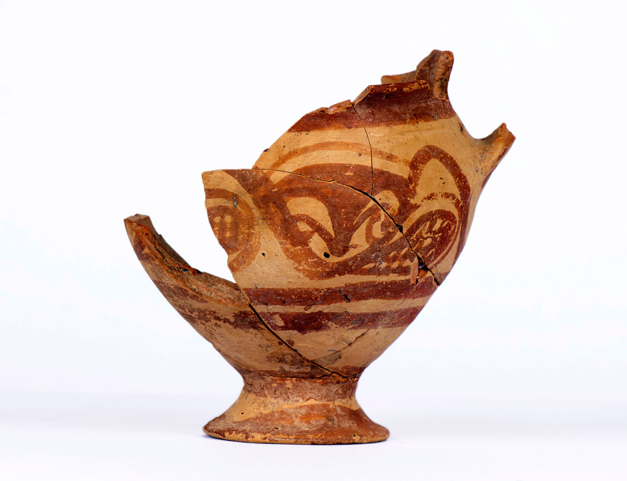
The building remains are quite dense and the habitation phases are consecutive. The area had been filled with small stones and sherds so as to level the ground before the construction of the buildings. In most cases the walls are built in the fishbone technique: they consist of two parallel rows of stones, the space between which is filled with smaller stones. The maximum height preserved consists of two or three rows of stones. Also, stones with specially formed inlets were found close to the walls. These inlets were intended for wooden posts supporting the roofs or were the bases for posts of roughly made sheds. Due to the disturbances of the area’s geomorphology, the walls have suffered damage. In addition to small rooms, it seems that relatively larger buildings did exist, including the typical ‘corridor house’ of the period. The pottery includes a wide range of shapes and vessel types; coarse ware, pithoi, jars, cups, bowls/phialae, sauceboats, but also rare types such as fruit-stands. Particularly important finds are the clay spit-support with an animal shaped ending, as well as a clay stand or brazier in the shape of a mask. On pottery, relief rope decoration is quite frequent, whereas incised or painted decoration is rather rare. Among the characteristic finds dating to the EH III period are the vessels of the type called ‘ouzo-glass’ and the clay anchor-shaped objects.
A large number of clay loom weights, stone mortars and grinders were found. Obsidian blades and chips, bronze objects – mainly tools, a dagger and a pendant, as indicated by the hole on its upper side, were also unearthed.
The long period of occupation and the large settlement area indicate its central (administrative) role in the area of Helike during the 3rd millennium. Moreover, it has been established that early proto-urban centers were being formed in the Peloponnese during this period and the extended Early Helladic settlement in Keryneia should be included in that group (note 11). Smaller settlements, like the one in Rizomylos, remains of which have been found near the seaside and are also dated to the EH II-III (note 12) were probably dependent on this central settlement. I believe that this smaller seaside settlement, located at a distance less that 500 m from our excavation, was the harbor of the larger settlement center in Keryneia.
New Railway Track Athens-Patras
I. Aigeira, Almyros site (Map, nr. 1)
In the area of ancient Aigeira, at the seaside site of Almyros to the west of Mavra Litharia and to the south of the existing railway track, part of an ancient cemetery has been excavated, spreading over an area of about 1000 sq.m.
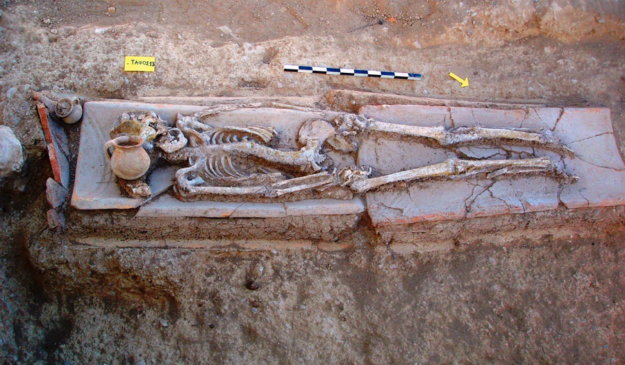
In the southern section of the site Late Hellenistic tombs have been revealed. Nine graves have been found in total, five of which were tile-covered, while the rest were pit graves. They are oriented from north to south. Lamps, coins, small bowls with out-curving lip, unguentaria, a juglet and a lopas were among their grave goods.
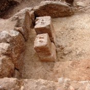
In the eastern section of the excavation a rectangular construction was found, made of large worked conglomerate stones, orientated from east to west. It measures 4,35m in length, 2,30m in width and is preserved to a height of 2,30m.
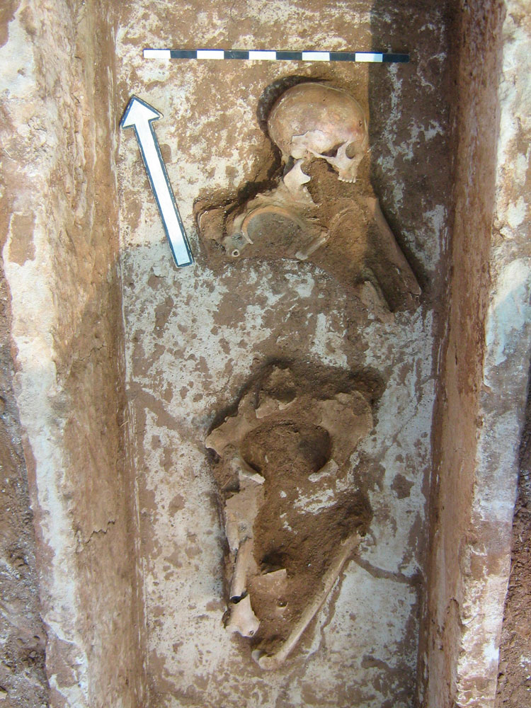
Two stone sarcophagi were located to the south of the construction. They were orientated from north to south and their faces were covered with white plaster. The covering slab of the first was slightly removed from its original place. In the interior, the skeleton was preserved with the scull turned to the northeast. The burial was accompanied by a lamp and an iron strigil. The burial in the second sarcophagus had been disturbed. A small black-glazed lekane with its lid was found in the southwestern corner. The grave goods date to the 4th cent. B.C.
In the area around the sarcophagi, two built cist graves and two shaft graves were revealed. The grave goods consisted of lamps, a skyphos (bowl) and an iron strigil.
ΙΙ. Platanos (Map, nr. 3)
On a field survey that was conducted in the area of the modern Platanos escape tunnel OX2, two tile-covered graves of the Late Roman period were located on the slope of the road leading to the construction site. The ensuing excavation revealed 16 burials of varied orientations. Most of the tombs were tile-covered and were found in a depth of 0,50m -1,50m below the surface of the ground. In 10 graves the skeletal remains were preserved, while six burials were accompanied by vessels, mainly jugs. To the southeastern section of the cemetery the remains of a carelessly built wall were found, probably dating to the same period.
A layer of pottery covering an area of about 100 sq.m. was located in the course of the digging on the western part of the Platanos tunnel’s face; its maximum thickness was 1,50m. Although a great amount of pottery, mainly of Hellenistic date, was found, no building remains were traced.
ΙΙΙ. Τrapeza (Map, nr. 4)
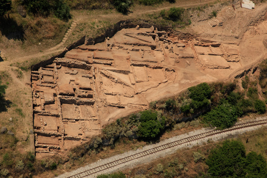
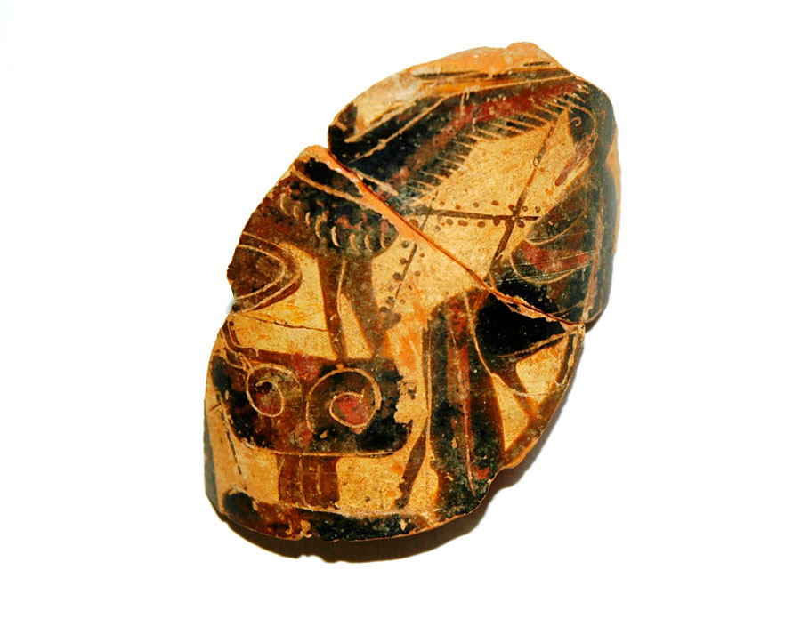
The works for the opening of the Trapeza escape tunnel ΣΔ 2 at the site Giannia, at the seaside area of Trapeza, brought to light the remains of buildings in an area of about 1.800 sq.m. The buildings belong to a settlement that was occupied from Archaic until Hellenistic times (6th-3rd cent. B.C.) (note 13). Only fragmentary remains are preserved from the earlier phases, except for one Classical building, which is preserved in good condition as it had been covered by a road constructed in the 4th cent. B.C. Vessels and figurines dating to the 5th cen. B.C. were found within the building. However, the most significant find was a terracotta relief plaque with vivid traces of colors, red and light blue. The relief decoration showed a composite figure with the head and torso of a human female and the lower body of a snake. The figure is identified as Scylla.
According to the excavation evidence, the settlement had been remodeled in the course of the 4th cent. B.C. The streets were then drawn almost parallel to the sea and oriented from NW to SE, while the buildings were adjusted to the steep inclination of the ground.
The roads were paved with gravel and beaten earth. Due to the profound altitude difference to the north, toward the sea, a strong retaining wall had been built and was uncovered in the eastern section of the excavation. This wall had also formed part of a building that faced the street traversing the settlement.
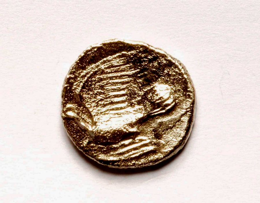
Six building complexes or parts of them were excavated, dating mainly to the last two phases of the settlement’s occupation, i.e. during the 4th and 3rd centuries B.C. This dating is based on the numerous coins from the extensive destruction layers of the two phases. The destruction layers remained intact from later intervention, sealing in this way the contents of the rooms, since the site was not re-occupied after the second half of the 3rd cent. B.C. (note 14). It is worth noting that the buildings show potential traces of destruction due to an earthquake. The pottery consists of storage vessels and amphorae. Smaller vessels: skyphoi, oinochoae, plates, bowls and lamps were also found. Many metal tools and bronze hooks were unearthed and are related to the everyday activities of the inhabitants. At the same time, the great amount of bronze coins – mostly small subdivisions with low purchasing value that were used in everyday transactions – are derived from various mints (Corinth, Sikyon, Athens, Kleonai, Pellene, Kleitor, Argos, Hermione, Phleious, Alea, Elis, Leukas, Chalkis, Istiaia, Lokroi Opountioi, Larissa, Amphipolis, Byzantium, Salamis Cyprus, Miletus, Ephesus, Achaean League, Epirote League, Thessalian League) thus confirming the intensive trade transactions and the circulation of people and products.
The remains of the ancient settlement extend as far as the sea, where a small shallow creek is formed and the road from Voura toward the seaside zone ends. Voura was an ancient city in the hinterland of Achaea, at the modern site of Kastro, Diakopto (note 15). Consequently, the above mentioned data lead to the conclusion that the settlement in the site of Giannia was the harbor of Voura.
Dr Erofili Kolia
Director of the 6th Ephorate of Prehistoric and Classical Antiquities of Patras