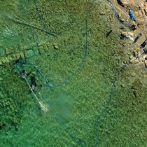

Underwater surveys have continued for the fourth successive year at the ancient harbour of Lechaion by the Lechaion Harbour Project – a collaboration of the Ephorate of Underwater Antiquities and the Danish Institute at Athens under the direction of the Ephorate. The mission of the Lechaion Harbour Project is to digitally survey, excavate, study, and publish the submerged archaeological remains of Lechaion.
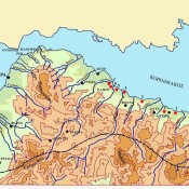
The harbour has played a pivotal role in the long history of ancient Corinth. Its location, at a distance of approx. 3 klm from the ancient city, and the fact that it faced west have undoubtedly been significant factors for the various flourishing periods of Corinth.
Dr. D. Kourkoumelis (Ephorate of Underwater Antiquities) and Dr. B. Lovén (SΑΧΟ-Institute, University of Copenhagen) are heading the surveys which are funded by the Augustinus Foundation and the Carlsberg Foundation.
During October-November 2016, the Lechaion Harbour Project has conducted excavations and digital mapping in the area of the Entrance Channel, at the Outer Harbour.
Also, for the first time detailed digital topographic maps of the harbour remains belonging to the Inner Harbour were made.
The most important results of this year’s season were the following:
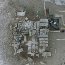
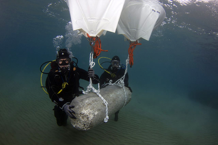
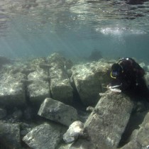
- Part of the quay (117mx5.4m) at the Inner Harbour, south of the entrance, was mapped digitally and manually. The height preserved is two blocks. However the quay has not been fully revealed yet. Its documentation and comparison with harbour structures of the Outer Harbour excavated in the last years will offer valuable information for its dating. Apart from that, other visible remains of harbour works in the area of the Inner Harbour along the channels were digitally mapped and a detailed topographic registration of the dimensions of the harbour basins was completed. Furthermore the remains of a monumental structure in the middle of the central harbour basin were mapped digitally and manually. The structure’s dimensions are 9x9m and the preserved height is 3 blocks. It consists of rectangular blocks with cutting marks. Its use remains unknown.
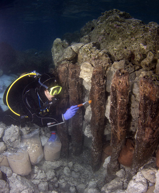
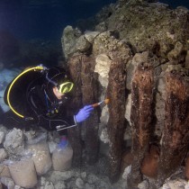
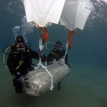
- At the west side of the Entrance Channel, the remains of vertical wooden caissons –probably belonging to the eastern mole– were located and mapped during previous excavation seasons. This year, part of the mole’s west side was excavated, and 40 caissons were found in situ (max. preserved height 1.30m) along the west face of the mole. This structure seems to be related to a stone structure, the remains of which are also preserved. The survey of the preserved wooden parts and the possible presence of other organic remains in the area will offer important information about the harbour construction methods in Late Antiquity. Conservation and protection works on the wooden finds were carried out in situ.
- In the northeastern part of the Entrance Channel, in a distance of 46.6 m from the shore, an underwater excavation of the remains of a structure was conducted. The structure is 23.4m long and faces east to west. This structure seems to define the eastern and the northern border of the ancient harbour’s face. It consists of big blocks with marks of rectangular and T-shaped cuttings. In many of the blocks metal rivets are preserved.
Furthermore geophysical surveys and sampling of sediment cores were carried out in collaboration with the University of Patras and the Harokopio University, focusing on the harbour basins and the Inner Harbour canals. The aim of these surveys was to study the stratigraphy and geomorphology of the harbour basins and the canals that connected them, in order to reconstruct the palaeogeography of the area and to locate possible submerged remains of harbour structures and other finds.