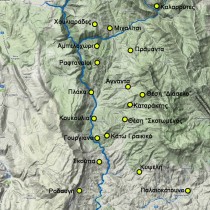
During the Byzantine period, the district of Tzoumerka, initially was to be joined administratively to the province of Palaia Epirus and later to the theme of Nikopolis. It would experience repeated barbaric raids perhaps not as intense as the rest of the more easily accessible parts of Epirus and mainly the urban centres of late antiquity. It would also suffer pillaging, conquest by the Slavs, a temporary Bulgarian occupation and after 1204 will be part of the Independent State of Epirus.
In general, we can assume that this region’s historical course coincides with that of the rest of Epirus. Since, however, the research is still at an early stage while the very few existing facts offer limited information we shall have to resort to generalizations and assumptions about its position and course within the framework of the Byzantine Empire.
To be precise, there is no evidence and testimonies about the population and its fluctuations, the form and places of settlement, any military operations and the overall economic, political and social organization. Nevertheless the site of ancient Athamania can be described as being a strategic pass that joined Epirus with Thessaly and controlled a section of the overland road network. The importance of this had already been noticed from classical antiquity as proved by the fact that it was often claimed by different clans (note 1).
Given that Epirus’ needs for contact and communication between itself and neighbouring regions did not essentially change during the Byzantine Empire, it seems reasonable to assume that the same area continued to maintain its prominent position secured by its geography. It, therefore, functioned as one of the main routes to Thessaly with which Epirus enjoyed special relations and a parallel historical course.
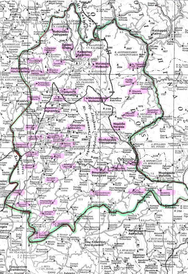
The importance of the steep Athamanian mountains increased during the period of the “Despotate of Epirus” as the region is not really far from the capital of Arta, through which also passed the main road directly linking Arta to Trikala and Epirus to Thessaly. Thus the isolated mountain range that is also a strategic pass finds itself, during the era of the Independent State of Epirus surrounding the latter’s capital and securing part of its overland communication. Its prominent position is no longer hypothetical. On the contrary, this is proved by the founding in the area of the Red Church of Voulgareli flanked by the corresponding Porta Panaghia in Pyle at Trikala (note 2). The two monuments are, in fact, placed near the two starting points of the highway which they also mark.
Additional information on the same period are drawn from two very important pieces of historical evidence which however cannot yet be attributed with complete certainty to the Tzoumerka region (note 3). More specifically, in a note from the bibliography of the Cromwell code 11 of 1225 (note 4) one of the Epirote manuscripts, its scribe, the reader Michael Papadopoulos hands down the information, among others, that he himself was the son of George the priest, a native of the theme of Ioannina residing in the droungos (Byzantine mountain military command) of Tzemernikos . Likewise in the 1321 Chrysobull (decree of the Emperor of Byzantium) (note 5) of Emperor Andronikos Palaiologos by which privileges were granted to the newly created metropolis as to the town of Ioannina, Tzemernikos is to be found among the five parishes of the theme of Ioannina. The two sources just mentioned prove that the region was inhabited during the Late Byzantine period. Moreover, its divisions in administration are revealed, since the term «drongos» (note 6) is used in a variety of Byzantine sources to describe administration in the mountains. This applies to its respective church division as it constituted a parish of the theme of Ioannina and subject to the Metropolis by the same name. The above facts combined with the production of manuscripts, lead to the conclusion that during the period of the Independent State of Epirus, not only was the region inhabited or considered strategically important because of its key geographic location, but it was also fully integrated into the structure and administration of both state and church, living, in fact, a period of general prosperity.
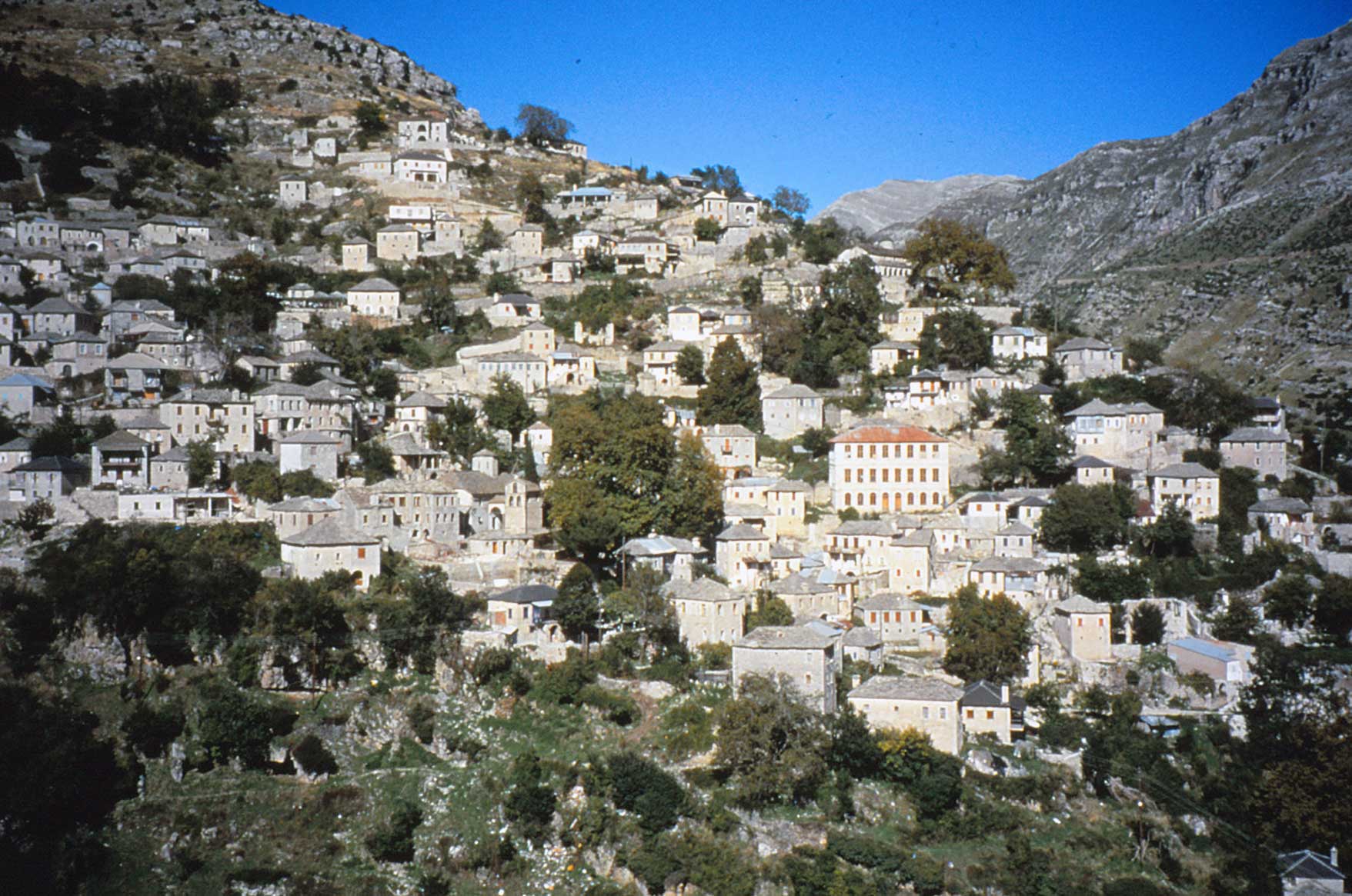
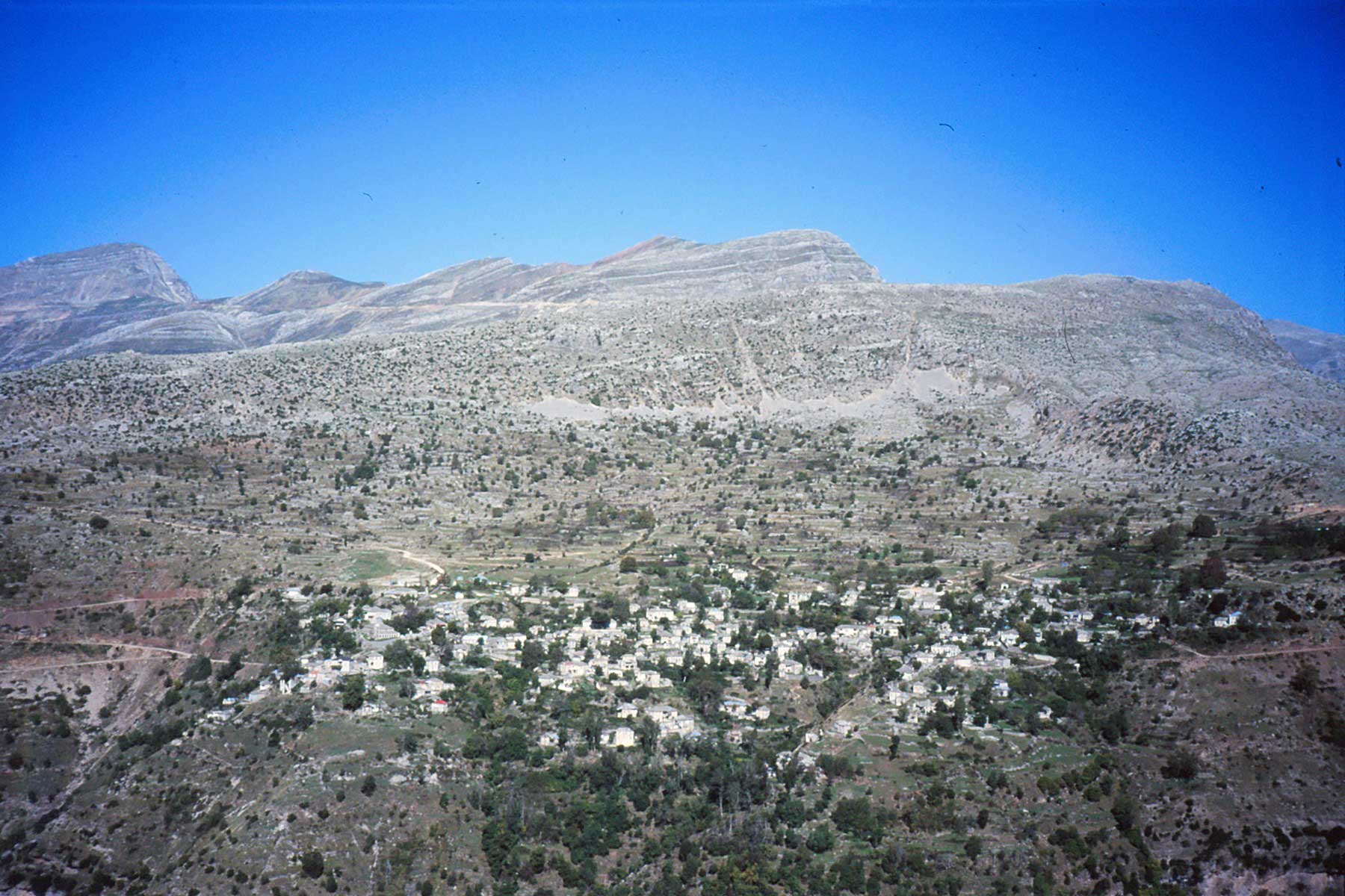
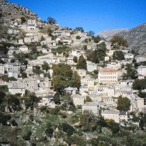
At the end of the 15th century the several centuries of Ottoman rule begins in the region which in fact obtains substantial privileges. Specifically, after the capitulation of Ioannina in 1430 and the surrender without bloodshed of Arta in1449 (note 7), the Ottomans attempted to subjugate the region valuing its key geographic position and great importance. In this way they would establish their dominance over wider territory and avoid any revolutionary uprisings which could happen in the region due to its mountainous and inaccessible geomorphology. However, as in other rural parts of Epirus, such as Eastern Zagori and parts of the Malakasios region, the inhabitants of Tzoumerka did not immediately surrender but continued to resist. Finally it was forced to capitulate in 1478 obtaining, however, a privileged state of semi independence and self government with particularly favourable terms (note 8). Moreover, some villages such as Kalarrytes and Syrrako were placed under the protection of the Queen Mother Valide Sultana because of their strategic position (note 9) controlling the Pindos passes. This resulted in its favourable treatment. Thus Tzoumerka did not experience the arbitrary behaviour and acts of violence of the Ottoman rulers as had other regions of Epirus (note 10). Instead and due to its relative autonomy, it would be a haven to many suffering Greeks who fled their homes in the plains and tried to settle in mountainous inaccessible regions.
The variety of references to this region in texts of Byzantine letters is thought to be a direct consequence of this region’s pivotal position, its strategic importance as well as the leading role it played in the period before the Roman conquest.
The terms Athamania and Athamanians (or Athamanes) are on the whole located in Byzantine literature (note 11) between the 5th century A.D. and the 12th century A.D. with a gap during the 4th, 7th, 8th and 11th centuries. Apart from the great time span, it is worth noting the variety of works that include relevant references and information. These are works of history, geography, travel, philosophy, literature as well as the most important Byzantine dictionaries. In addition there is valuable data to be extracted on the locations where the tribe of the Ancient Athamanians chose to settle, the latter’s proximity to other tribes, their relations with neighbouring territories and the region’s history and importance. Of course, these references are often repeated word for word from author to author.
In conclusion, the study of sources confirms both that the ancient Athamanians settled in parts of the region of today’s Tzoumerka and that they were the neighbours of other tribes of Epirus and Thessaly. It contributes to the historical course of all the region during classical antiquity. It offers valuable facts about its culture, and also rescues some traditions. Last, it proves its importance and strategic position since it constituted a pivotal point for neighbouring tribes, an importance that was maintained in fact during both the period of Roman rule and the Byzantine Empire.
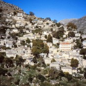
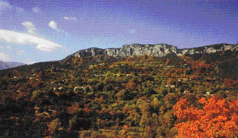
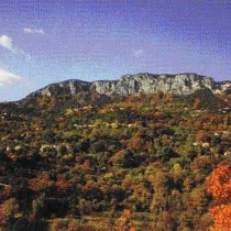
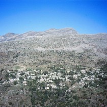
In general, the mountainous and arid Tzoumerka region has had a centuries old history. Its monuments from different periods as well as a variety of finds are irrefutable testimony to this history. However, most of the ancient monuments and almost all the finds remain unknown and undiscovered, buried under dense vegetation. Even the more easily accessible monuments, post Byzantine and of the recent past, with few exceptions, have not been adequately studied, enhanced and utilized.
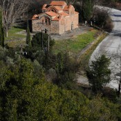
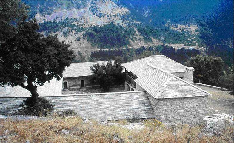
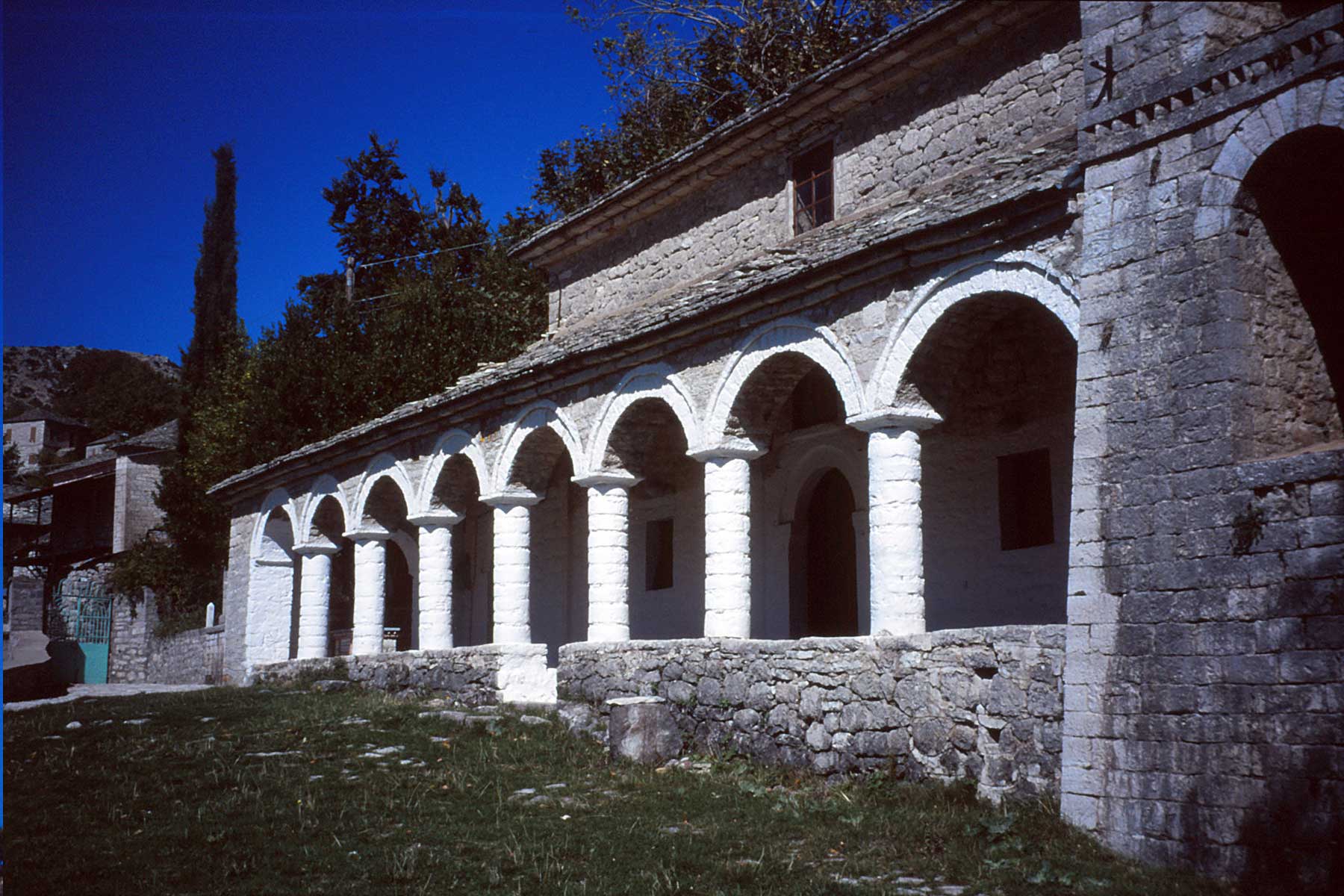
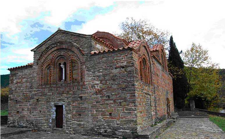
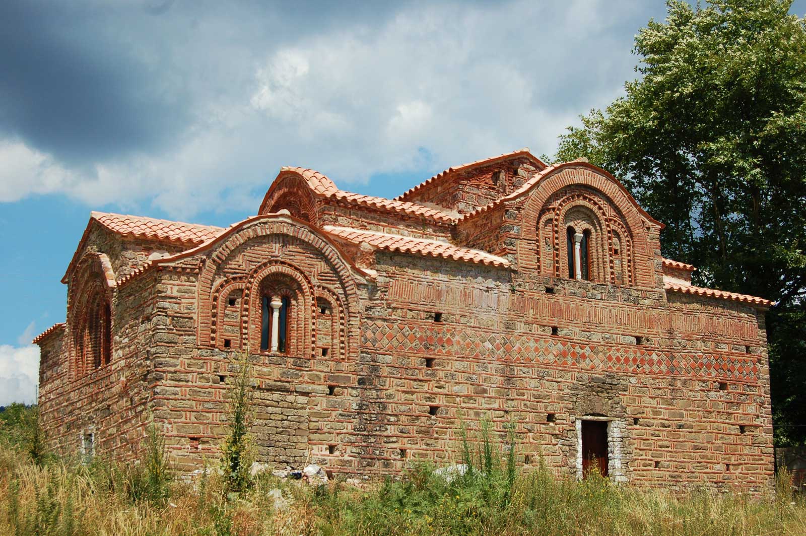
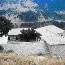
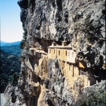
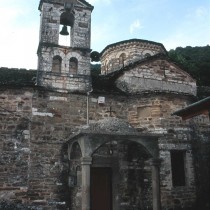
Panaghia Vella or the Red Church (Kokkini Ekklesia) is, to date, the only known surviving Byzantine monument of the Tzouerka region that proves the latter’s habitation and importance in the Medieval period. It is the Katholikon of a monastery apart from which nothing remains of the cells or the auxiliary buildings. It is located in the Palaiochori settlement, 3 klms south of Voulgareli (note 12) and right next to the highway that connected Arta to Trikala and Epirus to Thessaly (note 13) during the period of the “Despotate”. The church is dedicated to the Nativity of the Virgin Mary (note 14). It is, however, better known as the Red Church (Kokkini Ekklesia) because of the number of bricks that decorate its outer walls. It is also referred to as Panaghia Vellos, mainly by scholars, since for some time it has been a dependency/metochion of (subordinate to) the monastery by that same name. Likewise it is known as the “Vasilomonastero” (The Royal monastery) a nickname describing its original function as the Katholikon of the monastery, its importance and relations with the house of the despots of Epirus.
The very few surviving pieces of evidence make it very difficult to outline the church’s historical course. We can however pinpoint with some accuracy the year of its founding and its narration thanks to the surviving fragmentary inscription by the church’s donors (note 15) in the Katholikon above the west entrance to the nave. The text informs us that the church murals were realized during the 9th Indiction of the reign of Nikephoros I and his wife Anna Palaiologina. The mural of the church’s donors (note 16) survives parallel to the east side of the narthex. There have, of course, been several opinions as to the exact date of the Katholikon’s construction and wallpaintings depending on the reading of the inscription and the combination of the facts. The details of the construction and narration of the Katholikon are certainly placed at the end of the 13th century (note 17). The monastery was founded on a main road of strategic importance, quite far from the capital of Arta and is thought to be the most isolated among the district’s monuments. It must have experienced the height of its fame during the era of the Independent State of Epirus. At some point in time, we do not know when and while having fallen into decline, the monastery became a dependency/metochi of the Holy Monastery of Vella. After the founding of the Holy Monastery of St George in Voulgareli in the mid 17th century, the Red Church will be annexed to it and remain its metochi till the early 20th century. In the first decades of the 20th century, it is abandoned and in ruins. In 1927, A. Orlandos will publish it. In the 1950s it will be declared a listed monument. In 1967 it will suffer considerable damages by an earthquake that hit the region. Since then, extensive restoration work will be begun by A. Orlandos that will continue with few interruptions. Today the monument is being excavated, maintained and restored by the proper Ephorate of Antiquities while it has received considerable attention through articles, publications and studies of distinguished researchers and scientists.
Architecturally, the Red Church belongs to the school developed in NW Greece under the Independent State of Epirus and is known in research as “the School of the Despotate” (note 18). It is regarded as one of its important and characteristic monuments. It is a two columned cruciform church (note 19), almost rectangular (note 20) measuring 16x 9,15 m with a three-sided apse to the East and a rectangular narthex to the West. The masonry (note 21) of the Katholikon is cloisonné. Its brickwork decoration (note 22) is worth noting for the richness of its subject matter, the variety with which it is placed and the frequency of its appearance. Equally important as the katholikon’s architecture, are the finds within the church. These are the surviving sections of the original plaster iconostasis as well as fragments of the wallpaintings (note 23).
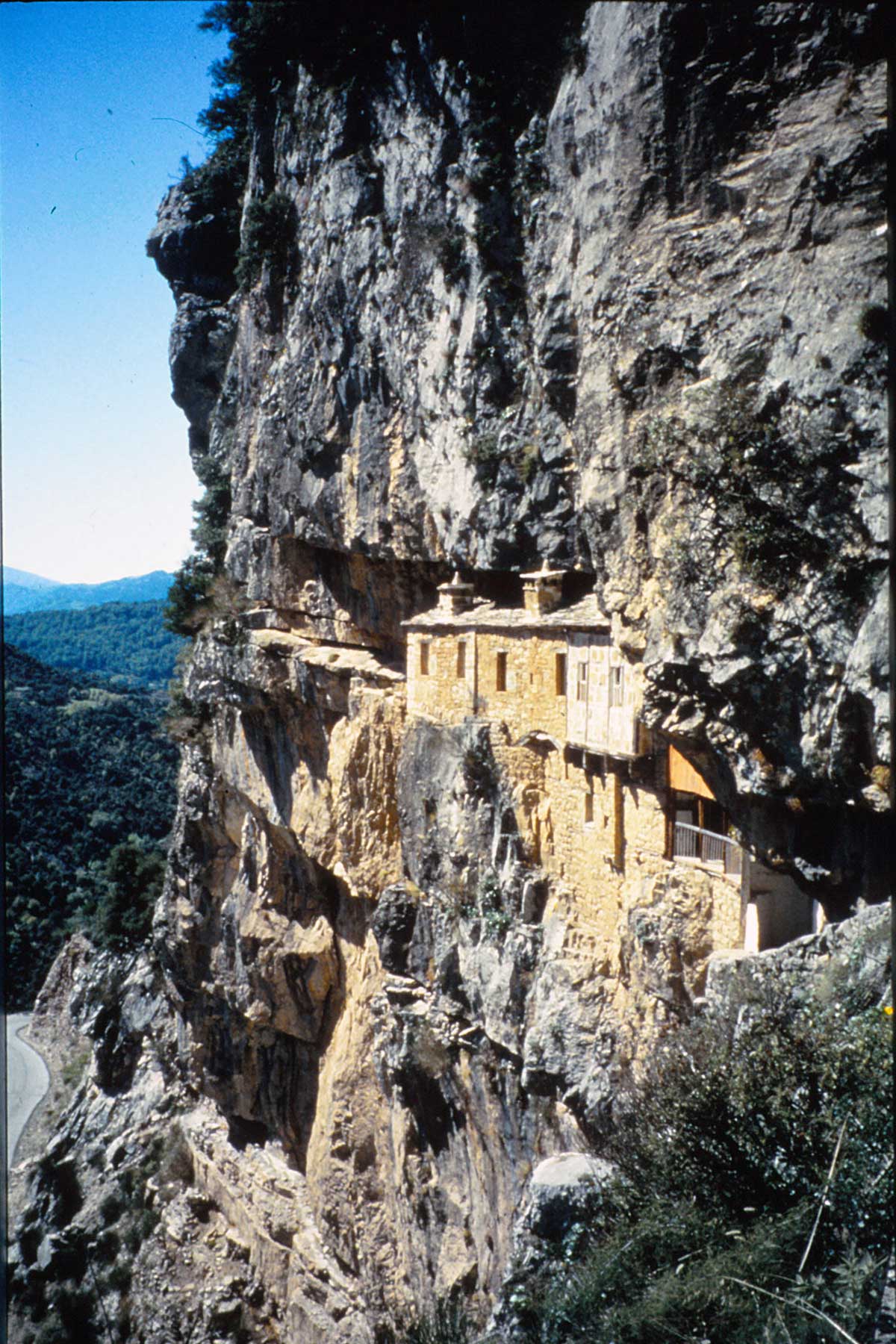
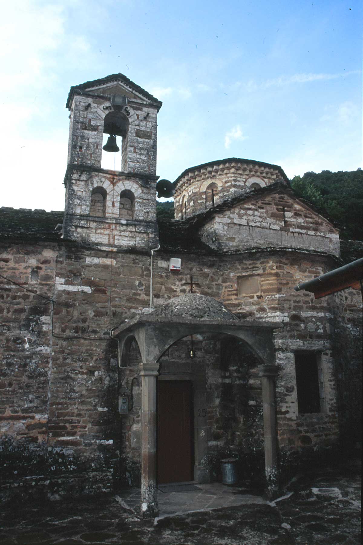
Throughout the difficult times of a centuries long Ottoman rule, the people of Tzoumerka were deeply religious and were primarily guided by God when coping with hardships arising both from their mountainous and barren land and from their conquerors. Their deep faith led to the construction of a multitude of monasteries and churches both in villages but also in isolated spots on mountain ridges.What is more, this building of church monuments benefited from the people’s isolation brought about by their geographical location and the relative independency granted them by the Ottomans. Most of the monasteries, apart from being religious institutions also functioned as places for hospitality, care for the sick, as shelters for the persecuted but mainly as spiritual institutions that preserved the language, the customs, traditions and above all the places where the idea of revolution and freedom took root in the hearts of the ordinary people during the dark times of slavery. Unfortunately the surviving monuments only date from the 17th century with very few exceptions. This may be justified considering the region’s troubled history with the successive burning of villages, their reconstruction or transportation. Even so their number is important in proportion to the data of the region.
The post Byzantine ecclesiastical monuments reflect several aspects of the life and culture of the people of Tzoumerka. However, their everyday life and popular culture from the difficult era of Ottoman rule down to modern times can be reestablished through a large number of various buildings such as fulling mills, water mills, bridges, private homes, schools and even entire settlements.
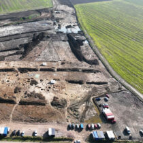
In order to promote and enhance the ancient monuments of Tzoumerka, the vegetation covering most of them, should be thinned out and got rid of. The second step, for all of the monuments, will be to make them accessible and clear up their surroundings. A topographic mapping follows, for the monument’s protection and the determining of their boundaries with geographic coordinates for them to be declared archaeological sites by the Services of the Ministry of Culture or to add to the files of those already declared, whenever necessary. For their more complete documentation excavation trenches can be opened at certain spots, which will also offer facts on their dates, while their complete photographic documentation is also thought necessary. It is equally important to mark them with signposts that will guide the visitor as well as the on site placing of information boards with facts about the monuments’ history and architecture. It would be useful to create seating resting spots with benches preferably in the shade, as well as installing electric lighting and supplying garbage bins. Last and in order for the visitor to have overall information about the monuments he/she can visit in the Tzoumerka region, a cultural map would be issued with the monuments marked and summary details about each one, while a relevant website could also be designed.
Priority should be given to ancient monuments that survive in a better condition. Indicatively these include the following: the citadel at Gouriana, the walls at the spot known as “Tsouka” in Palaiokatouno, the walls at Anemorrache, the remains of the settlement at Pramanda, the citadel at the spot named “Sirouno” between Chouliarades and Vaptistes. Also the complete fortification works such as enclosures or citadels where over the foundations or the walls of classical antiquity it is possible to uncover Byzantine repairs or additions and, in short, all the well known places with ancient remains.
The following places need to be directly surveyed in case of finding other Byzantine monuments:
-The surrounding region of Voulgareli in case of revealing remains of a settlement that would frame the Red Church complex of buildings.
-Ecclesiastical monuments that have been renovated during the first centuries of Ottoman rule, possibly replacing respective Byzantine ones e.g. the Holy Monastery of the Virgin’s Birthday or Mouchoustiou, the Holy Monastery of the Virgin’s Nativity or Chrysospeliotissa or Speliotissa, the Holy Monastery of the Virgin’s Dormition or Seltsou.
-The region near the Holy Monastery of the Prophet Elias in Kato Graikiko where, during the 1950s Professor S. Dakaris excavated Byzantine tombs.
-The former communities of Syrrakos and Kalarrytes which, after the Ottoman conquest, received important privileges, a sign that thriving and important settlements pre existed in these specific places.
-Ecclesiastical buildings founded on earlier buildings.
-Ecclesiastical monuments that according to local tradition were founded in the Byzantine era e.g. the Holy Monastery of Christo’s Presentation at Lepiana, the Holy Monastery of St Nicholas at Kalarrytes, the Holy Monastery of the Virgin’s Dormition or Kepinas, the Holy Monastery of the Annunciation or Vylizas, the Holy Monastery of St Vlasios in Proselio etc.
In addition, collecting information from the local population is extremely useful to research as well as concentrating written testimonies from researchers of history, local traditions but also from literature of the region related to places where earlier ruins have been located of fortifications, ancient walls, tombs, tiles and shards, since it is very likely that apart from the recorded sites, there may be others with ancient or Byzantine ruins.
Any operation, however, for uncovering enhancing and utilizing the monuments of Tzoumerka whether ancient, Byzantine or post Byzantine should be undertaken with respect for their unique physiognomy and with the aim to maintain the character both of the monument itself and of its surroundings. For this reason, the operations should be undertaken with the cooperation of the proper services of the Ministry of Culture and based on approve surveys prepared by specialists.
The route covered between this study’s writing and the carrying out of archaeological research and interventions on the Tzoumerka monuments both seems to be and is in fact long and arduous. Moreover, sole responsibility lies with the Ephorates of Antiquities in charge. Nevertheless, there is still a broad scope for activity that can be undertaken by the region’s people and cultural institutions as well as any person interested.
Moreover, the preparation of this study alone, with the concentration of the most important facts and literature related to ancient Athamania and Byzantine Tzemernikos can be the starting point for future scientific endeavours both general and specialized as well as acting as a catalyst in presenting the region’s history and monuments.
Konstantina Zidrou
Archaeologist, Doctoral Candidate of Archaeology PhD University of Ioannina