Although computer models of archaeological sites are ideal software tools for managing spatially referenced data and commonly used to yield insights which contribute to the protection of heritage materials, some scientists question their credibility, calling for these long-term trends be “ground truthed” in order to ensure that calculated rates of change reflect observed phenomena “in the field”. This is particularly true in areas which tend to experience more pronounced and cumulative impacts of modern climate change.
A recent study by Michael J. E. O’Rourke from the University of Toronto, published in Open Archaeology, provides a new perspective on the severe impacts of escalating climate change on the heritage resources of Canadian Arctic. Referring to the application of Geographic Information System (GIS) analytical methods in assessing the threat of shoreline erosion to archaeological sites in the Canadian Arctic, it details steps taken to review the quality of the GIS model in light of a discrepancy with rates observed during annual survey visits.
How reliable is GIS?
Using GIS methods to compile shoreline positions from archival aerial photography helps indicate valuable long-term trends when assessing shoreline erosion in the vicinity of archaeological sites. The author observed, however, that single episodes of extreme erosion resulting from increasingly volatile weather patterns in recent years have a serious impact on the reliability of shoreline erosion models, suggesting the use of more current imagery sources procured over shorter time intervals.
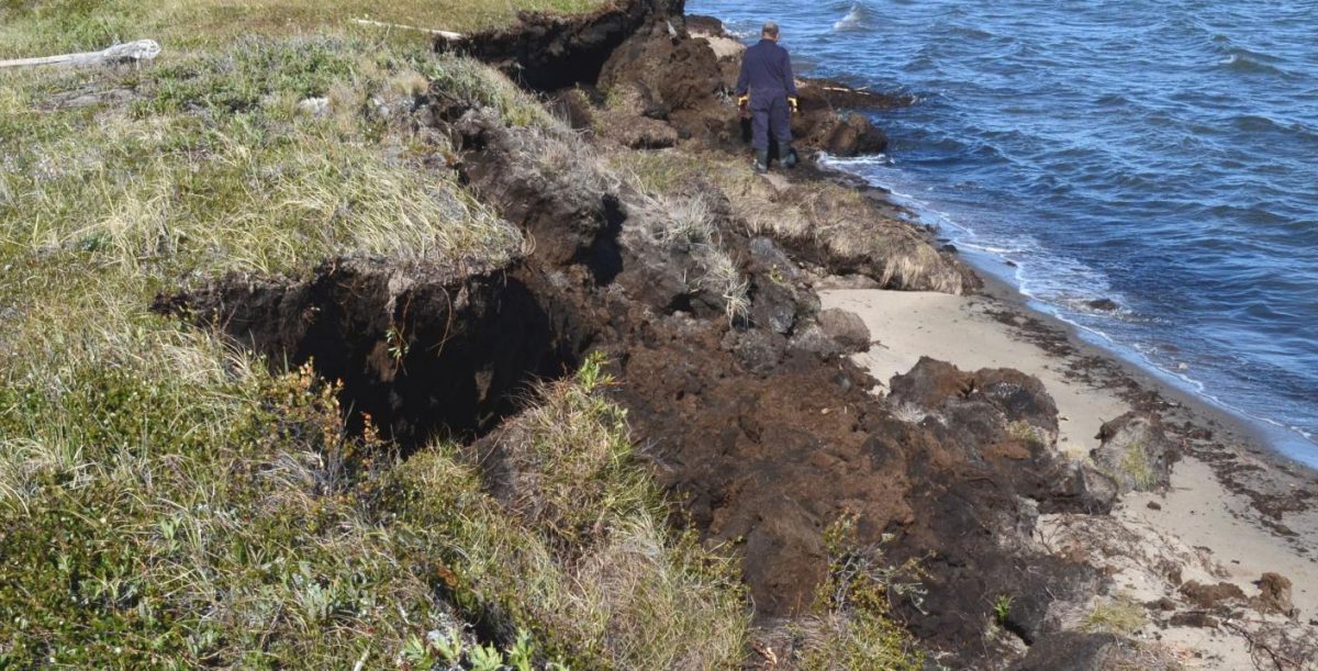
In this case, researchers produced a historical model of shoreline erosion for the Kugmallit Bay area, located along the Beaufort Sea coast in the Canadian Northwest Territories and processed the photography using ESRI’s ArcGIS software and the U.S. Geological Survey’s Digital Shoreline Analysis System. To assess the accuracy of this model they conducted two field surveys in 2013 and 2014 and found that the model significantly played down the change rates in the vicinity of Imnaaluk. Only then, the model was reviewed for errors and revised using recent satellite imagery secured through a Digital Globe Foundation Imagery Grant. Finally, they accounted for weather and sea-level records to determine the possible cause of the observed discrepancy.
But the review of analytical methods actually suggested that the model was an adequate means of calculating long-term trends in coastal change rates. The weakness of the model, however, was related to its lack of recent temporal resolution, which proves necessary to account for periodic episodes of extreme erosion taking place within the Kugmallit Bay area.
Scientists recommend using the system with caution: While change rates generated by such methods can be useful in highlighting areas at risk in a general sense, they can be limited by the increasingly volatile weather conditions. Given that rates of erosion within the study area reach as high as nine meters of shoreline loss per year, semi-regular imagery updates would be required to adequately manage coastally situated archaeological features.
“O’Rourke provides a clear, well-researched perspective on the serious impacts that climate change is having on the heritage resources of northern coasts”, says Dr. Christopher B. Wolff from the University at Albany. “As an archaeologist who studies Arctic and Subarctic coastal peoples, erosion associated with intense storm activity, loss of permafrost, rising sea levels, and increasing human activity is devastating to comprehend; however, this study not only documents those processes, but provides a means to examine their highly variable impacts that, hopefully, can lead to constructive ways to prioritize research and mitigate destructive processes in this extremely important region.”
