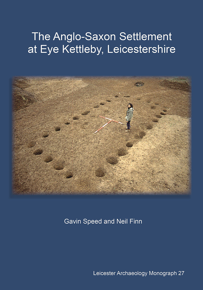
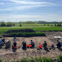
In the mid-1990s, one of the largest known early Anglo-Saxon settlements in the country was excavated by University of Leicester Archaeological Services at Eye Kettleby in Leicestershire. Now the results of the work have been published in a new book titled The Anglo-Saxon Settlement at Eye Kettleby, Leicestershire. The book forms the latest addition to the long-running Leicester Archaeology Monograph series from the University of Leicester.
In this blog, co-author of the new book – Dr Gavin Speed, Project Manager at ULAS – looks at some of the key discoveries from the project.
Early medieval Britain (and particularly the 5th to 7th centuries AD) are often termed the ‘Dark Ages’, it was a time of social, political, and economic change, and of increased migration following the collapse of Roman rule in Britain. It is a period poorly understood, due to the near absence of written records. Archaeological evidence is therefore of the upmost importance, although the archaeological remains are often frustratingly elusive too.
Our understanding of early Anglo-Saxon archaeology has, however, developed significantly in recent years, due to an upturn in both the recognition of the structural evidence, developing understanding of the material culture, and new developments in scientific studies. The results from Eye Kettleby – a seemingly unremarkable field on the outskirts of Melton Mowbray, Leicestershire – uncovered extensive, and well-preserved, remains of an early Anglo-Saxon settlement. Over 50 structures, of both post-built and sunken-featured type, along with other settlement features were uncovered. The results offer a significant contribution to wider understandings of how people lived at the time.
Situating Eye Kettleby
The settlement lay in the valley of the River Wreake, a tributary of the River Soar in Leicestershire. This area lies on the edge of one of the most active migrant settlement areas from the mid-5th to 7th centuries AD, a region of catchment rivers flowing into the Humber (Wreake, Soar and Trent) and the Wash (Witham, Welland, Nene, and Ouse).
The settlement lay on relatively flat ground, on terrace gravels on a tongue of land between two small streams. The place had seen significant activity in the prehistoric period. Most significantly, an early Bronze Age monument complex, including paired ring ditches and enclosures, became the focus for a cremation cemetery that was in use periodically over several centuries during the early to middle Bronze Age. There appears, however, to have been no significant human activity on the site itself between the late Bronze Age and the mid-5th century AD, although there was human activity in the wider vicinity (Iron Age and Roman sites are known in the vicinity).
Chronology and Phasing
The Anglo-Saxon settlement probably covered up to 3.5 ha, around the earlier prehistoric monuments. Evidence was found for around 50 structures, along with fire-pits, many other pits, and boundaries.
The artefactual evidence –pottery, brooches, loom weights and combs – together with radiocarbon dates and structural forms indicates that the main settlement was active from the mid-5th through to at least the middle or later 7th century AD. Some of the structures showed evidence for repair or re-building, and in several cases intercutting or patently non-contemporary features demonstrate that the settlement had several phases. The various strands of evidence hint at some longevity and perhaps a shift in focus during the life of the settlement towards the east, into the area of the medieval village.
Two main groups of buildings were revealed, a larger concentration in the north-western part of the excavation site and a second concentration in the central and north-eastern part. Additionally, several outlying buildings were recorded in the southern part of the site. The western settlement area was the most densely occupied, in contrast the eastern settlement area was more dispersed, containing fewer post-built structures but more sunken-featured buildings. This area also included a large number of pits, though these were also more dispersed. Many of the buildings, particularly in the western settlement area, were orientated in the same direction, or else at right-angles to each other, indicating a degree of organisation and planning, which followed the contours of the slightly sloping land. Environmental factors may have influenced the orientation of buildings. Constructing houses end-on to prevailing winds, for example, would have minimised draughts around doorways in their long sides.
Establishing the population size of the settlement is no easy task, perhaps (given the finds and radiocarbon dating evidence) the settlement was active for either as little as 70 years, or as long as 180 years, with between four and seven post-built structures in use at any one time.
The geographical extent of the settlement extended beyond the limits of excavation, but perhaps not by very much. It was likely defined to the south and east, but may have extended a short distance to the western towards the stream. Overall, the settlement fits a more widely recognised pattern of early Anglo-Saxon unenclosed settlement, with no archaeologically defined boundaries delineating the area of occupation.
Architecture and Building Function
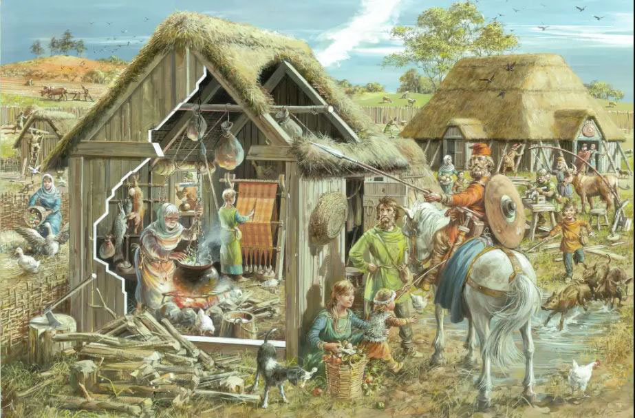
The remains of over 50 buildings provide a large dataset for analysis and comparison. Rectangular post-built structures (PBS) are often interpreted as domestic dwellings on settlement sites excavated elsewhere in England. Most of the larger PBSs discovered at Eye Kettleby may reasonably be interpreted as houses, although no floor surfaces survived to aid interpretation. Some possible internal features were evidenced by post-holes, perhaps indicating benches, beds, or other fixed furniture. Doorways were typically located towards the centre of one or both long sides of a building, and some had a porch. The buildings usually contained a single room, though some had an annexe and others an internal partition defining a small second room. The Sunken-Featured Buildings (SFBs) at Eye Kettleby are interpreted as ancillary structures, serving a variety of different functions: as workshops, weaving sheds, or for storage. Of the roughly 30 SFBs at Eye Kettleby, over half were of two-post or two-post derivative type, the most common form in England.
Farming and Food
The people of the settlement depended on food and other resources produced by mixed farming. Livestock provided meat, dairy, animal products and manure for the fields, as well as the animals being used for transport of goods and traction for ploughing. There was good evidence for the diet of the inhabitants. Analyses of the animal bones and charred plant remains recovered from the excavation, suggest that the inhabitants of Anglo-Saxon Eye Kettleby were a self-sufficient group. Cattle was the largest proportion of meat eaten, pigs and sheep provided the remainder, with limited amounts of game and fowl. Barley was the most numerous grain, followed by bread wheat, with some oats and rye.
There was also evidence for other activities within the settlement, including ironworking and butchery, along with weaving. Evidence for the latter included a number of objects (four spindle whorls, a pin-beater, two pins, and over a hundred loom weight fragments). Evidence for feasting in the form of fire-pits were also discovered. These were found in peripheral locations and may have been used for special feasts.
The number of combs from the settlement is small but notable; of particular interest is a comparatively rare type of display comb (sf 118/261). A fragment of casket mount may also have been an object of high status of a type often associated with female cremation burials. Another comb is so similar to a comb from Yarnton they may have come from the same workshop, showing links between Eye Kettleby and places further afield.
Placed Deposits
Placed deposits are interpreted as items deliberately ‘placed’ in the ground, rather than being lost or casually disposed of. Placed deposition were not an everyday occurrence, but evidence from elsewhere shows it was widely practised in Anglo-Saxon England. At Eye Kettleby, there were several instances of such activity, including two separate neonate human burials found within backfilled SFBs. The two infants were in SFBs in the central area of the site, and are likely to have died at or shortly after birth. The bodies may have been buried with care within the pits of abandoned or dismantled SFBs. Buried with one was a miniature three-lugged cup. The placed deposits at Eye Kettleby perhaps represent termination deposits in liminal areas of the settlement.
It is possible, if only hypothetical, that the Eye Kettleby settlement shifted further east from around the middle of the 7th century, below what remains of the now deserted medieval village.
Significance and Place
Even after almost three decades since the excavation, there are still no other excavated sites of the size of Eye Kettleby in Leicestershire, and few in the wider Midlands region. Nationally this is also true, with only a dozen or so similarly sized, near contemporary settlement sites excavated elsewhere in England.
Not only does this book detail the results of the Eye Kettleby excavations, but also assesses the known evidence for the early Anglo-Saxon period in the region. Our knowledge of this period in Leicestershire and Rutland has developed significantly in recent years, due to a relatively large upturn in structural evidence and enhanced understanding of the pottery and other artefacts, thanks in no small part to the Eye Kettleby excavations, which have added over 50 structures to the dataset and a large material culture assemblage that together offer a strong base for future studies both regionally and more widely.
The results from Eye Kettleby contribute significantly to advancing the research agenda in the East Midlands Archaeological Research Framework. The results are also of national importance, and since the excavation was completed, the site has featured as a case study in several academic research projects. Now with the results fully published, it is hoped that this data can be used for future research and help develop understanding of this, often poorly understood, period.
