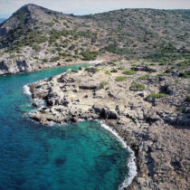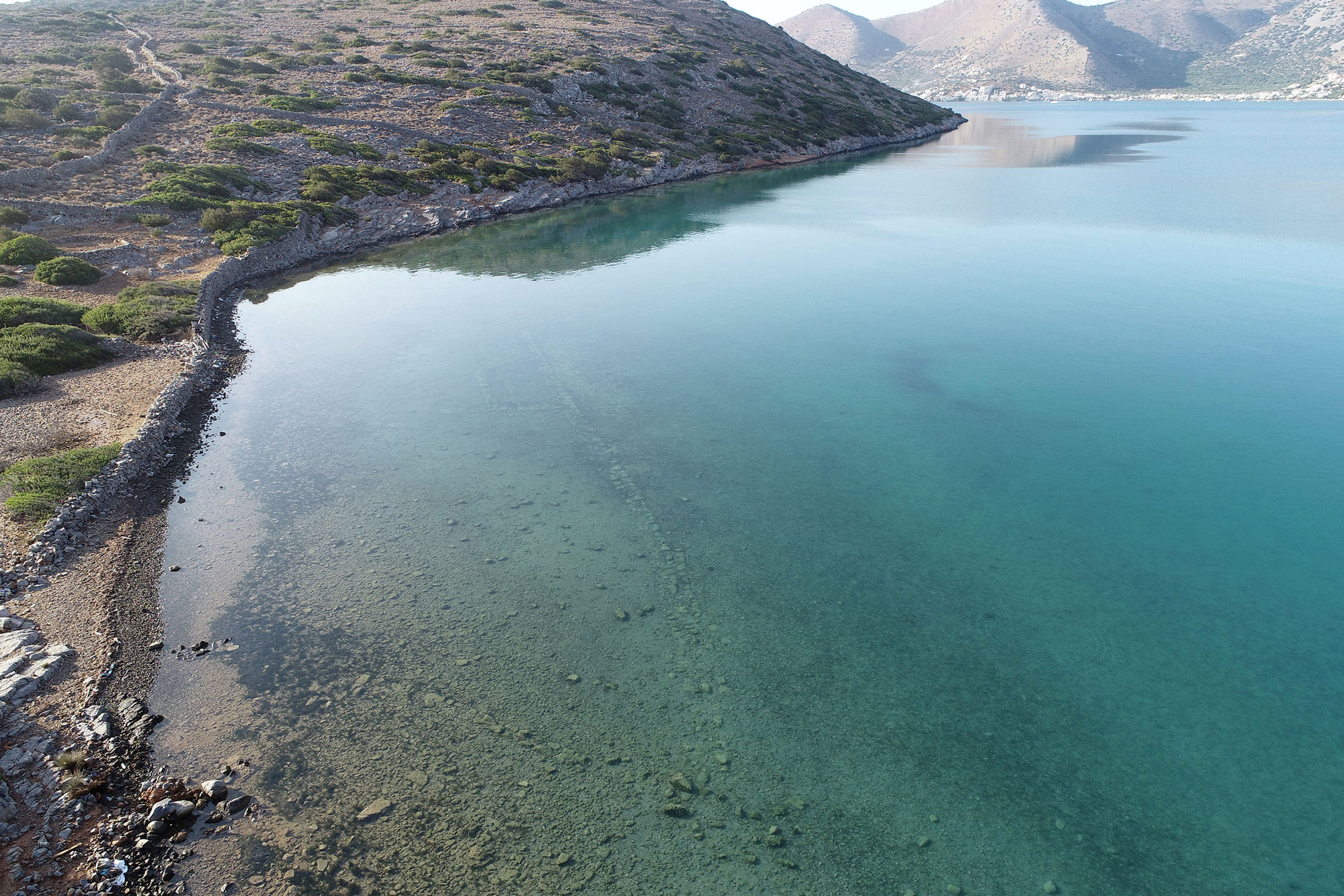

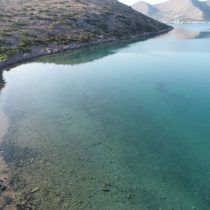
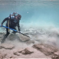
The Ministry of Culture and Sports announced that submerged archaeological evidence in the area and urban center of ancient Olous, today’s Elounda on Crete, has been investigated by an underwater research team from the Ephorate of Underwater Antiquities and a team of geophysicists from the Laboratory of Satellite Remote Sensing of the Institute of Mediterranean Studies. The research, conducted last October in much of Elounda Bay, involved volunteer divers and scientists of other specialties. This is the third research season in the five year project of the two bodies launched in 2017 and supported by the Municipality of Agios Nikolaos.
The city of Olous is quite clearly mentioned in ancient sources, mainly in inscriptions. Sporadic rescue excavations in the greater gulf region and especially in the area of Alykes and Poros, where the Kolokytha peninsula is joined to Crete, indicate the use of the site since prehistoric times. The city was particularly prosperous in historical years until the first Byzantine period, when it was abandoned and probably started to sink underwater.
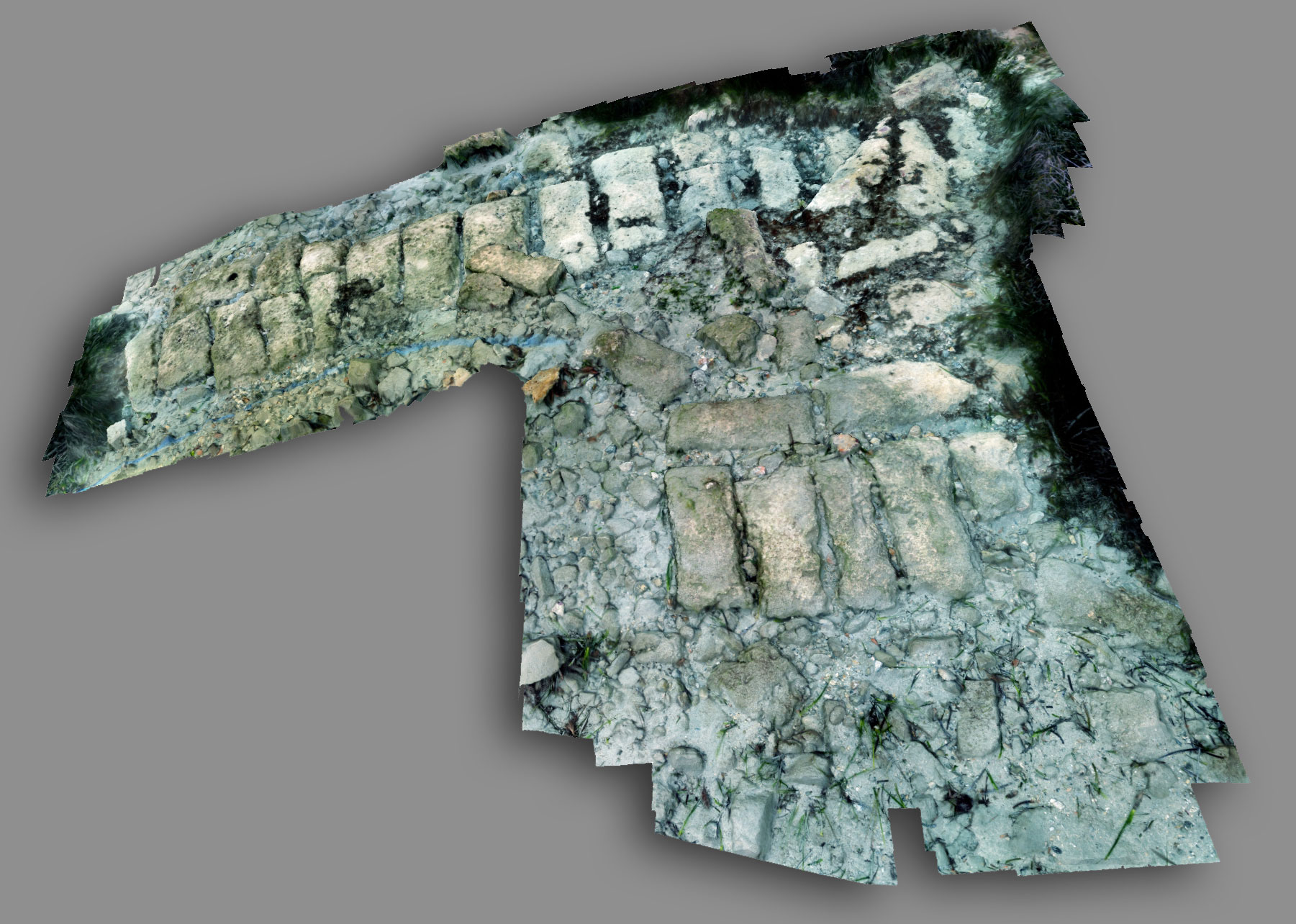
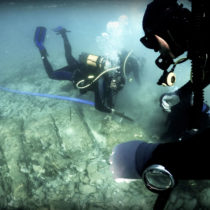
The research is twofold: the underwater overview of the coasts of Elounda Bay and the Kolokytha Peninsula and the documentation and mapping of the submerged structures on both sides of Poros, where the urban center of the ancient city is situated.
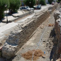
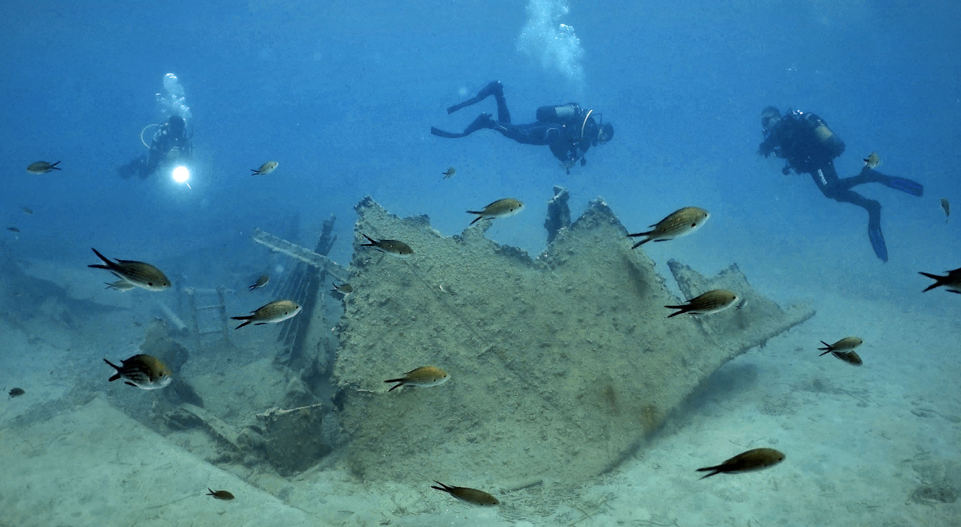
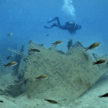
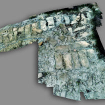
So far, submerged building complexes in Vathi and Melissos gulfs on Kolokytha as well as ancient quarries in three different parts of the peninsula have been located and mapped by methods of remote sensing and photogrammetry. In one of these, the research identified chiseled bollards and the loading platform. Also found were ships’ ballast, anchors, accidental rejects, signs of a Byzantine shipwreck, as well as remnants of a more recent 20th-century shipwreck.
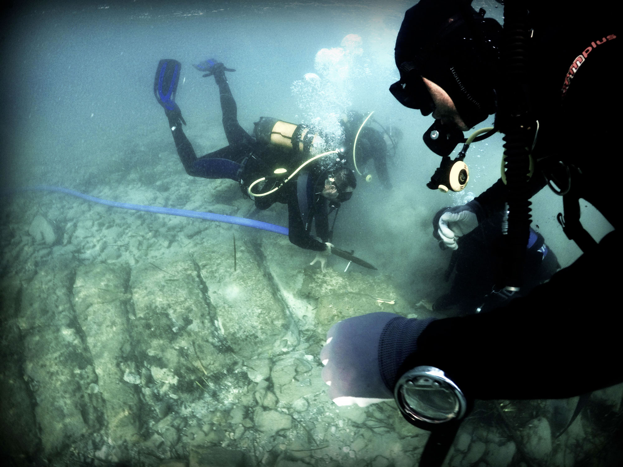
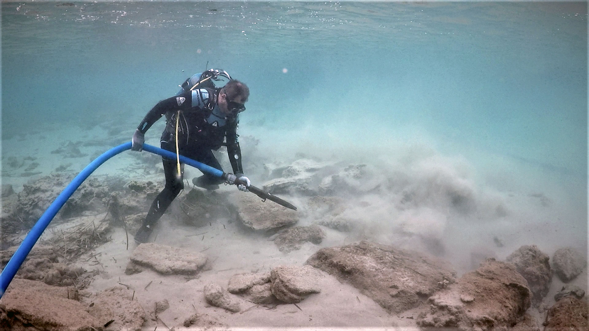
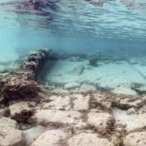
After surface clearing, remnants of the ancient city’s buildings, as well as parts of its fortification were located and are being gradually mapped in the Poros region, both on the two sides of the isthmus and in the adjacent bay to its southwest, at “Hava ton Lakko”, as it is known locally.
Evidence on the sea bed surface and the coast is completed by an investigation below the region’s sea bed by geophysical surveys (magnetic and electrical tomography), which show the existence of structures at depths of up to -1.5 m below seabed level.
All information is included in a digital geographic database (GIS), compatible with the one developed at the Crete Office of the Ephorate of Underwater Antiquities for the whole of the island’s marine cultural reserve.
Reconnaissance of Ierapetra
During the same period, the two bodies conducted a three-day reconnaissance of the port of Ierapetra to comprehend the remains of the harbour works and natural formations found in the area. The brief survey assisted by “Ierapetra”, the local cultural association, gathered necessary data to get a clearer understanding of the site. This data, along with information from ancient, medieval, and modern literature referring to the harbour, helps clarify relevant references to three harbour basins and the similarity of the ancient port with that of Alexandria, Egypt. The data will be used to study this important harbour of Roman Crete and the planning of more extensive underwater geo-archaeological research in the future.