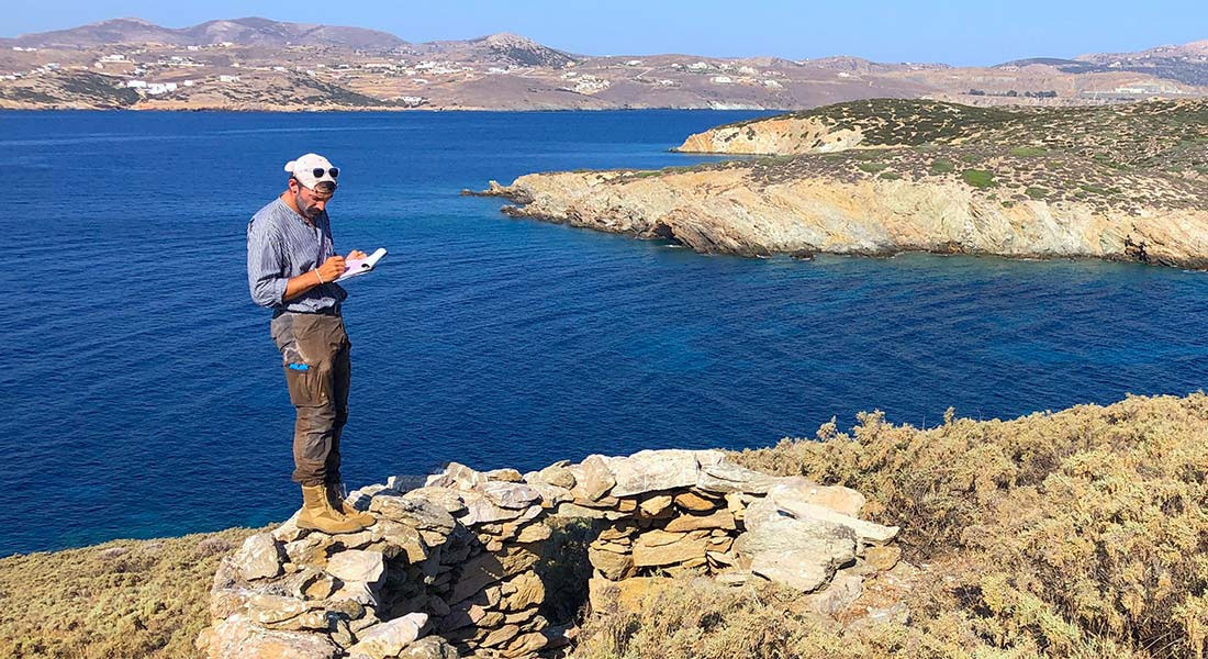


A group of scientists are studying the Cyclades, the Greek island group in the Aegean Sea, are looking for signs of early human activity. They are using technology such as laser scanning and magnetometry, which may be more effective and non-invasive than traditional archeological methods.
The Cyclades are an island group in the Aegean Sea, southeast of mainland Greece. Made up of more than 200 islands, the Cyclades attract millions of tourists each year for holidays on islands like Mykonos and Santorini. But recent studies have revealed that before the luxury villas took over the islands, the Cyclades have been home to humans in not only ancient Greece, but in pre-historic times as well.
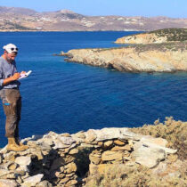
As part of several international teams, archaeologist Evan Levine from the University of Copenhagen is using groundbreaking technological methods such as LIDAR and magnetometry to shed new light on the archaeology of the Cycladic islands.
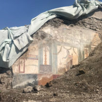
The Cycladic islands are already well-known for archaeological sites such as the sanctuary of Apollo on Delos and Akrotiri, a Bronze Age city destroyed by a volcanic eruption more than 3,000 years ago. But Evan Levine, a PhD Fellow in archaeology at the University of Copenhagen, and colleagues from Greece and the United States have just completed The Small Cycladic Islands Project, which studied studied 87 uninhabited islands, many of them for the first time.
“Our questions were simple. Were these now-uninhabited islands – some of which are big, some of which are small, some of which are rugged, some of which are very beautiful – used by people at any point in the past? If so, how were they used, and how does that change our perspective of these kinds of archipelago environments where big islands, small islands, coastlines, and the sea itself are all working together to dictate how people live?” says Evan Levine.
Tourism is an important factor in the Greek economy, but the country also has many unknown archaeological sites still buried in the ground, yet to be unearthed. By mapping out the areas of particular archaeological interest, Evan Levine and his colleagues are helping guide future development in the region, encouraging more sustainable tourism and protecting Greece’s cultural heritage. Their collaboration with the Greek Ministry of Culture has even resulted in the entire island of Polyaigos – the largest uninhabited Aegean island – being designated a protected archaeological site.
Lasers and magnetic waves
When you think of archaeological fieldwork, you might imagine dig sites and excavations. Careful as archaeologists may be, digging disturbs the area of interest. Evan Levine and his colleagues have been using modern archaeological techniques that are less intrusive and have not been used extensively in The Cyclades previously.
One of these methods is magnetometry – the subject of a recent publication in the Journal of Archaeological Science.
“Magnetometry is a technique that had never been used on these islands, so we weren’t sure if it would be effective. We use something called a gradiometer to record the ground’s magnetic signature as you walk across it. Different objects in the ground present different magnetic properties, which we use to see what’s under the ground. Magnetometry helps us find everything from stone walls and buildings to interesting events like ancient lightning strikes and human and natural activity that affect soil magnetics,” says Evan Levine.
“We’re trying to understand how ancient sites may have looked without having to completely excavate everything. Because archaeology is a destructive science, our goal is to document as much as possible to make sure that we’re digging in the right place and asking the right questions when we do excavate.” says Evan Levine.
Alongside magnetometry which helps document individual sites, Evan and his colleagues are using LIDAR to map out entire islands from the air.
In short, LIDAR works by shooting pulsating lasers from an airplane or drone. The laser pulses penetrate through vegetation and provide a clear image of the surface topography below. It has been used previously to discover lost cities in Mesoamerica and Southeast Asia, but is a relatively new method in Greece.
“There are several benefits of using these methods. They are non-invasive and can produce some amazing results. In the world of limited funding for research in the humanities, they allow you to be much more targeted than previously possible, using destructive methods like excavation much more sparingly to answer particular questions,” says Evan Levine.
LIDAR mapping of the island of Naxos is the topic of a recent article in Antiquity and will feature in the December edition of The Journal of Greek Archaeology.
Big histories of little islands
When using the methods that Evan Levine and his colleagues are applying, you find many things from several very different time periods all at once. While most archaeologists study particular periods, like Bronze Age or Classical Era, Evan Levine is using these tools to tell a new history of the Cyclades that spans thousands of years.
“We found everything from Bronze Age cities to Medieval castles and churches, and we may even have evidence of paleolithic activity on these islands,” says Evan Levine. “The responsible thing to do is to document all of it – from traces of exceptionally early activity to more recent archaeology like 19th century shepherd’s huts. It’s all part of the story of these places, and the work I have been doing allows us to think about how the earlier activity influences and interacts with the later activities.”
Many of their prehistoric findings are from 3000 to 1000 , periods when the region was home to the Cycladic culture, Minoans from Crete, and Mycenaeans from mainland Greece. But, surprisingly, Evan and his colleagues have also found artifacts that points to earlier human presence on the Cyclades.
“Some of our most exciting data focuses on the earliest colonization of the Cyclades during the Neolithic Period,” says Evan Levine. “These tools are allowing us to rethink how the earliest communities on these islands lived and interacted with the land and the sea around them. We definitely did not expect to find so much early material on such small islands, which clearly attracted humans for various reasons much earlier and in greater numbers than we previously thought,” Evan Levine says.
Methods like LIDAR, ground penetrating radar and magnetometry played a significant role in these findings according to the UCPH archaeologist.
“In some instances our methods have completely led to the discovery of the items we have found. In other instances, these tools have allowed us to do more than we otherwise would have, because they have made our search more targeted which allows us to document our findings more carefully,” he explains.
Future plans
Evan Levine plans to continue working with these methods and even more modern technologies that are new to the field of archaeology.
“My immediate plans are to work more closely with machine learning and LIDAR, which has led to some amazing results in other parts of the world. I’m lucky to be a part of all these ongoing projects where we can test new methods, and I hope that our findings can help archaeologists who are working in other areas as well,” he says.
“The happy biproduct of this is continued discovery about the diverse communities who have made what is, in my opinion one of the most beautiful and interesting parts of the world, their home for many, many thousands of years. And I’m hoping that our work will help preserve these islands by highlighting how much we have left to learn about them,” he says.
And this new research isn’t just about Greece, Evan Levine is working to bring his experiences using new archaeological technologies and methods back to Denmark. In 2024, he taught a course to undergraduate and master’s students at the University of Copenhagen about using cutting-edge digital methods to study the ancient world.
“Whether you’re studying archaeology like me or historical documents, these same tools are unlocking new ways to think about our collective past,” said Evan Levine.
“Tools like Generative AI and computational modeling are becoming key skills for historians and archaeologists, and my students at the university really took what I had to teach them and ran with it, producing some really exciting research.”
Evan Levine and his colleagues have published their work in the journals Antiquity and the Journal of Archaeological Science, and more work referenced here will be published this December in Hesperia and the Journal of Greek Archaeology.