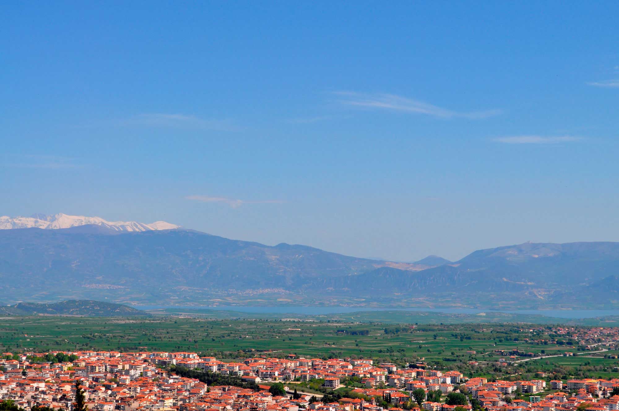
The Middle Haliakmon valley lies at the southernmost part of the broader geological basin of Kozani-Servia (note 1), which is defined by the mountains of Vourino to the West, Skopos to the Northeast, Pieria and Kamvounia to the East and South, and the plateau of the city of Kozani to the Northwest (fig. 1). The area has a northwest-southeast orientation and is crossed by a large number of streams, with continuous or seasonal flow (note 2), which originate in the surrounding mountains and flow into the Haliakmon River. The areas defined by the various streams create wide or narrow, oblong plateaus and low hills, on which both old and modern settlements thrive, thus forming distinct altitudinal zones or geomorphological concentrations. The plateaus on the mountains that border the basin, the foothills of the mountains, of which some parts are at a high altitude and often difficult to access, the small valleys at the margins of the Haliakmon valley, and the smaller ones along some big streams are equally populated, often by traditional groups of herders. At the foot of Pieria and Kamvounia mountains, overlooking the Haliakmon River, are the towns of Velvendos and Servia, while Aiani lies on the opposite side of the river, at the foot of mount Vourino.
This pattern of occupation, which according to historical data was formed over a continuous period of over 1,000 years, emerged from the coexistence of a large number of settlements that differed in a series of parameters: position, size, internal spatial organization, time, reason and means of establishment, duration of occupation, evolution, economic basis, role and importance in historical and socio-economic development and of cultural tradition as well as the ideological perceptions of their inhabitants.
Velvendos, in its current position, seems to antedate all other settlements of the area, and is thought to have been inhabited from the 8th century by people living a few kilometers further south (note 3). It was definitely a settlement in the 12th century, the date of some of its Byzantine religious monuments (note 4). Aiani and the small community of Kaisareia were founded later, at the beginning of the 11th century, as testified by the Byzantine churches of Aiani (note 5), after the destruction of the Roman and Byzantine settlement that existed at Palaiokastro Kaisareia (note 6).
Kozani, the modern capital of the prefecture of the same name, seems to have been founded during the Ottoman period, by a small group of fugitives from Epirus, who settled in the area of Skirka in 1390, who established its basic core. Later on, the population increased through successive migrations of families and larger groups from the surrounding areas, the most important being the migration of the inhabitants of Kteni, which took place after the destruction of the Byzantine settlement of Kastro by Albanians. However, in the area where the modern city spreads, near Skirka, historical data show the existence of two small Byzantine settlements, at of Sopoto and Tridendro, which date back to the first centuries of the 2nd millennium, while archaeological data have revealed a third, contemporary or possibly earlier, settlement, at the 25th of March Square; its existence has not however been attested in historical sources. The residents of the first settlement were transferred to Kozani around 1450, while the settlement of Tridendro may have possibly been in the same location uninterruptedly, rendering this part of Kozani and indeed Kozani itself one of the longest-lasting modern cities in the region, with a continuous existence of over one thousand years (note 7).
The Byzantine city that had thrived at the district of Kastro, the “most important of the medieval citadels in the contemporary Kozani prefecture” (note 8), was succeeded by Servia, at the foot of the mountains in 1430 (note 9). Many other smaller settlements in the area of Tsarsiampa, south of Kozani, seem to have a similar lifespan of approximately 600 years, whose residents had moved to their current positions for a variety of reasons. The earlier Byzantine era settlements are usually detected in the immediate vicinity, an indication of historical and demographic continuity (note 10).
However, many more of today’s settlements date back to the Ottoman period, having a lifespan of 300-600 years, when the colonization of the area by Turkish people, Koniari and Yuruks, took place at the end of the 14th century and led to intense demographic changes. The former residents, initially residing in the fertile valley of the Haliakmon River, next to the main road network and close to the urban centers, were driven away or were forced to flee, establishing new settlements in mountainous and inaccessible areas, while their former settlement areas were occupied by the invaders (note 11). In the early 20th century, after the population exchanges, refugees resettled these sites and adjacent locations, founding new communities (note 12). The most recent in the region is Neraida, founded in 1972 (note 13) by residents of the homonymous riverside settlement that was submerged in the waters of the Polyfytos artificial lake.
At the same time, many mountain settlements were abandoned during the 20th century for different reasons, among them Lava in the early 1970s due to a landslide (note 14). Its residents sought refuge within existing settlements or established new ones elsewhere. Today, there is a trend to repopulate these locations, albeit with a different pattern of occupation.
What is evident from the above is the continuity in the occupation of the valley by local populations, for at least one and a half millennia. At times and for reasons related to lack of residential security, due to dangerous circumstances, high mobility within the limits of the valley has been recorded, between neighbouring or more distant locations. In the areas abandoned, because of violence or because their inhabitants searched for a better future (a decisive factor in the eventual selection of new settlement locations), life continued, but was altered demographically. In some instances, such as in the case of refugees, new habitation is not found on top of the pre-existing settlements, but in nearby locations. The demographic structure of many of today’s local settlements resulted either from the division of bigger ones, or the merging of smaller residential units, usually neighbouring ones. In some cases the core consisted of small population groups or family groups from different settlements. The percentage of settlements that resulted from organized relocations of populations from distant areas is approximately the same as that from local districts (note 15), while that of “self-willed” migration of population groups – fugitives from faraway areas is almost non-existent.
The development and growth of the settlements existing today, as well as their role and importance in the life of the area do not correlate necessarily or exclusively with their antiquity, the importance of the earlier settlements that they replaced, or their geographical or geomorphological position, especially since the exploitation of its benefits is directly linked to the cultural, economic and technological achievements of the residents in each period. This growth is the result of a set of parameters – among which the economy was very important, which, in conjunction with the different historical conditions, at times promoted some settlements into economic and administrative centres while others fell into decay or abandonment and depopulation.
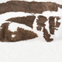
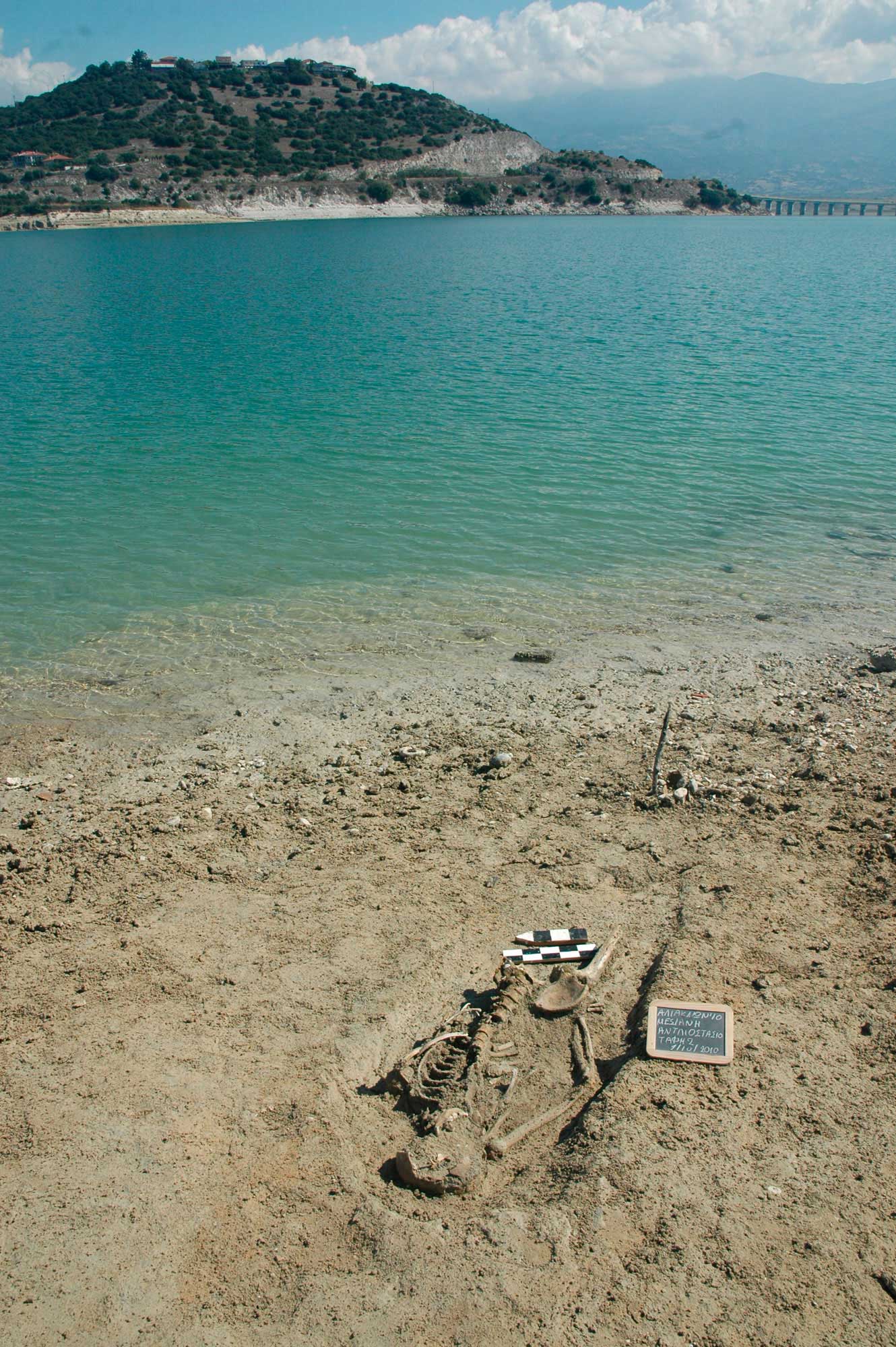
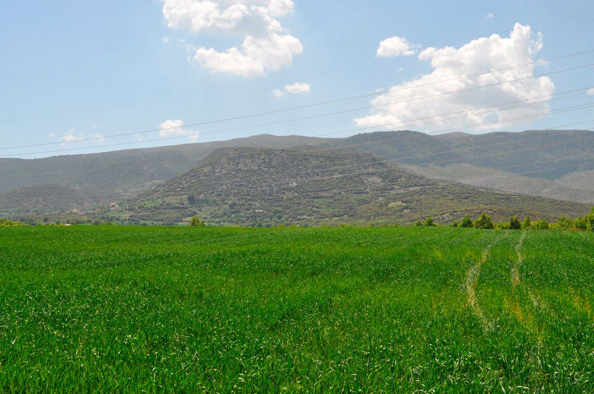
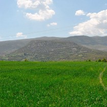
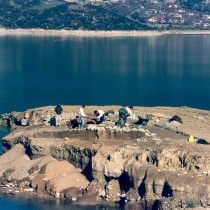
Of particular archaeological interest is the fact that the locations selected for the founding of the settlements existing today, according to current research data (note 16), are detected in only a few cases on top of ancient settlements, at least as far as their initial residential core is concerned. Roman settlements, almost all of which were established in positions different from those of Hellenistic times and often continued their existence through the Early Byzantine period, were abandoned at the end of the first millennium AD, except in a few cases (like perhaps the settlement at Tridendro Kozani). On the other hand, settlements of Hellenistic, Classical and Archaic times are usually detected on top of high, often fortified, hills as well as on extensive plateaus or hill slopes, which do not appear to have provided the necessary requirements for occupation during the 2nd millennium AD. The archaeological finds known to date originate from a small number of settlements (leaving aside the issue of others lost as the result of insufficient control of modern urban construction activity), and usually include grave offerings of the Early Iron Age (end of the 2nd and beginning of the 1st millennium BC) or slightly earlier, of the Late Bronze Age (2nd half of the 2nd millennium BC). The spatial concurrence of sites of specific time periods and modern settlements is thought to be coincidental, due to the high dispersion and small size of the settlements that characterize the habitation pattern of these periods, rather than dictated, except in maybe a small percentage of instances, by similar reasons for settlement foundation. Few Roman graves or settlement remains have been located, and even fewer Hellenistic ones. The case of Neraida remains unique, as it was founded on a high hill and was inhabited during Hellenistic and prehistoric times (note 17) (fig. 2).
It should, however, be noted that the city of Kozani and possibly other big modern settlements in the Kozani-Servia basin, subsequently expanded over areas previously inhabited during the Archaic-Classic-Hellenistic-Roman era (note 18). Nevertheless, this is not connected to the modern settlement onsite or the lifespan of existing settlements. The enduring occupation at, or the different function of, a particular site or a wider area, suggests that a place is coincidentally rendered suitable for a particular use by a large number of factors, which may cause it to be ranked, with good reason, among the most important of a region.
The origin of the pattern of habitation described above seems to be lost in the mists of time, in the settlements of the first farmers-herders, and to characterize the habitation in the area diachronically, with a lower or higher dispersion per historic period and with differentiations of socioeconomic and ideological content: settlements on plateaus or hillocks alongside the river Haliakmon, settlements along its tributaries, in the foothills of mountains, in small valleys and plateaus. The lifespan of a settlement in any one position in most cases is less than 500 years. Several longer-lasting settlements of almost a millennium have, however, been detected, as well as sites which were re-inhabited or reused in a later time period/periods, after a period of abandonment, thus increasing significantly the total duration of life or use of space. The importance and role of each within the network of contemporary settlements, as well as the reasons for the choice of each location, are determined by various factors, with its geographical position often dictating, the degree and character of its development and eventual fate.
In this framework, seven castles, most of them not yet dated with certainty, whose ruins have escaped complete dissolution as a result of the exploitation of their building materials, were built on top of very high naturally fortified hills around the limits of the basin. These seem to have constituted, in their own time, reference points for the wider region, offering protection to the residents in harsh historical times. These are Palaiokastro (or Palaiogratsano) in the Velvendos region in the east, the Lefkara castle in the Northeast, the Oinoi castle in the North and the castles of Kteni (fig. 3), Rodiani and Lefkopigi in the West (note 19). Moreover, the Byzantine castle of Servia, at the junction of the Pieria and Kamvounia mountains, and also the smaller one of Velvendos in Pieria still seem to control the mountain passes.
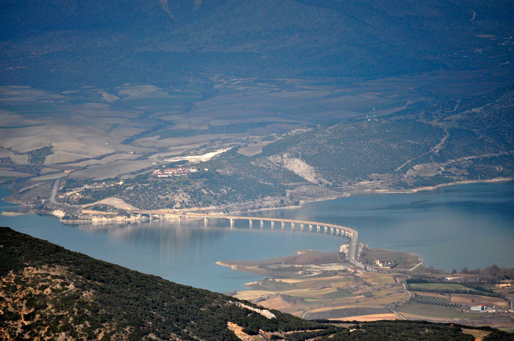
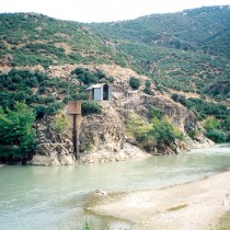
On the southern boundary of the basin is the natural route of Sarantaporo. This is one of the most important natural passes in Western Macedonia linking the wider region to Thessaly and southern Greece in every period. It was of particular strategic importance during historical times and had an indisputably important socioeconomic role during prehistoric times. The pass has two exits to the Haliakmon area, the pass guarded by the Servia castle (fig. 4) and the gorge of “Portes”, named after the gate closing the gorge during Ottoman times (note 20).
The Haliakmon River was an important waterway for the movements from east to west and vice versa (note 21), which before the creation of the Polyfytos artificial lake flowed through the area from southwest to northeast, while an easy exit to the sea was secured, through the pass of Pieria, just as it is today. The slopes on either side were covered by a dense forest with plane-trees, poplars and elms, while fertile croplands spread along both river banks especially to the right of the river (note 22) where they stretched up to 1.5 km in width.
Communication between inhabitants living on the two sides of the river, until the early 20th century and according to all available data, was feasible only when the river flow was reduced (note 23), especially during the summer season. For the rest of the year, the Haliakmon defined and separated the two regions, often influencing their history and cultural evolution. The crossing of the river, which for most of its length through the valley was wide and relatively shallow, was possible at several shallow points, where there were river crossings of wider or more local importance, directly linked to the land routes. One of the most important, where many roads from the northwest part of the basin met, was located near Rymnio, at the shallowest point of the river, where in modern times there was a wagon road named “poros” (note 24). Of special significance, at least during the Ottoman period, was also the crossing-“poros” of Sparto, at the site Paliochano, where there was a Han (inn) for passing travelers (note 25). Besides serving the communities of the surrounding area, the route served the whole area of Kozani, as well as the other districts of Western Macedonia. It was the only one in the wider region (as far as Amygdalia to the East) and was the shortest route to Thessaly, right opposite the Kryovrysi Kranidia site and Stena “Portes” near Prosilio, where there were also Hans serving travelers (note 26). Similar shallow crossings, of more or less local or diachronic importance, existed in Kaisareia, at the site of Palaiokastro (note 27), where the Roman and Byzantine settlement is located, at Velvendos that connected the area with the opposite settlements of the small valley of Imera, and at Servia (note 28).
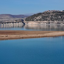
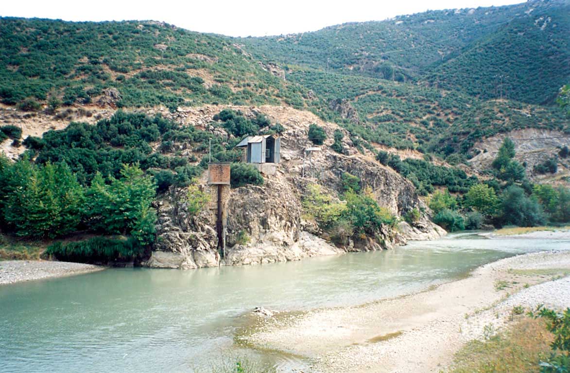
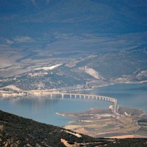
Near Servia, at the narrowest part of the river, the first bridge was constructed in 1912. This bridge was destroyed in 1941 by the British in order to block the German advance. The next rough wooden bridge had the same fate, and was destroyed in 1943 by Greek partisans to obstruct the Italians. In 1950, a steel bridge was built, which was submerged in the waters of the Polyfytos artificial lake (note 29), while in the meantime the crossing was carried out with a cable ferry. A second identical bridge existed until the recent construction of the Middle Haliakmon Dam by the Greek Public Power Corporation (PPC), in the small valley of the Monastery of Ilarion, in the southwest margin of the basin (fig. 5). Today, on the site of the iron bridge stands the “High Bridge of Servia” with a length of 1372m, one of the most important technological achievements of modern times and one of the local sights (fig. 6). A second similar one was constructed during the same period at the “poros” of Rymnio, demonstrating the function and continuous existence of the two river crossings, always in direct association with modern road arteries. It is worth mentioning that in the Middle Haliakmon valley the width of the river and its increased flow prevented the construction of stone bridges, while the second steel bridge the Army built near Rymnio, collapsed during the first river flooding (note 30). In fact, in our opinion, it is very difficult, or even impossible and unreasonable, to suppose that people tried, by any means, to bridge the river before the 20th century, especially as no such data suggest this. The continuous habitation of the area since the Early Neolithic era and the concentration of settlements on both river banks, at this point, indicate at least the existence and long-lasting function of an important natural crossing.
The geological bedrock of the Kozani-Servia basin comprises terrigenous and lacustrine sedimentary deposits, such as conglomerates, sands, clays, loams, red clay etc., with various rocks from the surrounding mountains ending up in the basin through its dense network of streams. Thus, mainly along these streams, one can come across limestone, sandstone, slate, gneiss, pyrites and ophiolites, all types of rock suitable for building and for the tools needed by the region’s inhabitants (note 31).
Since the completion and operation of the Hydro-electric power station of Polyfytos by the PPC in 1974, the waters of the artificial lake have covered the southern part of the basin, radically, almost shockingly, altering the ecosystem of the Haliakmon River and of the streams directly connected to it, while also destroying the riverside area, a landscape of outstanding beauty (note 32). Along with that, the material remains of the archaeological sites alongside the river, were submerged almost in their entirety or exposed to violent erosion, marking one of the greatest cultural disasters, at least on a pan-Hellenic scale (note 33).
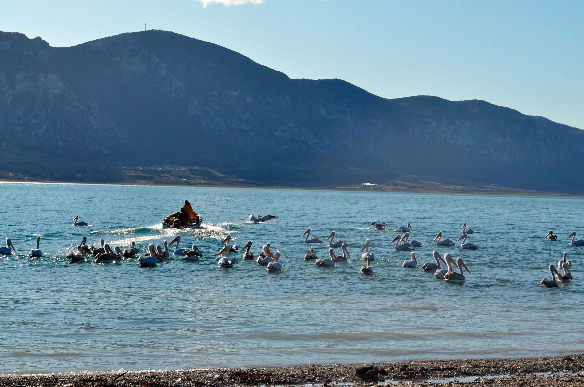
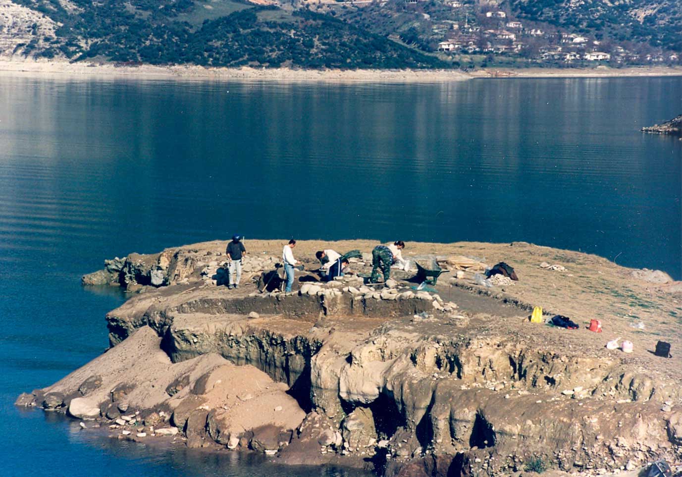
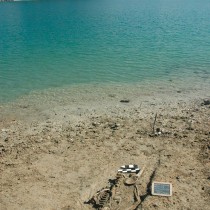
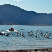
In the years that followed the formation of the lake, a new ecosystem was created (fig. 7), new potential for the development of the region arose and the economy, as well as the way of life were adjusted to the new “artificial”, anthropogenic environment (note 34). Accordingly, archaeological research has focused on the lakeside area collecting, rescuing and utilizing the fragmentary pieces of history that were unexpectedly uncovered (fig. 8).
The lake is elongated in shape, with an average size of 74 square km. Its width reaches a maximum of 2.5km and its length ranges between 31 and 22km, depending on the level of the water, which has a maximum altitude of 291m and minimum of 270m (note 35), a fluctuation of 21m.
Besides these technical characteristics though, the measurements that have been recorded so far in the excavated sites and the fieldwork of the last years have shown that the area covered by lake water is constantly and uncontrollably expanding, due to the vast mass of deposits on the bottom of the lake. These were created by the constant erosion of the lake shores, the wave action and the fluctuation of the water level, as well as by the foreign materials brought by the river and the streams of the basin. As a result, more and more sites located are in danger of complete erosion or definite flooding, while, at the same time, new unknown sites are constantly brought to light, and are added to a seemingly never-ending list of affected sites. Sites that were permanently covered in water, according to the excavation data seem to be favoured by these circumstances. The confirmation of this hypothesis, however, as well as the determination of the exact number rests with the archaeologists of the future. For the time being, the stabilization of the level of the Polyfytos artificial lake that is soon expected to occur with the operation of the new dam of the PPC in Ilariona (Middle Haliakmon dam) seems to represent the only solution, at least as far as concerns the conclusive determination of the number of sites affected (note 36).
Dr Areti Hondroyianni-Metoki
Archaeologist, 30th Ephorate of Prehistoric and Classical Antiquities, Ministry of Culture and Sports
* Acknowledgements
I would like to express my sincerest gratitude to Danai Chondrou, MA in Archaeology and PhD student in the Department of History – Archaeology in the Faculty of Philosophy of the Aristotle University of Thessaloniki, for her significant contribution to the translation of this article.
We also owe special thanks to Dr. Ken Wardle, Senior Lecturer in the University of Birmingham.