


World Museums Day is Coming to Town
Days and nights as well as weeks dedicated to museums and cultural heritage are designed to honor the World Museums Day on the 18th of May
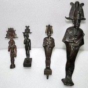
Egypt: Police return stolen bronzes to state antiquities department
Tourism and antiquities police have recovered four ancient bronze statuettes stolen from the Egyptian Museum in Cairo and elsewhere, Egypt's top antiquities body said in a statement.
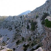
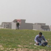
Living on the Edge: the case of Karfi, Crete
Seventy years after its first investigation, Karfi (Lasithi) was the subject of a new pilot excavation in 2008.
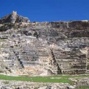
Restoration work in two ancient theatres in the Greek Islands
The ancient theatres of Thera and Lindos are to be restored according to a recent decision of the Prefecture Council of South Aegean
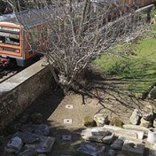
For the 12 Gods
Archaeologists, citizens, NGOs and neopagans in court against the chief Greek state railway company over the fate of the 12 God
Bucknell professors receive approval for first U.S.-Greek archaeological dig in Thebes
Bucknell classics professors Stephanie Larson and Kevin Daly, together with Vassilis Aravantinos, ephor of prehistoric and classical antiquities received approval to launch a comprehensive geophysical survey and excavation at the Ismenion Hill and surrounding areas
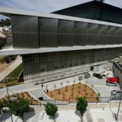
The New Acropolis Museum in Belgrade
Photos of the famous museum will be showi in an event for "Museums Night", 14th of May
The Macedonians Conquer Oxford
Insights from the exhibit Heracles to Alexander the Great: Treasures from the Royal Capital of Macedon, a Hellenic Kingdom in the Age of Democracy
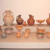
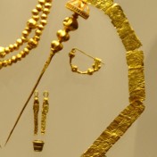
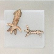
Treasures from the Age of Homer found in Thessaly
A hoard of impressive artefacts were hosted for three millenniums in the little-known tholos tombs of Geometric date found at Chloe, a site near Velestino, Thessaly, Greece
New school in Athens will have a time capsule of its own
A school is built with a floor-window to its past, back in Classical Athens
Sakellarakis
A new excavationsl programme was approved and it is about to start in the Minoan site of Ag. Georgios, in the island of Kythera

Lost and Found: from Epirus to the UK and back again
23rd of December 2010. In front of an icon depicting Christ, a Catholic nun is explaining the meaning of Christmas through an analysis of the icon


“Visualising the Late Antique City” in the University of Kent
A University of Kent new archaeological programme aims to shed light in one of the less known yet most important historical periods: the Late Roman or Late Antiquity Period
Instead of a Museum
Due to the 6-year closure of the Heracleion Archaeological Museum in Crete, the city
A new archaeological site is created at Aerino, Volos.
Five tholos tombs near Volos, Greece, will be soon accessible to visitors thanks to a European Union funding project

Roma Routes in the Byzantine Museum
The Byzantine Museum of Athens will introduce the Greek public with the intriguing culture of travelers
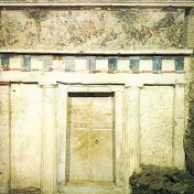
Macedonian Tombs to be Restored.
Ten well-known Macedonian Tombs will be reviewed and restored where needed through the framework of the E??? fund for Macedonia and Thrace 2007-2013
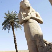
Egyptian Archaeologists Asking for a Leader
Egyptian archaeologists threaten with a strike unless a Head of the Antiquities Service is appointed. According to an official announcement to the Prime Minister Essam Sharaf, the strike is programmed for the coming Sunday
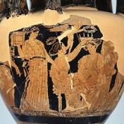
The amazing story of the Aegina Marbles
The adventurous story of a less known set of stolen marbles is told through a new exhibition in Munich
New internet platform to rescue cultural heritage sites
Combining Google Earth, scientific mapping from Esri, satellite imagery from DigitalGlobe, and social networking, the platform aims to serve as an early warning system for site conservation leaders, archaeologists, local communities, government officials, and volunteers.
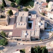
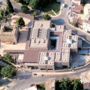
A Modern Museum for the City of Oedipus
Close to completion is the building housing the Archaeological Museum of Thebes in Boeotia, Greece